Polar Orbiter: Fly Up to Primary Landing Site with Altitude Map
white/red = high altitude (~3000 meters); blue = low altitude (~0 meters)
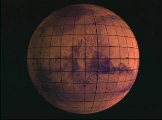
Mars true color Viking sphere rotating to Polar Lander site in MOLA false color

Video slate image reads, "MOLA
Fly up to site with False color height map
white/read = high altitude ~ 3000m
blue = low altitude ~ 0m".
Credits
Please give credit for this item to:
NASA/Goddard Space Flight Center Scientific Visualization Studio
-
Animator
-
Greg Shirah
(NASA/GSFC)

-
Greg Shirah
(NASA/GSFC)
-
Scientist
- David Smith (NASA/GSFC)
Missions
This page is related to the following missions:Series
This page can be found in the following series:Datasets used
-
[MGS: MOLA]
ID: 59 -
[Viking]
ID: 130
Note: While we identify the data sets used on this page, we do not store any further details, nor the data sets themselves on our site.
Alternate Versions
- ID: 684
- ID: 685

- ID: 686

- ID: 687

Release date
This page was originally published on Wednesday, August 25, 1999.
This page was last updated on Wednesday, May 3, 2023 at 1:58 PM EDT.