COVID-19 Earth Observing Fleet
COVID-19 Earth Observing Fleet
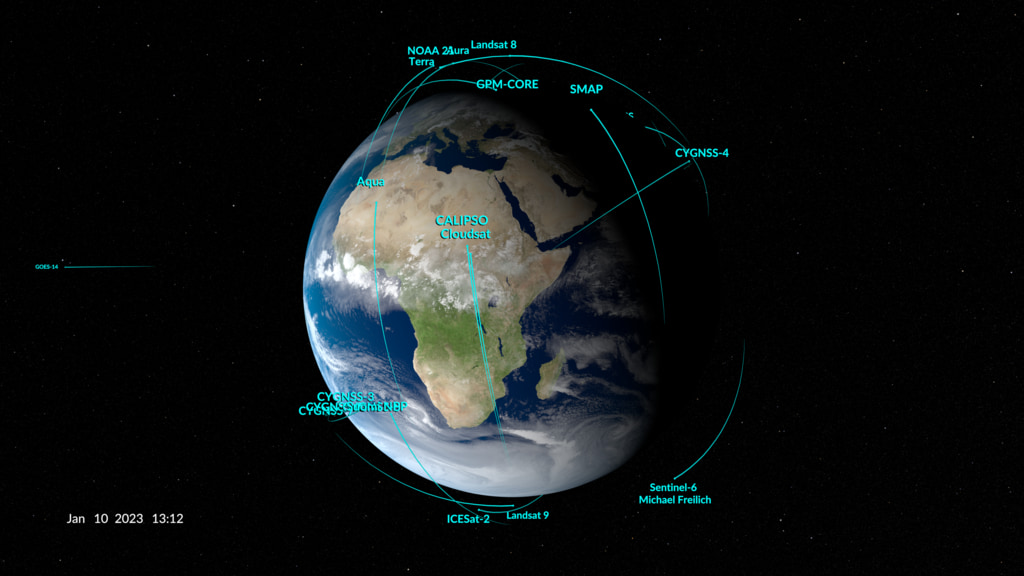
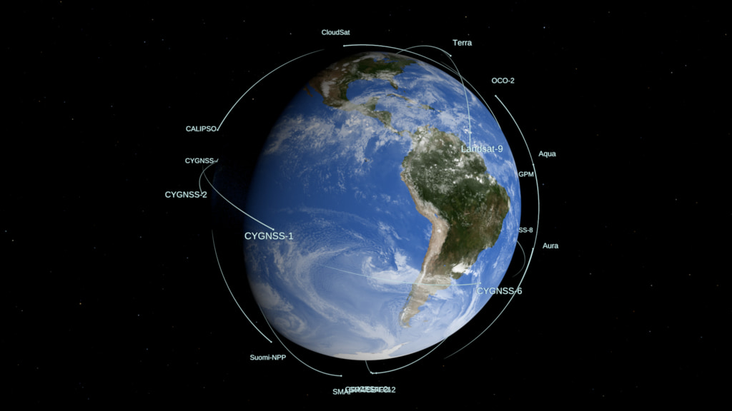
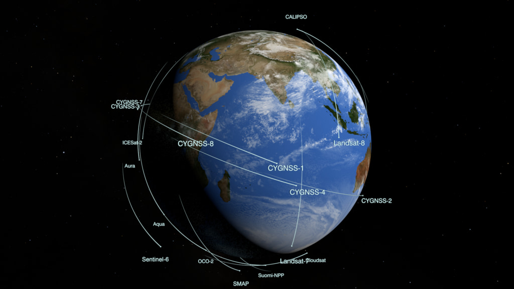
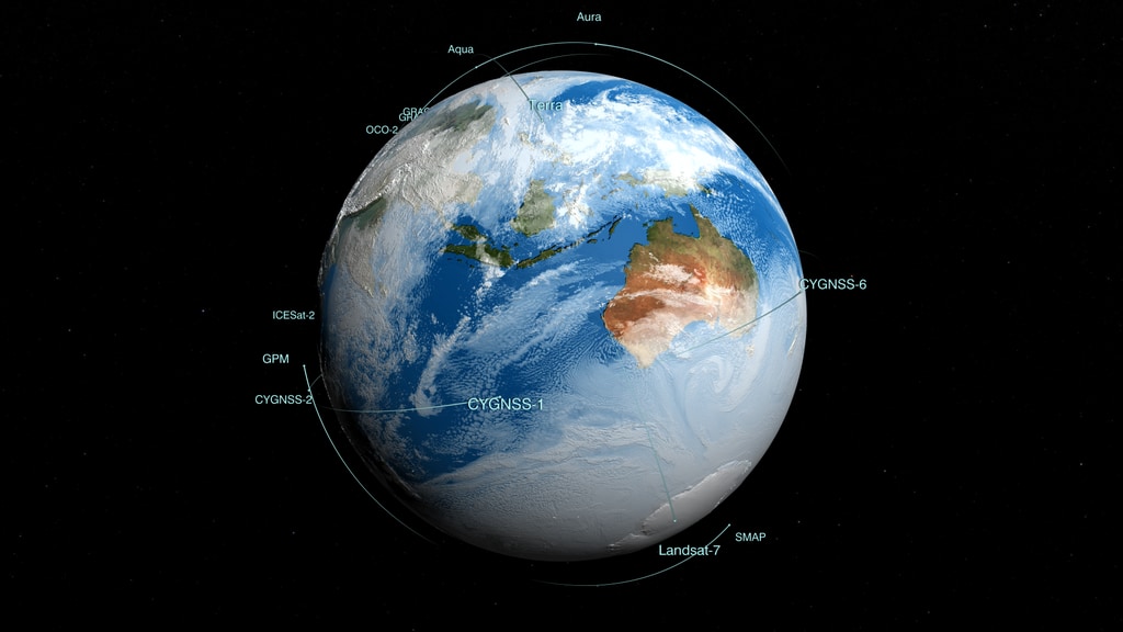
This animation shows the orbits of satellites that NASA is using to study the impact of the COVID-19 pandemic on the environment. It includes assets from our domestic partners, such as the National Oceanic and Atmospheric Administration (NOAA) and the U.S. Geological Survey, our international partners, such as the European Space Agency (ESA) and the Japan Aerospace Exploration Agency (JAXA), and our commercial partner Planet Labs.
Together, our combined measurements are providing the spatial and temporal breadth to more fully characterize and understand how society’s changing behavior during the pandemic is affecting the Earth system.
The clouds used in this version are from a high resolution GEOS model run at 10 minute time steps interpolated down to the per-frame level.
Spacecraft included:
NASA
Aqua
Aura
Suomi NPP: Suomi National Polar-orbiting Partnership
OCO-2: Orbiting Carbon Observatory-2
Terra
Landsat 7
Landsat 8
ISS: International Space Station
International
Sentinel-1
Sentinel-2
Sentinel-5P
GOSAT
ALOS-2
Commercial
Planet Labs 178 nanosatellites
Credits
Please give credit for this item to:
NASA's Scientific Visualization Studio
-
Visualizers
-
Kel Elkins
(USRA)

-
Greg Shirah
(NASA/GSFC)
-
Kel Elkins
(USRA)
-
Technical support
- Lori Perkins (NASA/GSFC)
-
Scientific data support
- Kevin J. Murphy (NASA/HQ)
-
Communications specialist
- Abigail Seadler (Global Science and Technology, Inc.)
Datasets used
-
CelesTrak Spacecraft Orbit Ephemeris
ID: 454This dataset can be found at: http://celestrak.com
See all pages that use this dataset -
BMNG (Blue Marble: Next Generation) [Terra and Aqua: MODIS]
ID: 508Credit: The Blue Marble data is courtesy of Reto Stockli (NASA/GSFC).
This dataset can be found at: http://earthobservatory.nasa.gov/Newsroom/BlueMarble/
See all pages that use this dataset -
GEOS Atmospheric Model
ID: 665
Note: While we identify the data sets used on this page, we do not store any further details, nor the data sets themselves on our site.
Related
- ID: 5061
 Visualization
 - ID: 4928
 Visualization
 - ID: 4931
 Visualization
 - ID: 4772
 Visualization
Used as a Source In
- ID: 13814
 Produced Video
Release date
This page was originally published on Tuesday, December 22, 2020.
This page was last updated on Thursday, January 7, 2021 at 10:57 AM EST.