Mars Upper Level Winds Observed by MAVEN - Visualizations
MAVEN observes upper level Martian winds over the course of about two years.
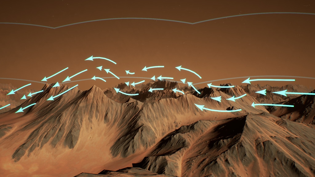
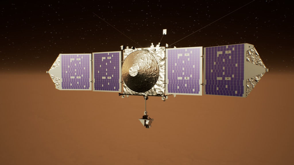
MAVEN is the first spacecraft specifically designed to study the Mars upper atmosphere, in order to better understand the evolution of its climate. These visualizations show MAVEN measuring the Martian upper level wind direction and magnitude over a series of thirty-three campaigns. In order for MAVEN to make these in-situ measurements, the spacecraft must be close to the upper atmosphere. The closest point of MAVEN's orbit to Mars (periapsis) dips into the tenuous upper reaches of the Martian thermosphere. The orbit also precesses over time to acquire measurements from different regions on the planet.
Now, scientists have used MAVEN data to map high-altitude wind currents on Mars for the first time. The data show that the Martian upper atmosphere is relatively independent of the daily rotation of Mars. On a day-to-day basis, high-altitude wind currents have a relatively fixed location with respect to the Sun, while Mars rotates underneath. Over the course of the Martian year, however, the currents follow the Sun north to south with the seasons.
MAVEN has also found that higher-elevation regions, such as the Tharsis plateau, cause small gravity waves that perturb the upper level winds and make them alter course. This means that certain topographic features on the Martian surface are detectable by MAVEN high above, as it skims the edge of space.
MAVEN's orbit precesses around Mars over the course of about 1.5 years.
MAVEN observes changes in wind direction due to orographic (mountainous) gravity waves, propagating upward from the high-altitude Tharsis region.
This closing shot depicts MAVEN acquiring upper level wind data during campaign #18.
For More Information
See the following sources:
Credits
Please give credit for this item to:
NASA/Goddard/SVS/MAVEN/CU Boulder/University of Michigan
-
Visualizers
-
Greg Shirah
(NASA/GSFC)

-
Ernie Wright
(USRA)
- Horace Mitchell (NASA/GSFC)
-
Greg Shirah
(NASA/GSFC)
-
Scientists
- Mehdi Benna (UMBC)
- Kali Roeten (University of Michigan)
-
Producer
- Dan Gallagher (USRA)
-
Technical support
- Laurence Schuler (ADNET Systems, Inc.)
- Ian Jones (ADNET Systems, Inc.)
Missions
This page is related to the following missions:Datasets used
-
[MGS: MOC]
ID: 58 -
CelesTrak Spacecraft Orbit Ephemeris
ID: 454This dataset can be found at: http://celestrak.com
See all pages that use this dataset -
Tycho Catalogue (Tycho 2 Catalogue) [Hipparcos: Telescope]
ID: 550This dataset can be found at: http://archive.eso.org/ASTROM/
See all pages that use this dataset -
NGIMS (Average Neutral Upper Level Wind Vectors) [MAVEN: Neutral Gas and Ion Mass Spectrometer]
ID: 1059Average neutral winds as observed by MAVEN/NGIMS during 33 monthly campaigns spanning from April 2016 to December 2018.
Credit: NGIMS: MAVEN Science Team
See all pages that use this dataset
Note: While we identify the data sets used on this page, we do not store any further details, nor the data sets themselves on our site.
Related
- ID: 20302
Used as a Source In
- ID: 13485
 Produced Video
Release date
This page was originally published on Thursday, December 12, 2019.
This page was last updated on Monday, January 6, 2025 at 12:15 AM EST.