Earthrise in 4K
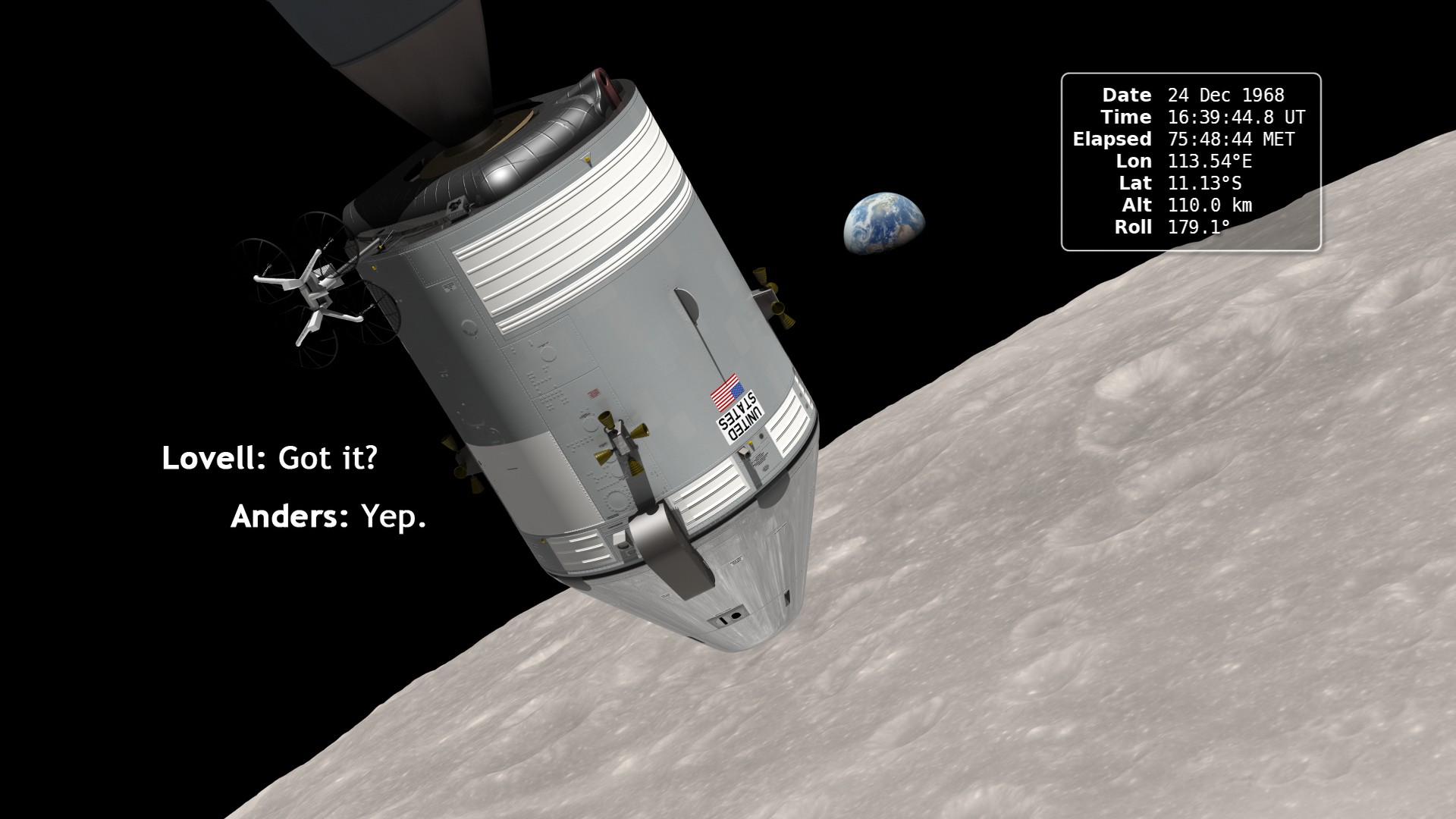
On December 24, 1968, Apollo 8 astronauts Frank Borman, Jim Lovell, and Bill Anders became the first humans to witness the Earth rising above the moon's barren surface. Now we can relive the astronauts' experience, thanks to data from NASA's Lunar Reconnaissance Orbiter. Complete transcript available.
Watch this video on the NASA Goddard YouTube channel.
This is a new, ultra-high definition (UHD, or 4K) version of the Earthrise visualization first published in 2013.
In December of 1968, the crew of Apollo 8 became the first people to leave our home planet and travel to another body in space. But as crew members Frank Borman, James Lovell, and William Anders all later recalled, the most important thing they discovered was Earth.
Using photo mosaics and elevation data from Lunar Reconnaissance Orbiter (LRO), this video commemorates Apollo 8's historic flight by recreating the moment when the crew first saw and photographed the Earth rising from behind the Moon. Narrator Andrew Chaikin, author of A Man on the Moon, sets the scene for a three-minute visualization of the view from both inside and outside the spacecraft accompanied by the onboard audio of the astronauts.
The visualization draws on numerous historical sources, including the actual cloud pattern on Earth from the ESSA-7 satellite and dozens of photographs taken by Apollo 8, and it reveals new, historically significant information about the Earthrise photographs. It has not been widely known, for example, that the spacecraft was rolling when the photos were taken, and that it was this roll that brought the Earth into view. The visualization establishes the precise timing of the roll and, for the first time ever, identifies which window each photograph was taken from.
Two craters visible in the Earthrise image, formerly called Pasteur T and Ganskiy M, were renamed Anders' Earthrise and 8 Homeward by the International Astronomical Union to commemorate the 50th anniversary of the Apollo 8 mission.
Credits
Please give credit for this item to:
NASA's Scientific Visualization Studio
-
Visualizer
- Ernie Wright (USRA)
-
Producers
- Ernie Wright (USRA)
- Andrew Chaikin
- Dan Gallagher (USRA)
- Noah Petro (NASA/GSFC)
-
Video editors
- Dan Gallagher (USRA)
- Michael Randazzo (Advocates in Manpower Management, Inc.)
-
Scientists
- Noah Petro (NASA/GSFC)
- John Keller (NASA/GSFC)
- Richard Vondrak (NASA/GSFC)
-
Narrator
-
Narration
-
Associate producer
- David Ladd (USRA)
-
Technical support
- Laurence Schuler (ADNET Systems, Inc.)
- Ian Jones (ADNET Systems, Inc.)
Release date
This page was originally published on Friday, December 21, 2018.
This page was last updated on Wednesday, May 3, 2023 at 1:46 PM EDT.
Missions
This visualization is related to the following missions:Series
This visualization can be found in the following series:Datasets used in this visualization
-
Blue Marble [Terra: MODIS]
ID: 492Credit: The Blue Marble data is courtesy of Reto Stockli (NASA/GSFC).
See all pages that use this dataset -
DEM (Digital Elevation Map) [LRO: LOLA]
ID: 653 -
Apollo 8 Trajectory Reconstruction
ID: 735This dataset can be found at: http://ntrs.nasa.gov/archive/nasa/casi.ntrs.nasa.gov/19740072902_1974072902.pdf
See all pages that use this dataset -
LROC WAC Color Mosaic (Natural Color Hapke Normalized WAC Mosaic) [Lunar Reconnaissance Orbiter: LRO Camera]
ID: 1015This natural-color global mosaic is based on the 'Hapke normalized' mosaic from LRO's wide-angle camera. The data has been gamma corrected, white balanced, and range adjusted to more closely match human vision.
See all pages that use this dataset
Note: While we identify the data sets used in these visualizations, we do not store any further details, nor the data sets themselves on our site.


![Watch this video on the NASA Goddard YouTube channel.Complete transcript available.Music credits: “Boreal Moment” by Benoit Scarwell [SACEM]; “Sensory Questioning”, “Natural Time Cycles”, “Emerging Designer”, and “Experimental Design” by Laurent Dury [SACEM]; “Superluminal” by Lee Groves [PRS], Peter George Marett [PRS] from Killer Tracks](/vis/a010000/a013200/a013275/13275_AstronautRadiation_Twitter.01205_print.jpg)
