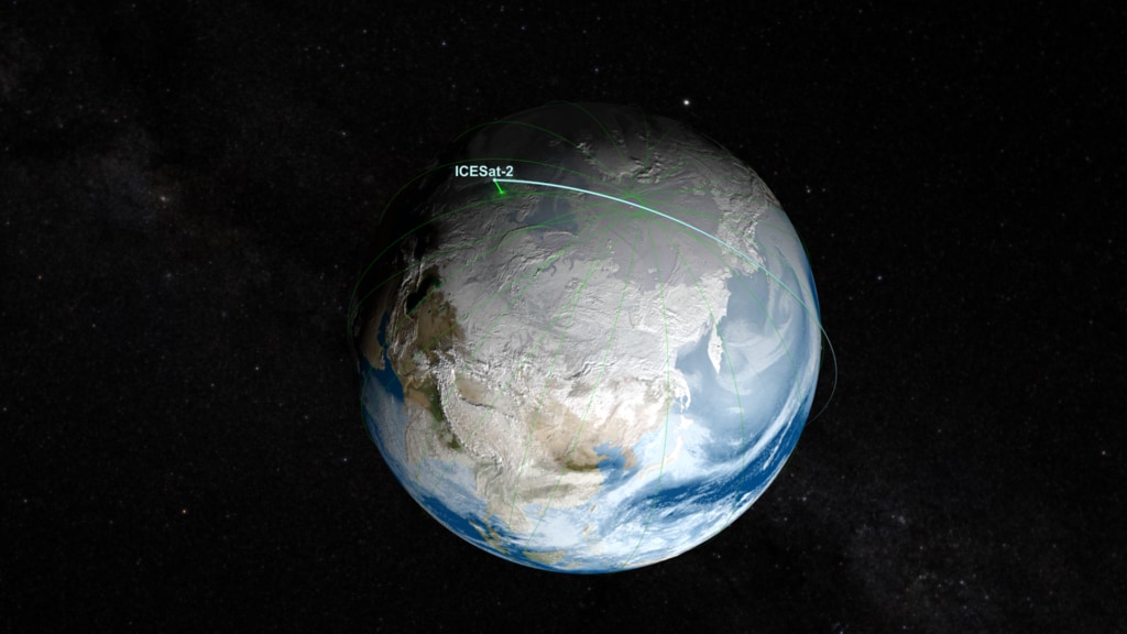
ICESat-2 Orbit
ICESat-2 orbiting Earth: starting with global view building up ground track, then riding the satellite view, then back to a global view with full ground track
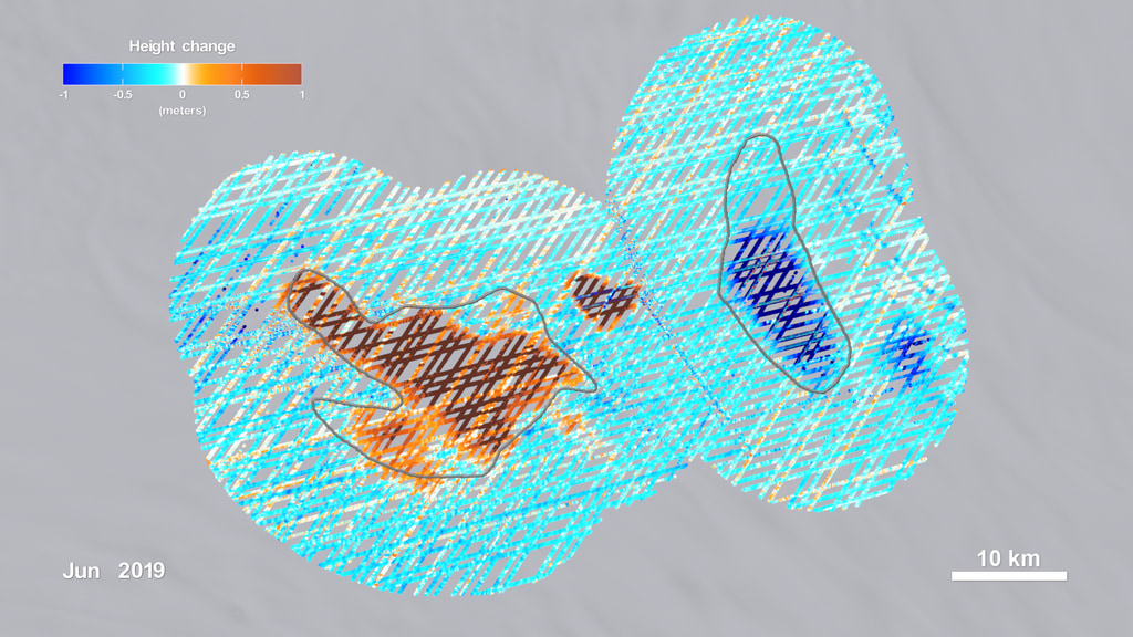
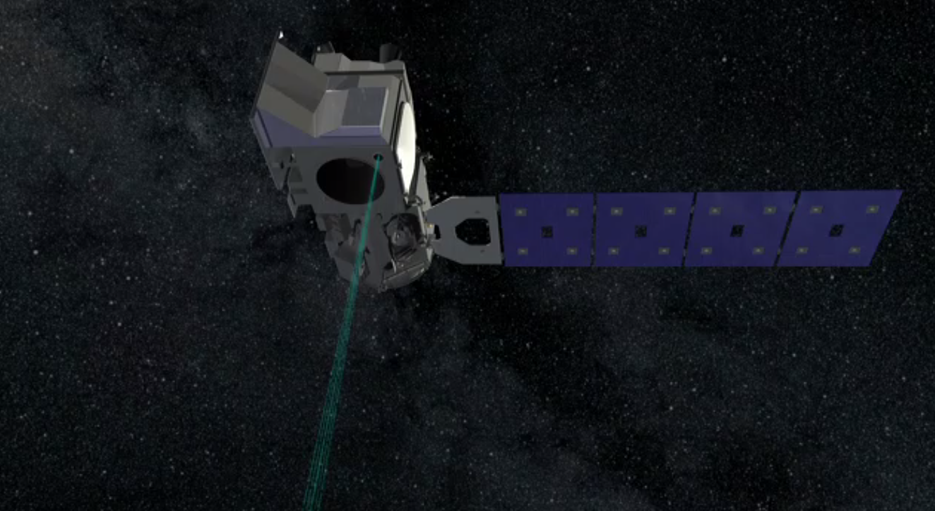
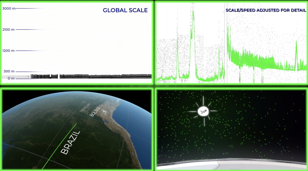
ICESat-2 is a spacecraft designed to accurately measure land and ice elevations on Earth. By comparing observations from different times, scientists will be able to study changes in elevations. ICESat-2 will be in a polar orbit which will provide high coverage near the poles where ice elevations are changing relatively quickly. This visualization shows ICESat-2's polar orbit from afar, then closer up. As we get close to the satellite, the 3 pairs of ICESat-2's ATLAS lidar laser beams begin to resolve. A ground track shows ICESat-2's global coverage which repeats about once every 90 days.
The ATLAS lidar on ICESat-2 uses 3 pairs of laser beams to measure the earth’s elevation and elevation change. As a global mission, ICESat-2 will collect data over the entire globe, however the ATLAS instrument is optimized to measure land ice and sea ice elevation in the polar regions.
For more information on ICESat-2 click here.
ICESat-2 orbit with ground track (short version)
Credits
Please give credit for this item to:
NASA's Scientific Visualization Studio
-
Visualizer
-
Greg Shirah
(NASA/GSFC)

-
Greg Shirah
(NASA/GSFC)
-
Technical support
- Laurence Schuler (ADNET Systems, Inc.)
- Ian Jones (ADNET Systems, Inc.)
-
Producer
- Ryan Fitzgibbons (USRA)
-
Scientist
- Thorsten Markus (NASA/GSFC)
-
Data provider
- Timothy Rebold (Emergent Space Technologies LLC)
Series
This page can be found in the following series:Datasets used
-
BMNG (Blue Marble: Next Generation) [Terra and Aqua: MODIS]
ID: 508Credit: The Blue Marble data is courtesy of Reto Stockli (NASA/GSFC).
This dataset can be found at: http://earthobservatory.nasa.gov/Newsroom/BlueMarble/
See all pages that use this dataset -
Tycho Catalogue (Tycho 2 Catalogue) [Hipparcos: Telescope]
ID: 550This dataset can be found at: http://archive.eso.org/ASTROM/
See all pages that use this dataset -
GEOS Atmospheric Model
ID: 665 -
STK Ephemeris [ICESat-2]
ID: 984
Note: While we identify the data sets used on this page, we do not store any further details, nor the data sets themselves on our site.
Related
- ID: 4913
 Visualization
 - ID: 13045
 Produced Video
Used as a Source In
- ID: 14261
 Produced Video
 - ID: 13735
 Produced Video
 - ID: 4742
 Visualization
 - ID: 13124
 Produced Video
 - ID: 12977
 Produced Video
 - ID: 13062
 Produced Video
 - ID: 12809
 Produced Video
 - ID: 12768
 Produced Video
Release date
This page was originally published on Friday, November 3, 2017.
This page was last updated on Wednesday, May 14, 2025 at 12:06 AM EDT.