Apollo 17 Landing Site
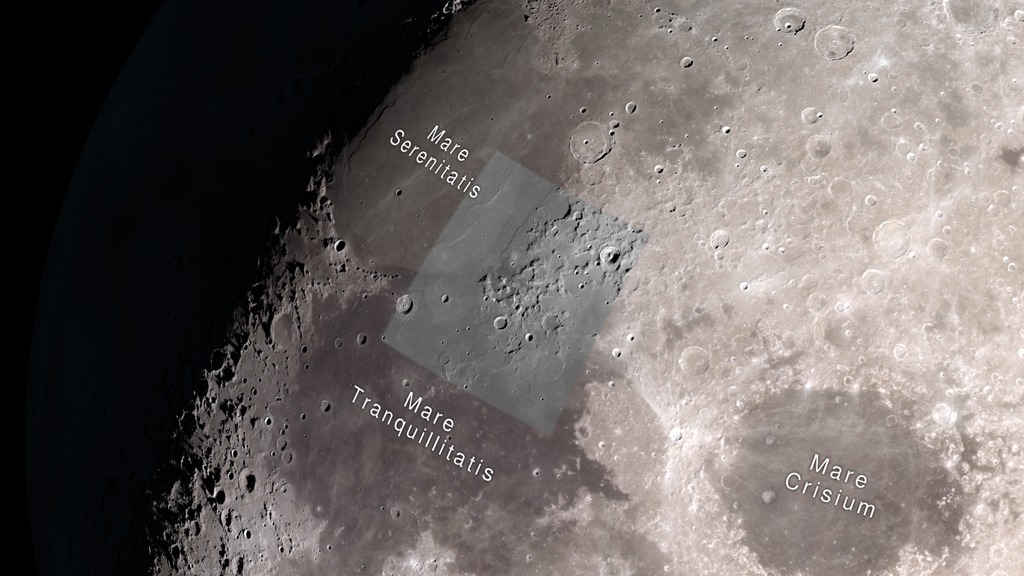
Apollo 17, crewed by Eugene Cernan, Ronald Evans, and Harrison Schmitt, was the final Apollo mission to the Moon. The Lunar Module Challenger landed in the Taurus-Littrow valley on December 11, 1972 and remained there for 75 hours. The landing site is a relatively flat spot among low mountains at the southeastern edge of Mare Serenitatis.
The images here are designed for display on NASA's hyperwall. They help tell the story of Apollo 17's exploration of the Taurus-Littrow site using data and imaging from Lunar Reconnaissance Orbiter (LRO) and photographs taken by the astronauts. LRO's detailed and comprehensive remote sensing capabilities have fostered a reinterpretation of the geology of the site.

Visualization of the Moon as viewed from Earth at the time of the Apollo 17 Moon landing, December 11, 1972 at 19:55 UTC.
Visualization of the Moon as viewed from the Earth at the time of the Apollo 17 return launch (when the LM left the surface of the Moon), December 14, 1972 at 22:55 UTC.
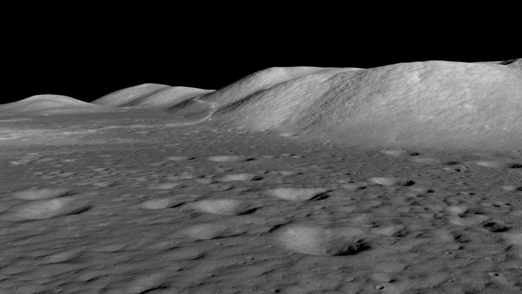
A flyover visualization of the Taurus-Littrow Valley looking due west, with the Sun angle at the time of the Apollo 17 landing. This uses a 32-degree square inset of LOLA data at 512 points per degree (roughly 60 meters per pixel).
An oblique image of the Taurus-Littrow valley taken by the LRO narrow-angle camera. This was cropped from M192703697LR. The Apollo 17 LM descent stage shadow is precisely centered in the image. The resolution is about 4 meters per pixel.
A nadir view of the Apollo 17 landing site taken by the LRO narrow-angle camera. West is up, north is to the right. The early morning Sun angle is similar to the lighting at the time of the landing. The resolution is about 0.48 meters per pixel. This is part of M162107606L.
A reverse-angle
oblique view of Taurus-Littrow taken July 7, 2012, cropped and scaled from M1096343661. Looking east (slew angle 56°) with afternoon Sun (subsolar longitude 48°W).
A full resolution detail from the reverse-angle
view of Taurus-Littrow, centered on the LM descent stage. The horizontal resolution is roughly 0.75 meters per pixel.
At Station 6, the astronauts collected samples from a boulder that had rolled down the side of the North Massif. The LROC image is a detail from M134991788R. See also this LROC featured image blog post.
Panoramic image of the landing site.
Another oblique image (M1182232465LE) of the Taurus-Littrow valley taken by the LRO narrow-angle camera on March 29, 2015.
A nadir view of the Apollo 17 landing site derived from a mosaic of LRO narrow-angle camera images. West is up, north is to the right. The LM descent stage is centered horizontally and about two-thirds of the way down (y = 1983 pixels).
AS17-134-20430, a panoramic view of the North Massif from Station 1, taken during the first EVA.
Radar image mosaic of Taurus-Littrow from LRO's Mini-RF instrument. Missing data has been filled in with data from an LROC NAC frame.
Credits
Please give credit for this item to:
NASA's Scientific Visualization Studio
-
Visualizer
-
Ernie Wright
(USRA)

-
Ernie Wright
(USRA)
-
Scientist
-
Noah Petro
(NASA/GSFC)
-
Noah Petro
(NASA/GSFC)
Missions
This page is related to the following missions:Series
This page can be found in the following series:Datasets used
-
NAC (Narrow Angle Camera) [LRO: LROC]
ID: 652
Note: While we identify the data sets used on this page, we do not store any further details, nor the data sets themselves on our site.
Related
- ID: 5053
 Visualization
 - ID: 13275
![Watch this video on the NASA Goddard YouTube channel.Complete transcript available.Music credits: “Boreal Moment” by Benoit Scarwell [SACEM]; “Sensory Questioning”, “Natural Time Cycles”, “Emerging Designer”, and “Experimental Design” by Laurent Dury [SACEM]; “Superluminal” by Lee Groves [PRS], Peter George Marett [PRS] from Killer Tracks](/vis/a010000/a013200/a013275/13275_AstronautRadiation_Twitter.01205_print.jpg) Produced Video
Produced Video - ID: 4717
 Visualization
Release date
This page was originally published on Tuesday, December 8, 2015.
This page was last updated on Thursday, October 12, 2017 at 3:52 PM EDT.