A newer version of this visualization is available.
Earthrise
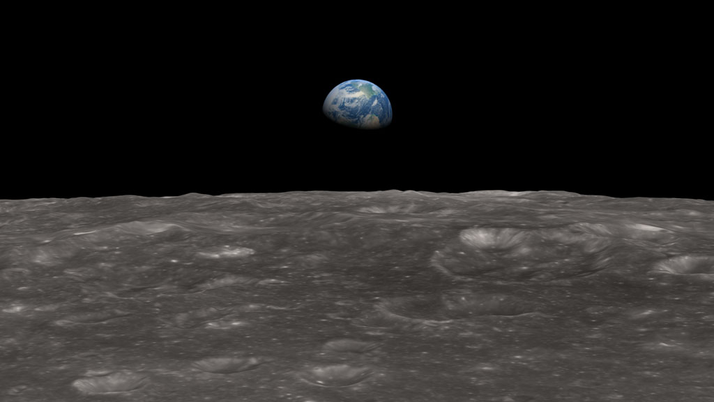
The famous color photograph known as Earthrise, as well as a black-and-white image taken a minute earlier, document the moment when Earth was seen for the first time by human eyes from behind the Moon. They were taken on December 24, 1968 by the crew of Apollo 8, the first humans to leave low Earth orbit.
The sight of a small, intensely blue Earth rising above the barren, gray horizon of the Moon was one of the few things that NASA and the crew of Apollo 8 had not thoroughly planned and rehearsed beforehand. As historian Robert Poole noted, this lack of preparation meant that the sight of Earth came with the force of a revelation,
not just for the astronauts but for everyone on the ground. We came all this way to explore the Moon,
Apollo 8 astronaut Bill Anders said, and the most important thing is that we discovered the Earth.
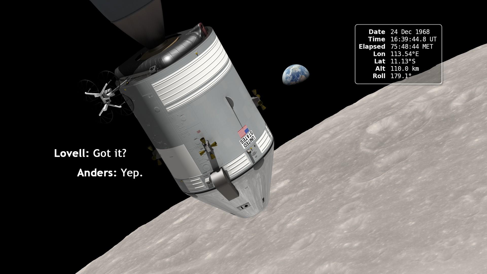
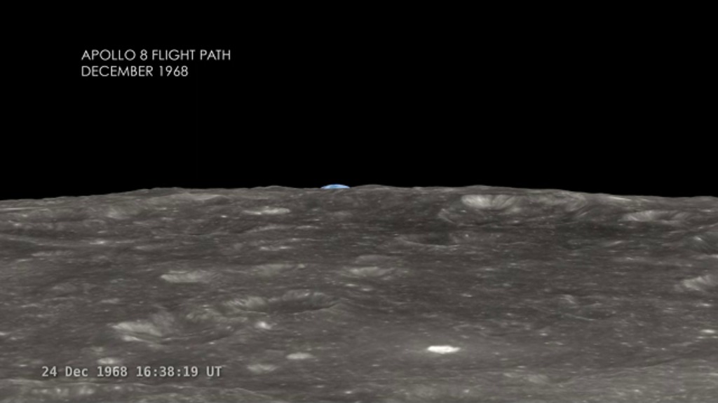
Using the latest elevation data from Lunar Reconnaissance Orbiter, this visualization attempts to recreate what the astronauts saw. The virtual camera of the rendering software is put in the position of the Apollo 8 spacecraft at the time of the photographs, as the spacecraft emerged from its fourth pass behind the Moon. It shows a two-minute interval centered on 16:39:06 UT (10:39 a.m. Houston time) on December 24, 1968. This is around the time of AOS (acquisition of signal), the moment when radio contact is re-established after being lost on the far side of the Moon.
The position and motion of the spacecraft are based on a state vector, a set of (x, y, z) position and (vx, vy, vz) velocity values, published in NASA's Apollo 8 Mission Report about a year after the flight. The animator translated these values, given in Moon-centered inertial coordinates for Besselian year 1969.0, into a modern coordinate system, then calculated an orbit. The spacecraft was 110 km (68 miles, 60 nautical miles) above the surface of the Moon at 11.2°S 113.8°E when the Earthrise photograph was taken.
A simulation of what the Apollo 8 crew saw as the Earth rose above the lunar horizon during their fourth orbit around the Moon. Overlays both a clock and two of the photographs taken at the time. The second, color photograph is the famous Earthrise image.
A simulation of what the Apollo 8 crew saw as the Earth rose above the lunar horizon during their fourth orbit around the Moon. Includes a clock overlay. This version runs at a constant speed and does not overlay the photographs.

The first color Earthrise photograph taken by the Apollo 8 crew, rotated and scaled to match the simulation, with alpha channel. The second image is the clock overlay.
The black-and-white image taken by the Apollo 8 crew, rotated and scaled to match the simulation, with alpha channel. This was taken about a minute before the first color photo.
The raw frames, rendered at twice the frame rate of the other animations. Played at 30 FPS, these frames run at the actual speed of the Earthrise event. At 60 FPS, they match the running speed of the other animations.
A map showing which parts of the lunar terrain are visible in the photographs. Annotated with coordinate values, crater names, and coverage outlines.
A map showing which parts of the lunar terrain are visible in the photographs. Without annotations.
Credits
Please give credit for this item to:
NASA/Goddard Space Flight Center Scientific Visualization Studio
-
Animator
-
Ernie Wright
(USRA)

-
Ernie Wright
(USRA)
-
Producer
- Chris Smith (HTSI)
-
Scientist
- Richard Vondrak (NASA/GSFC)
Missions
This page is related to the following missions:Series
This page can be found in the following series:Datasets used
-
Blue Marble [Terra: MODIS]
ID: 492Credit: The Blue Marble data is courtesy of Reto Stockli (NASA/GSFC).
See all pages that use this dataset -
750-nm Basemap [Clementine: UVVIS Camera]
ID: 545 -
DEM (Digital Elevation Map) [LRO: LOLA]
ID: 653 -
Apollo 8 Trajectory Reconstruction
ID: 735This dataset can be found at: http://ntrs.nasa.gov/archive/nasa/casi.ntrs.nasa.gov/19740072902_1974072902.pdf
See all pages that use this dataset
Note: While we identify the data sets used on this page, we do not store any further details, nor the data sets themselves on our site.
Newer Versions
- ID: 4129
 Visualization
Used as a Source In
- ID: 10951
 Produced Video
 - ID: 10961
Release date
This page was originally published on Thursday, April 19, 2012.
This page was last updated on Sunday, February 2, 2025 at 12:02 AM EST.