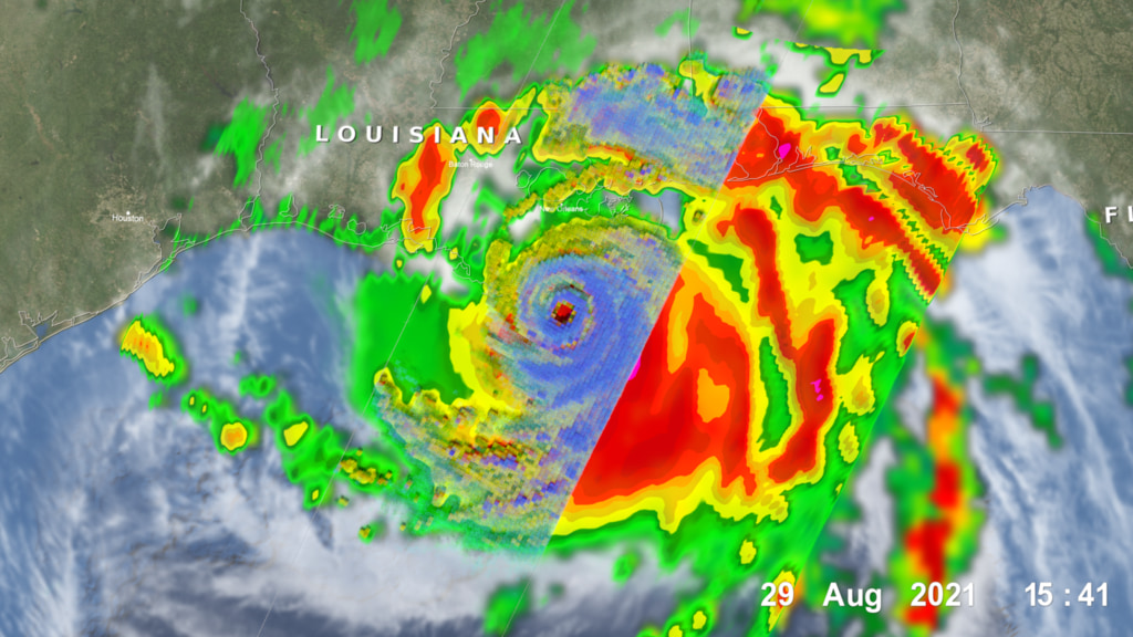
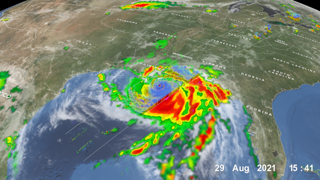
Hurricane Katrina from TRMM: August 29, 2005
NASA's TRMM spacecraft is used to understand Hurricane Katrina. TRMM observed this view of Hurricane Katrina just before the storm made landfall on August 29, 2005. Katrina remains an extremely large and dangerous hurricane. Hurricane force winds extend outward up to 105 miles from the storm's center. Coastal storm surge flooding of 18 to 22 feet above normal tide levels are expected. The cloud cover is taken by TRMM's Visible and Infrared Scanner(VIRS) and the GOES spacecraft. The rain structure is taken by TRMM's Tropical Microwave Imager (TMI). It looks underneath of the storm's clouds to reveal the underlying rain structure. Blue represents areas with at least 0.25 inches of rain per hour. Green shows at least 0.5 inches of rain per hour. Yellow is at least 1.0 inches of rain and red is at least 2.0 inches of rain per hour.
Hurricane Katrina strikes the southeastern Louisiana and the northern gulf coast as a category 4 hurricane. Look under the clouds to see the rainfall that powers the storm.
Credits
Please give credit for this item to:
NASA/Goddard Space Flight Center
Scientific Visualization Studio
-
Animator
- Lori Perkins (NASA/GSFC)
-
Scientist
- Jeff Halverson (JCET UMBC)
Missions
This page is related to the following missions:Series
This page can be found in the following series:Datasets used
-
[GOES]
ID: 22 -
[TRMM: PR]
ID: 109 -
[TRMM: TMI]
ID: 110 -
[TRMM: VIRS]
ID: 111
Note: While we identify the data sets used on this page, we do not store any further details, nor the data sets themselves on our site.
Related
- ID: 4933
 Visualization
 - ID: 4932
Release date
This page was originally published on Wednesday, September 14, 2005.
This page was last updated on Wednesday, May 3, 2023 at 1:56 PM EDT.