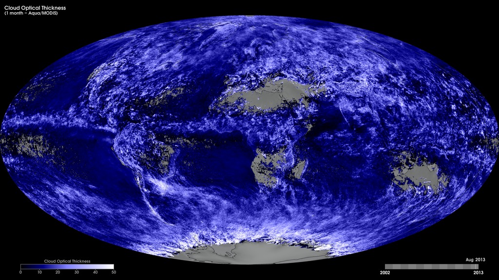
Monthly Cloud Optical Thickness (Terra/MODIS)
To better understand the role of clouds in the Earth's climate system, scientists need two important measurements: cloud optical thickness and cloud particle size. A cloud's optical thickness is a measure of attenuation of the light passing through the atmosphere due to the scattering and absorption by cloud droplets. Clouds do not absorb visible wavelengths of sunlight; rather, clouds scatter and reflect most visible light. The higher a cloud's optical thickness, the more sunlight the cloud is scattering and reflecting. These maps show monthly cloud optical thickness from January 2005 to the present, produced using data from the Moderate Resolution Imaging Spectroradiometer (MODIS) instrument onboard NASA’s Terra satellite. Dark blue shades indicate areas where there are low cloud-optical-thickness values, while white shades indicate high values (i.e., greater attenuation caused by the scattering and absorption from cloud droplets).
Monthly Terra/MODIS cloud optical thickness, January 2005 to the present.
For More Information
Credits
Based on imagery by Reto Stockli, NASA's Earth Observatory, using data provided by the MODIS Atmosphere Science Team, NASA Goddard Space Flight Center.
-
Visualizers
- Marit Jentoft-Nilsen (Global Science and Technology, Inc.)
- Reto Stockli (NASA/GSFC)
Missions
This page is related to the following missions:Series
This page can be found in the following series:Datasets used
-
[Terra: MODIS]
ID: 116
Note: While we identify the data sets used on this page, we do not store any further details, nor the data sets themselves on our site.
Related
- ID: 30398
 Hyperwall Visual
Release date
This page was originally published on Thursday, October 24, 2013.
This page was last updated on Sunday, February 2, 2025 at 11:31 PM EST.