Star Charts for ESCAPADE’s Earth Flyby
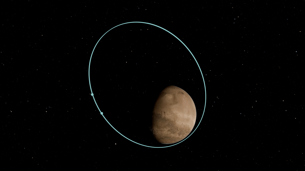
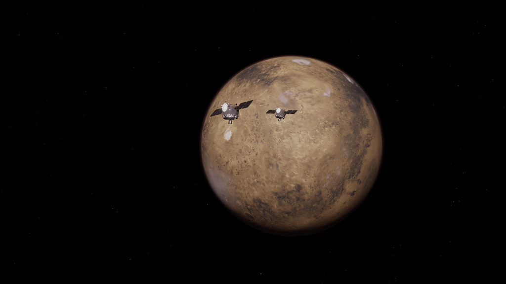
In November 2026, each of NASA’s two ESCAPADE (Escape and Plasma Acceleration and Dynamics Explorers) spacecraft will perform a “powered” flyby of Earth, combining Earth’s gravity with an approximately 9-minute engine burn, to slingshot itself toward Mars.
The first ESCAPADE spacecraft will make its closest approach and complete its engine burn around 5 a.m. EST on Nov. 7, and the second will do so two days later, around 6 a.m. EST on Nov. 9.
In the hours before, during, and after each spacecraft’s closest approach, observers on the ground might be able to spot the spacecraft in the night sky. However, a telescope will most likely be needed to find it as a dim point moving against the stars. Each spacecraft will appear to move through the sky relatively slowly and take several hours to cross overhead.
From the U.S., each spacecraft will be below the horizon during its closest approach to Earth. Therefore, the spacecraft will be best viewed in the western sky an hour or two before closest approach. From some viewing locations, the spacecraft will also reappear in the eastern sky an hour or two after its closest approach.
The star charts below show the path the spacecraft will take across the sky for several different locations in the U.S. The colors along the path represent the altitude of the spacecraft, which will decrease during the time shown, with red showing the lowest altitude along the path (when the spacecraft should be brightest).
If your viewing location is not represented here, you can use the NASA Jet Propulsion Laboratory’s Horizons System to get coordinates for the two spacecraft at different times for your location.
Locations included below:
- Berkeley, California
- Boulder, Colorado
- Chicago, Illinois
- Greenbelt, Maryland (NASA’s Goddard Space Flight Center)
- Goldstone, California
- Honolulu, Hawaii
- New York, New York
- Portland, Oregon
- Seattle, Washington
- Tempe, Arizona
- Temple, Texas
Berkeley, California
Animated map, first spacecraft
The color-coded arc in this animated star chart shows the path that the first ESCAPADE spacecraft will take across the sky as seen from Berkeley, California, from approximately 7 p.m. (19:00) Pacific Time (PT) on Nov. 6 to about 1 a.m. (01:00) PT on Nov. 7. The spacecraft rises again around 3 a.m. (03:00) PT on Nov. 7. Gray at the end of the path indicates when the spacecraft becomes unobservable as the sky brightens with sunlight (after 5 a.m. PT on Nov. 7). Dots appear along the path when the spacecraft is moving the fastest across the sky. The animation shows how the positions of the constellations change over time as the spacecraft crosses the sky.
Credit: Advanced Space
Animated map, second spacecraft
The color-coded arc in this animated star chart shows the path that the second ESCAPADE spacecraft will take across the sky as seen from Berkeley, California, from approximately 7 p.m. (19:00) Pacific Time (PT) on Nov. 8 to about 2 a.m. (02:00) PT on Nov. 9. The spacecraft rises again around 4 a.m. (04:00) PT on Nov. 9. Gray at the end of the path indicates when the spacecraft becomes unobservable as the sky brightens with sunlight (after 5 a.m. PT on Nov. 9). Dots appear along the path when the spacecraft is moving the fastest across the sky. The animation shows how the positions of the constellations change over time as the spacecraft crosses the sky.
Credit: Advanced Space
Boulder, Colorado

Still map, first spacecraft
The color-coded arc in this star chart shows the path that the first ESCAPADE spacecraft will take across the sky as seen from Boulder, Colorado, from approximately 7 p.m. (19:00) Mountain Time (MT) on Nov. 6 to 2 a.m. (02:00) MT on Nov. 7. The positions of the constellations, stars, and planets are shown as they will appear at 2 a.m. MT, when the spacecraft is at the lowest altitude along the path (represented by the small white circle at the red end of the path). Refer to the animated map for accurate positions of the constellations, stars, and planets at other times.
Credit: Advanced Space

Still map, second spacecraft
The color-coded arc in this star chart shows the path that the second ESCAPADE spacecraft will take across the sky as seen from Boulder, Colorado, from approximately 7 p.m. (19:00) Mountain Time (MT) on Nov. 8 to 2:45 a.m. (02:45) MT on Nov. 9. The positions of the constellations, stars, and planets are shown as they will appear at 2:45 a.m. MT, when the spacecraft is at the lowest altitude along the path (represented by the small white circle at the red end of the path). Refer to the animated map for accurate positions of the constellations, stars, and planets at other times.
Credit: Advanced Space
Animated map, first spacecraft
The color-coded arc in this animated star chart shows the path that the first ESCAPADE spacecraft will take across the sky as seen from Boulder, Colorado, from approximately 7 p.m. (19:00) Mountain Time (MT) on Nov. 6 to 2 a.m. (02:00) MT on Nov. 7. The spacecraft rises again around 4 a.m. (04:00) MT on Nov. 7. Gray at the end of the path indicates when the spacecraft becomes unobservable as the sky brightens with sunlight (starting around 5 a.m. MT on Nov. 7). Dots appear along the path when the spacecraft is moving the fastest across the sky. The animation shows how the positions of the constellations change over time as the spacecraft crosses the sky.
Credit: Advanced Space
Animated map, second spacecraft
The color-coded arc in this animated star chart shows the path that the second ESCAPADE spacecraft will take across the sky as seen from Boulder, Colorado, from approximately 7 p.m. (19:00) Mountain Time (MT) on Nov. 8 to 3 a.m. (03:00) MT on Nov. 9. The spacecraft rises again before 5 a.m. (05:00) MT on Nov. 9. Gray at the end of the path indicates when the spacecraft becomes unobservable as the sky brightens with sunlight (after 5 a.m. MT on Nov. 9). Dots appear along the path when the spacecraft is moving the fastest across the sky. The animation shows how the positions of the constellations change over time as the spacecraft crosses the sky.
Credit: Advanced Space
Chicago, Illinois
Animated map, first spacecraft
The color-coded arc in this animated star chart shows the path that the first ESCAPADE spacecraft will travel across the sky as seen from Chicago, Illinois, from approximately 7 p.m. (19:00) Central Time (CT) on Nov. 6 to after 2 a.m. (02:00) CT on Nov. 7. The spacecraft rises again before 5 a.m. (05:00) CT on Nov. 7. Gray at the end of the path indicates when the spacecraft becomes unobservable as the sky brightens with sunlight (starting around 5 a.m. CT on Nov. 7). Dots appear along the path when the spacecraft is moving the fastest across the sky. The animation shows how the positions of the constellations change over time as the spacecraft crosses the sky.
Credit: Advanced Space
Animated map, second spacecraft
The color-coded arc in this animated star chart shows the path that the second ESCAPADE spacecraft will travel across the sky as seen from Chicago, Illinois, from approximately 7 p.m. (19:00) Central Time (CT) on Nov. 8 to after 3 a.m. (03:00) CT on Nov. 9. The spacecraft rises again around 5 a.m. CT on Nov. 9, but the sky is too bright with sunlight to see the spacecraft then (indicated by gray along the path). Dots appear along the path when the spacecraft is moving the fastest across the sky. The animation shows how the positions of the constellations change over time as the spacecraft crosses the sky.
Credit: Advanced Space
NASA's Goddard Space Flight Center, Greenbelt, Maryland

Still map, first spacecraft
The color-coded arc in this star chart shows the path that the first ESCAPADE spacecraft will take across the sky as seen from NASA’s Goddard Space Flight Center in Greenbelt, Maryland, from approximately 7 p.m. (19:00) Eastern Time (ET) on Nov. 6 to after 3 a.m. (03:00) ET on Nov. 7. The positions of the constellations, stars, and planets are shown as they will appear at 3:30 a.m. ET, when the spacecraft is at the lowest altitude along the path (represented by the small white circle at the red end of the path). Refer to the animated map for accurate positions of the constellations, stars, and planets at other times.
Credit: Advanced Space

Still map, second spacecraft
The color-coded arc in this star chart shows the path that the second ESCAPADE spacecraft will take across the sky as seen from NASA’s Goddard Space Flight Center in Greenbelt, Maryland, from approximately 7 p.m. (19:00) Eastern Time (ET) on Nov. 8 to just after 4 a.m. (04:00) ET on Nov. 9. The positions of the constellations, stars, and planets are shown as they will appear at 4:15 a.m. ET, when the spacecraft is at the lowest altitude along the path (represented by the small white circle at the red end of the path). Refer to the animated map for accurate positions of the constellations, stars, and planets at other times.
Credit: Advanced Space
Animated map, first spacecraft
The color-coded arc in this animated star chart shows the path that the first ESCAPADE spacecraft will take across the sky as seen from NASA’s Goddard Space Flight Center in Greenbelt, Maryland, from approximately 7 p.m. (19:00) Eastern Time (ET) on Nov. 6 to after 3 a.m. (03:00) ET on Nov. 7. The spacecraft rises again around 5 a.m. ET on Nov. 7, but the sky is too bright with sunlight to see the spacecraft then (indicated by gray along the path). Dots appear along the path when the spacecraft is moving the fastest across the sky. The animation shows how the positions of the constellations change over time as the spacecraft crosses the sky.
Credit: Advanced Space
Animated map, second spacecraft
The color-coded arc in this animated star chart shows the path that the second ESCAPADE spacecraft will take across the sky as seen from NASA’s Goddard Space Flight Center in Greenbelt, Maryland, from approximately 7 p.m. (19:00) Eastern Time (ET) on Nov. 8 to after 4 a.m. (04:00) ET on Nov. 9. The spacecraft rises again around 6 a.m. ET on Nov. 9, but the sky is too bright with sunlight to see the spacecraft then (indicated by gray along the path). Dots appear along the path when the spacecraft is moving the fastest across the sky. The animation shows how the positions of the constellations change over time as the spacecraft crosses the sky.
Credit: Advanced Space
Goldstone, California

Still map, first spacecraft
The color-coded arc in this star chart shows the path that the first ESCAPADE spacecraft will take across the sky as seen from NASA’s Deep Space Network facility in Goldstone, California, from approximately 7 p.m. (19:00) Pacific Time (PT) on Nov. 6 to after 1 a.m. (01:00) PT on Nov. 7. The positions of the constellations, stars, and planets are shown as they will appear at 1:15 a.m. PT, when the spacecraft is at the lowest altitude along the path (represented by the small white circle at the red end of the path). Refer to the animated map for accurate positions of the constellations, stars, and planets at other times.
Credit: Advanced Space

Still map, second spacecraft
The color-coded arc in this star chart shows the path that the second ESCAPADE spacecraft will take across the sky as seen from NASA’s Deep Space Network facility in Goldstone, California, from approximately 7 p.m. (19:00) Pacific Time (PT) on Nov. 8 to 2 a.m. (02:00) PT on Nov. 9. The positions of the constellations, stars, and planets are shown as they will appear at 2 a.m. PT, when the spacecraft is at the lowest altitude along the path (represented by the small white circle at the red end of the path). Refer to the animated map for accurate positions of the constellations, stars, and planets at other times.
Credit: Advanced Space
Animated map, first spacecraft
The color-coded arc in this animated star chart shows the path that the first ESCAPADE spacecraft will take across the sky as seen from NASA’s Deep Space Network facility in Goldstone, California, from approximately 7 p.m. (19:00) Pacific Time (PT) on Nov. 6 to after 1 a.m. (01:00) PT on Nov. 7. The spacecraft rises again around 3 a.m. PT on Nov. 7. Gray at the end of the path indicates when the spacecraft becomes unobservable as the sky brightens with sunlight (around 5 a.m. PT on Nov. 7). Dots appear along the path when the spacecraft is moving the fastest across the sky. The animation shows how the positions of the constellations change over time as the spacecraft crosses the sky.
Credit: Advanced Space
Animated map, second spacecraft
The color-coded arc in this animated star chart shows the path that the second ESCAPADE spacecraft will take across the sky as seen from NASA’s Deep Space Network facility in Goldstone, California, from approximately 7 p.m. (19:00) Pacific Time (PT) on Nov. 8 to about 2 a.m. (02:00) PT on Nov. 9. The spacecraft rises again before 4 a.m. (04:00) PT on Nov. 9. Gray at the end of the path indicates when the spacecraft becomes unobservable as the sky brightens with sunlight (around 5 a.m. PT on Nov. 9). Dots appear along the path when the spacecraft is moving the fastest across the sky. The animation shows how the positions of the constellations change over time as the spacecraft crosses the sky.
Credit: Advanced Space
Honolulu, Hawaii

Still map, first spacecraft
The color-coded arc in this star chart shows the path that the first ESCAPADE spacecraft will take across the sky as seen from Honolulu, Hawaii, from approximately 8 p.m. (20:00) to after 11 p.m. (23:00) Hawaii Standard Time (HST) on Nov. 6. Dots appear along the path when the spacecraft is moving the fastest across the sky. The positions of the constellations, stars, and planets are shown as they will appear at 11:30 p.m. HST, when the spacecraft is at the lowest altitude along the path (represented by the small white circle at the red end of the path). Refer to the animated map for accurate positions of the constellations, stars, and planets at other times.
Credit: Advanced Space

Still map, second spacecraft
The color-coded arc in this star chart shows the path that the second ESCAPADE spacecraft will take across the sky as seen from Honolulu, Hawaii, from approximately 8 p.m. (20:00) Hawaii Standard Time (HST) on Nov. 8 to after 12 a.m. (00:00) HST on Nov. 9. Dots appear along the path when the spacecraft is moving the fastest across the sky. The positions of the constellations, stars, and planets are shown as they will appear at 12:30 a.m. (00:30) HST, when the spacecraft is at the lowest altitude along the path (represented by the small white circle at the red end of the path). Refer to the animated map for accurate positions of the constellations, stars, and planets at other times.
Credit: Advanced Space
Animated map, first spacecraft
The color-coded arc in this animated star chart shows the path that the first ESCAPADE spacecraft will take across the sky as seen from Honolulu, Hawaii, from approximately 8 p.m. (20:00) to after 11 p.m. (23:00) Hawaii Standard Time (HST) on Nov. 6. The spacecraft rises again before 3 a.m. HST on Nov. 7. Gray at the end of the path indicates when the spacecraft becomes unobservable as the sky brightens with sunlight (around 5 a.m. HST on Nov. 7). Dots appear along the path when the spacecraft is moving the fastest across the sky. The animation shows how the positions of the constellations change over time as the spacecraft crosses the sky.
Credit: Advanced Space
Animated map, second spacecraft
The color-coded arc in this animated star chart shows the path that the second ESCAPADE spacecraft will take across the sky as seen from Honolulu, Hawaii, from approximately 8 p.m. (20:00) Hawaii Standard Time (HST) on Nov. 8 to after 12 a.m. (00:00) HST on Nov. 9. The spacecraft rises again before 3 a.m. (03:00) HST on Nov. 9. Gray at the end of the path indicates when the spacecraft becomes unobservable as the sky brightens with sunlight (after 5 a.m. HST on Nov. 9). Dots appear along the path when the spacecraft is moving the fastest across the sky. The animation shows how the positions of the constellations change over time as the spacecraft crosses the sky.
Credit: Advanced Space
New York, New York
Animated map, first spacecraft
The color-coded arc in this animated star chart shows the path that the first ESCAPADE spacecraft will take across the sky as seen from New York City from approximately 7 p.m. (19:00) Eastern Time (ET) on Nov. 6 to after 3 a.m. (03:00) ET on Nov. 7. The spacecraft rises again after 5 a.m. ET on Nov. 7, but the sky is too bright with sunlight to see the spacecraft then (indicated by gray along the path). Dots appear along the path when the spacecraft is moving the fastest across the sky. The animation shows how the positions of the constellations change over time as the spacecraft crosses the sky.
Credit: Advanced Space
Animated map, second spacecraft
The color-coded arc in this animated star chart shows the path that the second ESCAPADE spacecraft will take across the sky as seen from New York City from approximately 7 p.m. (19:00) Eastern Time (ET) on Nov. 8 to after 4 a.m. (04:00) ET on Nov. 9. The spacecraft rises again around 6 a.m. ET on Nov. 9, but the sky is too bright with sunlight to see the spacecraft then (indicated by gray along the path). Dots appear along the path when the spacecraft is moving the fastest across the sky. The animation shows how the positions of the constellations change over time as the spacecraft crosses the sky.
Credit: Advanced Space
Portland, Oregon
Animated map, first spacecraft
The color-coded arc in this animated star chart shows the path that the first ESCAPADE spacecraft will take across the sky as seen from Portland, Oregon, from approximately 7 p.m. (19:00) Pacific Time (PT) on Nov. 6 to about 1 a.m. (01:00) PT on Nov. 7. The spacecraft rises again around 3 a.m. (03:00) PT on Nov. 7. Gray at the end of the path indicates when the spacecraft becomes unobservable as the sky brightens with sunlight (after 5 a.m. PT on Nov. 7). Dots appear along the path when the spacecraft is moving the fastest across the sky. The animation shows how the positions of the constellations change over time as the spacecraft crosses the sky.
Credit: Advanced Space
Animated map, second spacecraft
The color-coded arc in this animated star chart shows the path that the second ESCAPADE spacecraft will take across the sky as seen from Portland, Oregon, from approximately 7 p.m. (19:00) Pacific Time (PT) on Nov. 8 to about 2 a.m. (02:00) PT on Nov. 9. The spacecraft rises again before 4 a.m. (04:00) PT on Nov. 9. Gray at the end of the path indicates when the spacecraft becomes unobservable as the sky brightens with sunlight (after 5 a.m. PT on Nov. 9). Dots appear along the path when the spacecraft is moving the fastest across the sky. The animation shows how the positions of the constellations change over time as the spacecraft crosses the sky.
Credit: Advanced Space
Seattle, Washington
Animated map, first spacecraft
The color-coded arc in this animated star chart shows the path that the first ESCAPADE spacecraft will take across the sky as seen from Seattle, Washington, from approximately 7 p.m. (19:00) Pacific Time (PT) on Nov. 6 to about 1 a.m. (01:00) PT on Nov. 7. The spacecraft rises again around 3 a.m. (03:00) PT on Nov. 7. Gray at the end of the path indicates when the spacecraft becomes unobservable as the sky brightens with sunlight (after 5 a.m. PT on Nov. 7). Dots appear along the path when the spacecraft is moving the fastest across the sky. The animation shows how the positions of the constellations change over time as the spacecraft crosses the sky.
Credit: Advanced Space
Animated map, second spacecraft
The color-coded arc in this animated star chart shows the path that the second ESCAPADE spacecraft will take across the sky as seen from Seattle, Washington, from approximately 7 p.m. (19:00) Pacific Time (PT) on Nov. 8 to about 2 a.m. (02:00) PT on Nov. 9. The spacecraft rises again before 4 a.m. (04:00) PT on Nov. 9. Gray at the end of the path indicates when the spacecraft becomes unobservable as the sky brightens with sunlight (after 5 a.m. PT on Nov. 9). Dots appear along the path when the spacecraft is moving the fastest across the sky. The animation shows how the positions of the constellations change over time as the spacecraft crosses the sky.
Credit: Advanced Space
Tempe, Arizona
Animated map, first spacecraft
The color-coded arc in this animated star chart shows the path that the first ESCAPADE spacecraft will take across the sky as seen from Tempe, Arizona, from approximately 8 p.m. (20:00) Mountain Time (MT) on Nov. 6 to after 2 a.m. (02:00) MT on Nov. 7. The spacecraft rises again around 4 a.m. (04:00) MT on Nov. 7. Gray at the end of the path indicates when the spacecraft becomes unobservable as the sky brightens with sunlight (after 5 a.m. MT on Nov. 7). Dots appear along the path when the spacecraft is moving the fastest across the sky. The animation shows how the positions of the constellations change over time as the spacecraft crosses the sky.
Credit: Advanced Space
Animated map, second spacecraft
The color-coded arc in this animated star chart shows the path that the second ESCAPADE spacecraft will take across the sky as seen from Tempe, Arizona, from approximately 8 p.m. (20:00) Mountain Time (MT) on Nov. 8 to 3 a.m. (03:00) MT on Nov. 9. The spacecraft rises again before 5 a.m. (05:00) MT on Nov. 9. Gray at the end of the path indicates when the spacecraft becomes unobservable as the sky brightens with sunlight (before 6 a.m. MT on Nov. 9). Dots appear along the path when the spacecraft is moving the fastest across the sky. The animation shows how the positions of the constellations change over time as the spacecraft crosses the sky.
Credit: Advanced Space
Temple, Texas
Animated map, first spacecraft
The color-coded arc in this animated star chart shows the path that the first ESCAPADE spacecraft will travel across the sky as seen from Temple, Texas, from approximately 8 p.m. (20:00) Central Time (CT) on Nov. 6 to after 2 a.m. (02:00) CT on Nov. 7. The spacecraft rises again before 5 a.m. (05:00) CT on Nov. 7. Gray at the end of the path indicates when the spacecraft becomes unobservable as the sky brightens with sunlight (before 6 a.m. CT on Nov. 7). Dots appear along the path when the spacecraft is moving the fastest across the sky. The animation shows how the positions of the constellations change over time as the spacecraft crosses the sky.
Credit: Advanced Space
Animated map, second spacecraft
The color-coded arc in this animated star chart shows the path that the second ESCAPADE spacecraft will travel across the sky as seen from Temple, Texas, from approximately 8 p.m. (20:00) Central Time (CT) on Nov. 8 to after 3 a.m. (03:00) CT on Nov. 9. The spacecraft rises again after 5 a.m. CT on Nov. 9, but the sky is too bright with sunlight to see the spacecraft then (indicated by gray along the path). Dots appear along the path when the spacecraft is moving the fastest across the sky. The animation shows how the positions of the constellations change over time as the spacecraft crosses the sky.
Credit: Advanced Space
Credits
-
Writer
- Vanessa Thomas (eMITS)
Missions
This page is related to the following missions:Related
- ID: 5617
 Visualization
- ID: 5503

- ID: 14920

- ID: 14915
 Produced Video
- ID: 14664
 Produced Video
- ID: 14635
 Produced Video
Release date
This page was originally published on Monday, November 2, 2026.
This page was last updated on Monday, November 2, 2026 at 10:13 AM EST.