NASA Annular Eclipse Imagery
On Oct. 14, 2023, an annular solar eclipse crossed North, Central, and South America. Visible in parts of the United States, Mexico, and many countries in South and Central America, millions of people in the Western Hemisphere experienced this eclipse.
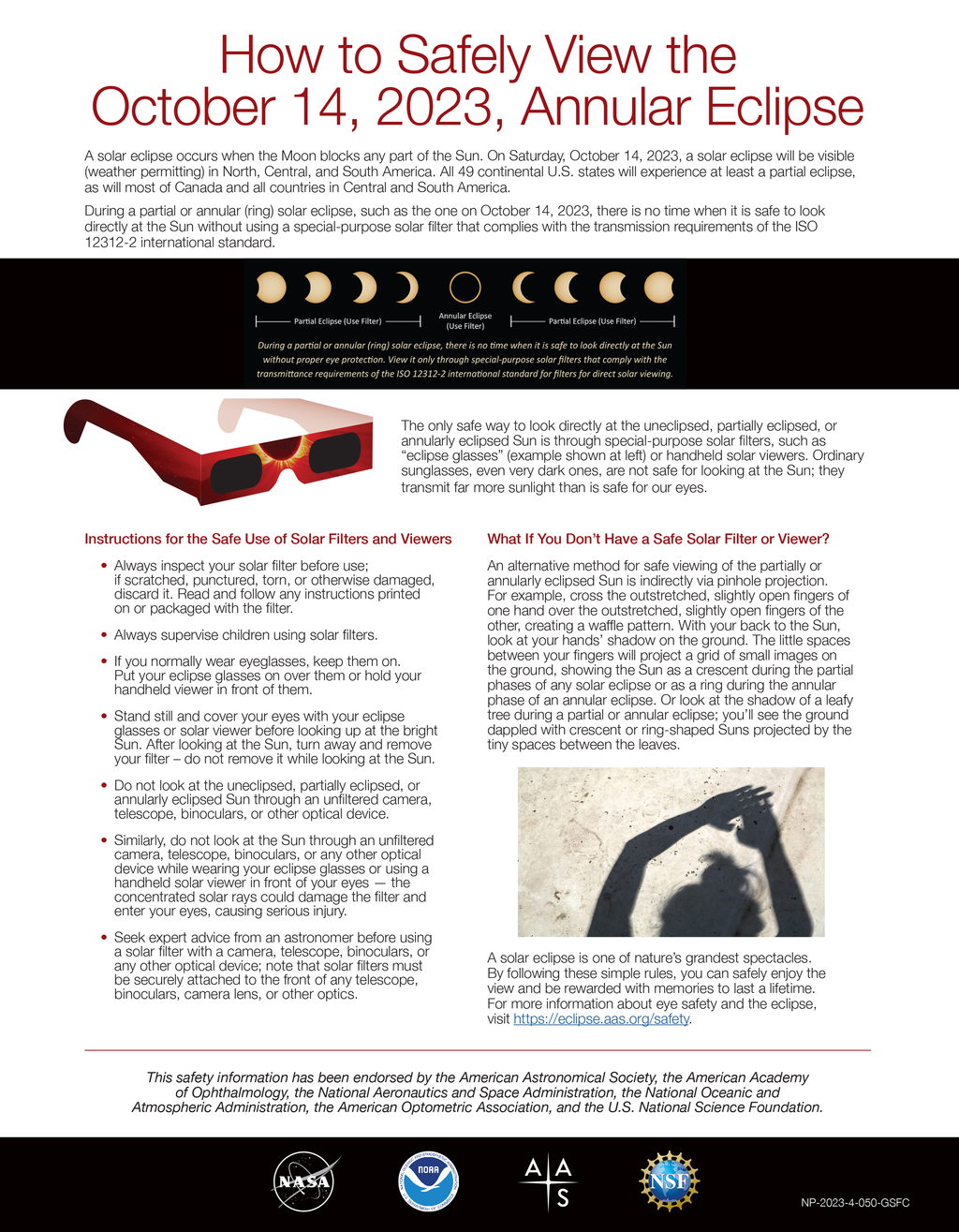
An annular solar eclipse happens when the Moon passes between the Sun and Earth while it is at or near its farthest point from Earth. Because the Moon is farther away from Earth than usual, it appears smaller than the Sun and does not completely cover the Sun's disk. Because of this, the Sun will appear like a “ring of fire” in the sky for those in the path of annularity.
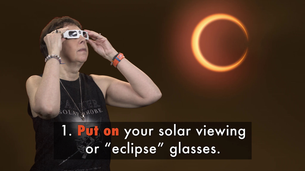
During an annular eclipse, it is never safe to look directly at the Sun without specialized eye protection designed for solar viewing.
To learn more about eclipses visit: science.nasa.gov/eclipses.

An annular solar eclipse photographed on October 14, 2023.
Image Credit: NASA/Jim Spann
An annular solar eclipse photographed on October 14, 2023.
Image Credit: NASA/Jim Spann
An annular solar eclipse photographed on October 14, 2023.
Image Credit: NASA/Jim Spann
A partial solar eclipse photographed on October 14, 2023.
Image Credit: NASA/Jim Spann
This composite shows a sequence of images taken during the annular solar eclipse in Albuquerque, New Mexico, on October 14, 2023.
Image Credit: NASA/Paul Morris
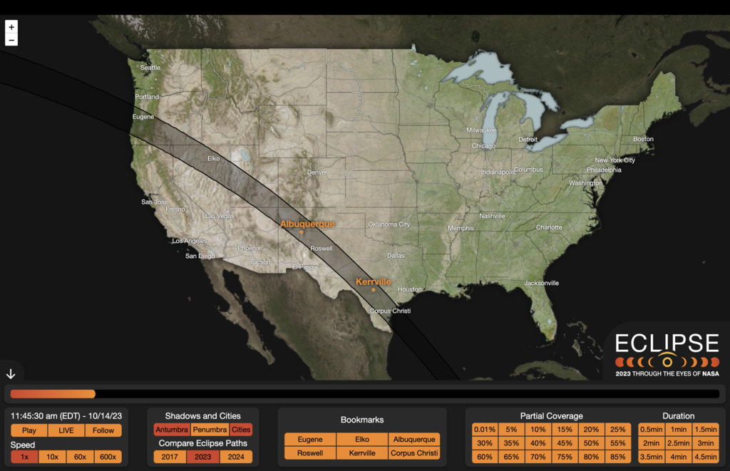
On October 14, 2023, an annular solar eclipse crossed North, Central, and South America. Visible in parts of the United States, Mexico, and many countries in South and Central America, millions of people in the Western Hemisphere were able to experience this “ring of fire” eclipse. NASA’s official broadcast and outreach teams were located in Kerrville, TX, and Albuquerque, NM, to capture the event and celebrate with the communities in the path of annularity.
View the Official NASA Broadcast
Credit: NASA
 imager aboard DSCVR (Deep Space Climate Observatory), a joint NASA, NOAA, and U.S. Air Force satellite. In this view, acquired at 16:58 Universal Time (11:58 a.m. Central Daylight Time), the shadow, or umbra, from the Moon can be seen falling across the southeastern coast of Texas, near Corpus Christi.Image Credit: NASA/DSCOVR")
The above image was acquired during the eclipse by NASA’s EPIC (Earth Polychromatic Imaging Camera) imager aboard DSCVR (Deep Space Climate Observatory), a joint NASA, NOAA, and U.S. Air Force satellite.
In this view, acquired at 16:58 Universal Time (11:58 a.m. Central Daylight Time), the shadow, or umbra, from the Moon can be seen falling across the southeastern coast of Texas, near Corpus Christi.
Image Credit: NASA/DSCOVR
Credits
Please give credit for this item to:
NASA's Goddard Space Flight Center
-
Producers
- Beth Anthony (KBR Wyle Services, LLC)
- Joy Ng (KBR Wyle Services, LLC)
Release date
This page was originally published on Wednesday, November 1, 2023.
This page was last updated on Thursday, February 29, 2024 at 2:20 PM EST.
Related
- ID: 5340
- ID: 14400
 Infographic
 - ID: 14446
 Produced Video
 - ID: 5169
- ID: 14394
 Produced Video
 - ID: 14390
![VERTICAL VersionMusic Credit: “Tall Grass” by Jacob Paul Turner [BMI], Marc Pueschl [GEMA], Sebastian Barnaby Robertson [BMI] via Universal Production MusicComplete transcript available.](/vis/a010000/a014300/a014390/AnnularEclipseSafety_Thumbnail-VERTICAL_print.jpg) Produced Video
Produced Video - ID: 14325
![Credit: NASA's Goddard Space Flight CenterMusic: "Insect Village" by Anthony Donje [PRS] from Universal Production MusicComplete transcript available.](/vis/a010000/a014300/a014325/14325_AnnularEclipseExplainer_FB.00120_print.jpg) Produced Video
Produced Video