Aug. 31st, 2020
Data visualization featuring the glacier rich region of the Himalayas, along with many of Earth’s highest peaks. The visualization sequence starts with a wide view of the Tibetan plateau and moves along a hiking path highlighting Mt. Everest, Mt. Lhotse, Mt Nuptse, the Everest Base Camp, the Khumbhu glacier, all the way to Imja Lake. Moving to a top-down view of Imja Lake, a time series of Landsat data unveils its dramatic growth for the period 1989-2019.This video is also available on our YouTube channel. Data visualization content in 9600x3240 resolution. This set of frames can be shown on 3x3 and 5x3 hyperwalls. A lower resolution preview movie is provided and it includes lines to illustrate the extents of the hyperwall screens. Zoom in to the region without the city names - for video editors who may want to fade the names out. Animated gif image of Imja Lake in 1989 and in 2019 using Landsat data. Glaciers are retreating on a near-global scale due to rising temperatures and climate change. The melt and retreat of glaciers contributes to sea level rise and in the formation of glacial lakes typically right at the foot of the glaciers. 
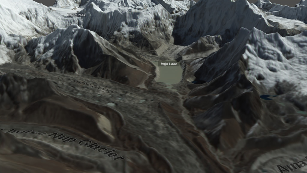
In the largest-ever study of glacial lakes, NASA-funded researchers Dan Shugar et al. working under a grant from NASA’s High Mountain Asia Program found that glacial lake volume has increased by about 50% worldwide since 1990. The findings, published in the journal Nature Climate Change with the title Rapid worldwide growth of glacial lakes since 1990 affect how researchers evaluate the amount of glacial meltwater reaching the oceans and contributing to sea level rise as well as evaluate hazard risks for mountain communities downstream. Glacial lakes, which are often dammed by ice or glacial sediment called a moraine, are not stable like the lakes most people are used to swimming or boating in. Rather, they can be quite unstable and can burst their banks or dams, causing massive floods downstream. These kinds of floods from glacial lakes, also known as glacial lake outburst floods or GLOFs, have been responsible for thousands of deaths over the last century, as well as the destruction of villages, infrastructure and livestock.The data visualization featured on this page showcases the glacier rich and wondrous landscape of High Mountain Asia and provides a glimpse into how glacial lakes have increased during the last thirty years, by demonstrating the growth of Imja Lake for the period 1989-2019. It is important to mention that while Imja Lake is just one of the 14,394 glacial lakes analyzed by the science team in the study for the period of 2015-2018, it serves as a vivid example due to its dramatic growth.The visualization sequence starts with a wide view of Asia and the Tibetan plateau and slowly zooms into the Himalayan region, which includes many of Earth’s highest peaks and is paired with the highest concentration of snow and glaciers outside of the polar regions. Soon after a block of the Eastern Himalayan region rises featuring realistically scaled terrain data from the High Mountain Asia 8-meter Digital Elevation Model (DEM). The 8-meter DEM is draped over with Landsat 8 data from the same region. The sequence takes us on a hiking path from Mt. Everest (8,848 m / 29,029 ft), Mt. Lhotse (8,516 m / 27,940 ft) and Mt. Nuptse (7,861 m / 25,791 ft), to the Everest Base Camp, the Khumbu Glacier all the way to Imja Lake. Moving to a top-down view, a time series of geo-registered Landsat data unveils the growth of Imja Lake from 1989 to 2019. Outlines of the Imja Lake extents highlight the growth during the 30 years occurring from meltwater from the adjacent glaciers.Until now climate models that translated glacier melt into sea level change assumed that water from glacier melt is instantaneously transported to the oceans, which presented an incomplete picture. Therefore, understanding how much of glacial meltwater is stored in lakes or groundwater underscores the importance of studying and monitoring glacial lakes worldwide. Data Sources:High Mountain Asia 8-meter Digital Elevation Model (DEM) derived from Optical Imagery, Version 1. The dataset is available from the NASA National Snow and Ice Data Center Distributed Active Archive Center (NSIDC DAAC). The DEM is realistically scaled (Vertical exaggeration 1x) in this visualization. The DEM is generated from very-high-resolution imagery from DigitalGlobe satellites (GEOEYE-1, QUICKBIRD-2, WORLDVIEW-1, WORLDVIEW-2, WORLDVIEW-3) during the period of 28 January 2002 to 24 November 2016.Citation: Shean, D. 2017. High Mountain Asia 8-meter DEM Mosaics Derived from Optical Imagery, Version 1. [Subset Used: HMA_DEM8m_MOS_20170716_tile-677 | subregion with extents 27.7394° -28.1638° N, 86.6007°-87.2118° E ]. Boulder, Colorado USA. NASA National Snow and Ice Data Center Distributed Active Archive Center. doi: https://doi.org/10.5067/KXOVQ9L172S2. [Date Accessed: 06/17/2020]. Landsat 5, Landsat 7 and Landsat 8 data comprise the time series of Imja Lake for the period 1989-2019. Landsat 5 Thematic Mapper (TM) Level-1 Data Products (doi: https://doi.org/10.5066/F7N015TQ) were used for the period 1989-1999. The Landsat 5 Product Identifiers are:LT05_L1TP_140041_19891109_20170201_01_T1LT05_L1TP_140041_19900112_20170201_01_T1LT05_L1TP_140041_19910131_20170128_01_T1LT05_L1TP_140041_19921117_20170121_01_T1LT05_L1TP_140041_19931120_20170116_01_T1LT05_L1TP_140041_19941022_20170111_01_T1LT05_L1TP_140041_19951009_20170106_01_T1LT05_L1TP_140041_19961112_20170102_01_T1LT05_L1TP_140041_19970216_20170101_01_T1LT05_L1TP_140041_19981102_20161220_01_T1LT05_L1TP_140041_19990427_20161219_01_T1Landsat 7 Enhanced Thematic Mapper Plus (ETM+) Level-1 Data Products (doi: https://doi.org/10.5066/F7WH2P8G) were used for the period 2000-2012. The Landsat 7 Product Identifiers are:LE07_L1TP_140041_20001030_20170209_01_T1LE07_L1TP_140041_20011017_20170202_01_T1LE07_L1TP_140041_20021020_20170127_01_T1LE07_L1TP_140041_20030124_20170126_01_T1LE07_L1TP_140041_20041110_20170117_01_T1LE07_L1TP_140041_20051113_20170112_01_T1LE07_L1TP_140041_20060116_20170111_01_T1LE07_L1TP_140041_20070103_20170105_01_T1LE07_L1TP_140041_20081020_20161224_01_T1LE07_L1TP_140041_20091023_20161217_01_T1LE07_L1TP_140041_20101026_20161212_01_T1LE07_L1TP_140041_20111013_20161206_01_T1LE07_L1TP_140041_20121015_20161127_01_T1Landsat 8 Operational Land Imagery (OLI) and Thermal Infrared Sensor (TIRS) Level-1 Data Products (doi: https://doi.org/10.5066/F71835S6) were used for the period 2013-2019. The Landsat 8 Product Identifiers are:LC08_L1TP_140041_20131010_20170429_01_T1LC08_L1TP_140041_20140927_20170419_01_T1LC08_L1TP_140041_20150930_20170403_01_T1LC08_L1TP_140041_20161018_20170319_01_T1LC08_L1TP_140041_20171021_20171106_01_T1LC08_L1TP_140041_20181024_20181031_01_T1LC08_L1TP_140041_20191112_20191115_01_T1**Draped over the High Mountain Asia 8-meter Digital Elevation Model (DEM) during the visualization.For the purposes of this data visualization the above Landsat data were processed and color-stretched. Bands 3-2-1 were used for Landsat 5 and 7 data. Bands 4-3-2 were used for Landsat 8 data. In addition, Landsat 7 and 8 data used pan-chromatic sharpening (Band 8). Landsat 5, Landsat 7 and Landsat 8 data courtesy of the U.S Geological Survey and NASA Landsat. Blue Marble: Next Generation was produced by Reto Stöckli, NASA Earth Observatory (NASA Goddard Space Flight Center). Citation: Reto Stöckli, Eric Vermote, Nazmi Saleous, Robert Simmon and David Herring. The Blue Marble Next Generation – A true color earth dataset including seasonal dynamics from MODIS, October 17, 2005.Global 30 Arc-Second Eleveation (GTOPO 30) from USGS. doi: https://doi.org/10.5066/F7DF6PQSShuttle Radar Topography Mission (SRTM) 1 Arc-Second Global. doi: https://doi.org/10.5066/F7PR7TFTNepal city labels and locations were created using Natural Earth 1:10m Cultural Vectors (Populated places database) and OpenStreetMap data.The rest of this webpage offers additional versions and visual material associated with the development of this data-driven visualization. Related pages