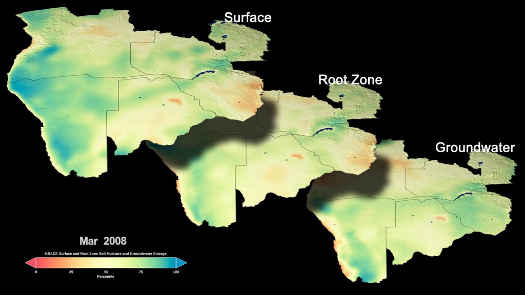
Global Maps of Dryness Help Prepare for Water Use around the Globe
Using measurements from two satellite missions assimilated into a computer model, researchers have created global maps of terrestrial water around the planet. In addition, they can forecast water availability in the United States up to three months out.
Credits
Please give credit for this item to:
NASA's Goddard Space Flight Center
-
Producer
- Kathryn Mersmann (USRA)
-
Writer
- Ellen T. Gray (ADNET Systems, Inc.)
-
Visualizer
- Trent L. Schindler (USRA)
-
Scientist
-
Matthew Rodell
(NASA/GSFC)

-
Matthew Rodell
(NASA/GSFC)
-
Technical support
- Aaron E. Lepsch (ADNET Systems, Inc.)
Series
This page can be found in the following series:Sources
- ID: 4806
 Visualization
Used as a Source In
- ID: 4806Visualization
Release date
This page was originally published on Tuesday, March 31, 2020.
This page was last updated on Tuesday, September 17, 2024 at 11:51 AM EDT.