What Spacecraft Saw During the 2017 Solar Eclipse
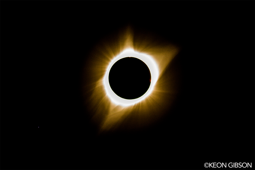
On Aug. 21, 2017, a solar eclipse passed over North America. People throughout the continent experienced a partial solar eclipse, and a total solar eclipse passed over a narrow swath of land stretching from Oregon to South Carolina, called the path of totality.
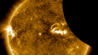
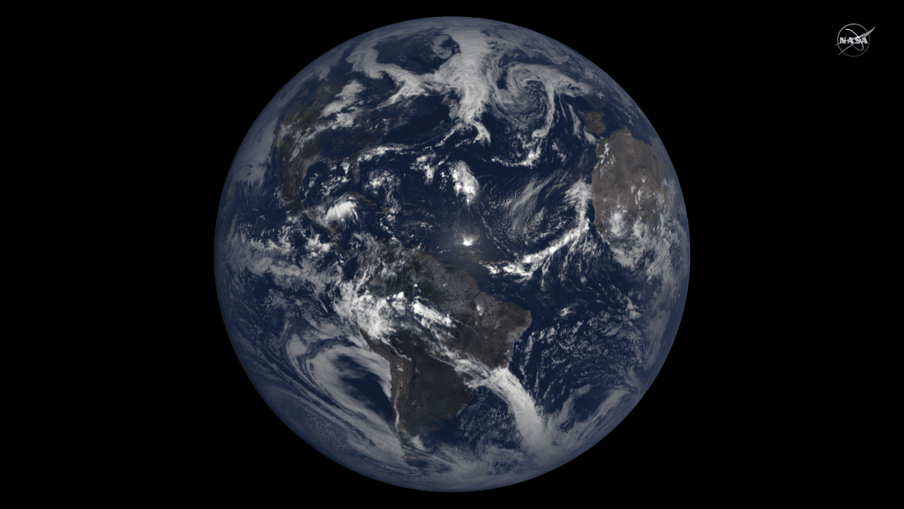
NASA and its partner’s satellites had a unique vantage point to watch the eclipse. Several Sun-watching satellites were in a position to see the Moon cross in front of the Sun, while many Earth-observing satellites – and NASA’s Lunar Reconnaissance Orbiter, which typically images the Moon’s landscape – captured images of the Moon’s shadow on Earth’s surface.
See more and download content at https://go.nasa.gov/2x7b8kf
Complete transcript available.
Watch this video on the NASA Goddard YouTube channel.
Music credit: Wonderful Nature by July Tourret
Imagery provided by:
SDO
NASA/SDO
ISS
NASA/ISS
SOHO
inside image credit: Solar Dynamics Observatory, LMSAL and NASA’s GSFC;
Middle image: Jay Pasachoff, Ron Dantowitz, Christian Lockwood, and the Williams College Eclipse Expedition/NSF/National Geographic
Outside image credit: LASCO from NRL on SOHO from ESA/NASA
Hinode
Image credit: JAXA/NASA
GOES
Image credit: NOAA/NASA’s GOES-16
NOAA’s DSCOVR
Image credit: NASA EPIC Team
Terra
Image credit: NASA Earth Observatory images by Joshua Stevens and Jesse Allen, using MODIS data from the Land Atmosphere Near real-time Capability for EOS (LANCE) and EOSDIS/Rapid Response
Suomi NPP
Image credit: NASA Earth Observatory image by Joshua Stevens and Jesse Allen, using VIIRS data from the University of Wisconsin’s Space Science and Engineering Center Direct Broadcast system.
IRIS
Image credit: LMSAL/NASA, Bart De Pontieu
LRO
Image credit: NASA/GSFC/Arizona State University
Credits
Please give credit for this item to:
NASA's Goddard Space Flight Center
-
Producers
- Genna Duberstein (USRA)
- Scott Wiessinger (USRA)
- Kathryn Mersmann (USRA)
- Kathalina Tran (KBR Wyle Services, LLC)
-
Writer
- Sarah Frazier (ADNET Systems, Inc.)
-
Editor
- Genna Duberstein (USRA)
Series
This page can be found in the following series:Related
- ID: 12704
 Produced Video
Sources
- ID: 12688
 Produced Video
 - ID: 12690
 Produced Video
Release date
This page was originally published on Wednesday, August 30, 2017.
This page was last updated on Wednesday, May 3, 2023 at 1:47 PM EDT.