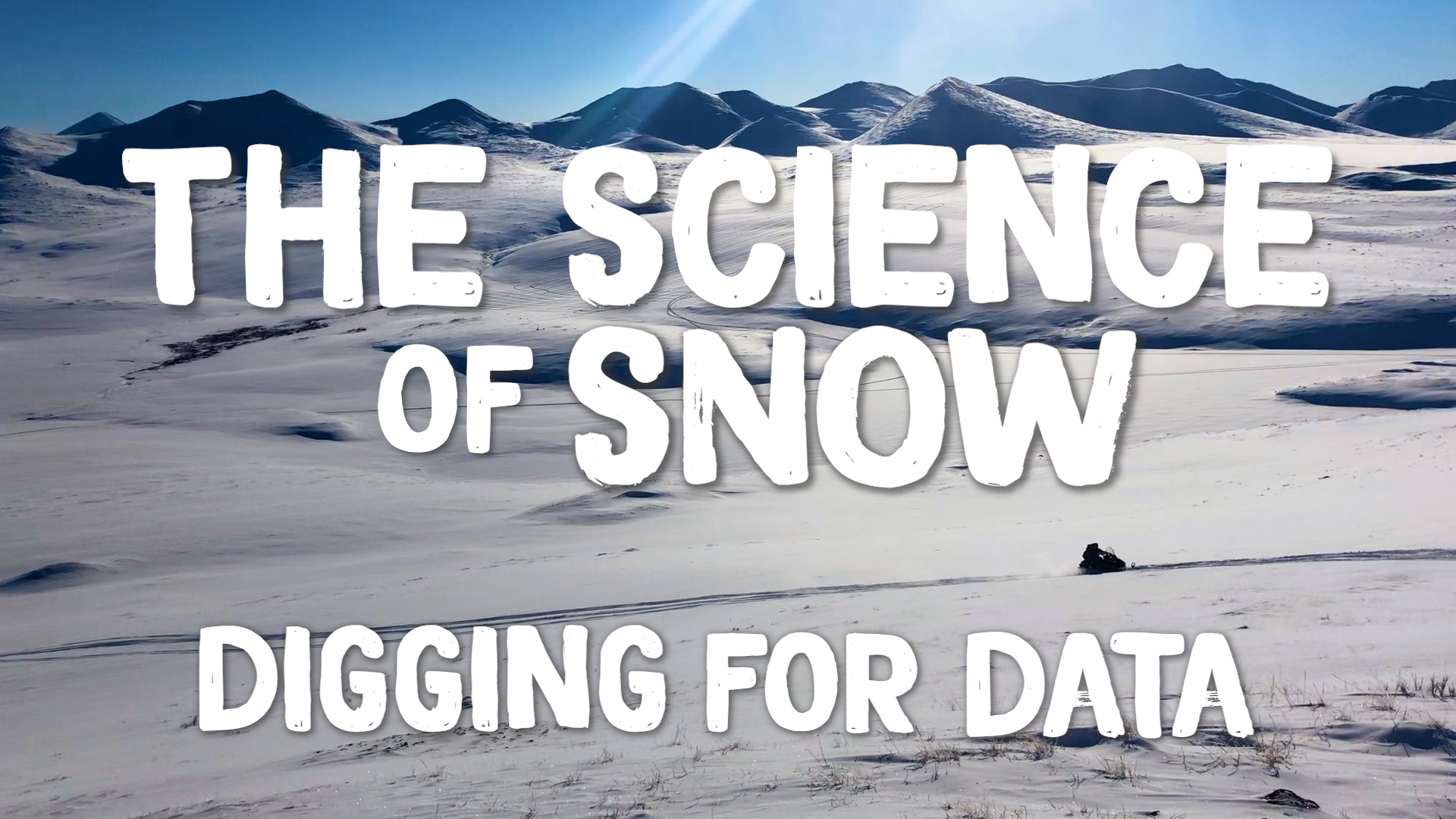
SnowEx Field Campaign: B-roll From The P-3 Orion Aircraft
Five aircraft with a total of ten different sensors will participate in the SnowEx campaign. From a base of operations at Peterson Air Force Base, Colorado Springs, SnowEx will deploy a P-3 Orion aircraft operated by the Scientific Development Squadron ONE (VXS-1), based at Naval Air Station Patuxent River, Maryland. A King Air plane will fly out of Grand Junction, Colorado, while high-altitude NASA jets will fly from Johnson Space Center in Houston.
The planes will carry passive and active microwave sensors that are good at measuring snow-water equivalent in dry snow, but are less optimal for measuring snow forests or light snow cover. The campaign will also deploy an airborne laser instrument to measure snow depth, and airborne sensors to measure surface temperature and reflected light from snow.
Data acquired from the SnowEx campaign will be stored at the National Snow and Ice Data Center in Boulder, Colorado, and will be available to anyone to order at no cost, as is the case with all NASA data.
For more information: https://www.nasa.gov/earthexpeditions
Movies
- PRORES_B-ROLL-12489_SnowEx_B-roll_Outside_Plane_prores.mov (1280x720) [311.5 MB]
- APPLE_TV-12489_SnowEx_B-roll_Outside_Plane_appletv.m4v (1280x720) [23.0 MB]
- NASA_TV-12489_SnowEx_B-roll_Outside_Plane.mpeg (1280x720) [148.7 MB]
- YOUTUBE_HQ-12489_SnowEx_B-roll_Outside_Plane_youtube_hq.mov (1920x1080) [160.0 MB]
- 12489_SnowEx_B-roll_Outside_Plane_Prores.mov (1920x1080) [611.8 MB]
- LARGE_MP4-12489_SnowEx_B-roll_Outside_Plane_large.mp4 (1920x1080) [44.5 MB]
- LARGE_MP4-12489_SnowEx_B-roll_Outside_Plane_large.webm (1920x1080) [4.9 MB]
- NASA_PODCAST-12489_SnowEx_B-roll_Outside_Plane_ipod_sm.mp4 (320x240) [7.5 MB]
Images
- LARGE_MP4-12489_SnowEx_B-roll_Outside_Plane_large.00550_print.jpg (1024x576) [88.7 KB]
- LARGE_MP4-12489_SnowEx_B-roll_Outside_Plane_large.00550_thm.png (80x40) [5.3 KB]
- LARGE_MP4-12489_SnowEx_B-roll_Outside_Plane_large.00550_searchweb.png (320x180) [66.2 KB]
- LARGE_MP4-12489_SnowEx_B-roll_Outside_Plane_large.00550_web.png (320x180) [66.2 KB]
A collection of b-roll captured from the Peterson Air Force Base in Colorado Springs of the P-3 Orion aircraft.
Movies
- APPLE_TV-12489_SnowEx_B-roll_Inside_Plane_appletv.m4v (1280x720) [73.5 MB]
- NASA_TV-12489_SnowEx_B-roll_Inside_Plane.mpeg (1280x720) [494.3 MB]
- PRORES_B-ROLL-12489_SnowEx_B-roll_Inside_Plane_prores.mov (1280x720) [1.0 GB]
- APPLE_TV-12489_SnowEx_B-roll_Inside_Plane_appletv.webm (1280x720) [16.2 MB]
- LARGE_MP4-12489_SnowEx_B-roll_Inside_Plane_large.webm (1920x1080) [16.2 MB]
- 12489_SnowEx_B-roll_Inside_Plane_Prores.mov (1920x1080) [1.9 GB]
- LARGE_MP4-12489_SnowEx_B-roll_Inside_Plane_large.mp4 (1920x1080) [148.7 MB]
- YOUTUBE_HQ-12489_SnowEx_B-roll_Inside_Plane_youtube_hq.mov (1920x1080) [812.3 MB]
- NASA_PODCAST-12489_SnowEx_B-roll_Inside_Plane_ipod_sm.mp4 (320x240) [25.2 MB]
Images
- LARGE_MP4-12489_SnowEx_B-roll_Inside_Plane_large.02550_print.jpg (1024x576) [71.6 KB]
- LARGE_MP4-12489_SnowEx_B-roll_Inside_Plane_large.02550_thm.png (80x40) [6.0 KB]
- LARGE_MP4-12489_SnowEx_B-roll_Inside_Plane_large.02550_searchweb.png (320x180) [70.6 KB]
- LARGE_MP4-12489_SnowEx_B-roll_Inside_Plane_large.02550_web.png (320x180) [70.6 KB]
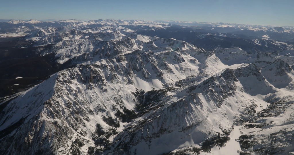
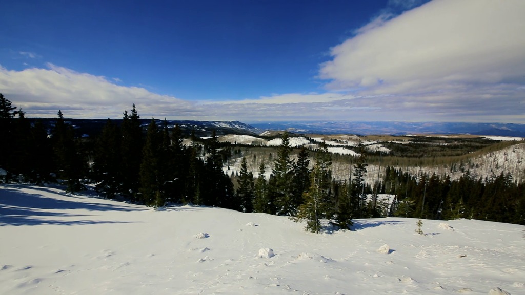
A collection of b-roll captured during a science flight from Colorado Springs over Grand Mesa and Senator Beck Basin.
Movies
- APPLE_TV-12489_SnowEx_B-roll_Landscape2_VX-683282_appletv.m4v (1280x720) [32.2 MB]
- NASA_TV-12489_SnowEx_B-roll_Landscape2_VX-683282.mpeg (1280x720) [228.8 MB]
- PRORES_B-ROLL-12489_SnowEx_B-roll_Landscape2_VX-683282_prores.mov (1280x720) [488.2 MB]
- 12489_SnowEx_B-roll_Landscape2_Prores.mov (1920x1080) [930.0 MB]
- LARGE_MP4-12489_SnowEx_B-roll_Landscape2_VX-683282_large.mp4 (1920x1080) [68.5 MB]
- YOUTUBE_HQ-12489_SnowEx_B-roll_Landscape2_VX-683282_youtube_hq.mov (1920x1080) [352.6 MB]
- LARGE_MP4-12489_SnowEx_B-roll_Landscape2_VX-683282_large.webm (1920x1080) [7.2 MB]
- NASA_PODCAST-12489_SnowEx_B-roll_Landscape2_VX-683282_ipod_sm.mp4 (320x240) [11.9 MB]
Images
- LARGE_MP4-12489_SnowEx_B-roll_Landscape2_VX-683282_large.00146_print.jpg (1024x576) [89.2 KB]
- LARGE_MP4-12489_SnowEx_B-roll_Landscape2_VX-683282_large.00146_thm.png (80x40) [4.7 KB]
- LARGE_MP4-12489_SnowEx_B-roll_Landscape2_VX-683282_large.00146_searchweb.png (320x180) [70.5 KB]
- LARGE_MP4-12489_SnowEx_B-roll_Landscape2_VX-683282_large.00146_web.png (320x180) [70.5 KB]
A collection of b-roll captured of the view during a SnowEx science flight over Grand Mesa and Senator Beck Basin in Colorado.
Movies
- NASA_TV-12489_B-roll_PAX_P3_Prores.mpeg (1280x720) [351.1 MB]
- APPLE_TV-12489_B-roll_PAX_P3_Prores_appletv.m4v (1280x720) [55.7 MB]
- PRORES_B-ROLL-12489_B-roll_PAX_P3_Prores_prores.mov (1280x720) [772.4 MB]
- APPLE_TV-12489_B-roll_PAX_P3_Prores_appletv.webm (1280x720) [9.3 MB]
- LARGE_MP4-12489_B-roll_PAX_P3_Prores_large.mp4 (1920x1080) [105.4 MB]
- 12489_B-roll_PAX_P3_Prores.mov (1920x1080) [1.4 GB]
- YOUTUBE_HQ-12489_B-roll_PAX_P3_Prores_youtube_hq.mov (1920x1080) [756.6 MB]
- NASA_PODCAST-12489_B-roll_PAX_P3_Prores_ipod_sm.mp4 (320x240) [18.4 MB]
Images
- LARGE_MP4-12489_B-roll_PAX_P3_Prores_large.00001_print.jpg (1024x576) [127.3 KB]
- LARGE_MP4-12489_B-roll_PAX_P3_Prores_large.00001_thm.png (80x40) [6.7 KB]
- LARGE_MP4-12489_B-roll_PAX_P3_Prores_large.00001_web.png (320x180) [90.9 KB]
- LARGE_MP4-12489_B-roll_PAX_P3_Prores_large.00001_searchweb.png (320x180) [90.9 KB]
A collection of b-roll captured from Patuxent River in Maryland where snow sensors were integrated into the P-3 Orion aircraft.
Movies
- APPLE_TV-12489_B-roll_PAX_P3Inside_Prores_appletv.m4v (1280x720) [36.2 MB]
- PRORES_B-ROLL-12489_B-roll_PAX_P3Inside_Prores_prores.mov (1280x720) [508.3 MB]
- NASA_TV-12489_B-roll_PAX_P3Inside_Prores.mpeg (1280x720) [239.7 MB]
- APPLE_TV-12489_B-roll_PAX_P3Inside_Prores_appletv.webm (1280x720) [7.0 MB]
- LARGE_MP4-12489_B-roll_PAX_P3Inside_Prores_large.mp4 (1920x1080) [72.3 MB]
- 12489_B-roll_PAX_P3Inside_Prores.mov (1920x1080) [985.1 MB]
- YOUTUBE_HQ-12489_B-roll_PAX_P3Inside_Prores_youtube_hq.mov (1920x1080) [281.6 MB]
- NASA_PODCAST-12489_B-roll_PAX_P3Inside_Prores_ipod_sm.mp4 (320x240) [13.3 MB]
Images
- LARGE_MP4-12489_B-roll_PAX_P3Inside_Prores_large.00465_print.jpg (1024x576) [130.0 KB]
- LARGE_MP4-12489_B-roll_PAX_P3Inside_Prores_large.00465_thm.png (80x40) [7.5 KB]
- LARGE_MP4-12489_B-roll_PAX_P3Inside_Prores_large.00465_web.png (320x180) [102.4 KB]
- LARGE_MP4-12489_B-roll_PAX_P3Inside_Prores_large.00465_searchweb.png (320x180) [102.4 KB]
A collection of b-roll captured from Patuxent River in Maryland where snow sensors were integrated into the P-3 Orion aircraft.
Credits
Please give credit for this item to:
NASA's Goddard Space Flight Center
Videographer
- Joy Ng (KBRwyle)
Support
- Kathryn Mersmann (KBRwyle)
Related pages
SnowEx Field Campaign: 4K B-roll From The P-3 Orion Aircraft
Feb. 22nd, 2017
Read moreDuring the 2017 SnowEx field campaign, the P-3 Orion aircraft flew over Grand Mesa and Senator Beck Basin in Colorado. The P-3 Orion aircraft was stationed at the Peterson Air Force Base in Colorado Springs. A collection of 4K b-roll captured during a science flight on the P-3 Orion aircraft. SnowEx is a NASA led multi-year research campaign to improve measurements of how much snow is on the ground at any given time and how much liquid water is contained in that snow.Five aircraft with a total of ten different sensors will participate in the SnowEx campaign. From a base of operations at Peterson Air Force Base, Colorado Springs, SnowEx will deploy a P-3 Orion aircraft operated by the Scientific Development Squadron ONE (VXS-1), based at Naval Air Station Patuxent River, Maryland. A King Air plane will fly out of Grand Junction, Colorado, while high-altitude NASA jets will fly from Johnson Space Center in Houston.The planes will carry passive and active microwave sensors that are good at measuring snow-water equivalent in dry snow, but are less optimal for measuring snow forests or light snow cover. The campaign will also deploy an airborne laser instrument to measure snow depth, and airborne sensors to measure surface temperature and reflected light from snow.Data acquired from the SnowEx campaign will be stored at the National Snow and Ice Data Center in Boulder, Colorado, and will be available to anyone to order at no cost, as is the case with all NASA data.For more information: https://www.nasa.gov/earthexpeditions For More InformationSee [NASA: Snow Science in Support of Our Nation’s Water Supply](https://www.nasa.gov/feature/goddard/2017/snow-science-in-support-of-our-nations-water-supply) Related pages
NASA Investigates Water Supply in Snow
Feb. 16th, 2017
Read moreComplete transcript available.Music credit: "Detective Analysis" by Laurent Dury [SACEM] from Killer Tracks Music This February, a NASA-led research campaign called SnowEx kicked off in Colorado. The 5-year study will advance global measurements of how much snow is on the ground at any given time and how much liquid water is contained in that snow. The amount of water in snow plays a huge role in water availability for drinking water, agriculture, and hydropower.Teams of 50 researchers are stationed at Grand Mesa and Senator Beck Basin over a three-week period to measure snow using a variety of snow-sensing instruments and techniques. Ground measurements will allow the team to validate the remotely sensed measurements acquired by multiple sensors on the various aircraft.Data acquired from the SnowEx campaign will be stored at the National Snow and Ice Data Center in Boulder, Colorado, and will be available to anyone to order at no cost, as is the case with all NASA data. For more information: https://www.nasa.gov/earthexpeditions/ Related pages
SnowEx Field Campaign: B-roll From Grand Mesa
Feb. 12th, 2017
Read moreA collection of b-roll captured from the Grand Mesa in Colorado. SnowEx is a NASA led multi-year research campaign to improve measurements of how much snow is on the ground at any given time and how much liquid water is contained in that snow.Starting in February, teams of 50 researchers are stationed at Grand Mesa and Senator Beck Basin over a three-week period to measure snow using a variety of snow-sensing instruments and techniques.Ground measurements will allow the team to validate the remotely-sensed measurements acquired by the multiple sensors on the various aircraft.Data acquired from the SnowEx campaign will be stored at the National Snow and Ice Data Center in Boulder, Colorado, and will be available to anyone to order at no cost, as is the case with all NASA data. For more information: https://www.nasa.gov/earthexpeditions/ Related pages
Snow Live Shots (Feb. 17, 2017)
Feb. 7th, 2017
Read moreB-roll for NASA interviews on Friday, February 17, 2017. Soundbites from NASA Scientist Dr. Dalia Kirschbaum. Includes TEXT transcript file. Note that slates separate the questiosn and for 4 questions there are two options - one without graphics and one with graphics. Researchers have completed the first flights of a NASA-led field campaign that is targeting one of the biggest gaps in scientists' understanding of Earth's water resources: snow.Complete transcript available. Canned interview with graphics with NASA Scientist Dr. Dalia Kirschbaum Short NASA snow facts social media video. Canned Interview with NASA Scientist Dorothy Hall NASA Views Snow from Space: What a Difference a Year MakesSnow doesn’t fall everywhere, but how much falls and where has global consequencesThe snapshot of snow from space tells a different story every year. Last January, a winter storm pummeled the east coast and broke several snowfall records. This winter the Sierra Nevada was hit by consecutive storms, each one piling more snow on top of the last storm's snow. NASA’s view from space highlights these dramatic differences, but the story is incomplete.More than a sixth of the world’s population relies on melt water from seasonal snowpack and glaciers, but it is challenging to measure the volume and depth of snow cover, especially in remote locations and dense forests. Determining exactly how much snow is on the ground globally and understanding the contribution of winter storms to the world’s water resources are key pieces to the Earth system puzzle.NASA is in the field right now, testing techniques and technologies for measuring snow’s water content. Join NASA scientists on Friday, February 17, from 6:00 a.m – 11:30 a.m. EST to show your viewers NASA’s snow imagery and discuss strides towards improved space-based measurement of snow on Earth.The effects of snow are global. For example, California’s Central Valley, which relies on seasonal snow melt, constitutes only 2 percent of US cropland, yet it produces nearly half the nation’s fruits and nuts. The benefits of snow measurements are huge because of the importance of snow to agriculture, water security, natural hazards and more.Thanks to a half-century of snow observations, we know these amazing facts, which are crucial to understanding what’s necessary to advance snow measurements.• More than one-sixth of the world’s population (1.2 billion people) relies on melt water from snowpack and glaciers. • Up to 70 percent of water resources in the western United States are from snow melt. In California, more than 70 percent of water from the San Joaquin River, which originates from Sierra Nevada snow, is used to irrigate the Central Valley.• 60 million people in the U.S. rely on snowmelt as their primary source of freshwater.• Globally, 30 percent of land area gets covered by snow and about half of the snow cover area has tree cover of some sort.• Since 1967, a million square miles of spring snow cover has disappeared from the Northern Hemisphere, an area the size of the entire southwestern United States.• NASA’s Global Precipitation Measurement Mission (GPM) tracks falling snow, including off the coast where few observations exist, in the mountains where ground-based radar may have challenges, and even at the tops of hurricanes.• Snowflakes (crystals) have six sides, but most of the snowflakes we see are multiple crystals stuck together. Snow crystals stick together and begin to change or metamorphose as soon as they fall to the ground.• The same sensing technology used to measure seasonal snowpack on Earth can be used to measure ice on Mars.*** To Book a Window ***Contact Clare Skelly – clare.a.skelly@nasa.gov / 301-286-4994 (office)HD Satellite Coordinates for G17-K18Upper: Galaxy 17 Ku-band Xp 18 Slot Upper| 91.0 ° W Longitude | DL 12069.0 MHz | Vertical Polarity | QPSK/DVB-S | FEC 3/4 | SR 13.235 Mbps | DR 18.2954 MHz | HD 720p | Format MPEG2 | Chroma Level 4:2:0 | Audio EmbeddedSuggested Questions:1. NASA satellites see snow cover from space. How does this winter compare to previous years?2. NASA scientists are in the field right now testing advanced technologies for measuring snow. How will these new measurements be used? 3. Can NASA actually see falling snow from space?4. Up to 70 percent of water resources in the western United States come from snow melt. California has been getting heavy rain and snow recently, does that mean the drought is over?5. How does snow impact parts of the country that rarely see any snowfall?6. Where can we learn more?Scientists:Dorothy Hall / NASA Scientist—or—Matthew Rodell / NASA Scientist—or—Dalia Kirschbaum / NASA Scientist Related pages
How a NASA Science Flight is No Ordinary Journey
March 24th, 2017
Read moreComplete transcript available.Music credit: “Time Shift Equalibrium” by Ben Niblett [PRS] and Jon Cotton [PRS] from Killer Tracks MusicWatch this video on the NASA Goddard YouTube channel. A GIF optimized for posting on Twitter.The SnowEx mission flew over specific flight lines in Grand Mesa and Senator Beck Basin where scientists were also on the ground collecting science data. A GIF optimized for posting on Twitter.The Navy P-3 Orion aircraft was used on the SnowEx mission. A GIF optimized for posting on Twitter.The Navy P-3 Orion aircraft was used on the SnowEx mission. A group of scientists and pilots conducted a series of science flights over Western Colorado for a new five-year NASA-led airborne mission called SnowEx.SnowEx is exploring better ways to measuring how much water is stored in snow-covered regions with the goal of eventually creating a future snow satellite mission. More accurate snow measurements will help scientists and decisions-makers better understand our world’s water supply and better predict floods and droughts. Data acquired from the SnowEx campaign will be stored at the National Snow and Ice Data Center in Boulder, Colorado, and will be available to anyone to order at no cost, as is the case with all NASA data.For more information:NASA's SnowEx Challenges the Sensing Techniques...'Until They Break'NASA: Snow Science in Support of Our Nation's Water Supply For More InformationSee [NASA's SnowEx Challenges the Sensing Techniques...'Until They Break'](https://www.nasa.gov/feature/goddard/2017/nasa-s-snowex-challenges-the-sensing-techniques-until-they-break) Related pages