Coastal Fly Down from Santa Barbara 2
Coastal fly down to Santa Barbara (N to S) #2
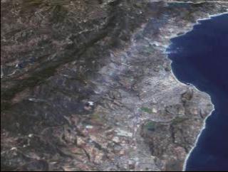
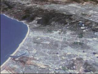
Flying down US 101 in Santa Barbara to Los Angeles Ca.
Using Landsat 7 data, we are albe to add USGS elevation data, which helps us see
in 3D the coast of California.
Credits
Please give credit for this item to:
NASA/Goddard Space Flight Center
Scientific Visualization Studio
-
Animator
- Stuart A. Snodgrass (Global Science and Technology, Inc.)
-
Scientist
- Darrel Williams (NASA/GSFC)
Missions
This page is related to the following missions:Series
This page can be found in the following series:Datasets used
-
[Landsat-7: ETM+]
ID: 55This dataset can be found at: http://landsat.gsfc.nasa.gov/about/wrs.html
See all pages that use this dataset
Note: While we identify the data sets used on this page, we do not store any further details, nor the data sets themselves on our site.
Related
- ID: 1230
 Visualization
Alternate Versions
- ID: 1222
 Visualization
 - ID: 1225
 Visualization
Release date
This page was originally published on Monday, November 1, 1999.
This page was last updated on Wednesday, May 3, 2023 at 1:58 PM EDT.