Monsoons: Wet, Dry, Repeat...
Complete transcript available.
Music: Letting Go by Mario Lauer, 24 Dimensions by Christian Telford, David Travis Edwards, Matthew St. Laurent, and Robert Anthony Navarro
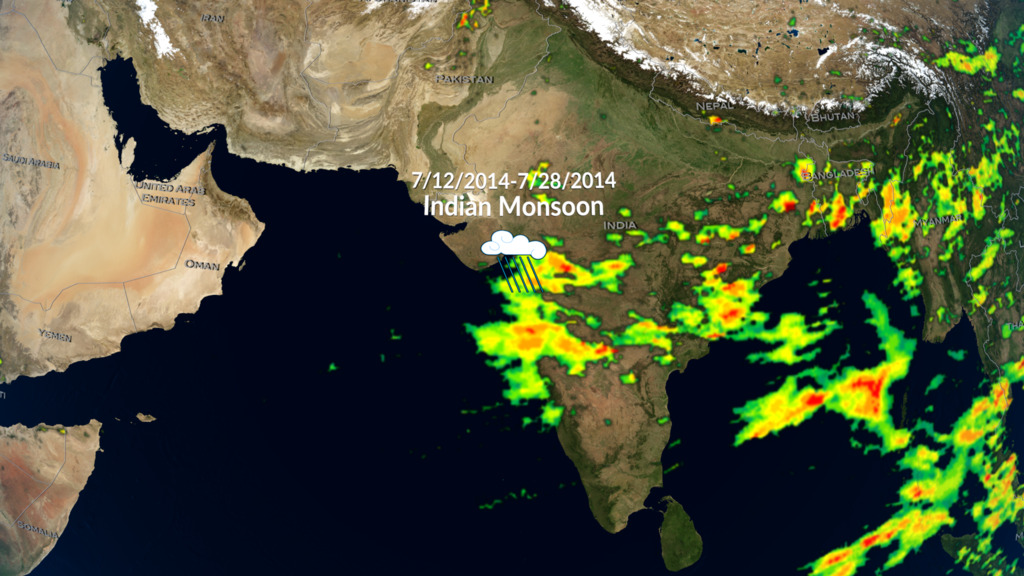
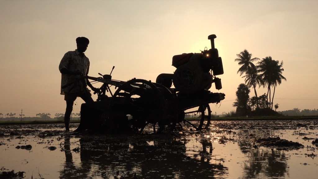
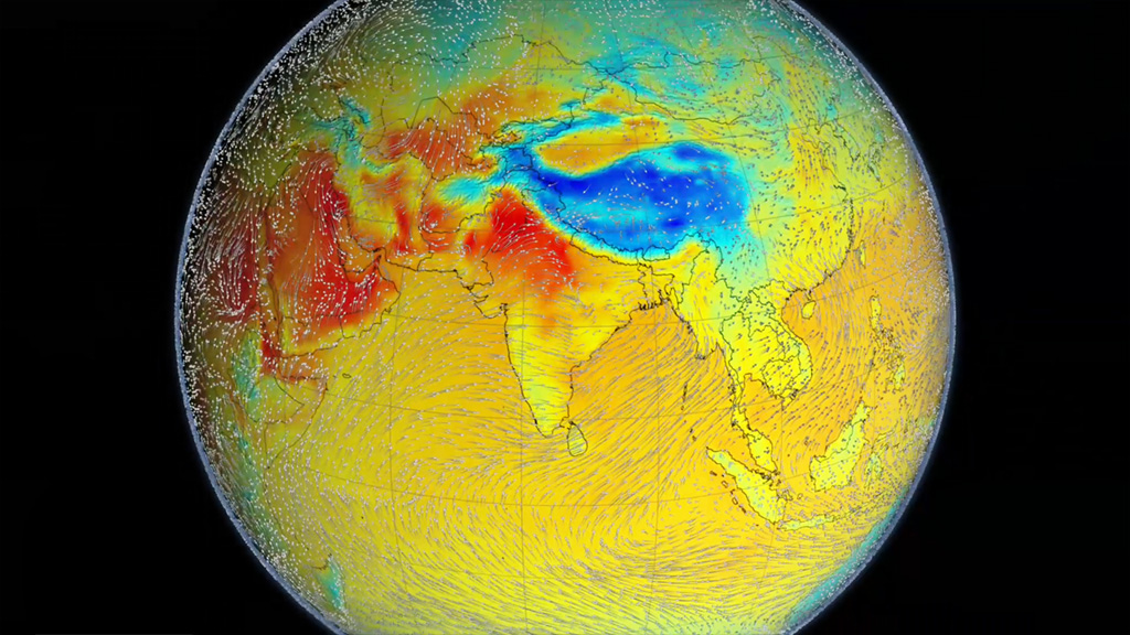
The monsoon is a seasonal rain and wind pattern that occurs over South Asia (among other places). Through NASA satellites and models we can see the monsoon patterns like never before. Monsoon rains provide important reservoirs of water that sustain human activities like agriculture and supports the natural environment through replenishment of aquifers. However, too much rainfall routinely causes disasters in the region, including flooding of the major rivers and landslides in areas of steep topography.
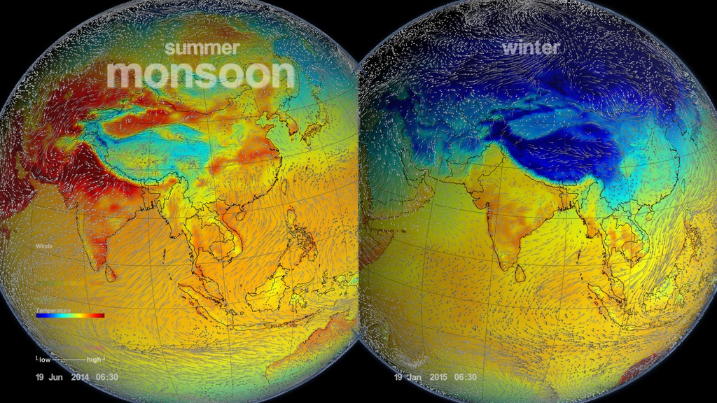
This visualization uses a combination of NASA satellite data and models to show how and why the monsoon develops over this region. In the summer the land gets hotter, heating the atmosphere and pulling in cooler, moisture-laden air from the oceans. This causes pulses in heavy rainfall throughout the region. In the winter the land cools off and winds move towards the warmer ocean and suppressing rainfall on land.
Credits
Please give credit for this item to:
NASA's Goddard Space Flight Center
-
Producer
- Ryan Fitzgibbons (USRA)
-
Visualizers
-
Greg Shirah
(NASA/GSFC)

- Horace Mitchell (NASA/GSFC)
-
Alex Kekesi
(Global Science and Technology, Inc.)
- Lori Perkins (NASA/GSFC)
-
Greg Shirah
(NASA/GSFC)
-
Scientists
- Gail Skofronick Jackson (NASA/GSFC)
- Dalia B Kirschbaum (NASA/GSFC)
-
George Huffman
(NASA/GSFC)
Missions
This page is related to the following missions:Series
This page can be found in the following series:Datasets used
-
Soil Moisture [GEMS]
ID: 405GEMS stands for Goddard Earth Modeling System. It is also known as the NSIPP Global Climate Model.
See all pages that use this dataset -
CPC (Climate Prediction Center) Cloud Composite
ID: 600Global cloud cover from multiple satellites
See all pages that use this dataset -
MERRA
ID: 684 -
IMERG
ID: 863This dataset can be found at: http://pmm.nasa.gov/sites/default/files/document_files/IMERG_ATBD_V4.4.pdf
See all pages that use this dataset
Note: While we identify the data sets used on this page, we do not store any further details, nor the data sets themselves on our site.
Related
- ID: 5361
 Visualization
Alternate Versions
- ID: 12254
 Produced Video
 - ID: 4397
 Visualization
 - ID: 12252
 Produced Video
Used as a Source In
- ID: 12303
 Produced Video
Release date
This page was originally published on Thursday, June 23, 2016.
This page was last updated on Thursday, August 29, 2024 at 11:27 AM EDT.