Tracking Agricultural Water Use from Space
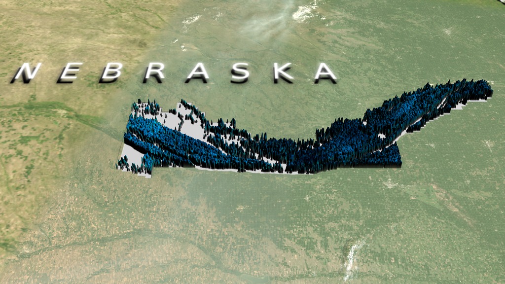
Water managers in 15 states accross the U.S. use METRIC technology to monitor and track agricultural water consumption. Nebraksa has 23 natural resource districts and more than 10 major river basins, making this satellite-based technology a critical part of managing water resources.
For complete transcript, click here.
Watch this video on the NASA Goddard YouTube channel.
Water managers in 15 states across the United States currently use METRIC technology to track agricultural water use. METRIC measures evapotranspiration- the amount of water evaporating from the soil and transpiring from plant's leaves. This process cools the plant down so irrigated farm fields appear cooler (bluer) in Landsat satellite images. The thermal band data on Landsat satellites allows water specialists to measure ET. The latest evolution of METRIC technology- an application called EEFLUX, will allow anyone in the world to produce field-scale maps of water consumption, including on mobile devices. METRIC was developed in the early 2000s and to date, EEFLUX has been introduced to the California Department of Water Resources, the California Water Control Board, and the World Bank.
Credits
Please give credit for this item to: NASA's Goddard Space Flight Center
-
Producers
- Alison Schuyler Ogden (NASA/GSFC)
- Matthew R. Radcliff (USRA)
-
Visualizer
-
Alex Kekesi
(Global Science and Technology, Inc.)

-
Alex Kekesi
(Global Science and Technology, Inc.)
-
Scientist
- Ayse Kilic (University of Nebraska)
Series
This page can be found in the following series:Tapes
The media on this page originally appeared on the following tapes:-
Nebraska Water Management
(ID: 2015077)
Wednesday, September 30, 2015 at 4:00AM
Produced by - David Hon (NASA)
Related
- ID: 4381
 Visualization
Release date
This page was originally published on Thursday, October 15, 2015.
This page was last updated on Wednesday, May 3, 2023 at 1:49 PM EDT.