NASA On Air: Great Lakes Ice Time Lapse - Winter 2013 to 2014 (3/25/2015)
LEAD: Instruments aboard NASA satellites are able to track the winter ice growth and retreat across the Great Lakes.
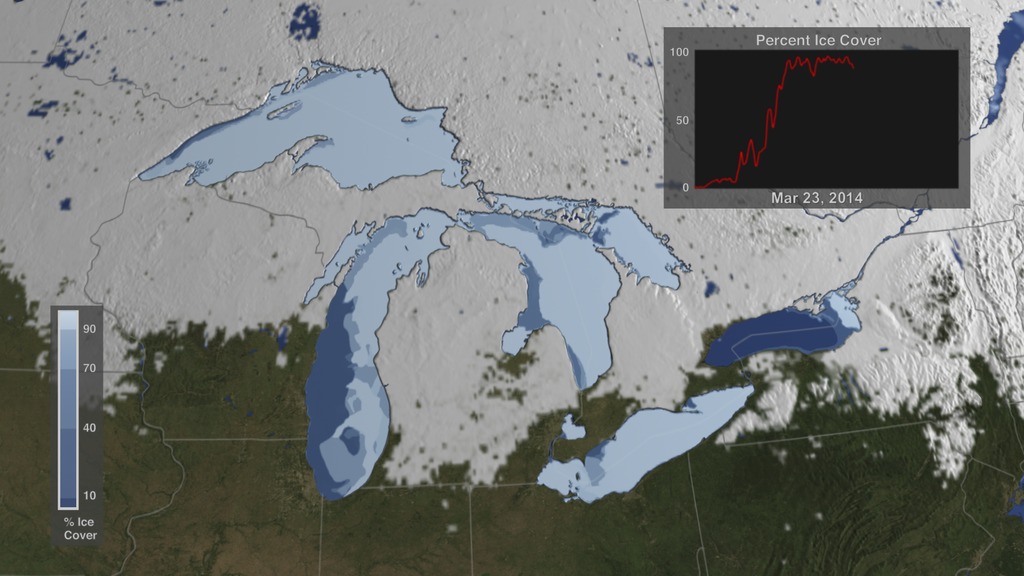
1. Changes in lake ice within a six-month period between 2013 and 2014 can be seen in 18 seconds.
2. The maximum ice extent occurred on March 6, 2014 and covered 92% of the Great Lakes.
3. It was the second most extensive ice cover of the past 40 years of satellite observations.
TAG: The ice in eastern Lake Superior reached a thickness of three and a half feet, which disrupted shipping routes.
For More Information
Credits
Please give credit for this item to:
NASA's Goddard Space Flight Center
-
Producer
- Howard Joe Witte (ADNET Systems, Inc.)
-
Scientists
- Dorothy Hall (NASA/GSFC)
- George Leshkevich (NOAA)
- Son Nghiem (NASA/JPL CalTech)
-
Data visualizer
-
Cindy Starr
(Global Science and Technology, Inc.)

-
Cindy Starr
(Global Science and Technology, Inc.)
-
Technical support
- Laurence Schuler (ADNET Systems, Inc.)
- Ian Jones (ADNET Systems, Inc.)
-
Video editor
- Joy Ng (USRA)
Related
- ID: 4256
Release date
This page was originally published on Wednesday, March 25, 2015.
This page was last updated on Wednesday, May 3, 2023 at 1:49 PM EDT.