Mapping Soil Moisture
To improve weather forecasts and build better climate models, scientists are looking at changes in soil moisture. Soil moisture is a measurement of the amount of water contained within soil particles. In 2011, NASA and the Argentina space agency launched the Aquarius/SAC-D satellite to observe the salt content of the ocean surface. But researchers also developed a method for the satellite to provide global maps of soil moisture. Orbiting Earth at an altitude of 400 miles, the satellite measures the wetness of soil by detecting microwave energy that's naturally emitted from the top two inches of land. The maps show how severe weather and seasonal cycles affect soil conditions in different parts of the world—information that can be used to help predict the onset of floods or drought. Watch the video to learn more.

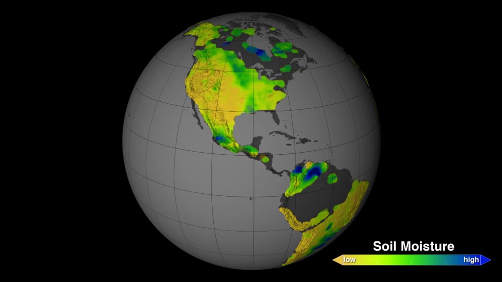
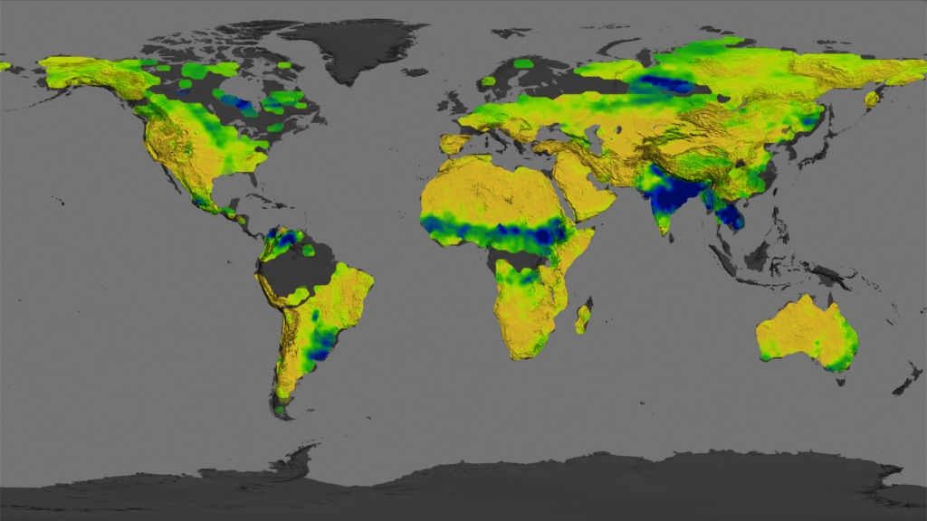
NASA monitors the wetness of Earth’s continents.
See how soil moisture varies worldwide in this video.
Dry soils (yellow) were observed in the U.S. West in August 2011. By that month severe to extreme drought affected about one-quarter of the region.
The land-soaking effects of India’s monsoon rains produce extremely wet soils (blue), as seen in this image from September 2012.
In January 2013, a belt of rain left behind a trail of moist soil (dark green, blue) on the African continent.
The Aquarius/SAC-D satellite creates a global view of soil moisture every eight days.
For More Information
See NASA.gov
Credits
Please give credit for this item to:
NASA's Goddard Space Flight Center
-
Animators
- Trent L. Schindler (USRA)
- Horace Mitchell (NASA/GSFC)
-
Video editor
- Joy Ng (USRA)
-
Narration
- Kayvon Sharghi (USRA)
- Joy Ng (USRA)
-
Narrator
- Joy Ng (USRA)
-
Producers
- Kayvon Sharghi (USRA)
- Joy Ng (USRA)
-
Scientists
- Rajat Bindlish (USDA-ARS Hydrology and Remote Sensing Laboratory)
- Tom Jackson (USDA-ARS Hydrology and Remote Sensing Laboratory)
-
Writer
- Kasha Patel (Wyle Information Systems)
Related
- ID: 11604
 Produced Video
 - ID: 4165
 Visualization
Release date
This page was originally published on Thursday, July 10, 2014.
This page was last updated on Wednesday, May 3, 2023 at 1:50 PM EDT.