Megacanyon
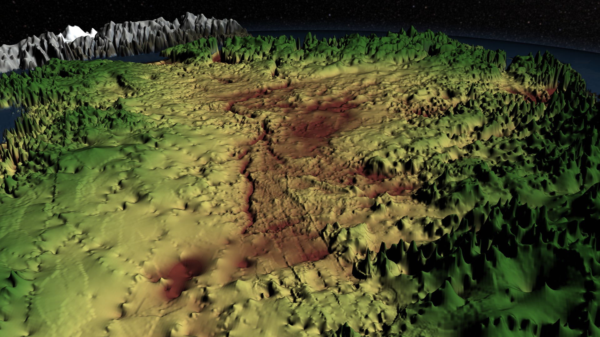
Ice has blanketed Greenland for millions of years. In some places it can be almost two miles thick. Scientists now know that hidden beneath the ice is a canyon that extends hundreds of miles north from near the center of the ice sheet. By combining more than four years’ worth of ice-penetrating radar measurements from NASA’s Operation IceBridge mission with other data sets, researchers created a topographic map of Greenland’s bedrock. The map shed light on the existence of a canyon that measures at least 460 miles in length and a half-mile deep. At greater than 1.5 times the length of the Grand Canyon, it is longer than any known canyon on Earth. Watch the visualization for a tour of Greenland’s massive, under-ice canyon. In the visualization the terrain elevation is shown using color, where greens indicate areas above sea level, browns indicate areas below sea level, and yellows indicate areas at or near sea level.

Scientists have discovered a giant canyon buried under ice.
The blue line above traces the canyon over Greenland’s ice sheet.
The canyon carves a continuous path from Greenland's interior to the coast.
The canyon ends somewhere beneath the Petermann Glacier fjord in northern Greenland.
The ice-covered fjord and calving front of Petermann Glacier are seen in this image.
For More Information
See NASA.gov
Credits
Please give credit for this item to:
NASA's Goddard Space Flight Center
Petermann Glacier image courtesy of NASA/M. Studinger
-
Animators
-
Cindy Starr
(Global Science and Technology, Inc.)

-
Greg Shirah
(NASA/GSFC)
-
Cindy Starr
(Global Science and Technology, Inc.)
-
Producer
- Jefferson Beck (USRA)
-
Scientists
- J. L. Bamber (School of Geographical Sciences, University of Bristol, UK)
- Michael Studinger (NASA/GSFC)
-
Writer
- Kayvon Sharghi (USRA)
Related
- ID: 4097
 Visualization
Release date
This page was originally published on Tuesday, September 17, 2013.
This page was last updated on Wednesday, May 3, 2023 at 1:51 PM EDT.