Scorched Earth
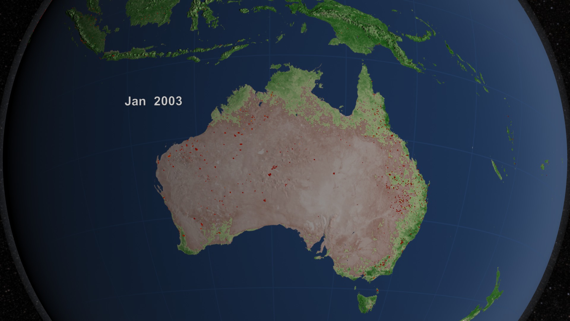
Australia's blisteringly dry climate makes it prone to fire every summer. But an extreme, record-breaking heat wave that began in late 2012 has sparked hundreds of wildfires this season. As firefighting crews battled fires across Australia, NASA satellites captured a wide-angle view of the activity. Imaging instruments snapped shots of smoke plumes drifting off to sea, and thermal sensors detected the location of individual fires and the severity of burn scars. A longer-term look at fire activity in Australia reveals a pattern of controlled fires in fall and winter—often set by fire managers to reduce "fuel"—and bursts of less predictable, more intense wildfires during spring and summer. The visualization shows 10 years of fires and vegetation changes across Australia, observed by the MODIS instruments on NASA's Terra and Aqua satellites.

Wildfires have left their mark in Australia during this Southern Hemisphere summer.
Watch how the growth of vegetation and spread of fire often go hand in hand. Red dots indicate individual fires detected by NASA satellites.
Winds blowing to the northwest carry away the smoke of multiple wildfires burning in northern Australia in Oct. 2012.
Heavy smoke rises from fires burning on the densely vegetated Cape York Peninsula in Nov. 2012. Red outlines mark intensely hot surfaces.
Thick smoke plumes from the southwestern tip of Australia waft over the Indian Ocean in Feb. 2012.
In this false-color image, healthy vegetation (red) surrounds a nearly 10-mile-wide burn scar (brown) from a Jan. 2013 fire in Tasmania.
For More Information
Credits
Please give credit for this item to:
NASA's Goddard Space Flight Center
Cover photo courtesy Commander Chris Hadfield, International Space Station
Satellite images courtesy of NASA Earth Observatory
-
Animators
- Lori Perkins (NASA/GSFC)
- Greg Shirah (NASA/GSFC)
-
Producer
- Kayvon Sharghi (USRA)
-
Scientists
- Chris Justice (University of Maryland)
- Louis Giglio (University of Maryland)
- Luigi Boschetti (University of Maryland College Park)
-
Writer
- Patrick Lynch (Wyle Information Systems)
Release date
This page was originally published on Tuesday, January 29, 2013.
This page was last updated on Wednesday, May 3, 2023 at 1:52 PM EDT.
Related
- ID: 3871
 Visualization