Landsat 8 Overview
The Landsat Data Continuity Mission (LDCM) is a collaboration between NASA and the U.S. Geological Survey that will continue the Landsat Program's 40-year data record of monitoring Earth's landscapes from space. LDCM will expand and improve on that record with observations that advance a wide range of Earth sciences and contribute to the management of agriculture, water and forest resources.
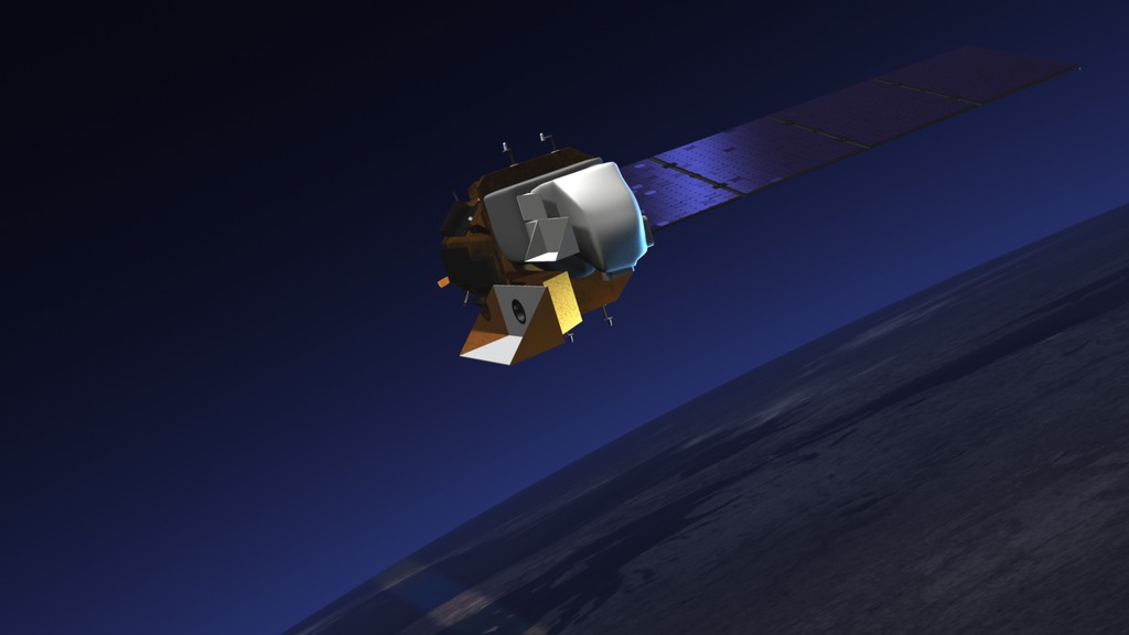
The Landsat Program is a series of Earth-observing satellite missions jointly managed by NASA and the U.S. Geological Survey. The first Landsat satellite launched in 1972 and the next satellite in the series, the Landsat Data Continuity Mission — LDCM, is scheduled to launch on February 11, 2013
The Landsat Data Continuity Mission (LDCM) is a collaboration between NASA and the U.S. Geological Survey that will continue the Landsat Program's 40-year data record of monitoring Earth's landscapes from space. LDCM will expand and improve on that record with observations that advance a wide range of Earth sciences and contribute to the management of agriculture, water and forest resources.
For complete transcript, click here.
Credits
Please give credit for this item to:
NASA's Goddard Space Flight Center
-
Animators
- Tyler Chase (UMBC)
- Chris Meaney (HTSI)
-
Video editors
- Matthew R. Radcliff (USRA)
- Michael Randazzo (Advocates in Manpower Management, Inc.)
-
Interviewees
- James R. Irons (NASA/GSFC)
- Del Jenstrom (NASA/GSFC)
-
Doug C. Morton
(NASA/GSFC)

-
Narrator
- Aries Keck (ADNET Systems, Inc.)
-
Producer
- Matthew R. Radcliff (USRA)
-
Scientist
- James R. Irons (NASA/GSFC)
-
Videographers
- Rob Andreoli (Advocates in Manpower Management, Inc.)
- Michael Randazzo (Advocates in Manpower Management, Inc.)
-
Writers
- Matthew R. Radcliff (USRA)
- Aries Keck (ADNET Systems, Inc.)
Missions
This page is related to the following missions:Series
This page can be found in the following series:Tapes
The media on this page originally appeared on the following tapes:-
LDCM Overview
(ID: 2012101)
Thursday, January 10, 2013 at 5:00AM
Produced by - Walt Feimer (HTSI)
Related
- ID: 12851
![In its five years in space, Landsat 8 made 26,500 orbits around Earth and captured 1.1 million "scenes" of our home planet, representing 16 percent of all the observations kept in the 45-year Landsat archive.Music: Divine Punishment by Christopher Franke [BMI]Complete transcript available.](/vis/a010000/a012800/a012851/12851_Landsat8_5_year_large.01975_print.jpg) Produced Video
Produced Video
Sources
- ID: 12754
 Produced Video
Release date
This page was originally published on Thursday, January 10, 2013.
This page was last updated on Wednesday, May 3, 2023 at 1:52 PM EDT.