Coldest Map In The World
We've grown used to seeing landscapes from above. The terrain that early explorers once took years to cross we now conquer during a routine business flight on a weekday morning. Yet there remain places too remote and too rugged for most to reach. This is Antarctica, where ice sheets stretch across the eastern part of the continent like a frozen Great Plains, and mountains that would be at home in the Rockies crop up in nearly snow-free, dry regions. Otherwise experienced by only a small group of scientists and polar travelers, NASA, in partnership with the National Science Foundation, the U.S. Geological Survey, and the British Antarctic Survey, has made Antarctica accessible to all by piecing together Landsat 7 satellite images to create a mosaic that represents the first true-color, high-resolution map of the continent. Even without crampons and an ice ax, you can now explore one of the world's most brutal environments in this flyover view of Antarctica.
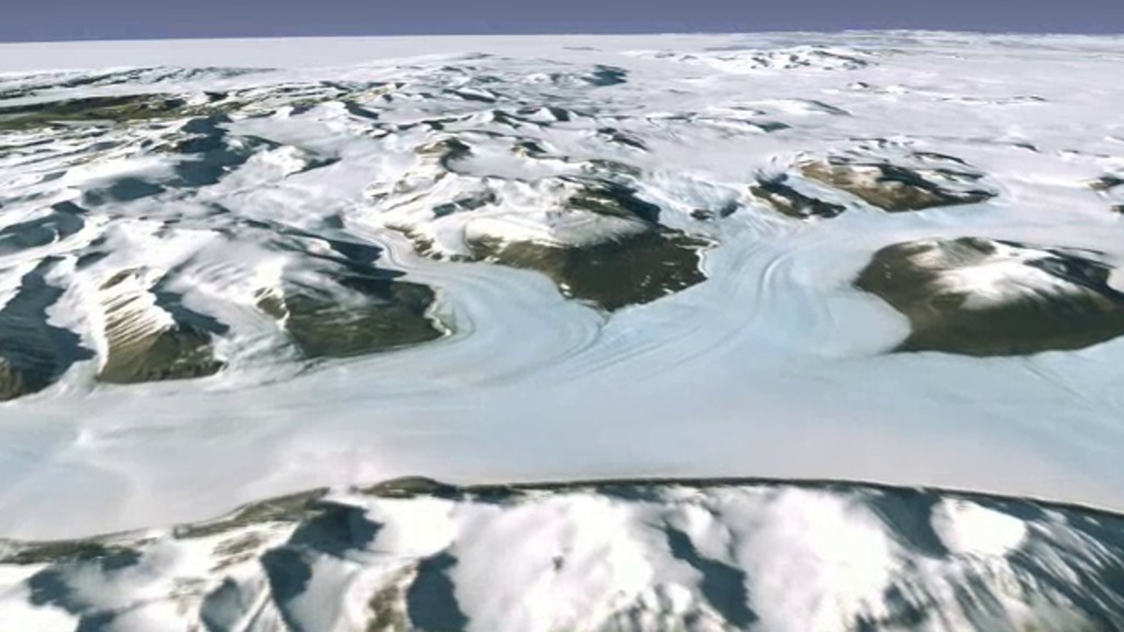
Features like the Koettlitz Glacier come to life in this video of the Landsat Image Mosaic of Antarctica (LIMA).

The Ferrar Glacier creeps through the craggy Kukri Hills like a great river of ice, just one majestic landscape in this singular map.
Dense pack ice crowds the Ross Sea. Each pixel is roughly the size of half a basketball court.
Scientists corrected for reflectance off snow and ice that blurred many images in the mosaic. Here, Ross Island meets the Ross Ice Shelf.
The runway for McMurdo Station sits atop a dense mass of sea ice, making it one of the only runways in the world not built on land.
McMurdo Station, as photographed in 2008 by Michael Studinger, who is now NASA's Operation IceBridge project scientist.
Credits
Please give credit for this item to:
NASA's Goddard Space Flight Center
The Landsat Program is a series of Earth-observing satellite missions jointly managed by NASA and the U.S. Geological Survey
-
Animator
- Lori Perkins (NASA/GSFC)
-
Video editor
- Michelle Williams (UMBC)
-
Narrator
- Laura Motel (UMBC)
-
Producers
- Michelle Williams (UMBC)
- Andrew Freeberg (NASA/GSFC)
- Ryan Fitzgibbons (USRA)
- Jefferson Beck (USRA)
-
Scientist
- Bob Bindschadler (NASA/GSFC)
-
Writer
- Patrick Lynch (Wyle Information Systems)
Series
This page can be found in the following series:Related
- ID: 10416
 Produced Video
Release date
This page was originally published on Thursday, August 4, 2011.
This page was last updated on Wednesday, May 3, 2023 at 1:53 PM EDT.