NASA On Air: NASA Tracks Amazon Plume and Ocean Salinity (12/11/2014)
LEAD: Hurricane forecasters can now use ocean salinity to help them better predict hurricanes.
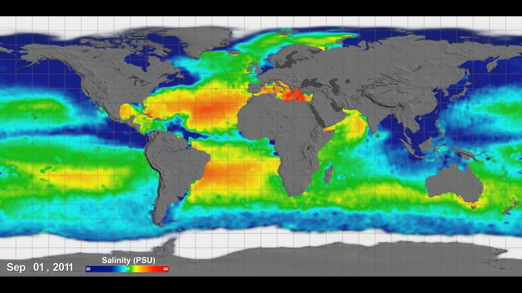
1. NASA’s Aquarius satellite data shows how ocean salinity (saltiness) changes during the year. Bright orange indicates higher saltiness.
2. Hurricane forecasters can now zero in on the huge floating plume of fresh water coming from the Amazon River, the world’s largest river. The thick plume acts as a potential hot plate to energize hurricanes.
3. From 1960 to 2000, two-thirds of Category 5 hurricanes passed directly over the Amazon plume.
TAG: The ability to map the Amazon plume more precisely with ocean salinity measurements from NASA’s Aquarius satellite will benefit hurricane forecasters.
REFERENCES
Grodsky, S., Reul, N., Lagerloef, G., et al. (2012). Haline hurricane wake in the Amazon/Orinoco plume. Geophysical Research Letters, (39).
Grodsky, S., et al (2014). Year-to-Year Salinity Changes. Remote Sensing of Environment. (140).
For More Information
Credits
Please give credit for this item to:
NASA's Goddard Space Flight Center
-
Producer
- Howard Joe Witte (ADNET Systems, Inc.)
-
Video editor
- Joy Ng (USRA)
Related
- ID: 4233
 Visualization
Release date
This page was originally published on Thursday, December 11, 2014.
This page was last updated on Wednesday, May 3, 2023 at 1:50 PM EDT.