NASA On Air: NASA’s Carbon Dioxide Plumes - World Map (11/21/2014)
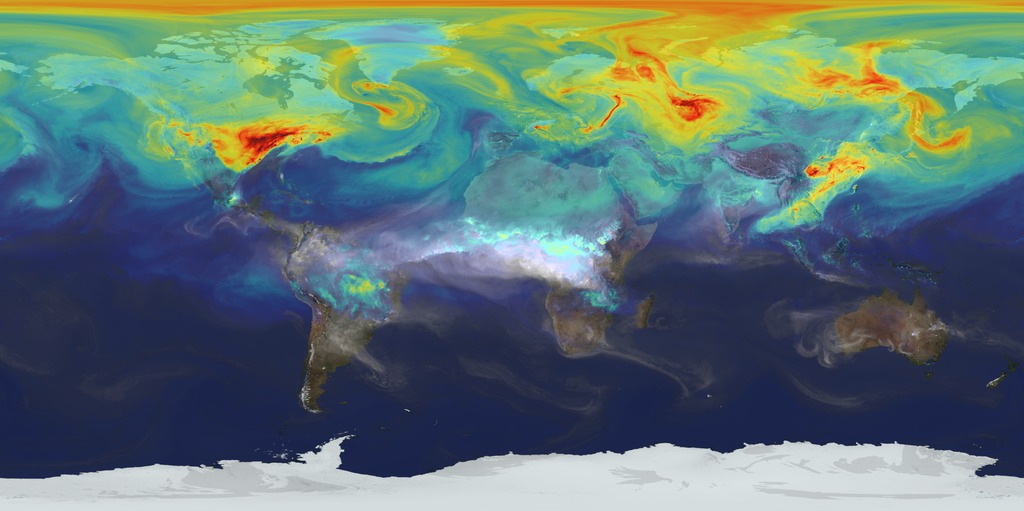
LEAD: NASA scientists have a new super HD view of how the carbon dioxide in the air moves around the world with the winds.
1. Using an ultra-high-resolution computer model 64 times greater than typical climate models NASA tracks CO2. Each pixel grid size is four miles wide.
2. During late summer forest fires in Africa produce plumes of CO2.
3. During late autumn to winter the bright reds show the three major sources of fossil fuel burning: the eastern U.S., Europe and China. The winds blow much of the CO2 towards the North Pole.
TAG: Ultra-high-resolution models such as this will help scientists better project future climate.
Credits
Please give credit for this item to:
NASA's Goddard Space Flight Center
-
Producer
- Howard Joe Witte (ADNET Systems, Inc.)
-
Video editor
- Joy Ng (USRA)
-
Project support
- Aaron E. Lepsch (ADNET Systems, Inc.)
Related
- ID: 12057
 Produced Video
 - ID: 11719
 Produced Video
Release date
This page was originally published on Friday, November 21, 2014.
This page was last updated on Wednesday, May 3, 2023 at 1:50 PM EDT.