Earth
ID: 99
This series of animated maps portrays the growth and gradual merger of Washington and Baltimore over the past 200 years. They provide a powerful tool that could help manage the region's suburban sprawl in the near future.
Baltimore - Washington: 200 Years of Urban Growth
Researchers incorporated historical maps and census information dating back to 1792, as well as satellite photographs and other data collected from NASA satellites and space shuttles over the past 25 years. These animations were developed using provisional data, which may contain anomalies. The final database is scheduled for completion after June, 1996.
Urban Growth (in red) around the Chesapeake Bay from 1792 to 1992
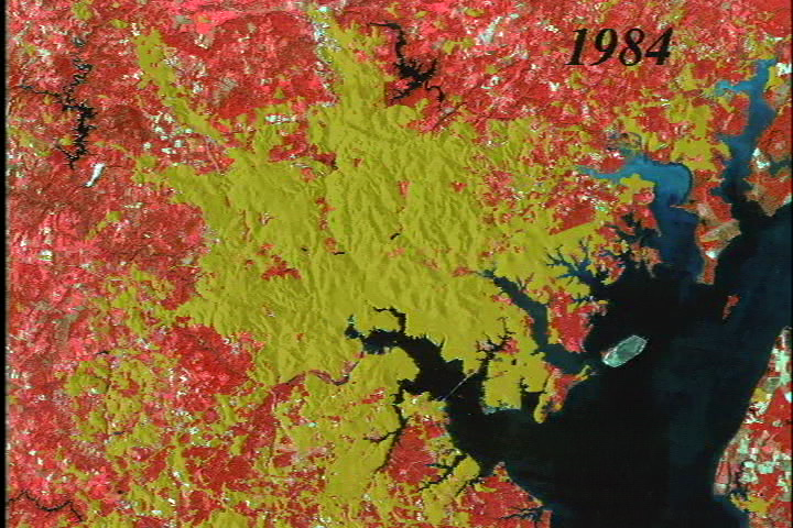
Urban Growth (in yellow) around the Chesapeake Bay from 1792 to 1992.
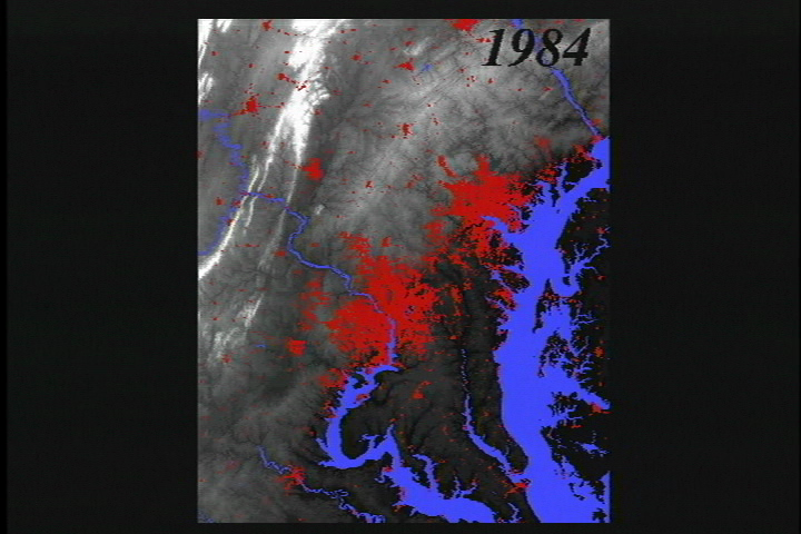
Urban Growth (in red) around the Chesapeake Bay from 1792 to 1992 overlaid over a relief map.
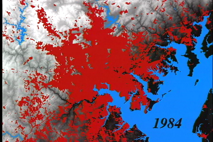
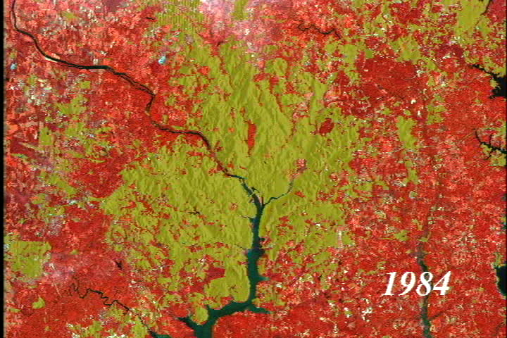
Urban Growth (in red) in the Washington/Baltimore region from 1792 to 1992.
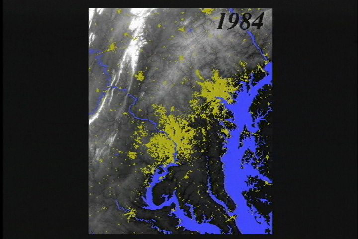
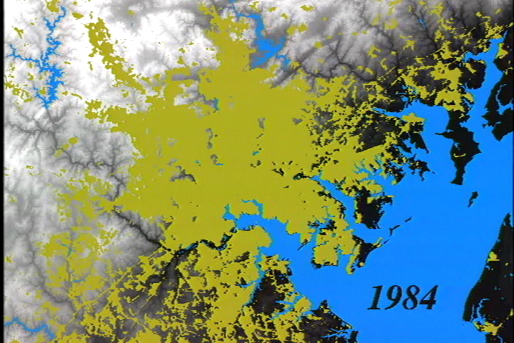
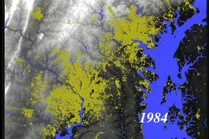
Urban Growth (in yellow) in the Washington/Baltimore region from 1792 to 1992.
Urban Growth (in red) in the Washington/Baltimore region from 1792 to 1992 overlaid over a relief map.
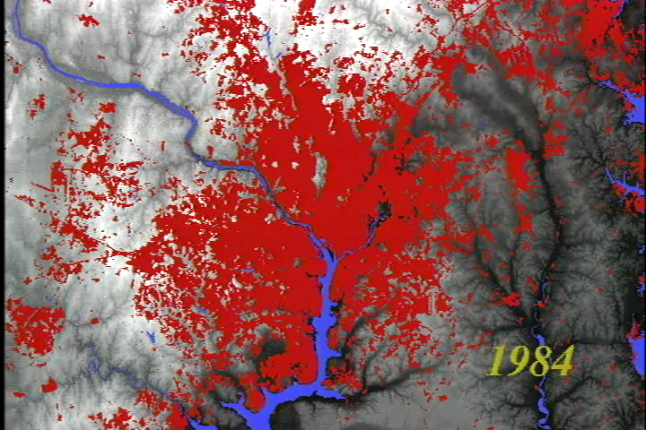
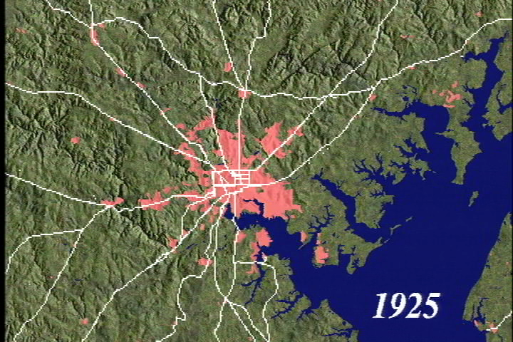
Urban Growth (in red) in the region around Baltimore from 1792 to 1992.
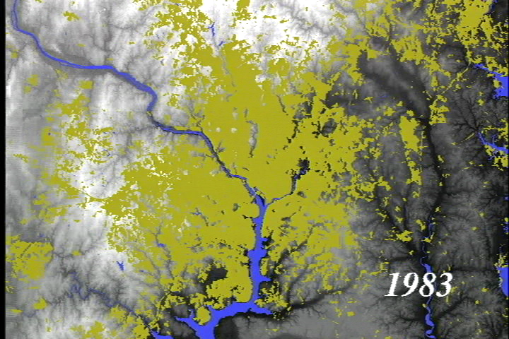
Urban Growth (in yellow) in the region around Baltimore from 1792 to 1992.
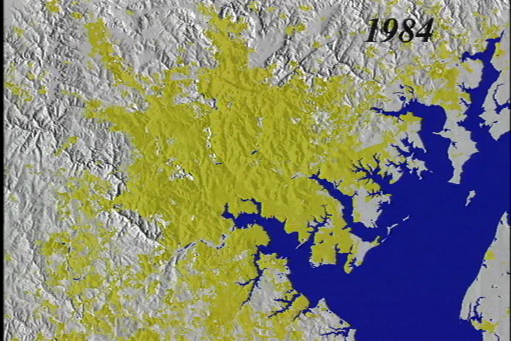
Urban Growth (in yellow) in the region around Baltimore from 1792 to 1992 overlaid over a relief map.
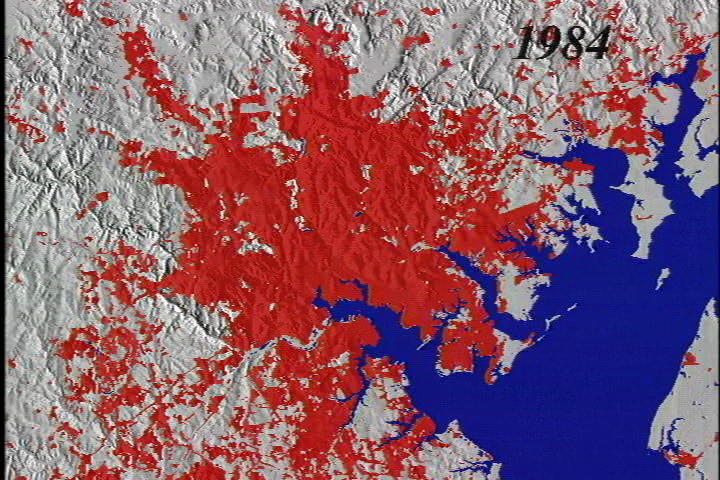
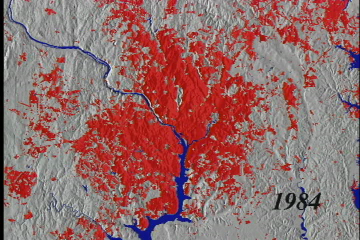
Urban Growth (in red) in the region around Baltimore from 1792 to 1992 overlaid over a relief map.
Urban Growth (in yellow) in the region around Baltimore from 1792 to 1992 overlaid over a modern Landsat image.
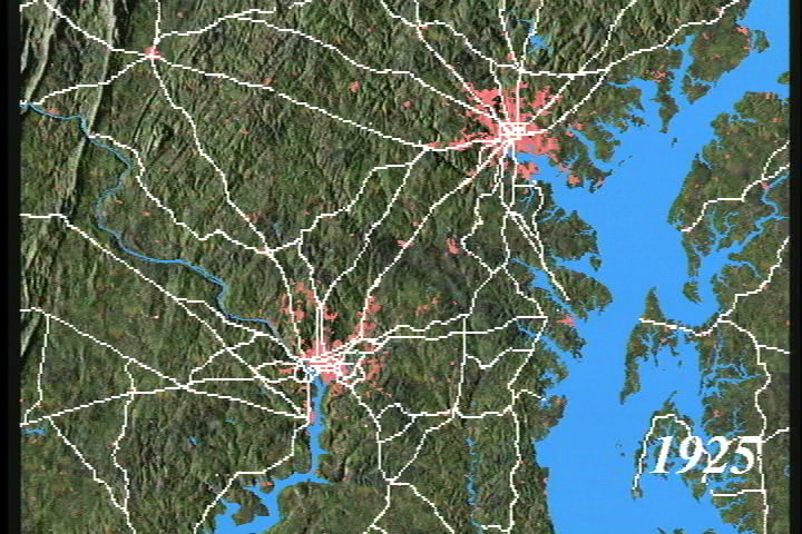
Urban Growth (in red) in the region around Washington from 1792 to 1992.
Urban Growth (in yellow) in the region around Washington from 1792 to 1992.
Urban Growth (in red) in the region around Washington from 1792 to 1992 overlaid over a relief map.
Urban Growth (in yellow) in the region around Washington from 1792 to 1992 overlaid over a modern Landsat image.
Urban Growth (in yellow) in the region around Baltimore from 1792 to 1992 overlaid over a naturalistic relief map in perspective view.
Urban Growth (in red) in the region around Baltimore from 1792 to 1992 overlaid over a relief map in perspective view.
Urban Growth (in yellow) in the region around Baltimore from 1792 to 1992 overlaid over a naturalistic relief map.
Urban Growth (in pink) in the region around Baltimore from 1792 to 1992 overlaid over a naturalistic relief map with major roads in white.
Urban Growth (in pink) in the region around Baltimore from 1792 to 1992 overlaid over a naturalistic relief map with major roads in yellow.
Urban Growth (in pink) in the Washington/Baltimore region from 1792 to 1992 overlaid over a naturalistic relief map with major roads in white.
Urban Growth (in pink) in the Washington/Baltimore region from 1792 to 1992 overlaid over a naturalistic relief map with major roads in yellow.
Urban Growth (in yellow) in the region around Baltimore from 1792 to 1992 overlaid over a naturalistic relief map in a rotating perspective view.
Urban Growth (in yellow) in the region around Baltimore from 1792 to 1992 overlaid over a naturalistic relief map in a rapidly rotating perspective view.
Urban Growth (in pink) in the region around Baltimore from 1792 to 1992 overlaid over a naturalistic relief map with major roads in white. Pauses in the animation indicate the addition of new road data.
Urban Growth (in pink) in the Washington/Baltimore region from 1792 to 1992 overlaid over a naturalistic relief map with major roads in white. Pauses in the animation indicate the addition of new road data.
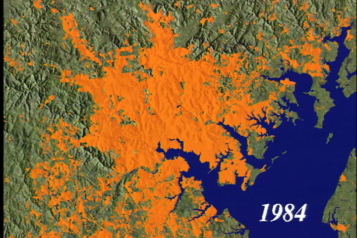
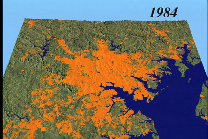
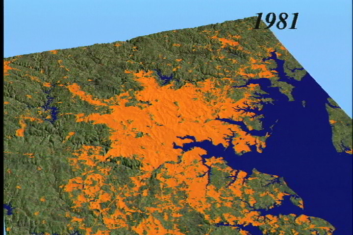
Urban Growth (in orange) in the region around Baltimore from 1792 to 1992 overlaid over a naturalistic relief map.
Urban Growth (in orange) in the region around Baltimore from 1792 to 1992 overlaid over a naturalistic relief map in perspective view.
Urban Growth (in orange) in the region around Baltimore from 1792 to 1992 overlaid over a naturalistic relief map in a rotating perspective view.
Urban Growth (in orange) in the region around Baltimore from 1792 to 1992 overlaid over a naturalistic relief map in a rapidly rotating perspective view.
Video slate image reads "Two Hundred Years of Human Impacts on the Baltimore-Washington Region: A Critical Perspective for our Future".
Visualization Credits
Timothy Foresman (University of Maryland Baltimore County): Scientist
Penny Masuoka (NASA/GSFC): Scientist
Penny Masuoka (NASA/GSFC): Scientist
Please give credit for this item to:
NASA/Goddard Space Flight Center Scientific Visualization Studio
NASA/Goddard Space Flight Center Scientific Visualization Studio
Short URL to share this page:
https://svs.gsfc.nasa.gov/99
Dates of Data Used:
1792-1992
Goddard TV Tape:
G2008-034HD -- NASAs HD Chesapeake Bay Resource Tape
Keywords:
DLESE >> Ecology
DLESE >> Environmental science
DLESE >> Human geography
SVS >> Urban Growth
NASA Science >> Earth
https://svs.gsfc.nasa.gov/99
Dates of Data Used:
1792-1992
Goddard TV Tape:
G2008-034HD -- NASAs HD Chesapeake Bay Resource Tape
Keywords:
DLESE >> Ecology
DLESE >> Environmental science
DLESE >> Human geography
SVS >> Urban Growth
NASA Science >> Earth


