Sun
ID: 936
These images are compressed versions of high definition television (HDTV) images showing how Landsat data, which spans a very broad swatch of the electromagnetic spectrum, can be turned into images. The TIFF versions of these images are full resolution HDTV frames (1920 x 1080). All images have the HDTV standard aspect ratio (16:9).
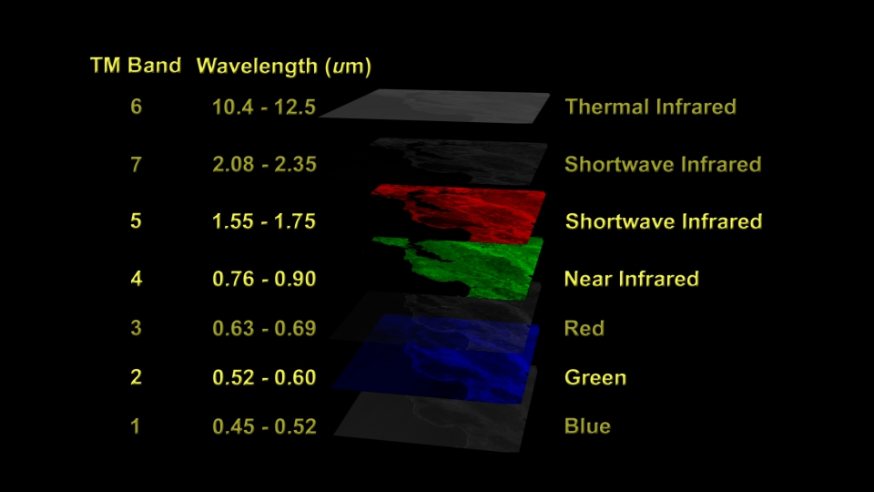
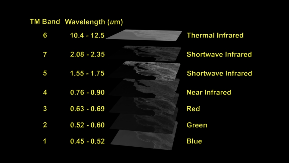
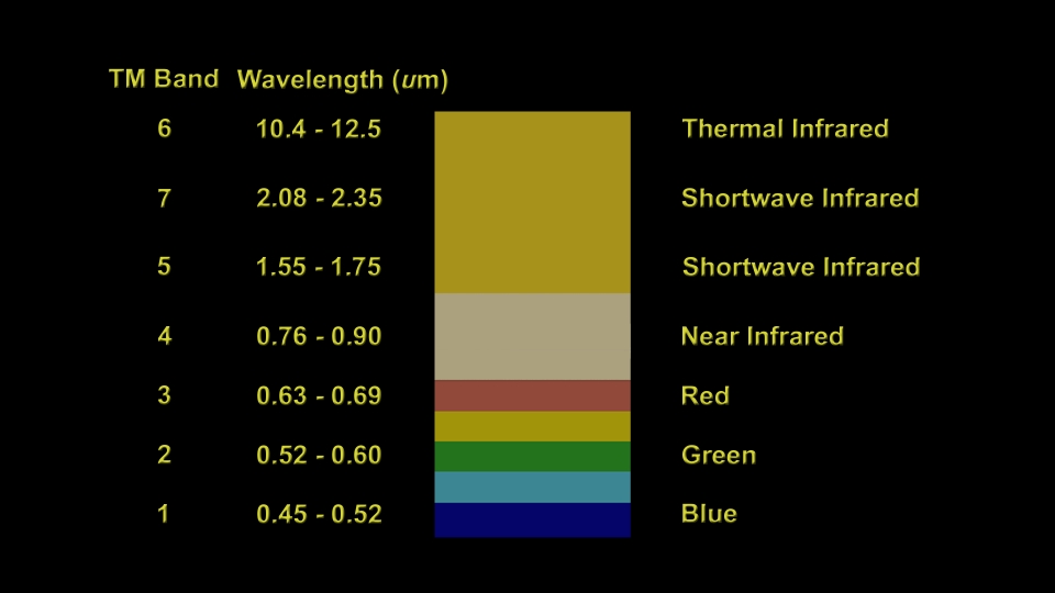
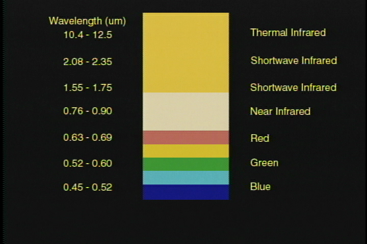
The Thematic Mapper (TM) on Landsat 4 and 5 observes reflected sunlight from the Earth all the way from blue in the visible part of the electromagnetic spectrum to shortwave infrared well beyond the ability of the human eye to percieve. The TM instrument also can observe infrared radiation actively emitted by the Earth from thermal infrared radiation. Landsat 7 carries an improved version of the TM instrument, called ETM+. In addition to 7 channels of spectral data collected by the older TM instruments, ETM+ can observe in a special panchromatic band spanning the entire visible spectrum at twice the resolution of the TM bands (15 meter resolution instead of 30 meters). The ETM+ also has a major improvement in the resolution of the thermal band (60 meter resolution instead of 160 meters).
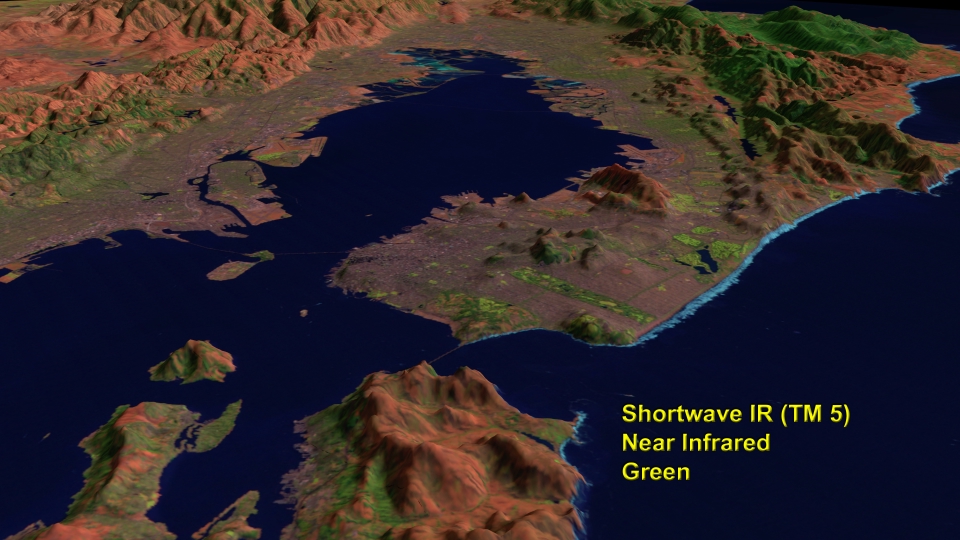
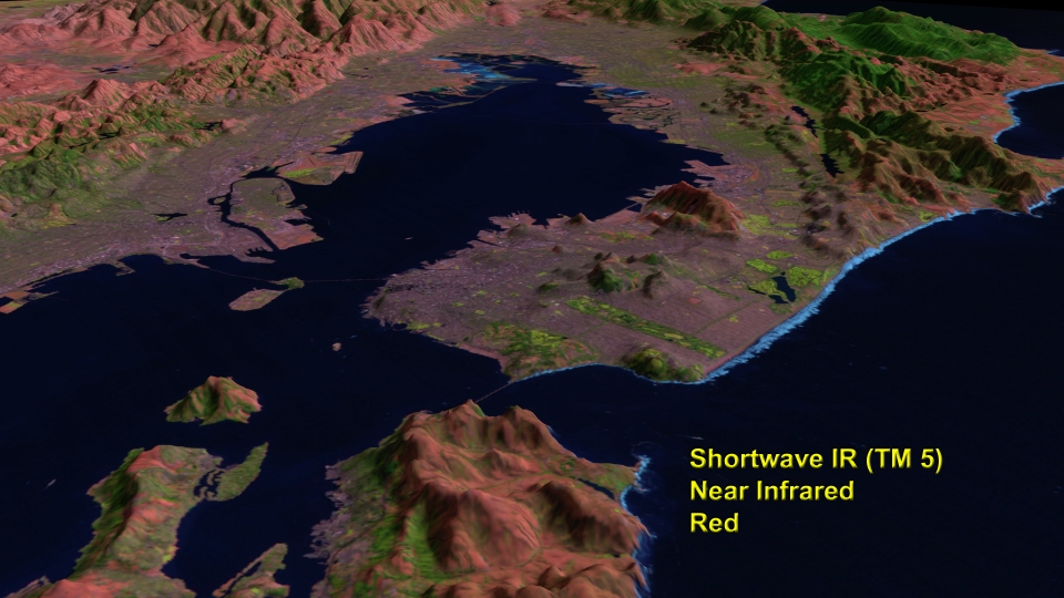
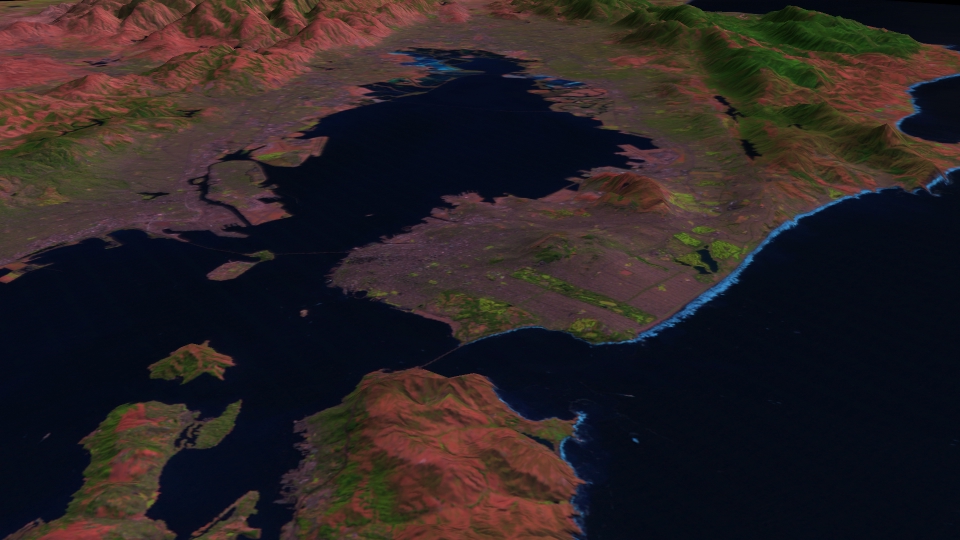
A standard way to create images from raw Landsat TM and ETM+ data is to display a single band as a primary color, then combine different bands to create a full color image. Images shown here demonstrate combining three bands to make a color image using TM bands 5, 4, and 2, which covers a very broad range of the TM's spectral coverage. It is also shown in combination with a digital elevation model. Terrain data is shown with vertical features exaggerated by a factor of three to emphasize details.
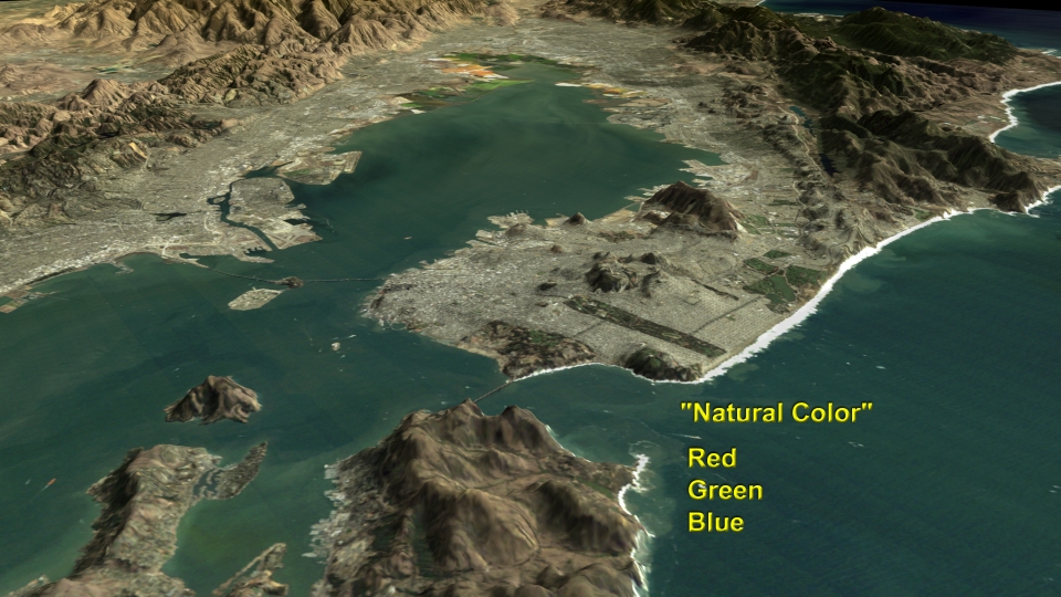
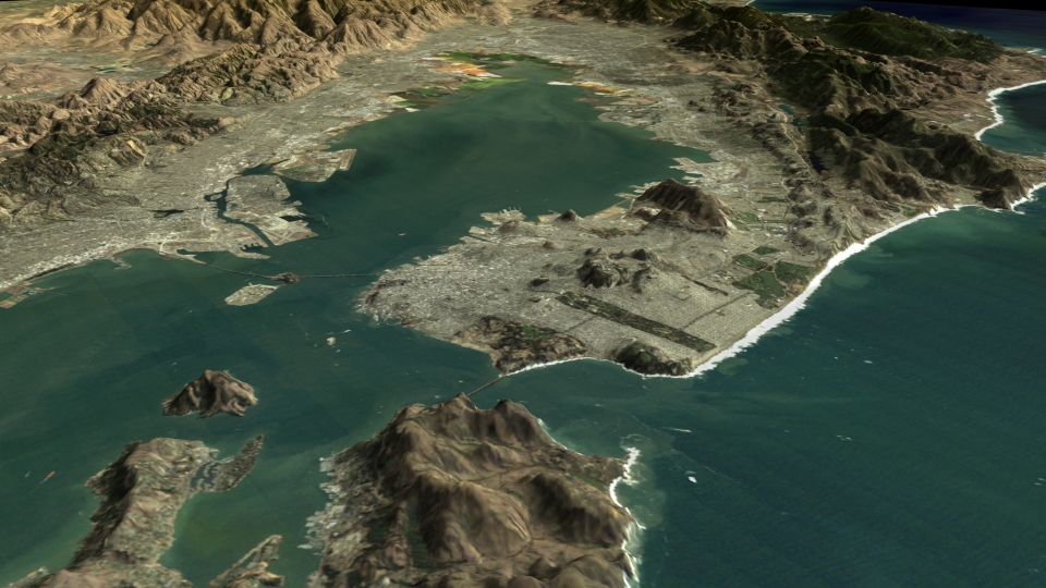
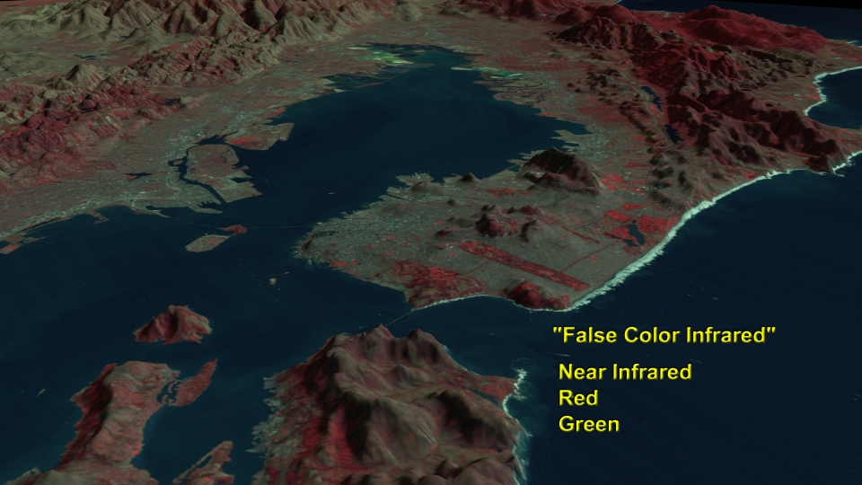
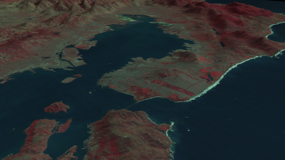

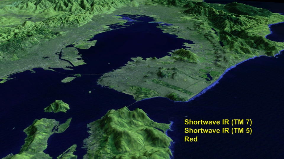

Creating Landsat Images from Raw Data: San Francisco - Oakland
The Thematic Mapper (TM) on Landsat 4 and 5 observes reflected sunlight from the Earth all the way from blue in the visible part of the electromagnetic spectrum to shortwave infrared well beyond the ability of the human eye to percieve. The TM instrument also can observe infrared radiation actively emitted by the Earth from thermal infrared radiation. Landsat 7 carries an improved version of the TM instrument, called ETM+. In addition to 7 channels of spectral data collected by the older TM instruments, ETM+ can observe in a special panchromatic band spanning the entire visible spectrum at twice the resolution of the TM bands (15 meter resolution instead of 30 meters). The ETM+ also has a major improvement in the resolution of the thermal band (60 meter resolution instead of 160 meters).
A standard way to create images from raw Landsat TM and ETM+ data is to display a single band as a primary color, then combine different bands to create a full color image. Images shown here demonstrate combining three bands to make a color image using TM bands 5, 4, and 2, which covers a very broad range of the TM's spectral coverage. It is also shown in combination with a digital elevation model. Terrain data is shown with vertical features exaggerated by a factor of three to emphasize details.
For More Information
Visualization Credits
Please give credit for this item to:
NASA/Goddard Space Flight Center Scientific Visualization Studio
NASA/Goddard Space Flight Center Scientific Visualization Studio
Short URL to share this page:
https://svs.gsfc.nasa.gov/936
Mission:
Landsat
Data Used:
Note: While we identify the data sets used in these visualizations, we do not store any further details nor the data sets themselves on our site.
Keywords:
DLESE >> Human geography
DLESE >> Physical geography
SVS >> San Francisco
DLESE >> Technology
GCMD >> Location >> California
NASA Science >> Sun
GCMD keywords can be found on the Internet with the following citation: Olsen, L.M., G. Major, K. Shein, J. Scialdone, S. Ritz, T. Stevens, M. Morahan, A. Aleman, R. Vogel, S. Leicester, H. Weir, M. Meaux, S. Grebas, C.Solomon, M. Holland, T. Northcutt, R. A. Restrepo, R. Bilodeau, 2013. NASA/Global Change Master Directory (GCMD) Earth Science Keywords. Version 8.0.0.0.0
https://svs.gsfc.nasa.gov/936
Mission:
Landsat
Data Used:
Landsat-5/TM
1997/09/27DTED Level 1 (3 arc second)
Model - USGSKeywords:
DLESE >> Human geography
DLESE >> Physical geography
SVS >> San Francisco
DLESE >> Technology
GCMD >> Location >> California
NASA Science >> Sun
GCMD keywords can be found on the Internet with the following citation: Olsen, L.M., G. Major, K. Shein, J. Scialdone, S. Ritz, T. Stevens, M. Morahan, A. Aleman, R. Vogel, S. Leicester, H. Weir, M. Meaux, S. Grebas, C.Solomon, M. Holland, T. Northcutt, R. A. Restrepo, R. Bilodeau, 2013. NASA/Global Change Master Directory (GCMD) Earth Science Keywords. Version 8.0.0.0.0


