Earth
ID: 929
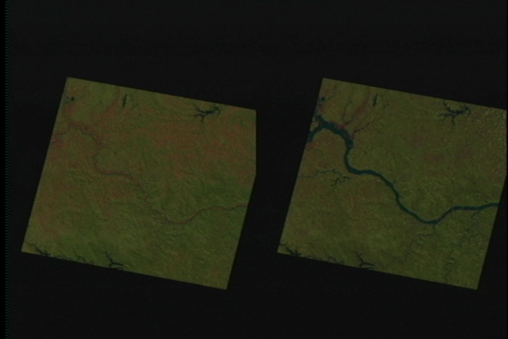
The three river scenes shown here are from central Missouri near Gasconade, Rocheport, and the confluence of the Grand River. The first in each pair was in September, 1992, the second in September of 1993. Notice the farmland in the river flood plain. The data uses Landsat TM bands 5, 4, and 2 mapped to red, green, and blue respectively. Bare soil and plowed land appears red, vegetation (which reflects very strongly in the near infrared) appears green, and water is dark blue. The perspective in each of these images is looking approximately westward, which is upstream.
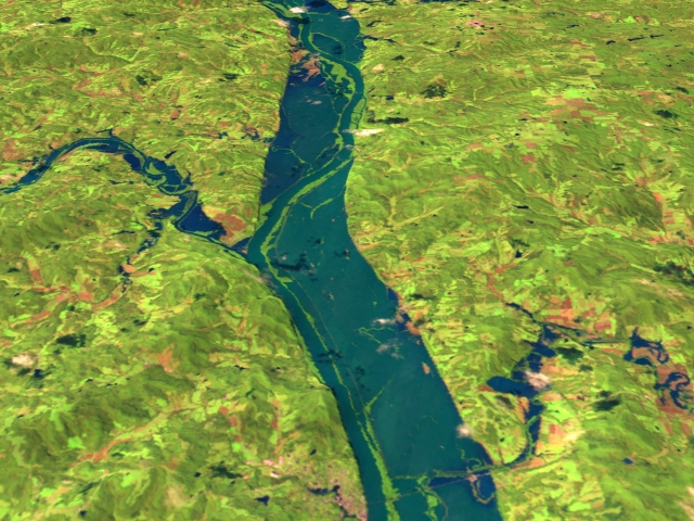
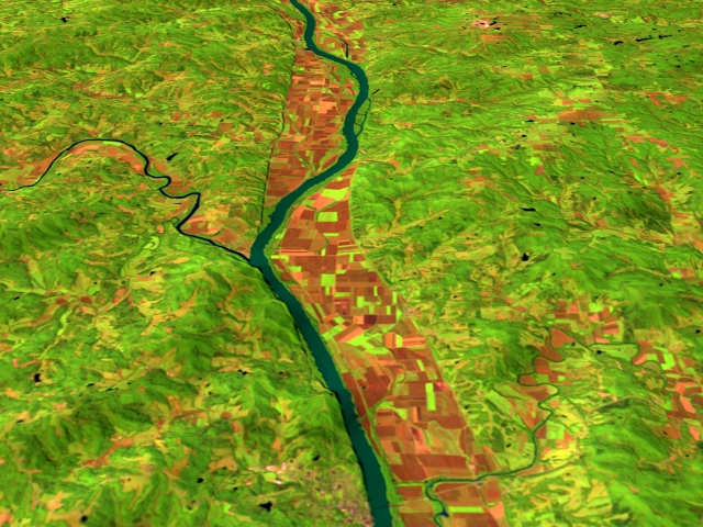

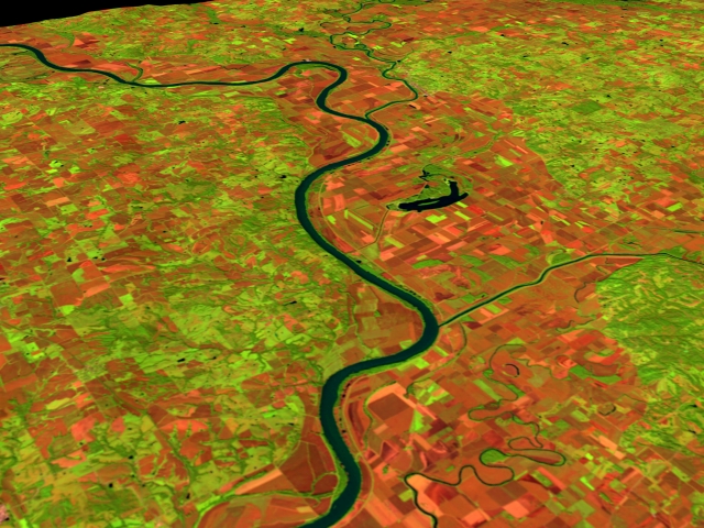
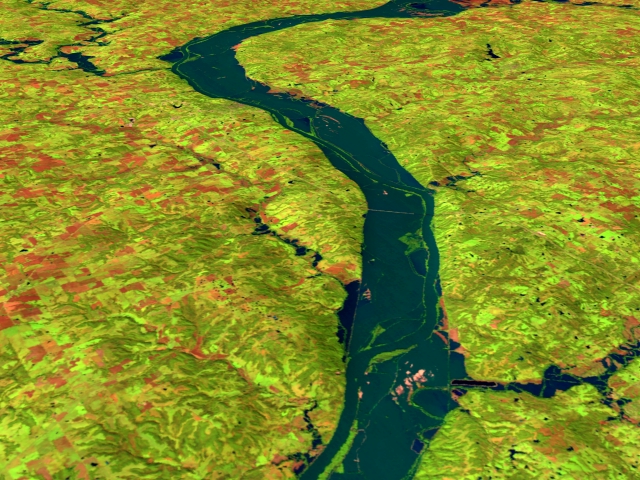
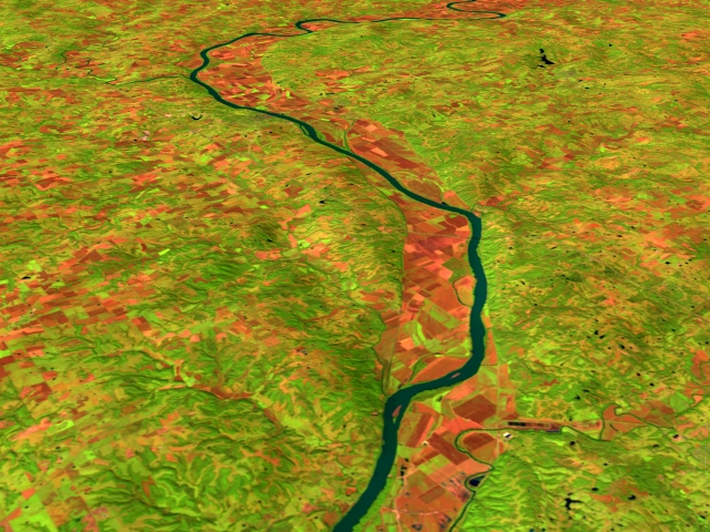
Flooding of the Missouri River. Before (Sept 1992) and during/after (Sept 1993)
For More Information
Visualization Credits
Please give credit for this item to:
NASA/Goddard Space Flight Center Scientific Visualization Studio
NASA/Goddard Space Flight Center Scientific Visualization Studio
Short URL to share this page:
https://svs.gsfc.nasa.gov/929
Mission:
Landsat
Data Used:
Note: While we identify the data sets used in these visualizations, we do not store any further details nor the data sets themselves on our site.
Keywords:
DLESE >> Human geography
SVS >> Missouri River
DLESE >> Natural hazards
DLESE >> Physical geography
GCMD >> Earth Science >> Hydrosphere >> Surface Water >> Floods
NASA Science >> Earth
GCMD keywords can be found on the Internet with the following citation: Olsen, L.M., G. Major, K. Shein, J. Scialdone, S. Ritz, T. Stevens, M. Morahan, A. Aleman, R. Vogel, S. Leicester, H. Weir, M. Meaux, S. Grebas, C.Solomon, M. Holland, T. Northcutt, R. A. Restrepo, R. Bilodeau, 2013. NASA/Global Change Master Directory (GCMD) Earth Science Keywords. Version 8.0.0.0.0
https://svs.gsfc.nasa.gov/929
Mission:
Landsat
Data Used:
Landsat-5/TM
1992/09/24, 1993/09/27Keywords:
DLESE >> Human geography
SVS >> Missouri River
DLESE >> Natural hazards
DLESE >> Physical geography
GCMD >> Earth Science >> Hydrosphere >> Surface Water >> Floods
NASA Science >> Earth
GCMD keywords can be found on the Internet with the following citation: Olsen, L.M., G. Major, K. Shein, J. Scialdone, S. Ritz, T. Stevens, M. Morahan, A. Aleman, R. Vogel, S. Leicester, H. Weir, M. Meaux, S. Grebas, C.Solomon, M. Holland, T. Northcutt, R. A. Restrepo, R. Bilodeau, 2013. NASA/Global Change Master Directory (GCMD) Earth Science Keywords. Version 8.0.0.0.0


