Earth
ID: 864
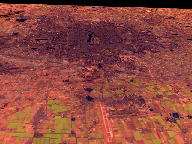
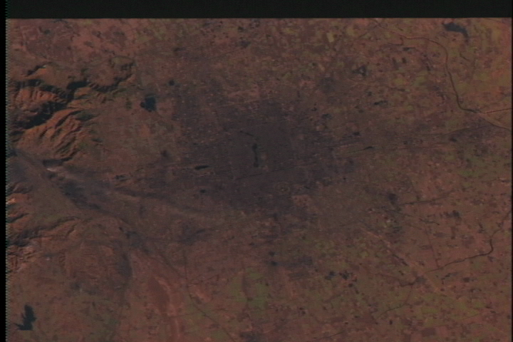
This Landsat scene shows the city of Beijing, looking northward. The main city airport is visible in the foreground. The Landsat data is shown with shortwave infrared (TM Band 5) displayed as red, near infrared (TM Band 4) as green, and visible green (TM Band 2) as blue. Reddish tone shows bare soil or recently cultivated land, greens shows vegetation, while dark gray tones correspond to concrete and asphalt. The overall dark pink/red tone of the city in this image is due to the data coming from the early winter when there is much less vegetation coverage.
Beijing Flyby
For More Information
Visualization Credits
Please give credit for this item to:
NASA/Goddard Space Flight Center Scientific Visualization Studio
NASA/Goddard Space Flight Center Scientific Visualization Studio
Short URL to share this page:
https://svs.gsfc.nasa.gov/864
Mission:
Landsat
Data Used:
Note: While we identify the data sets used in these visualizations, we do not store any further details nor the data sets themselves on our site.
Goddard TV Tape:
G1999-019
Keywords:
DLESE >> Human geography
DLESE >> Physical geography
GCMD >> Location >> China
NASA Science >> Earth
GCMD keywords can be found on the Internet with the following citation: Olsen, L.M., G. Major, K. Shein, J. Scialdone, S. Ritz, T. Stevens, M. Morahan, A. Aleman, R. Vogel, S. Leicester, H. Weir, M. Meaux, S. Grebas, C.Solomon, M. Holland, T. Northcutt, R. A. Restrepo, R. Bilodeau, 2013. NASA/Global Change Master Directory (GCMD) Earth Science Keywords. Version 8.0.0.0.0
https://svs.gsfc.nasa.gov/864
Mission:
Landsat
Data Used:
Landsat-5/TM
1988/12/25Goddard TV Tape:
G1999-019
Keywords:
DLESE >> Human geography
DLESE >> Physical geography
GCMD >> Location >> China
NASA Science >> Earth
GCMD keywords can be found on the Internet with the following citation: Olsen, L.M., G. Major, K. Shein, J. Scialdone, S. Ritz, T. Stevens, M. Morahan, A. Aleman, R. Vogel, S. Leicester, H. Weir, M. Meaux, S. Grebas, C.Solomon, M. Holland, T. Northcutt, R. A. Restrepo, R. Bilodeau, 2013. NASA/Global Change Master Directory (GCMD) Earth Science Keywords. Version 8.0.0.0.0


