Earth
ID: 848
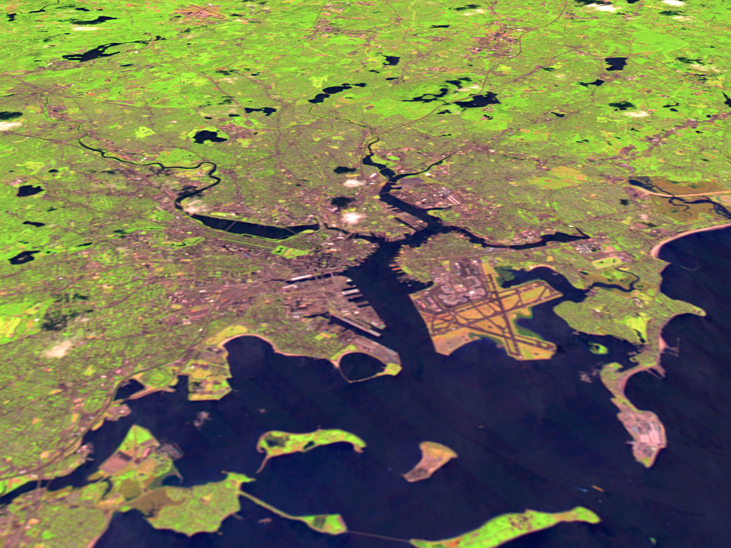
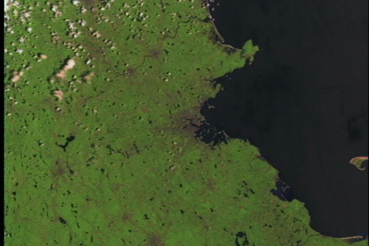
This scene shows Landsat Thematic Mapper data from the shortwave infrared (TM band 5), infrared (TM band 4), and visible green (TM band 2) channels of Boston. Logan Airport is visible in the foreground, while high resolution images show the highway network running around the city.
Boston Flyby
For More Information
Visualization Credits
Please give credit for this item to:
NASA/Goddard Space Flight Center Scientific Visualization Studio
NASA/Goddard Space Flight Center Scientific Visualization Studio
Short URL to share this page:
https://svs.gsfc.nasa.gov/848
Mission:
Landsat
Data Used:
Note: While we identify the data sets used in these visualizations, we do not store any further details nor the data sets themselves on our site.
Goddard TV Tapes:
G1999-021
G2003-046
Keywords:
SVS >> Boston
DLESE >> Human geography
DLESE >> Hydrology
DLESE >> Physical geography
GCMD >> Location >> Massachusetts
NASA Science >> Earth
GCMD keywords can be found on the Internet with the following citation: Olsen, L.M., G. Major, K. Shein, J. Scialdone, S. Ritz, T. Stevens, M. Morahan, A. Aleman, R. Vogel, S. Leicester, H. Weir, M. Meaux, S. Grebas, C.Solomon, M. Holland, T. Northcutt, R. A. Restrepo, R. Bilodeau, 2013. NASA/Global Change Master Directory (GCMD) Earth Science Keywords. Version 8.0.0.0.0
https://svs.gsfc.nasa.gov/848
Mission:
Landsat
Data Used:
Landsat-5/TM
1997/06/23Goddard TV Tapes:
G1999-021
G2003-046
Keywords:
SVS >> Boston
DLESE >> Human geography
DLESE >> Hydrology
DLESE >> Physical geography
GCMD >> Location >> Massachusetts
NASA Science >> Earth
GCMD keywords can be found on the Internet with the following citation: Olsen, L.M., G. Major, K. Shein, J. Scialdone, S. Ritz, T. Stevens, M. Morahan, A. Aleman, R. Vogel, S. Leicester, H. Weir, M. Meaux, S. Grebas, C.Solomon, M. Holland, T. Northcutt, R. A. Restrepo, R. Bilodeau, 2013. NASA/Global Change Master Directory (GCMD) Earth Science Keywords. Version 8.0.0.0.0


