Planets and Moons
ID: 765
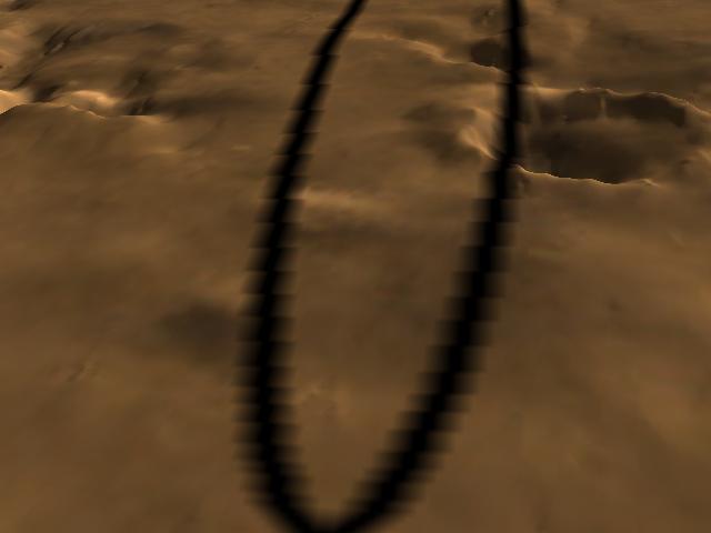
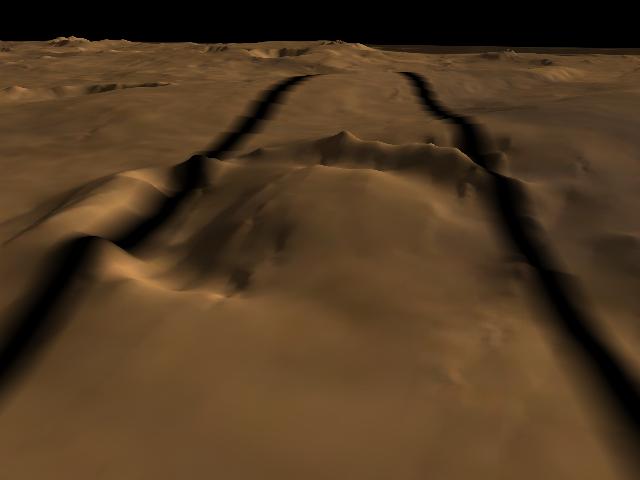
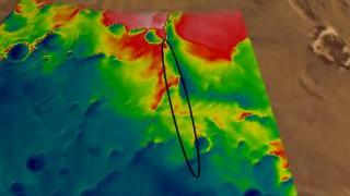
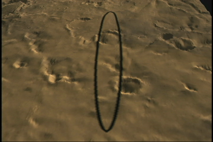
This is one of a series of visualizations showing false-colored renderings of the Martian topography measured by MOLA in the vicinity of the Mars Polar Lander landing site. Blue tones represent elevations of less than 2 kilometers, while reddish tones are greater than about 2.8 kilometers, relative to the mean equatorial height of Mars. The elevation of the landing site is about 2.4 km, midway into the polar layered terrain. The 400 meters (1/4 mile) resolution of the MOLA data gives a smoothed but vertically exaggerated view of the topography. At this scale it is impossible to ascertain the actual roughness at the lander's destination, forcing project directors to make their best guesses based on available data.
Close Up Fly Over of Mars Polar Lander Landing Area in True Color
Alternate Version
For More Information
Visualization Credits
Please give credit for this item to:
NASA/Goddard Space Flight Center Scientific Visualization Studio
NASA/Goddard Space Flight Center Scientific Visualization Studio
Short URL to share this page:
https://svs.gsfc.nasa.gov/765
Missions:
Mars Global Surveyor - MGS
Viking
Data Used:
Note: While we identify the data sets used in these visualizations, we do not store any further details nor the data sets themselves on our site.
This item is part of this series:
Mars Polar Lander
Goddard TV Tape:
G1999-097
Keywords:
SVS >> Mars
DLESE >> Space science
NASA Science >> Planets and Moons
https://svs.gsfc.nasa.gov/765
Missions:
Mars Global Surveyor - MGS
Viking
Data Used:
Viking
1976-1980MGS/MOLA/Topography
This item is part of this series:
Mars Polar Lander
Goddard TV Tape:
G1999-097
Keywords:
SVS >> Mars
DLESE >> Space science
NASA Science >> Planets and Moons


