Planets and Moons
ID: 559
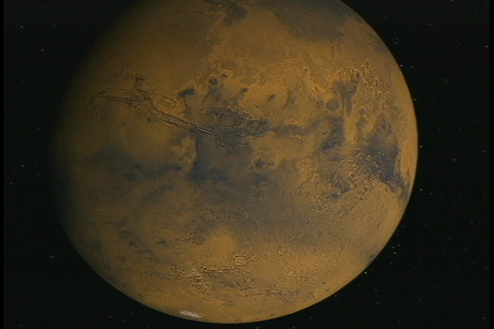
The true global geography of Mars first emerged with comprehensive maps from Mariner 9 and Viking during the 1970's. This visualization tours the Red Planet using the Viking data set, hitting such features as the Valles Marineris canyons and the Olympus Mons volcano.
Mars
Visualization Credits
Robert Crippen (NASA): Lead Animator
David Curkendall (NASA/JPL CalTech): Animator
Joseph Jacob (NASA): Animator
Peggy Li (NASA): Animator
Lucian Plesea (NASA/JPL CalTech): Animator
Marc Pomerantz (NASA): Animator
Frank Semerano (NASA): Animator
Cris Windoffer (NASA): Animator
Kathya Zamora-Diaz (NASA): Animator
Ron Blom (NASA/JPL CalTech): Scientist
Please give credit for this item to:
NASA/Jet Propulsion Laboratory
NASA/Jet Propulsion Laboratory
Short URL to share this page:
https://svs.gsfc.nasa.gov/559
Missions:
Mariner
Viking
Data Used:
Note: While we identify the data sets used in these visualizations, we do not store any further details nor the data sets themselves on our site.
This item is part of this series:
Images of Earth and Space
Goddard TV Tape:
Not On Tape
Keywords:
SVS >> Mars
DLESE >> Space science
NASA Science >> Planets and Moons
https://svs.gsfc.nasa.gov/559
Missions:
Mariner
Viking
Data Used:
Mariner-9/Vidicon
1971-1972Viking/VIS
1976-1980This item is part of this series:
Images of Earth and Space
Goddard TV Tape:
Not On Tape
Keywords:
SVS >> Mars
DLESE >> Space science
NASA Science >> Planets and Moons


