Earth
ID: 4062
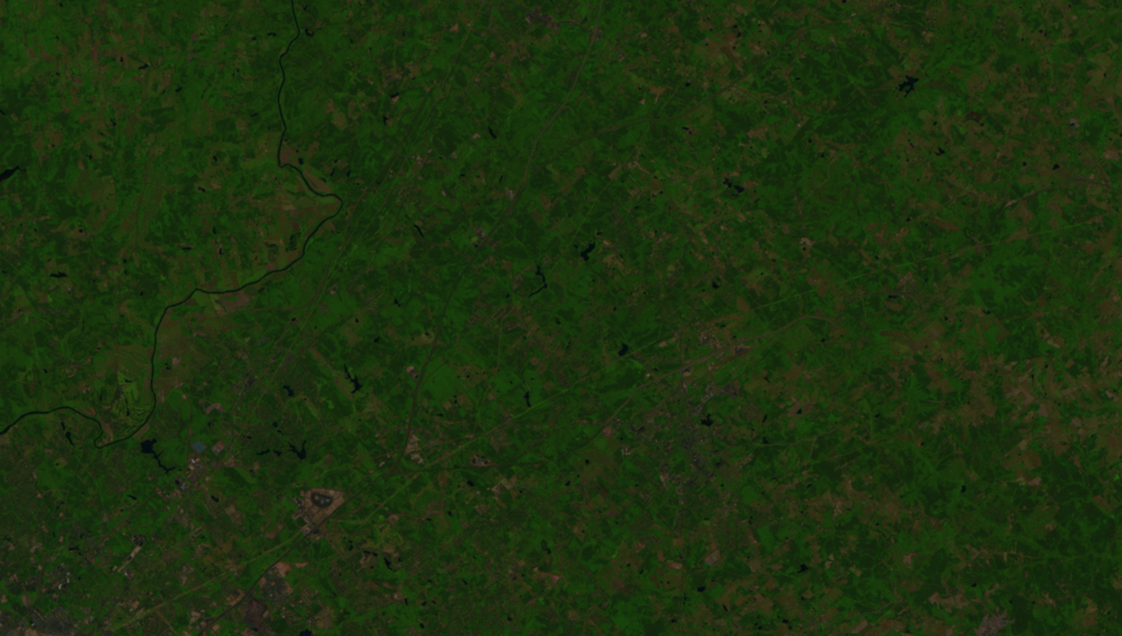
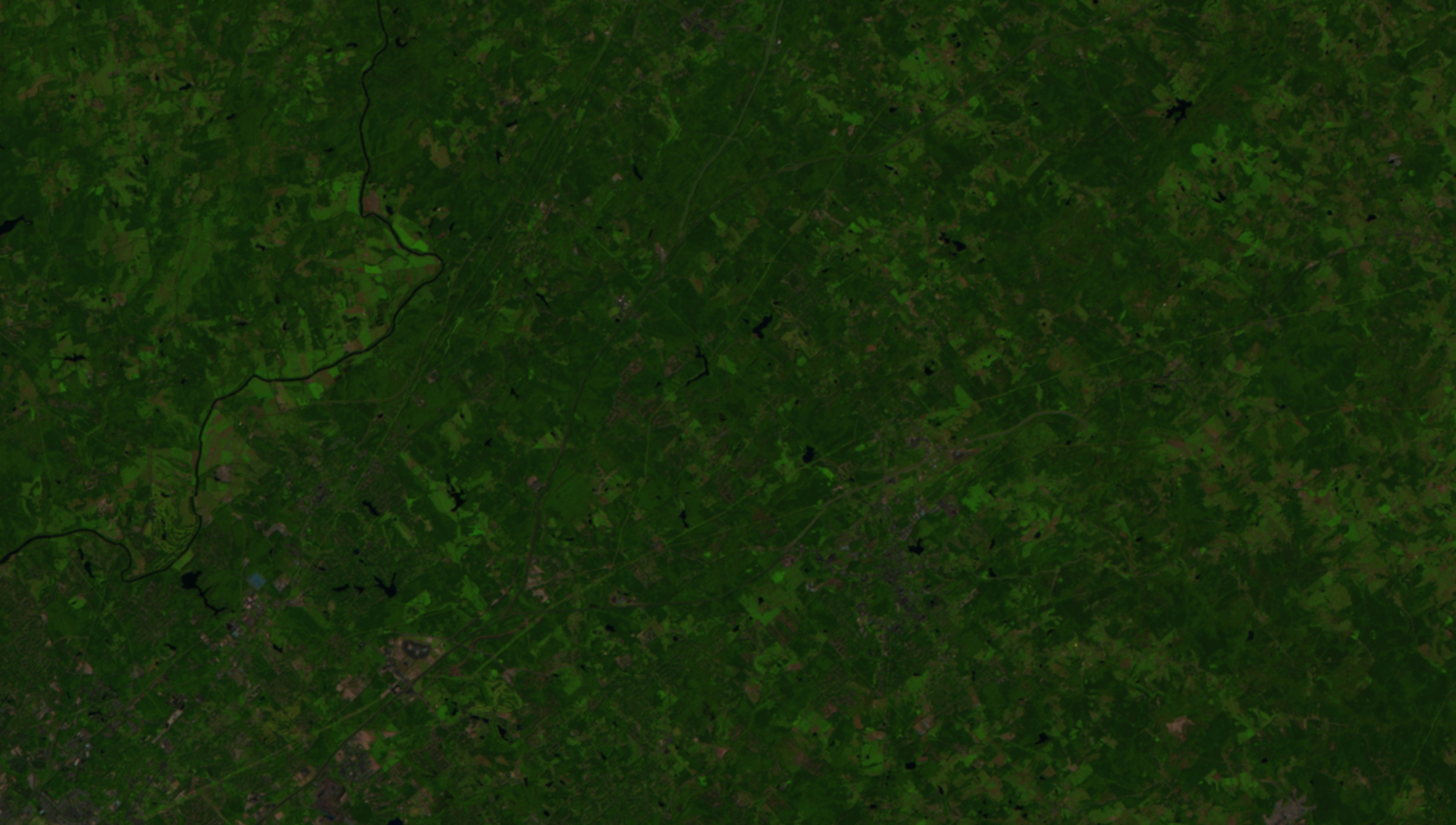
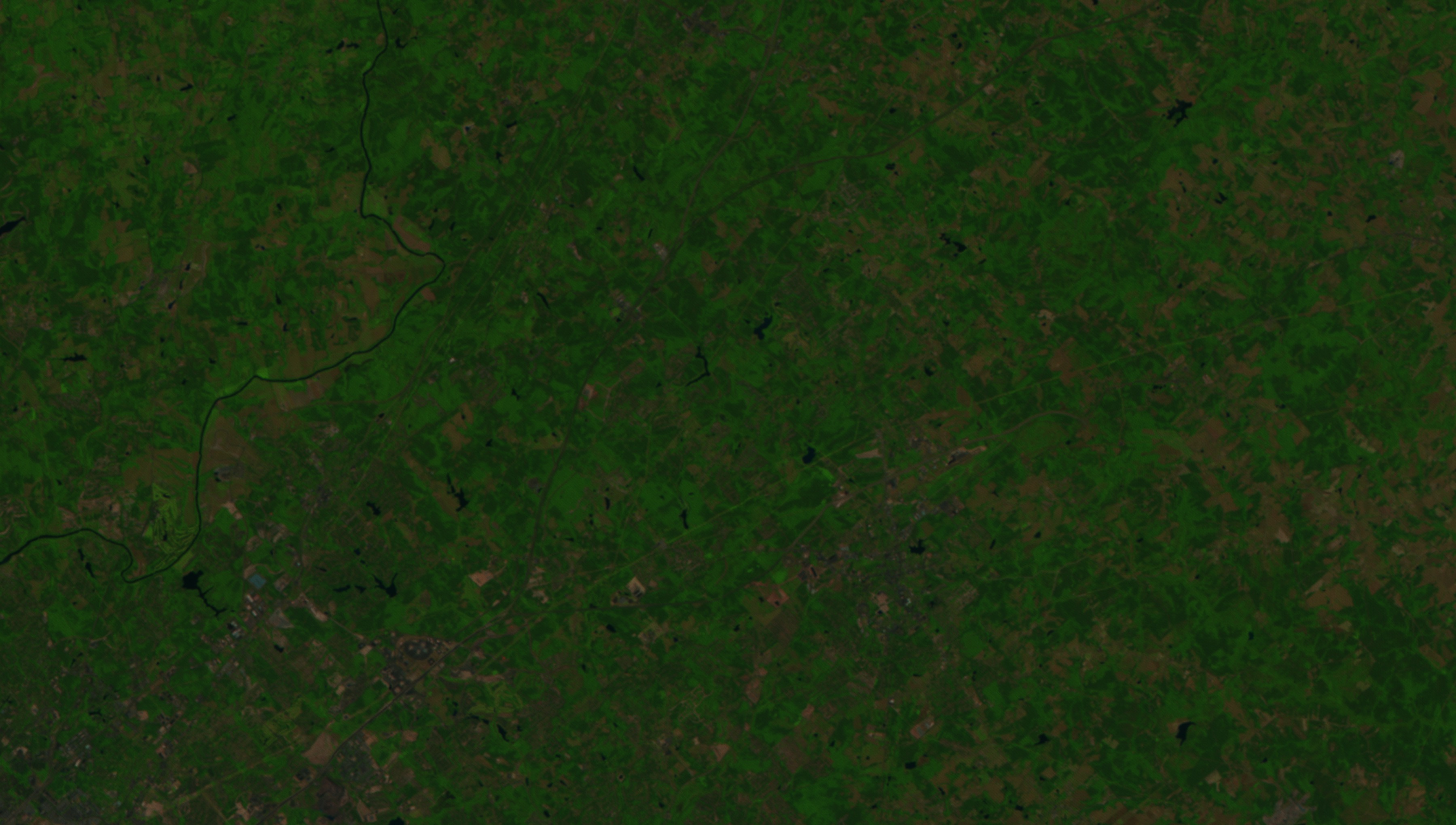
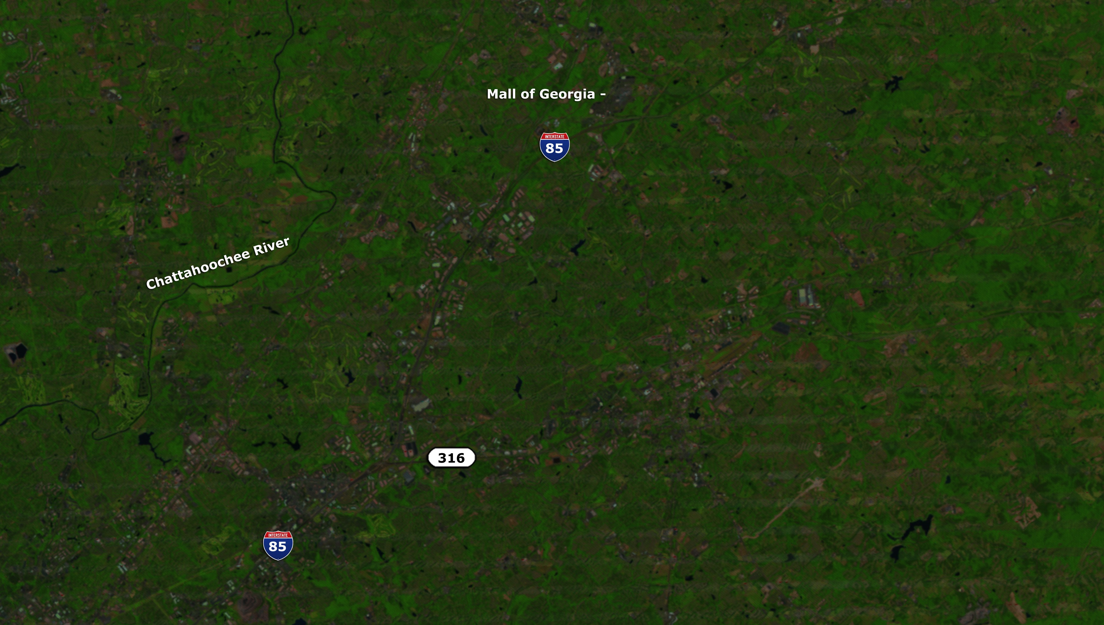
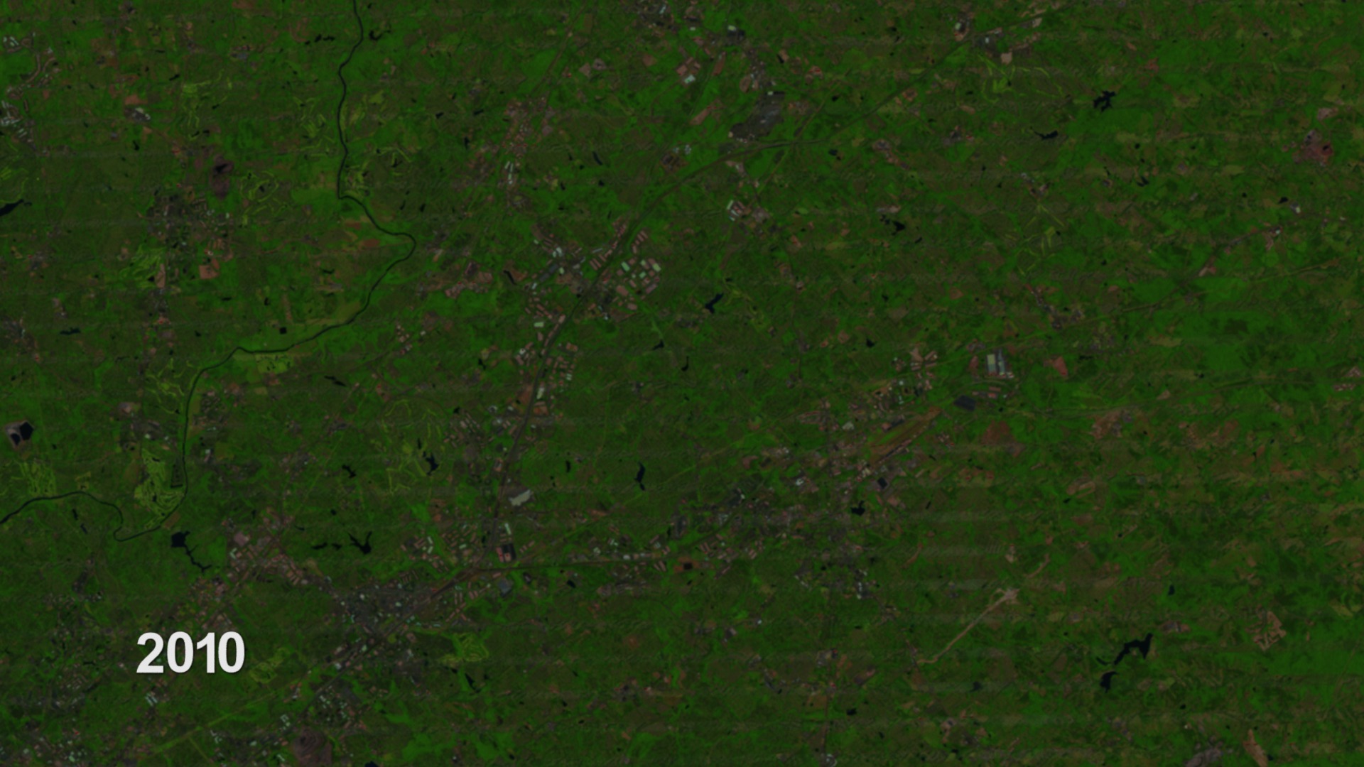
One of the many ways to keep FEMA maps up to date is by tracking urban change using satellite imagery. Take this suburb of Atlanta, Georgia as an example. By mining Landsat images spanning a 27 year period, it's possible to identify areas where the land surface has permanently changed and affect the areas ability to absorb water.
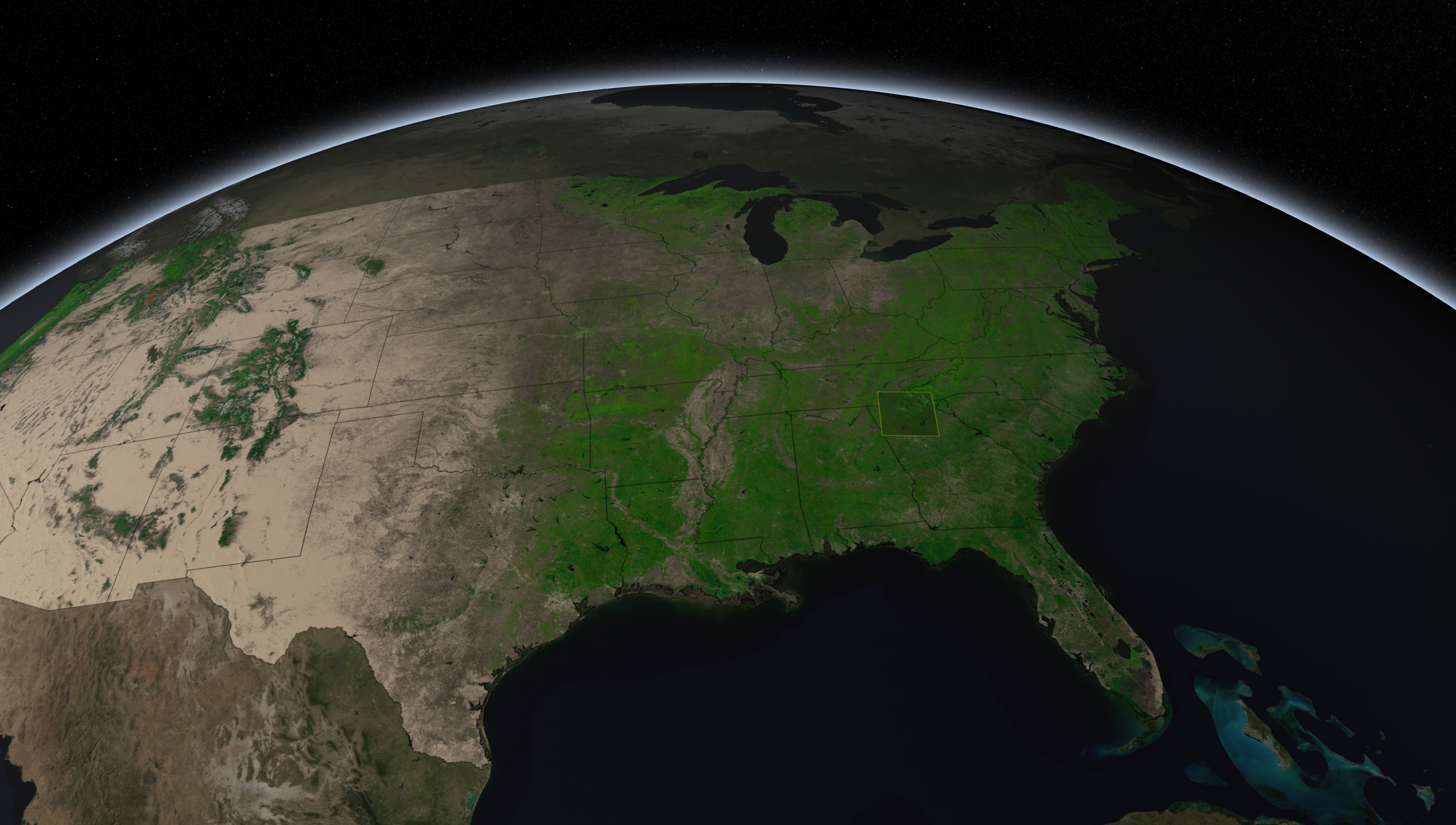
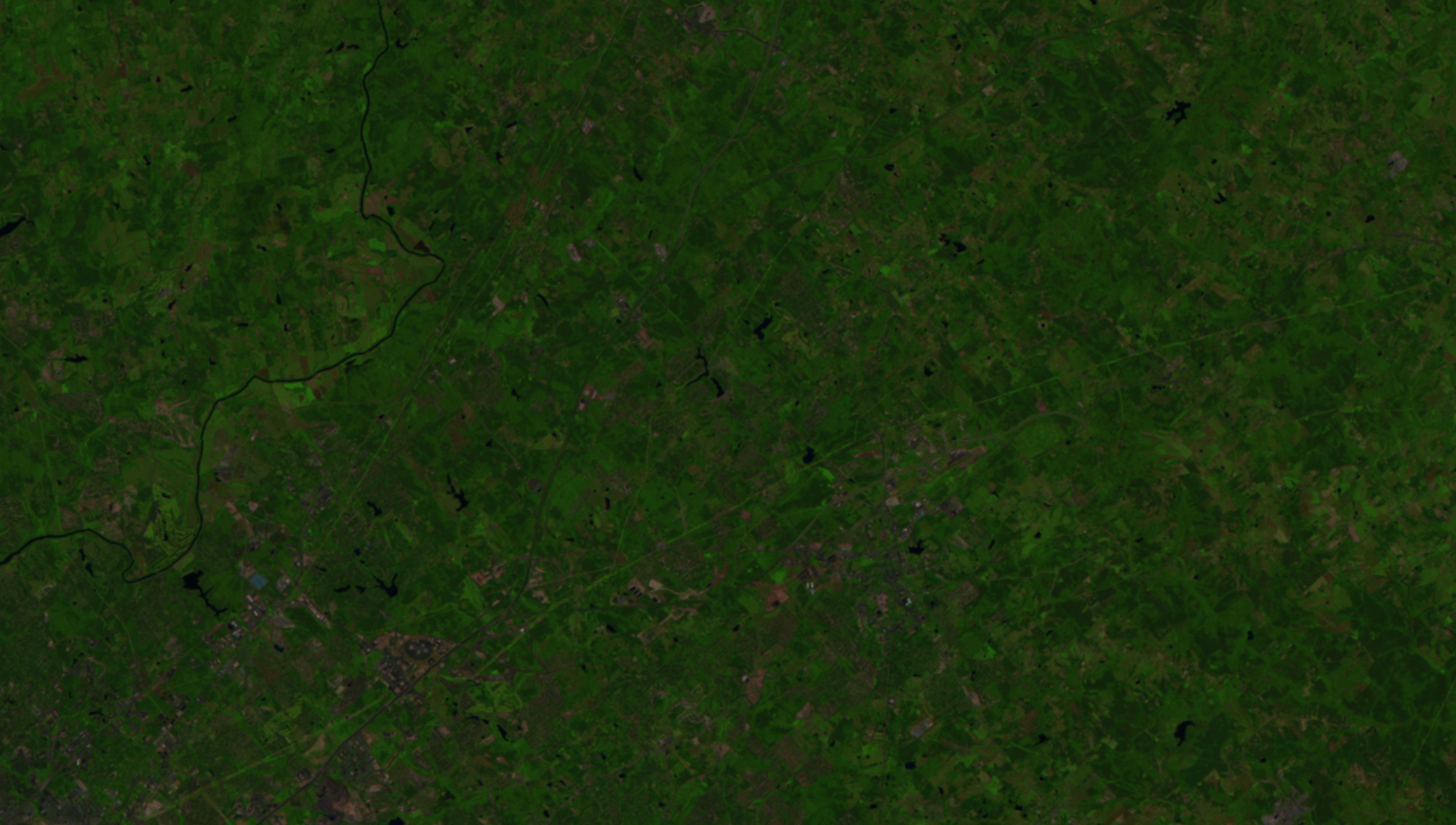
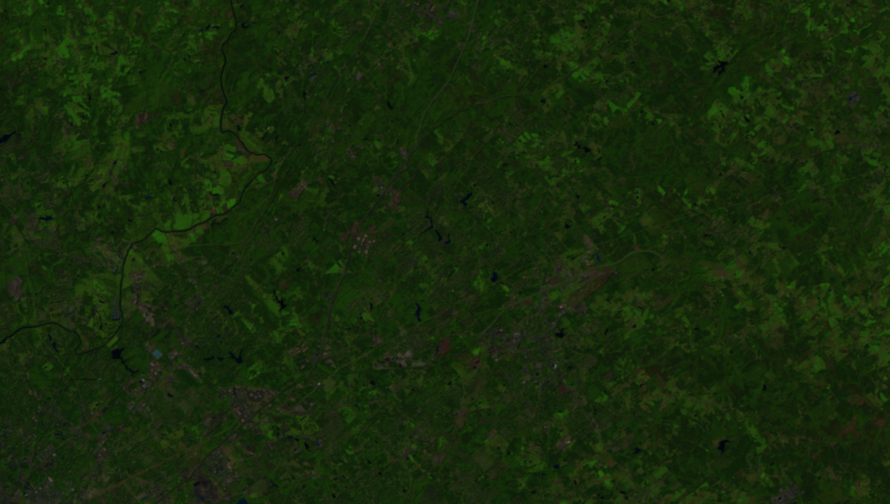
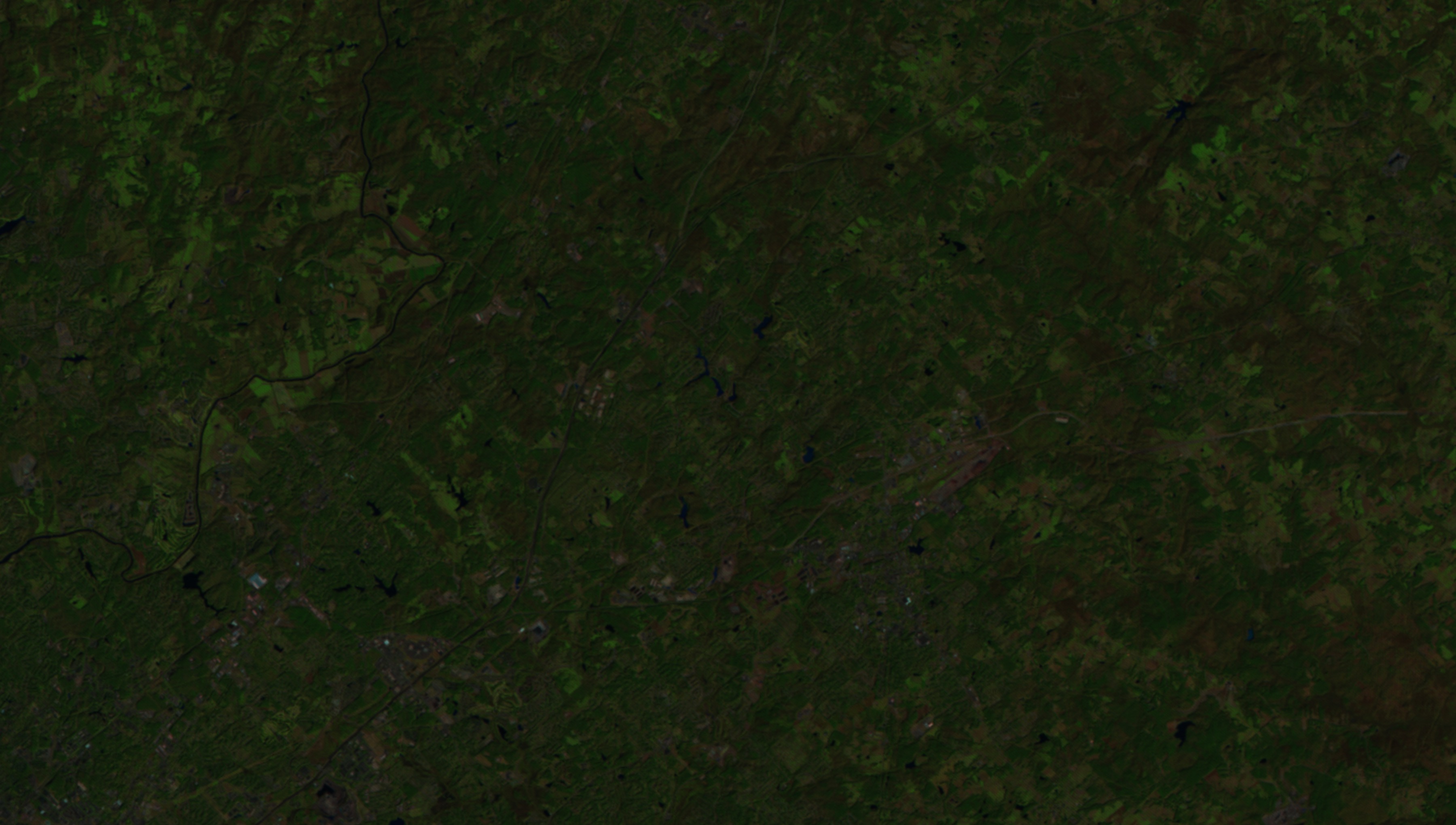
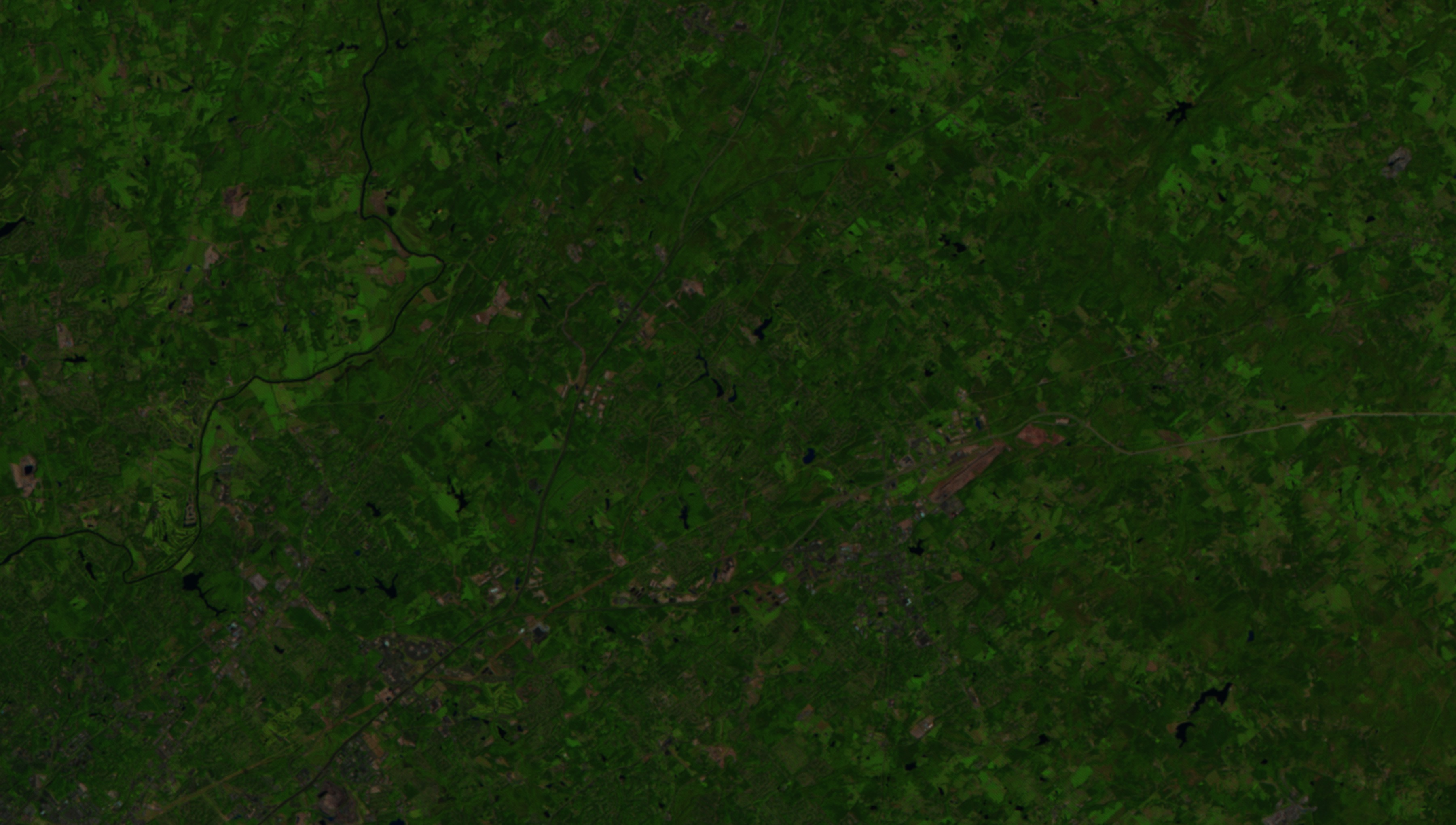
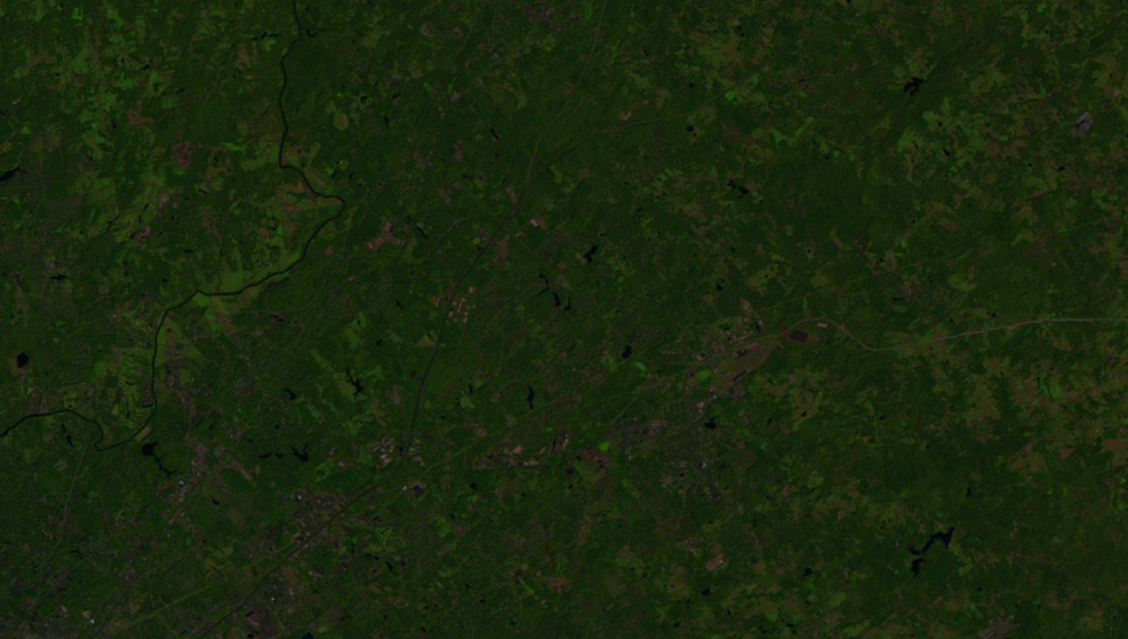
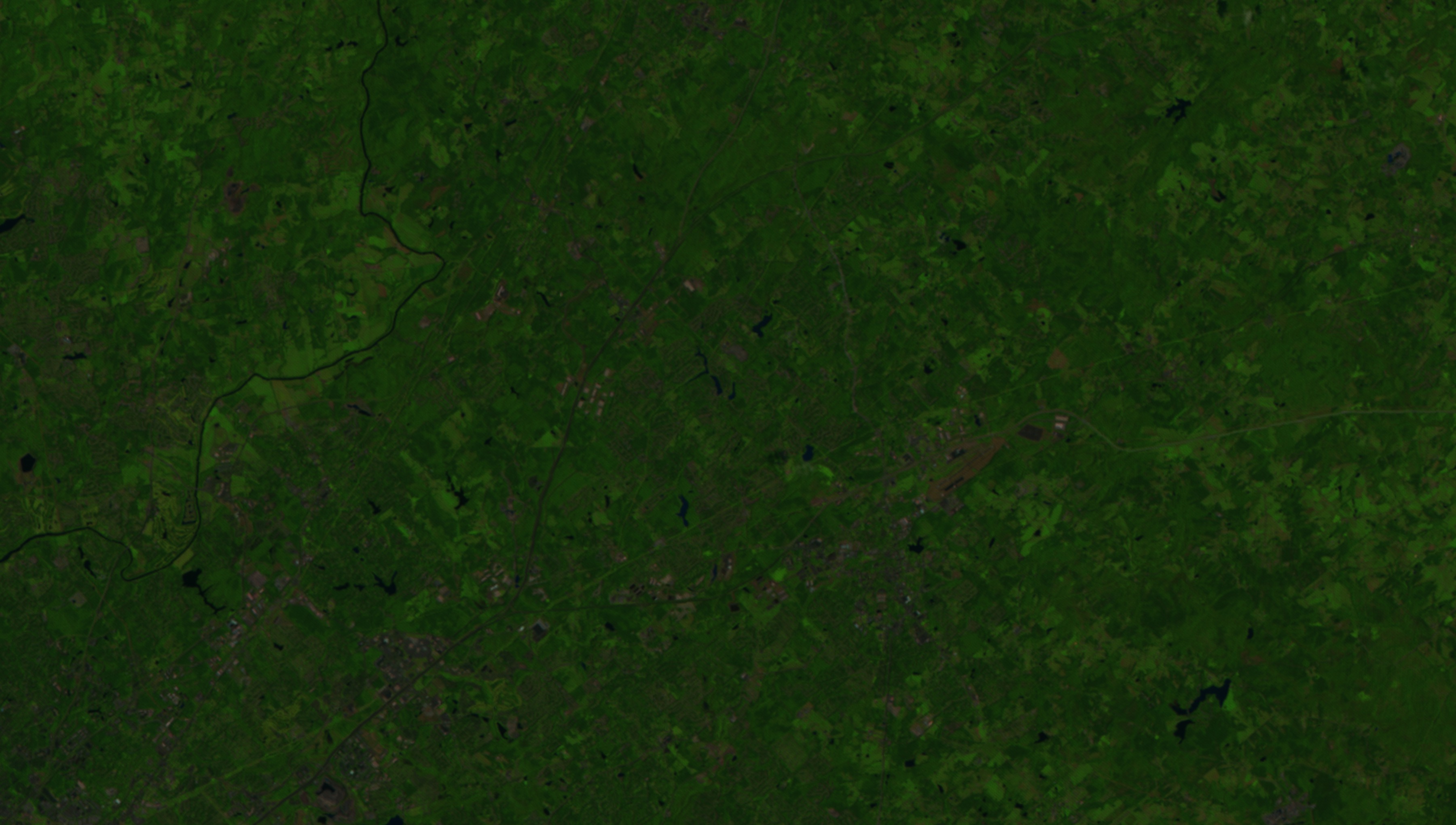
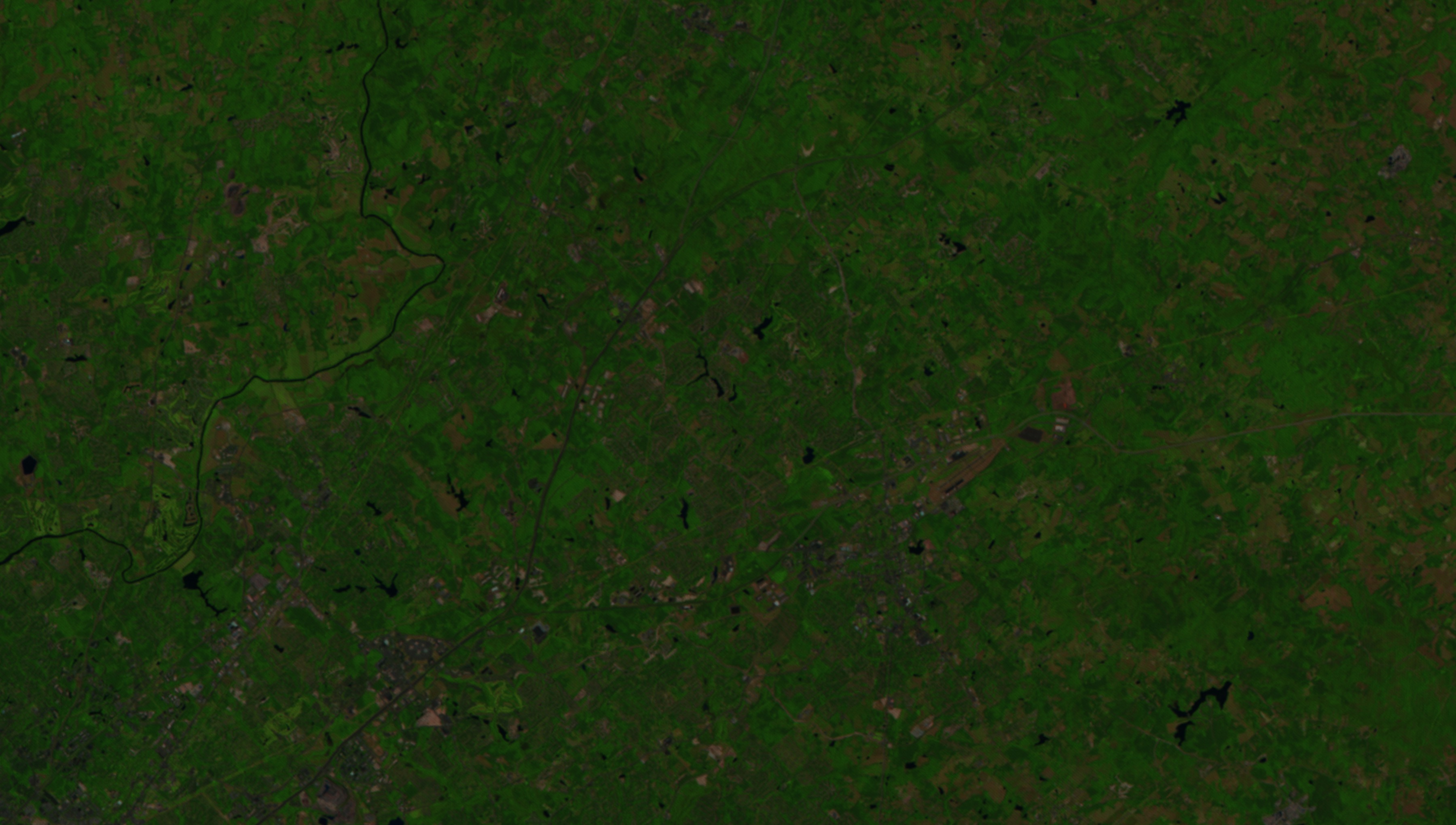
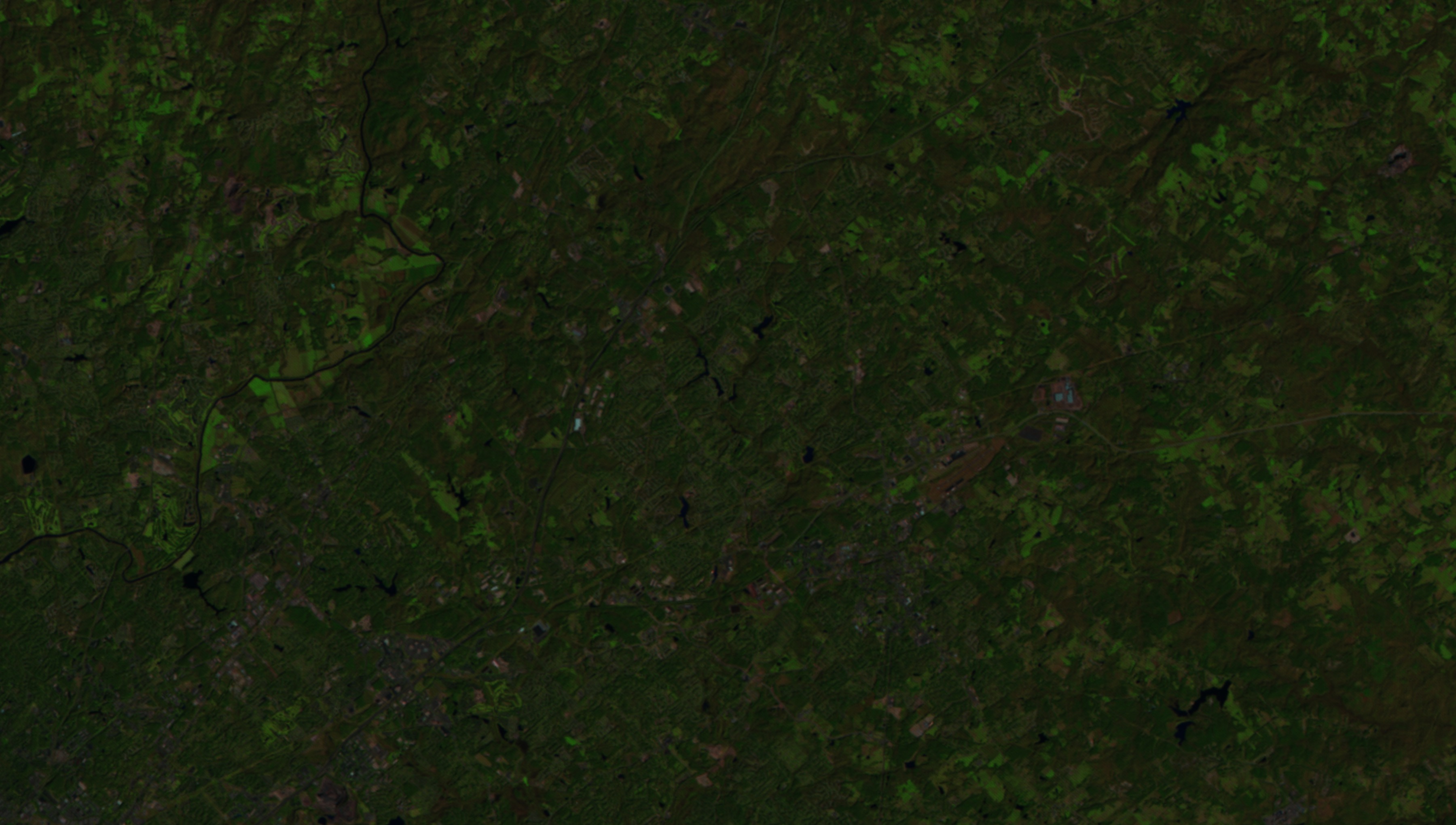
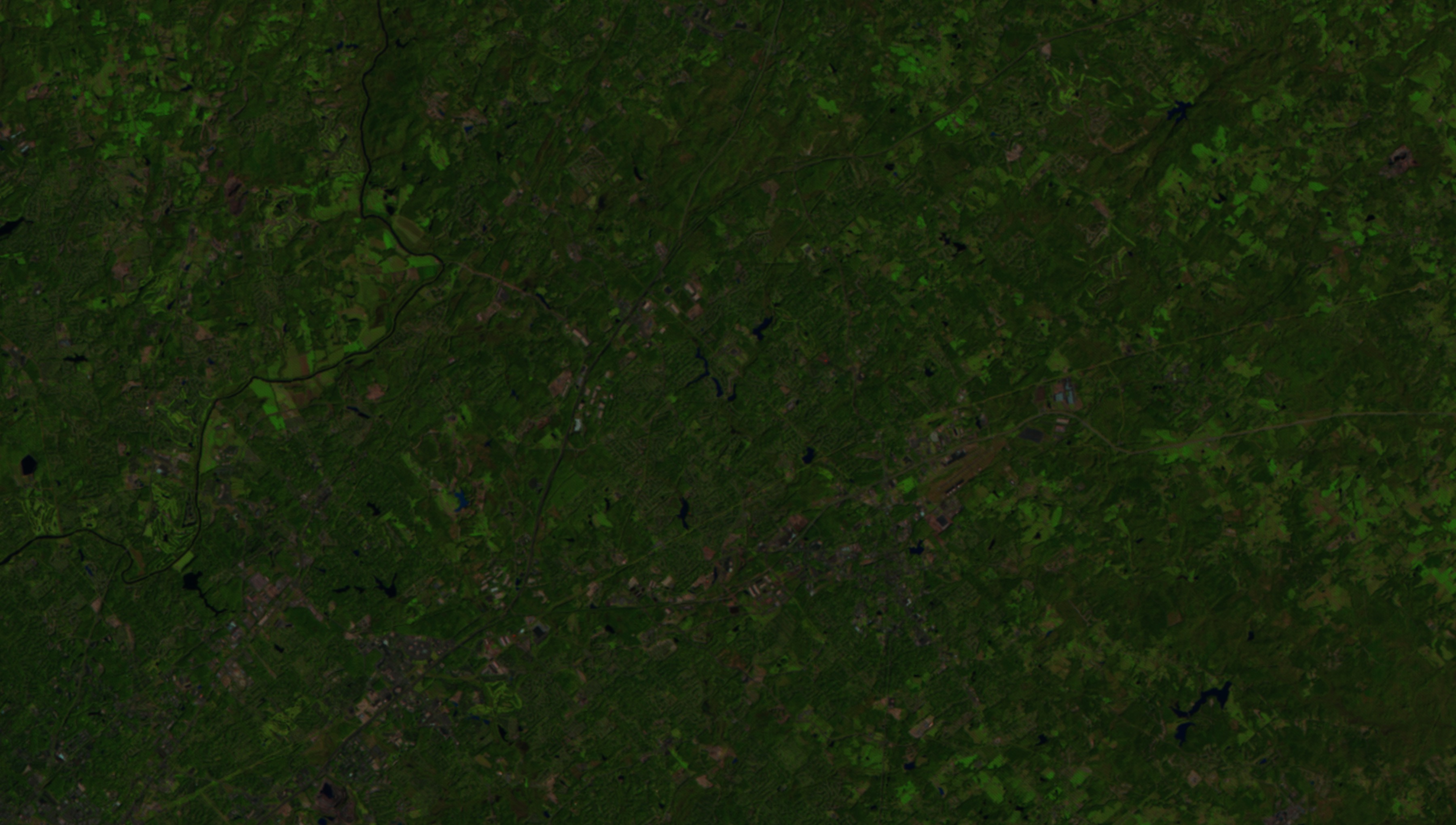
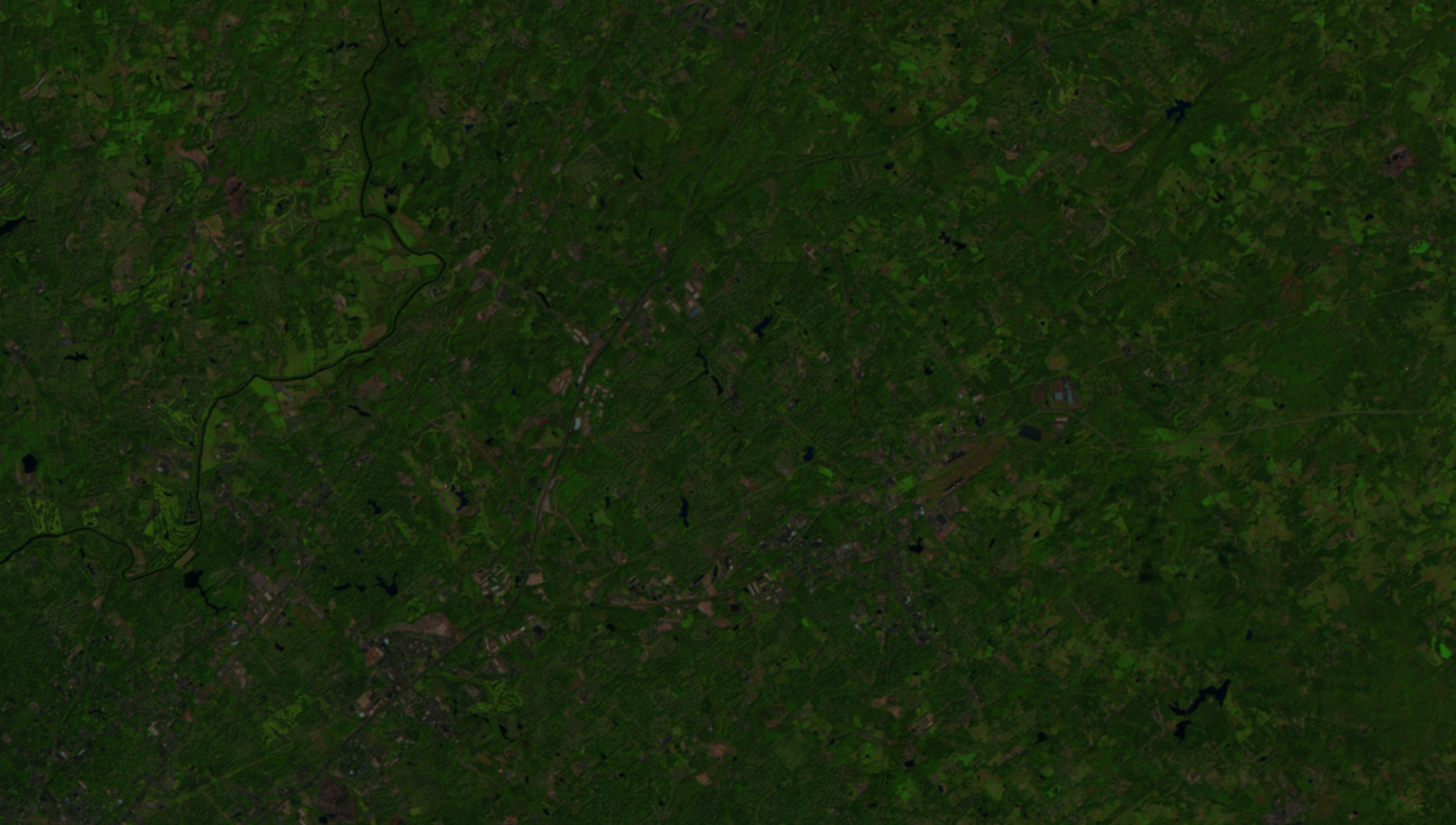
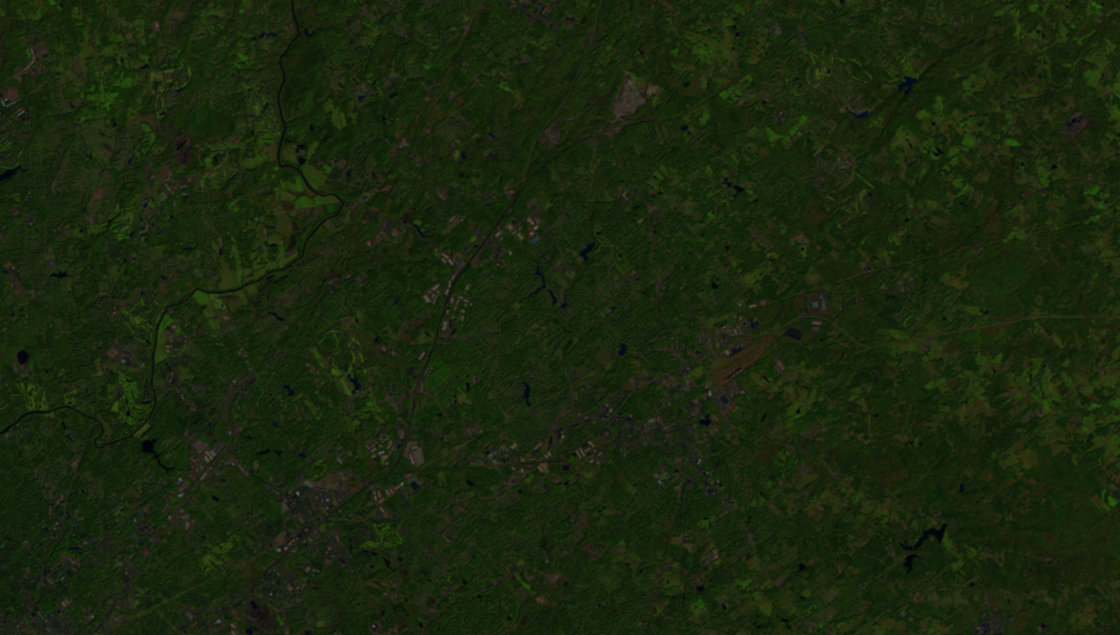
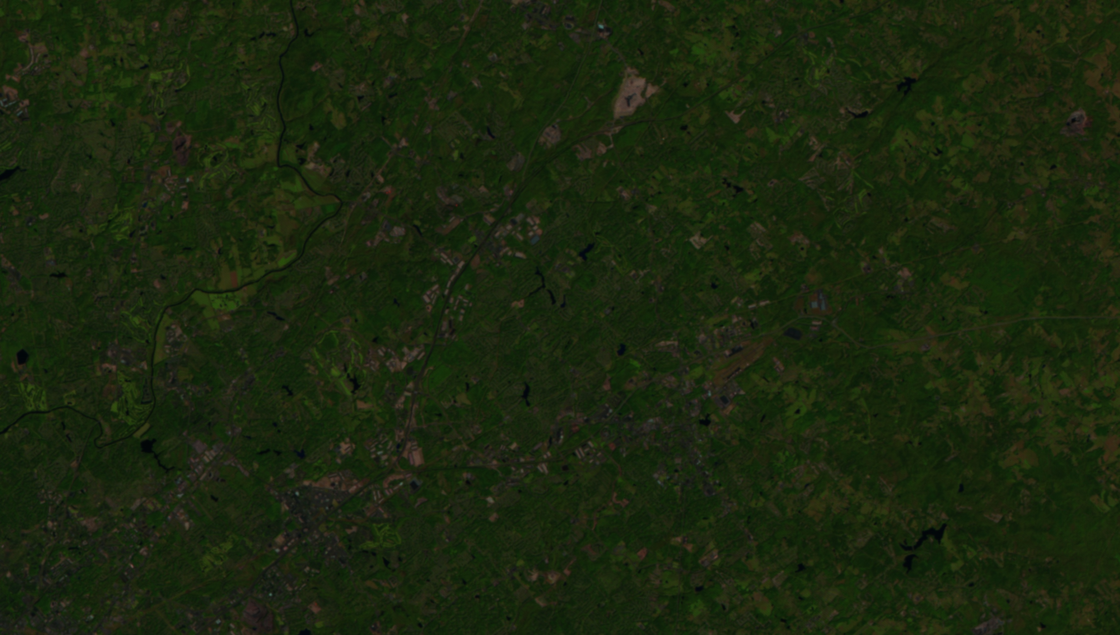
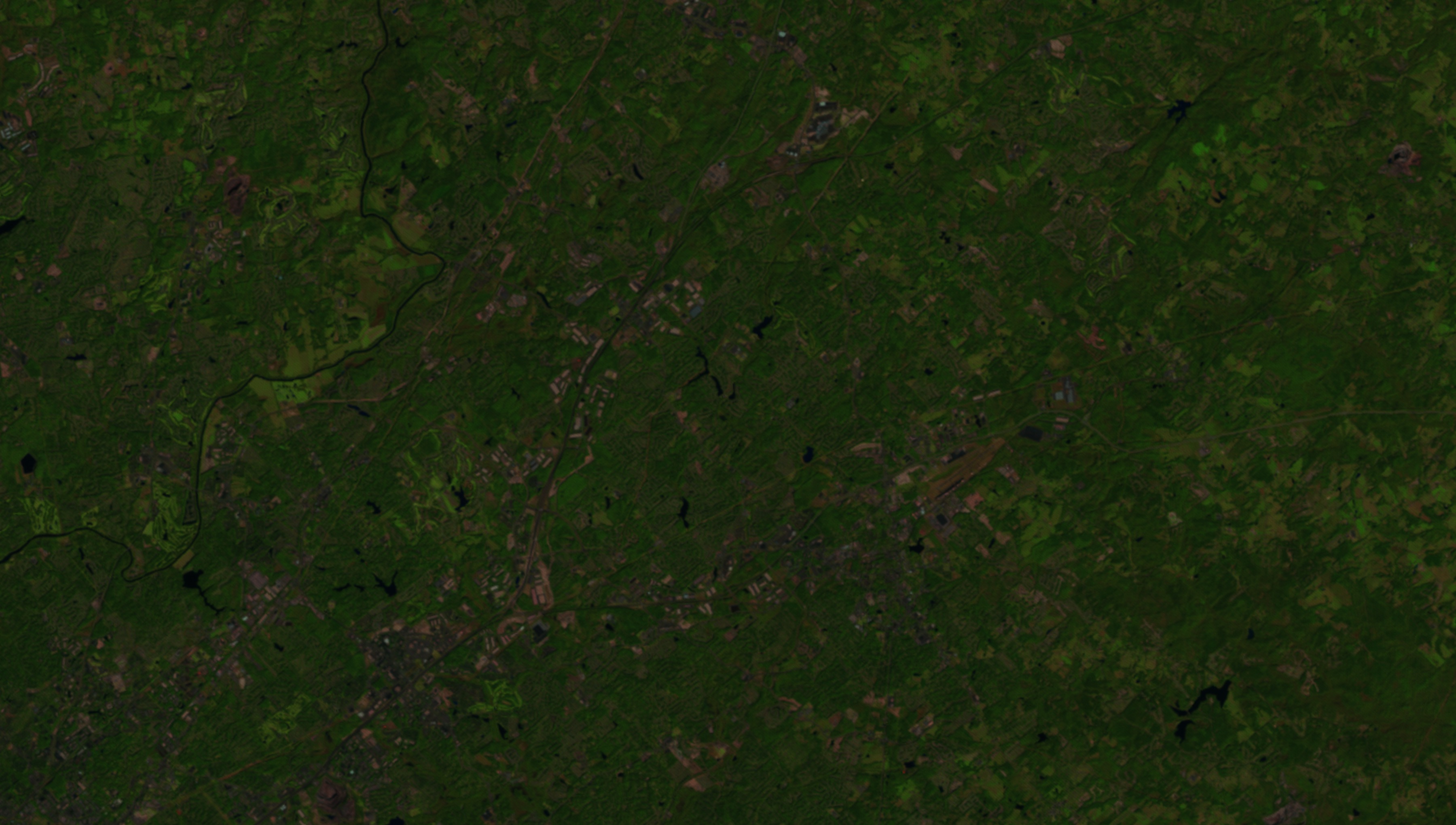
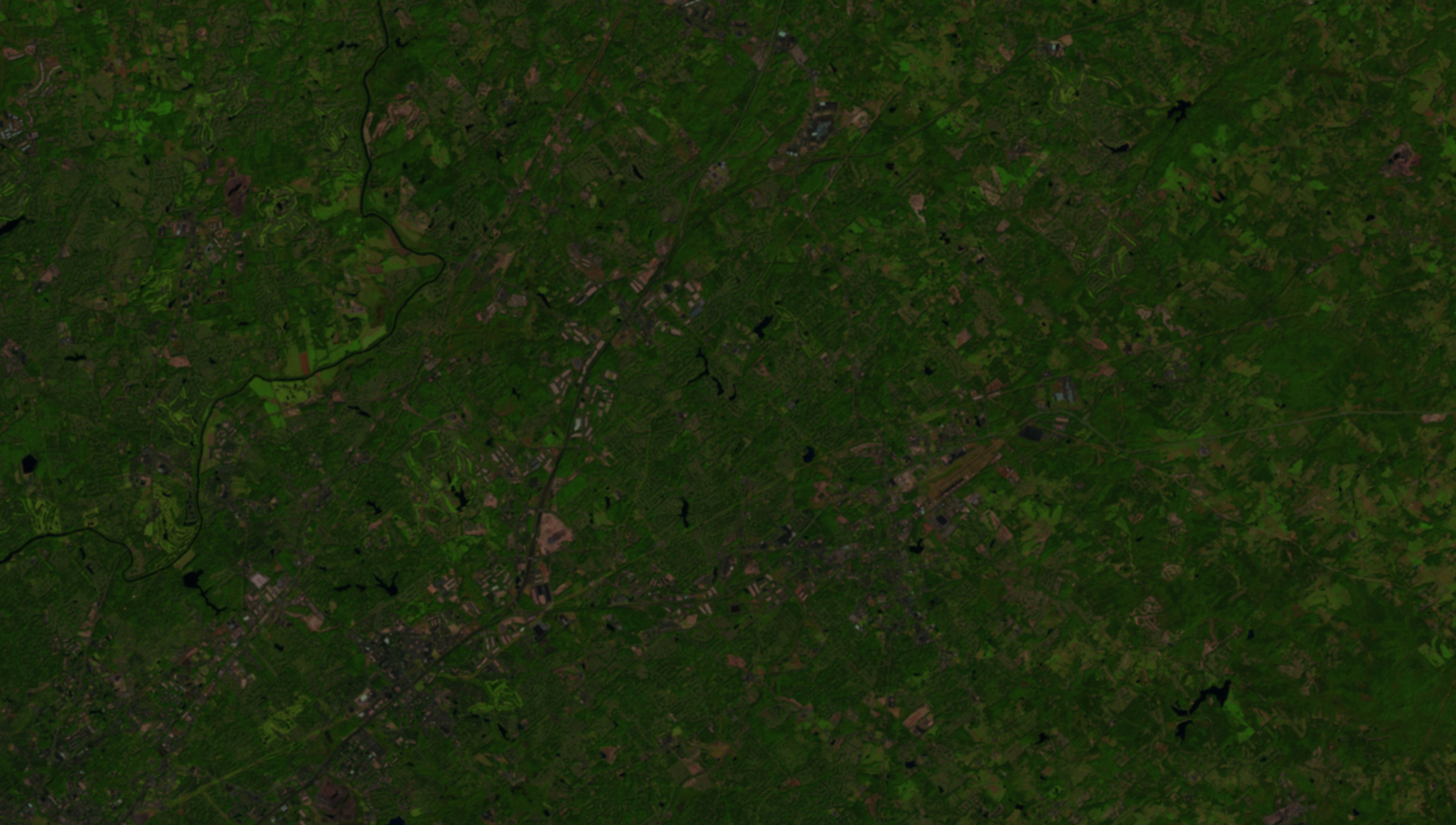
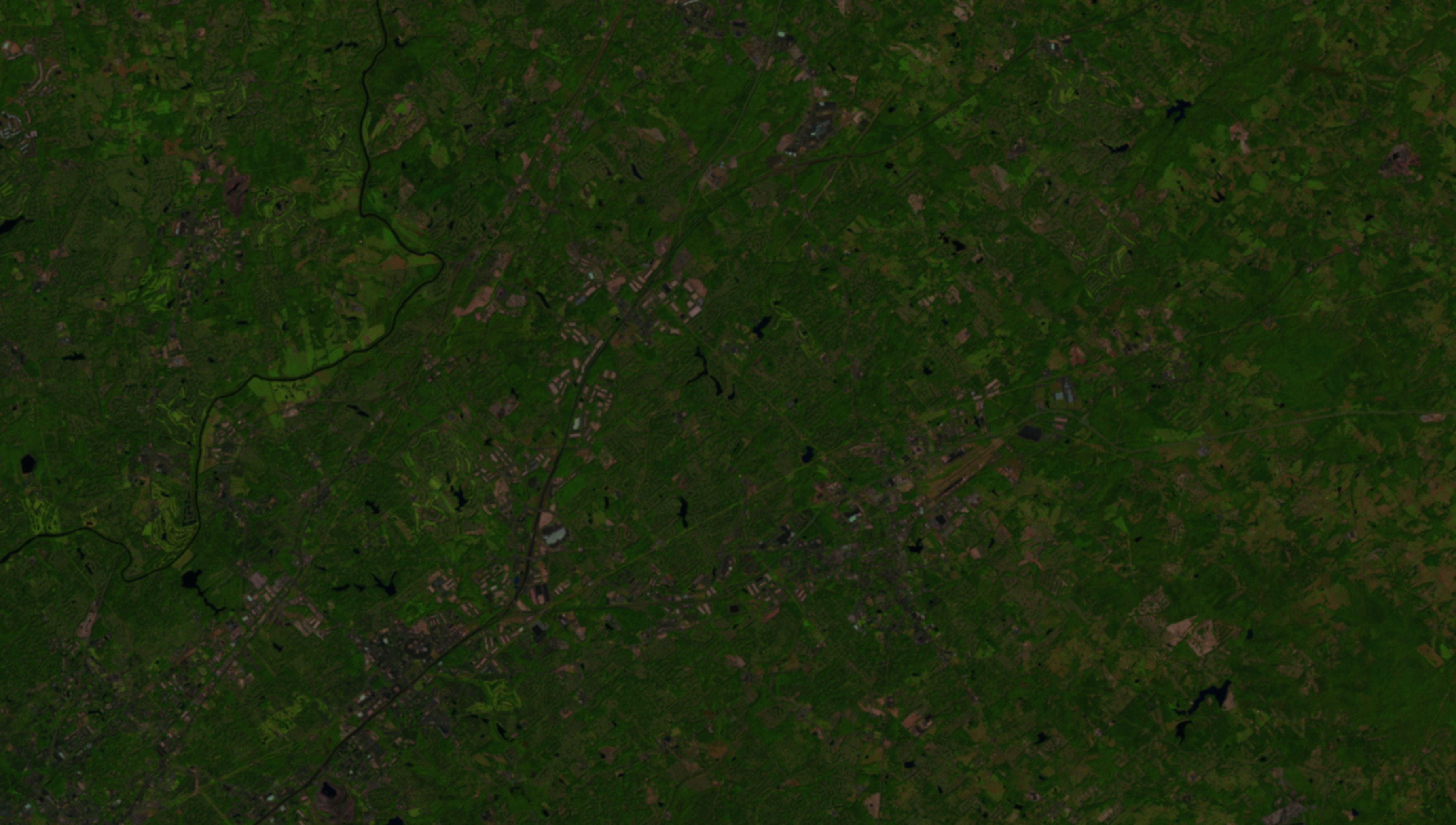
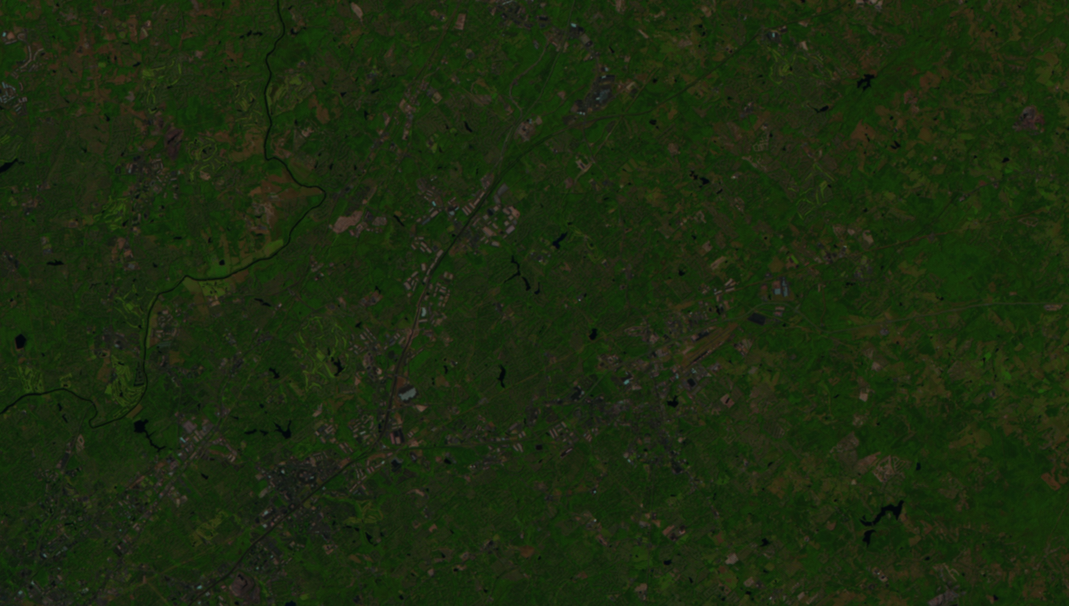
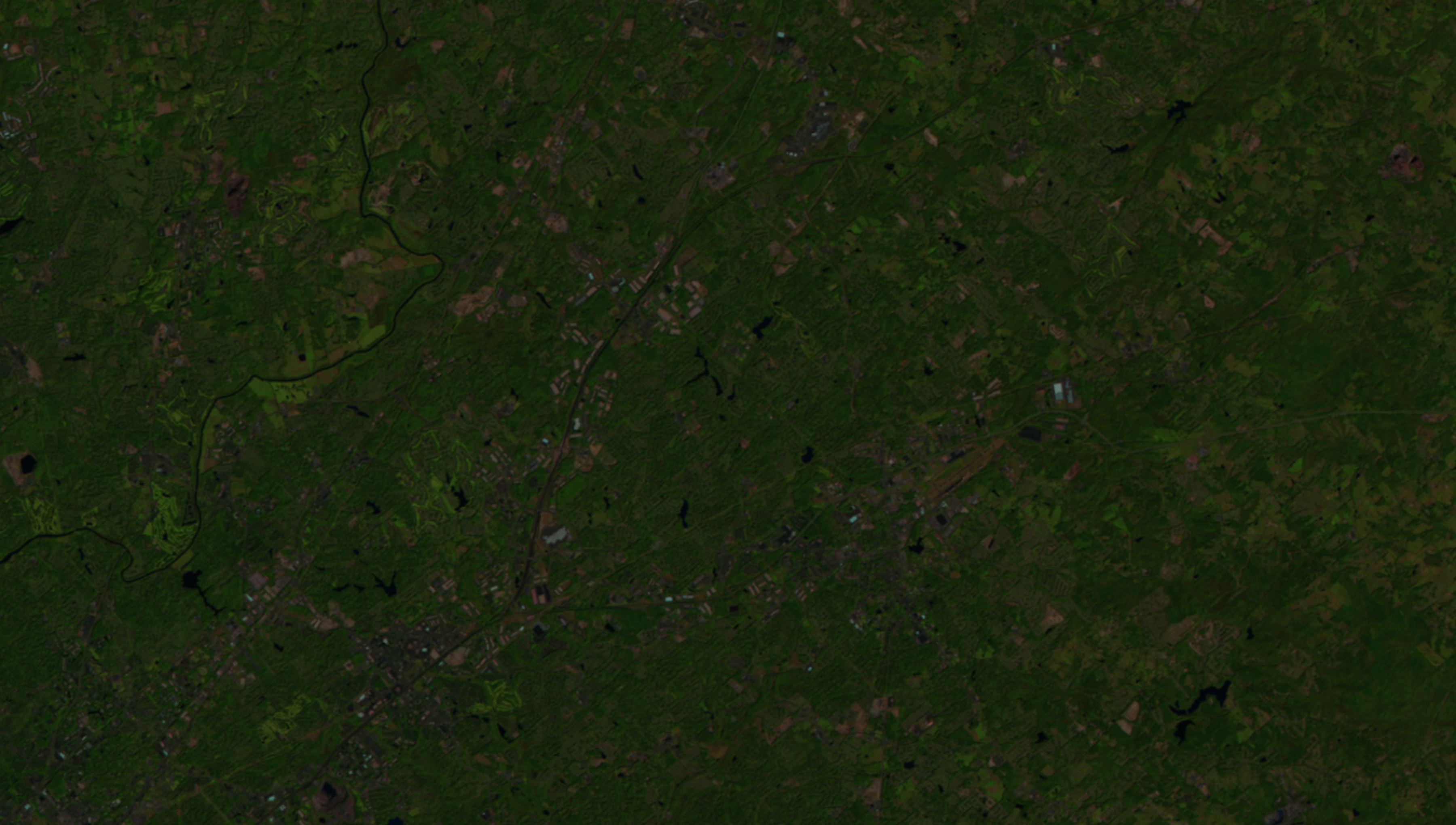
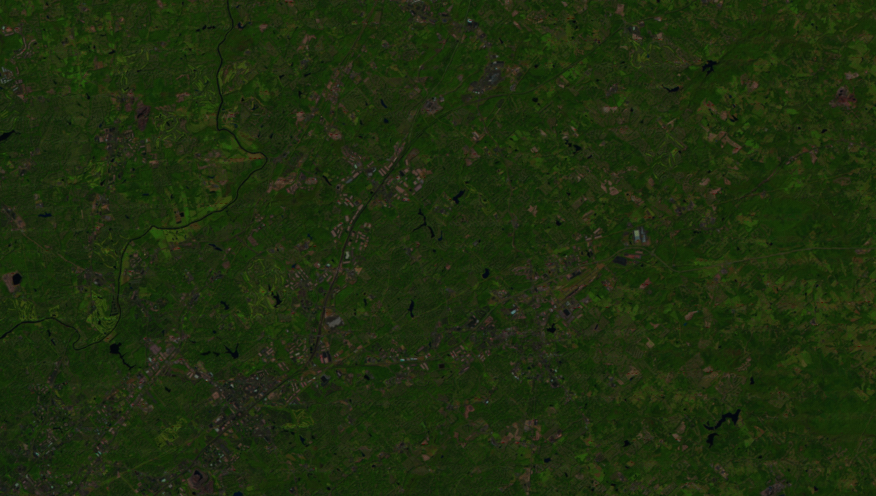
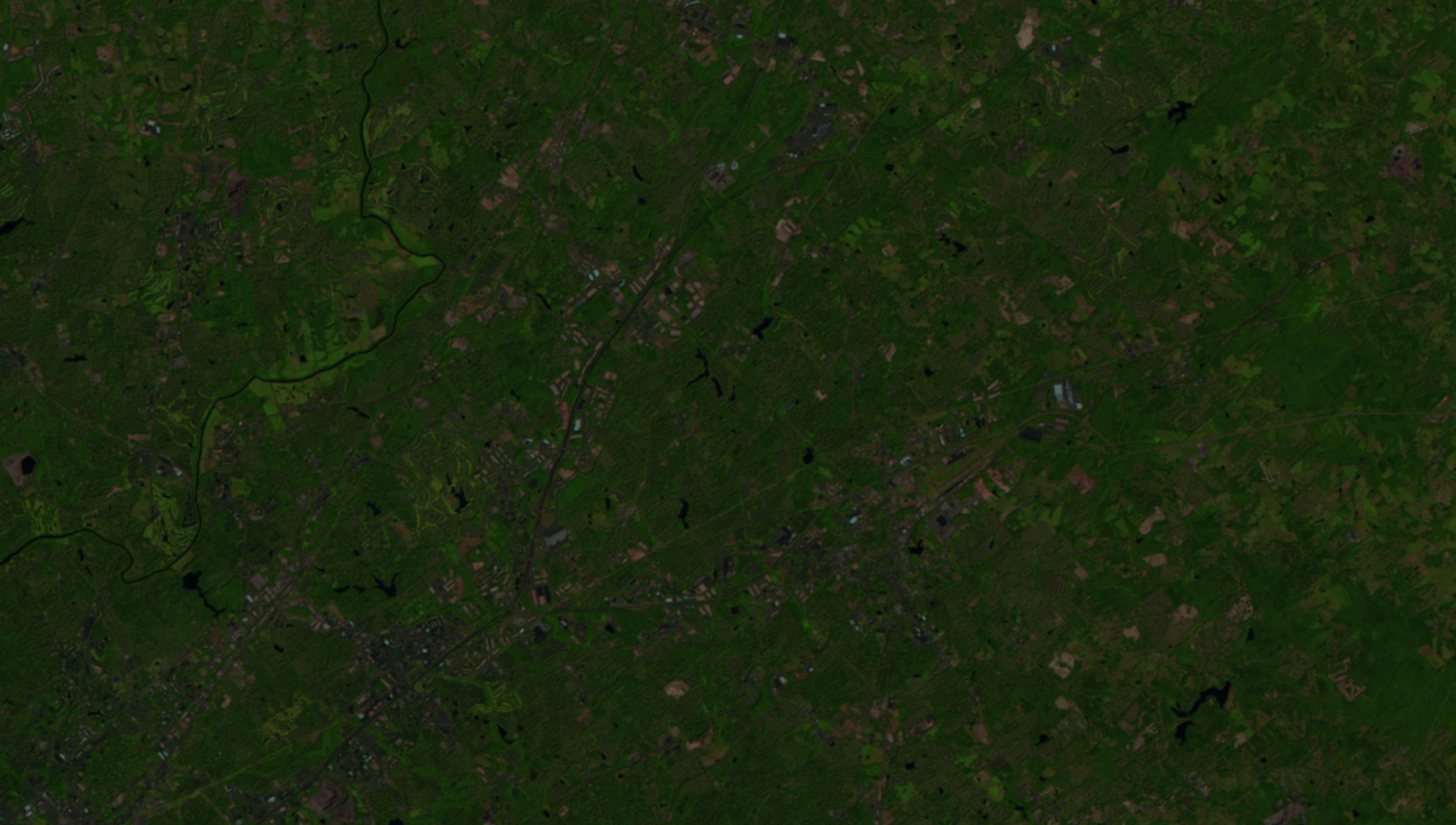
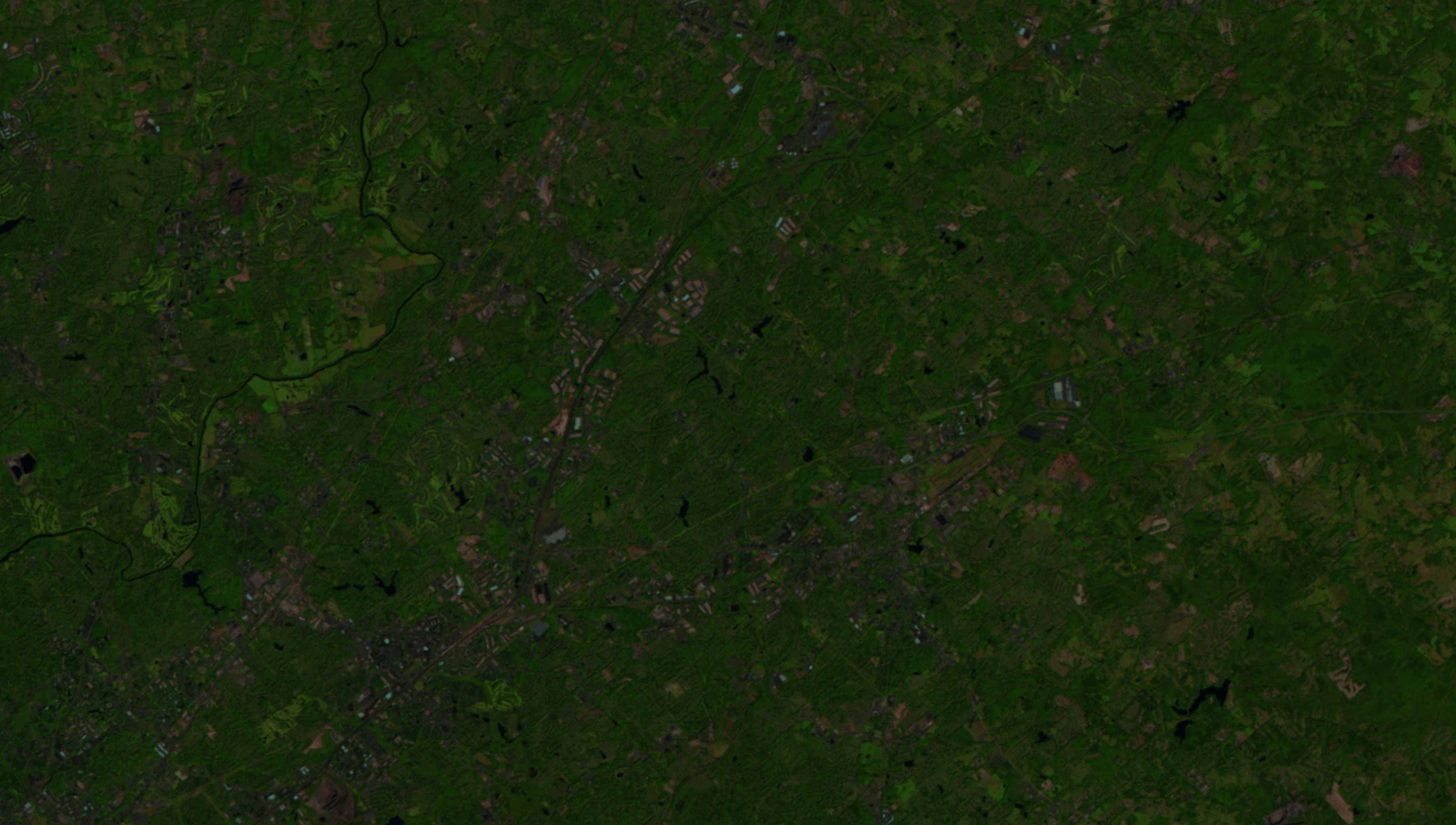
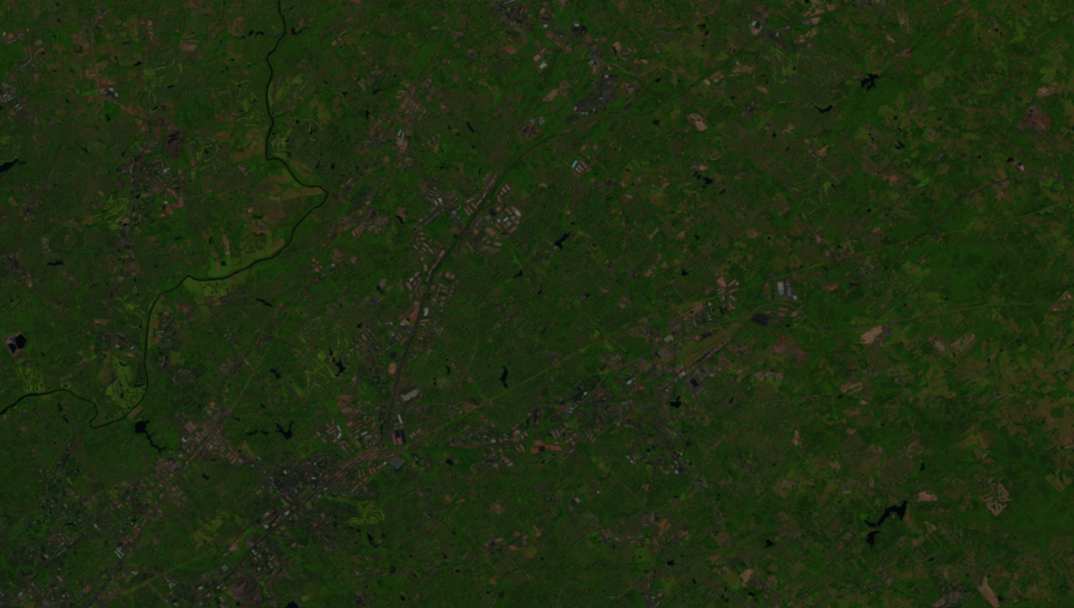
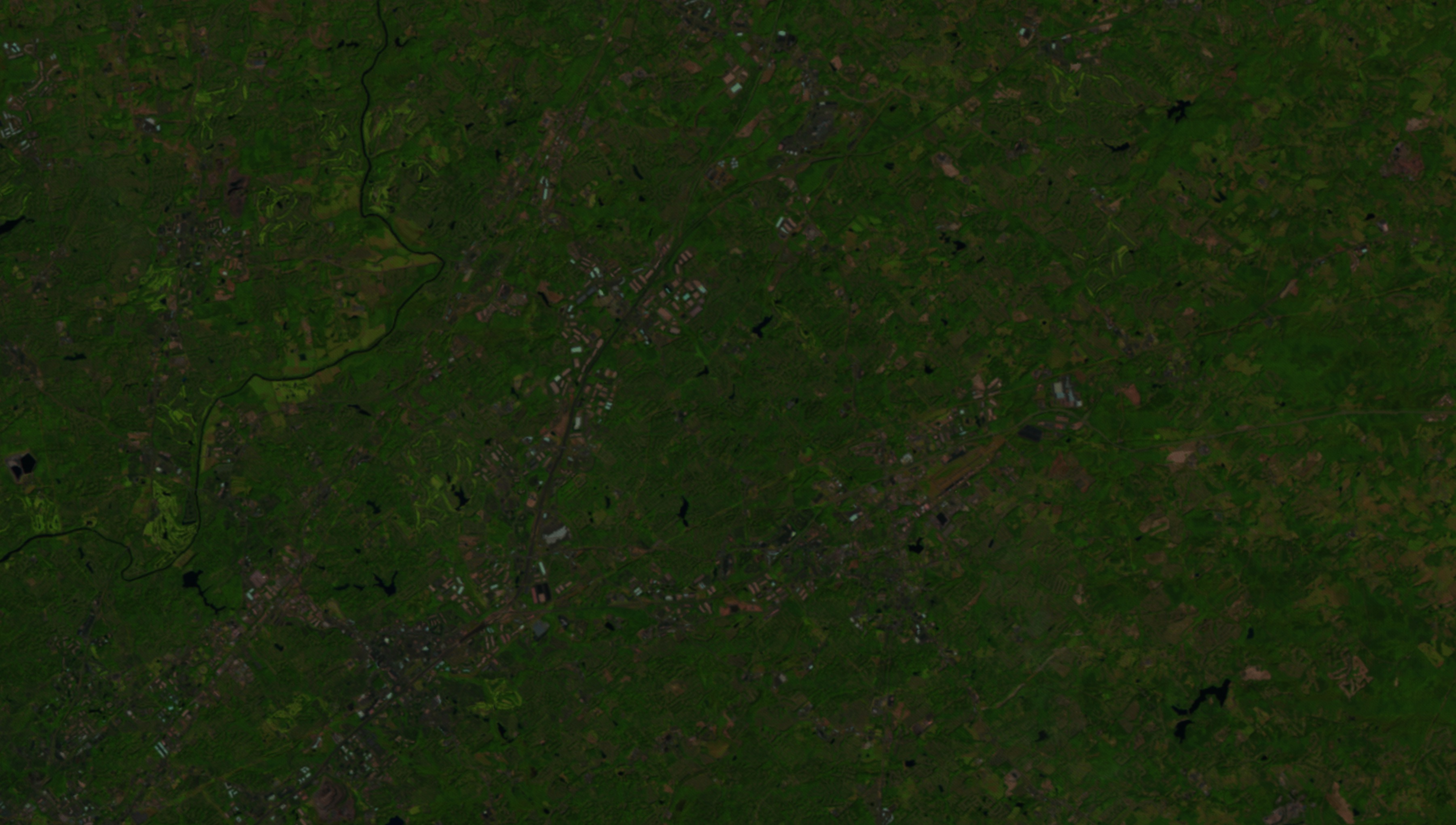
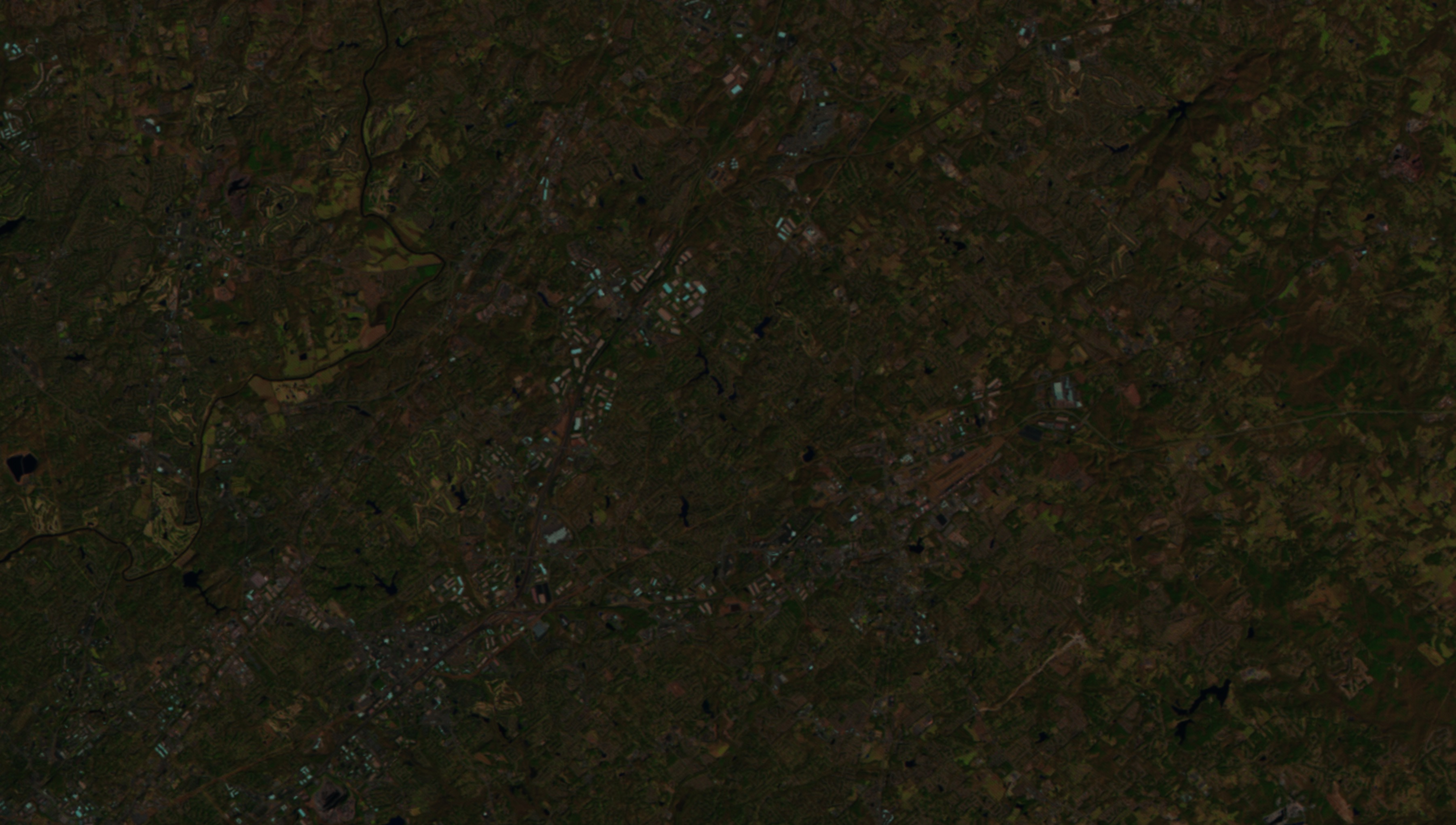
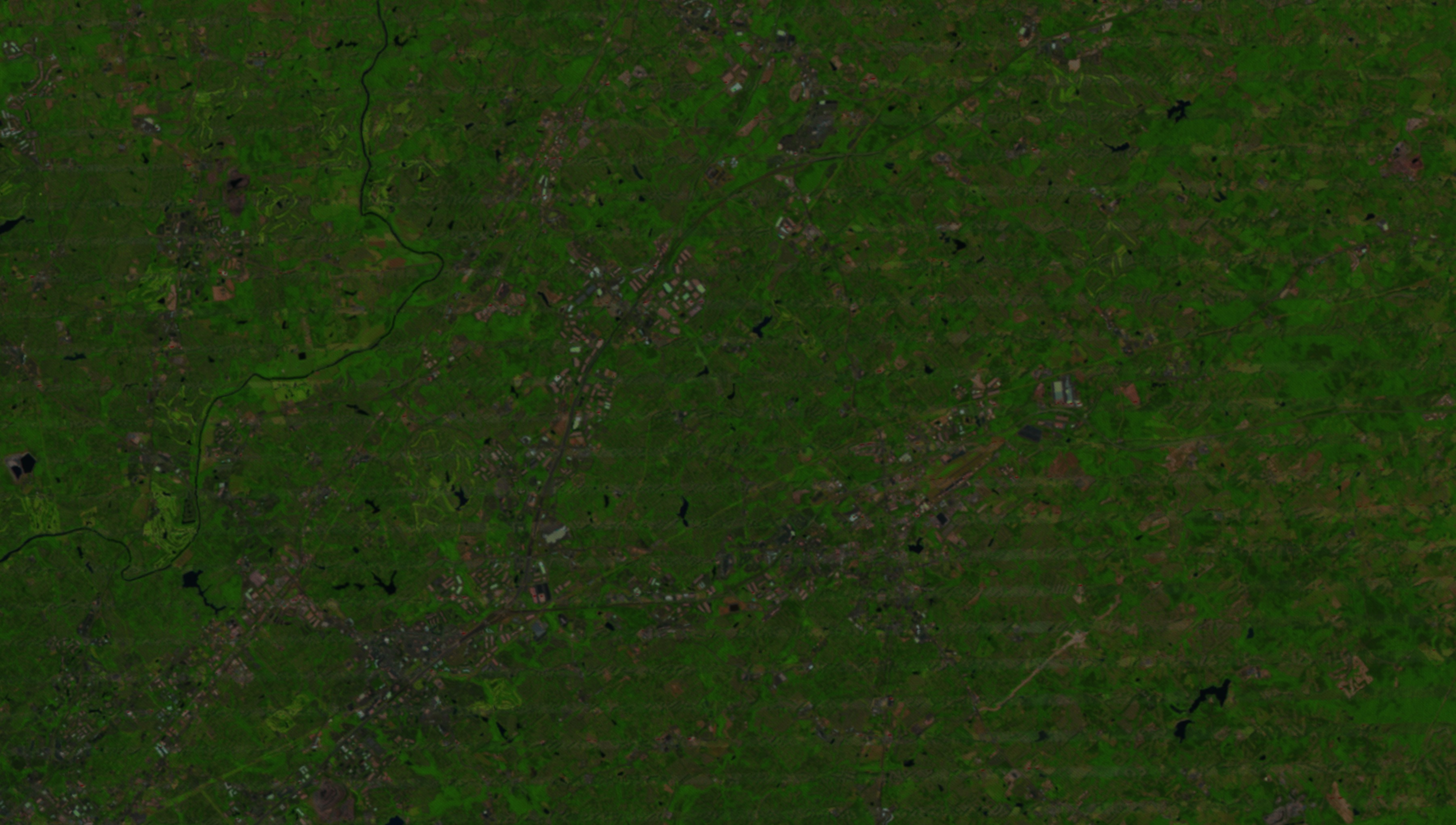
Georgia Urban Sprawl
The river to the Northwest is the Chattahoochee River. The "Y"-shaped roads are Interstate 85 (upper branch) and Route 316 (lower branch). As the years go by, one can see the Mall of Georgia being built in the upper middle part of the screen, immediately north of Interstate 85. Surrounding neighborhoods sprout up throughout this whole area as we move through time.
This animation was created for use in a NASA video on water run-off changes related to urban sprawl titled "FEMA Risk Map".
Related

Visualization Credits
Alex Kekesi (Global Science and Technology, Inc.): Lead Animator
Greg Shirah (NASA/GSFC): Animator
Alison Schuyler Ogden (NASA/GSFC): Producer
Anna Oldak (MDA Information Systems): Scientist
Ian Jones (ADNET Systems, Inc.): Project Support
Laurence Schuler (ADNET Systems, Inc.): Project Support
Greg Shirah (NASA/GSFC): Animator
Alison Schuyler Ogden (NASA/GSFC): Producer
Anna Oldak (MDA Information Systems): Scientist
Ian Jones (ADNET Systems, Inc.): Project Support
Laurence Schuler (ADNET Systems, Inc.): Project Support
Please give credit for this item to:
NASA's Goddard Space Flight Center Scientific Visualization Studio
NASA's Goddard Space Flight Center Scientific Visualization Studio
Short URL to share this page:
https://svs.gsfc.nasa.gov/4062
Mission:
Landsat
Data Used:
Note: While we identify the data sets used in these visualizations, we do not store any further details nor the data sets themselves on our site.
This item is part of this series:
LDCM
Keywords:
DLESE >> Environmental science
SVS >> HDTV
DLESE >> Human geography
GCMD >> Earth Science >> Human Dimensions >> Environmental Impacts >> Urbanization
GCMD >> Location >> Georgia
NASA Science >> Earth
GCMD keywords can be found on the Internet with the following citation: Olsen, L.M., G. Major, K. Shein, J. Scialdone, S. Ritz, T. Stevens, M. Morahan, A. Aleman, R. Vogel, S. Leicester, H. Weir, M. Meaux, S. Grebas, C.Solomon, M. Holland, T. Northcutt, R. A. Restrepo, R. Bilodeau, 2013. NASA/Global Change Master Directory (GCMD) Earth Science Keywords. Version 8.0.0.0.0
https://svs.gsfc.nasa.gov/4062
Mission:
Landsat
Data Used:
Landsat/TM, ETM, ETM+/Band Combination 1, 2, 3
1984 - 2010This item is part of this series:
LDCM
Keywords:
DLESE >> Environmental science
SVS >> HDTV
DLESE >> Human geography
GCMD >> Earth Science >> Human Dimensions >> Environmental Impacts >> Urbanization
GCMD >> Location >> Georgia
NASA Science >> Earth
GCMD keywords can be found on the Internet with the following citation: Olsen, L.M., G. Major, K. Shein, J. Scialdone, S. Ritz, T. Stevens, M. Morahan, A. Aleman, R. Vogel, S. Leicester, H. Weir, M. Meaux, S. Grebas, C.Solomon, M. Holland, T. Northcutt, R. A. Restrepo, R. Bilodeau, 2013. NASA/Global Change Master Directory (GCMD) Earth Science Keywords. Version 8.0.0.0.0


