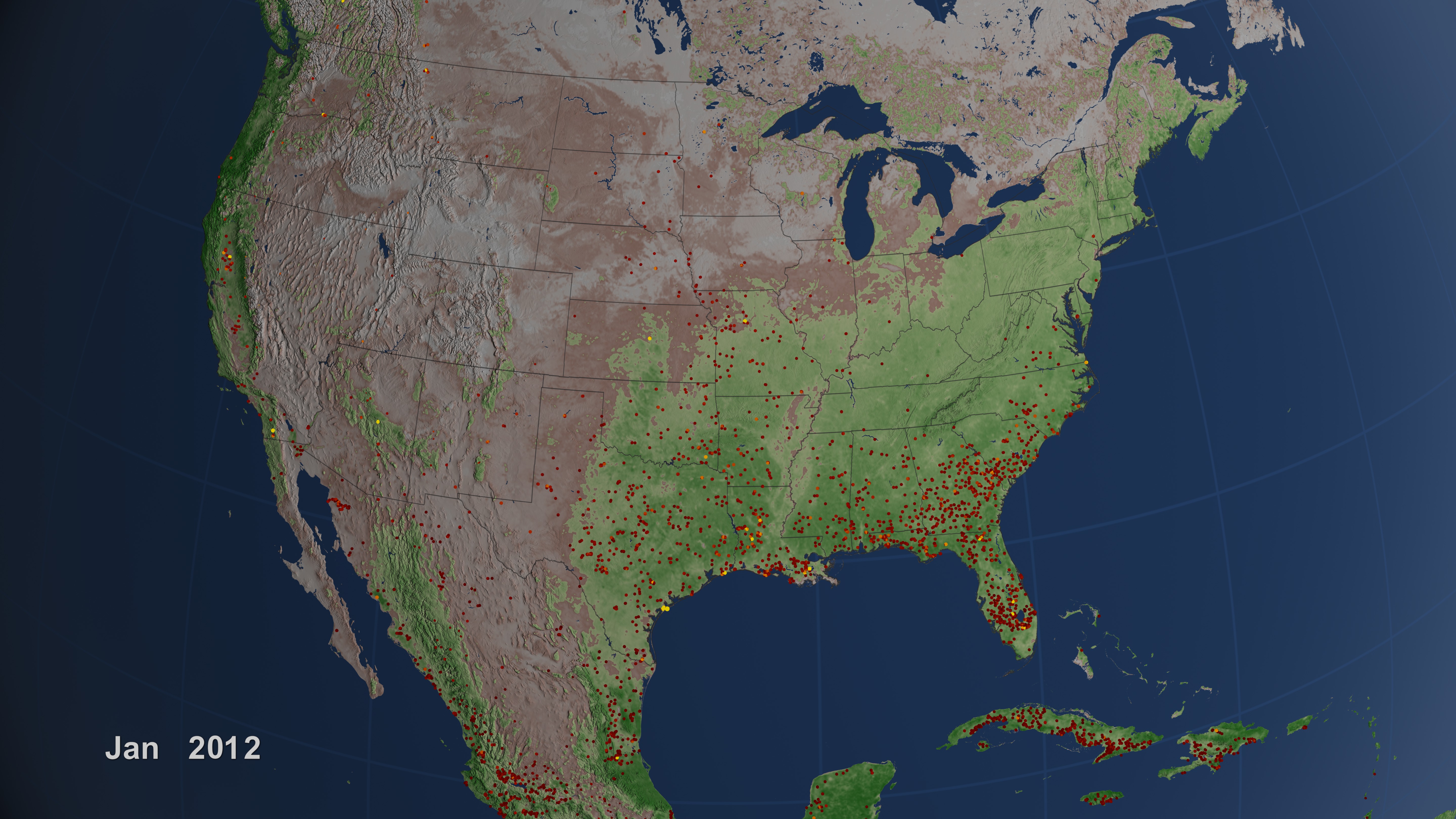
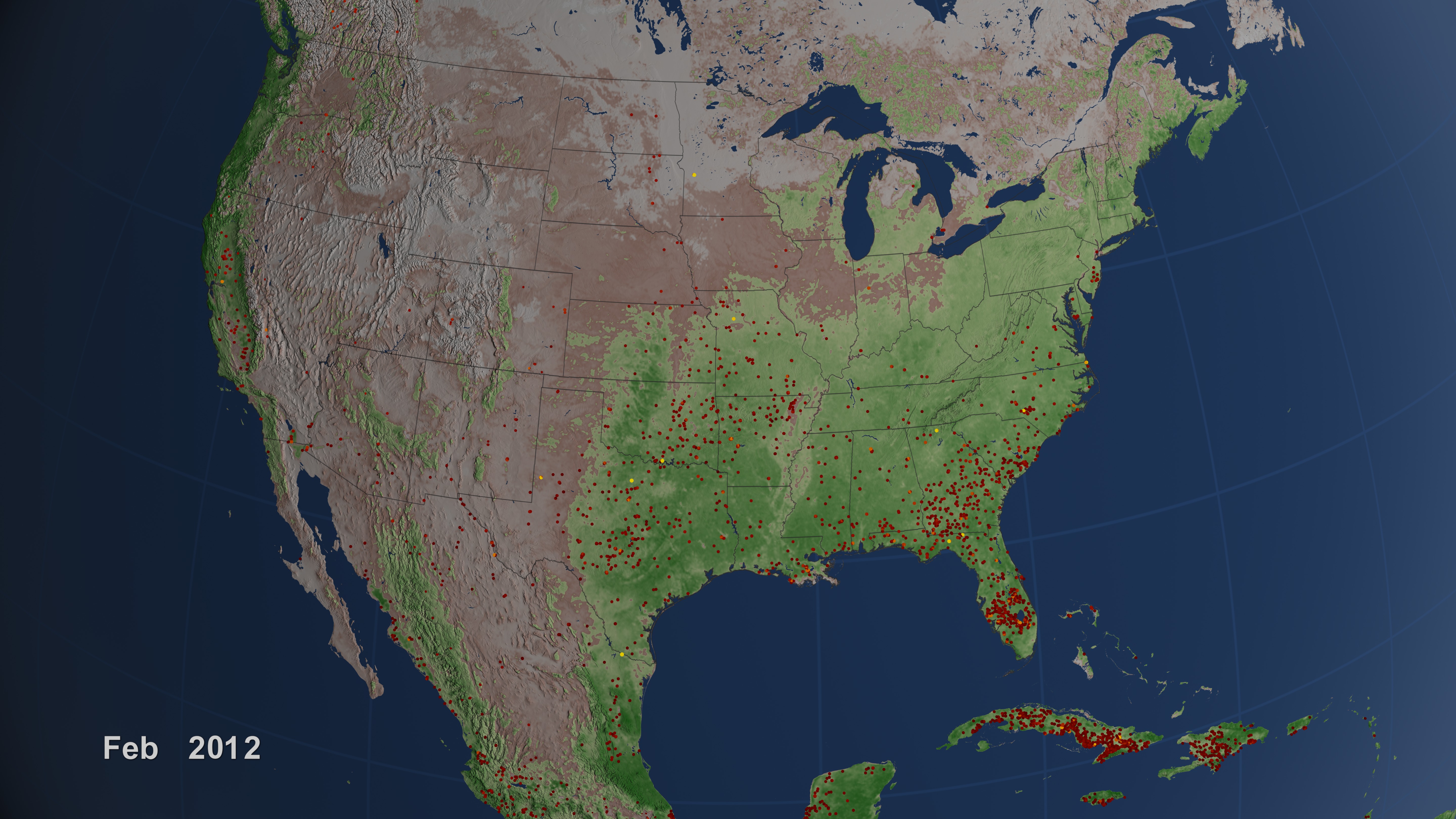
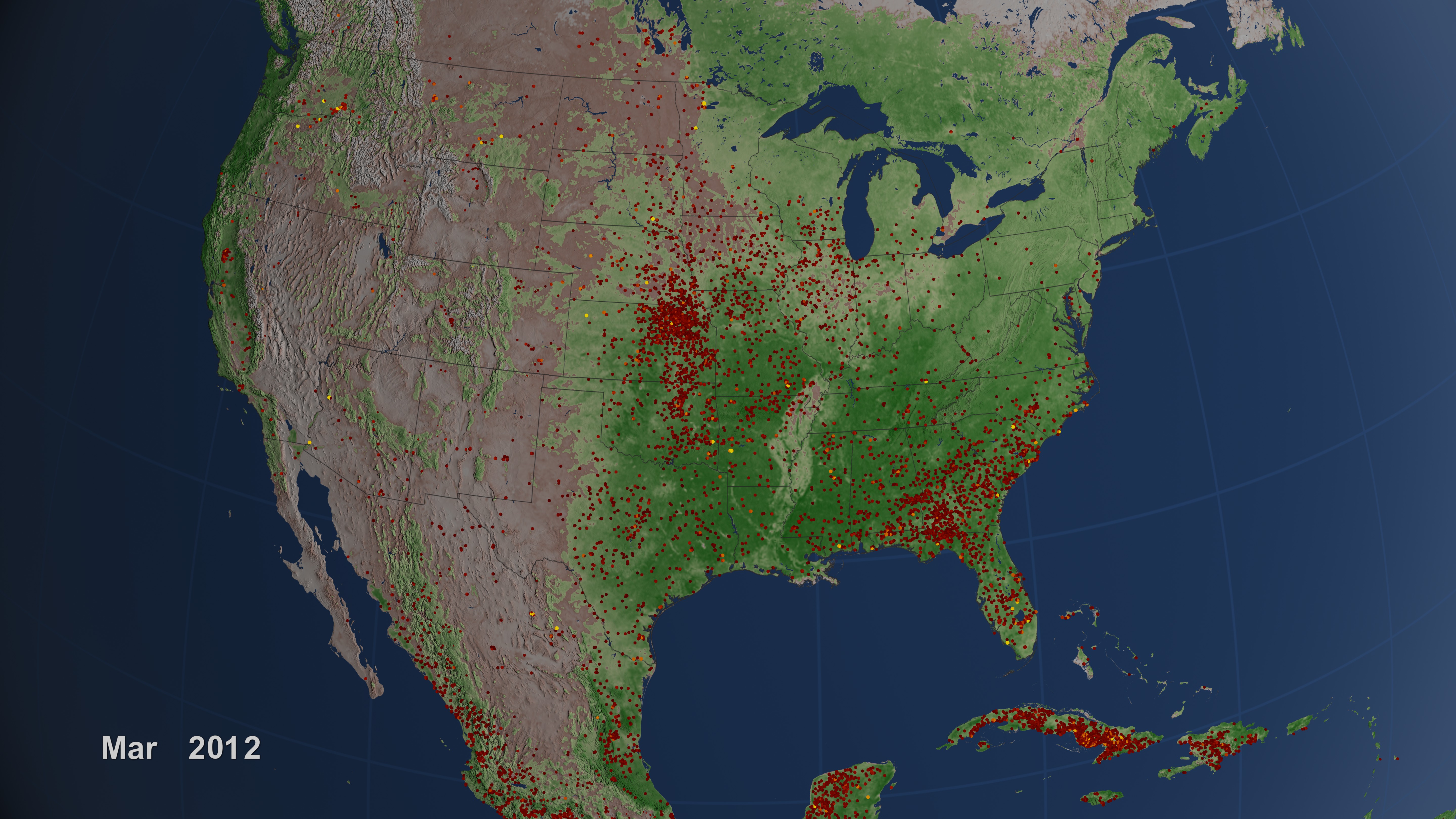
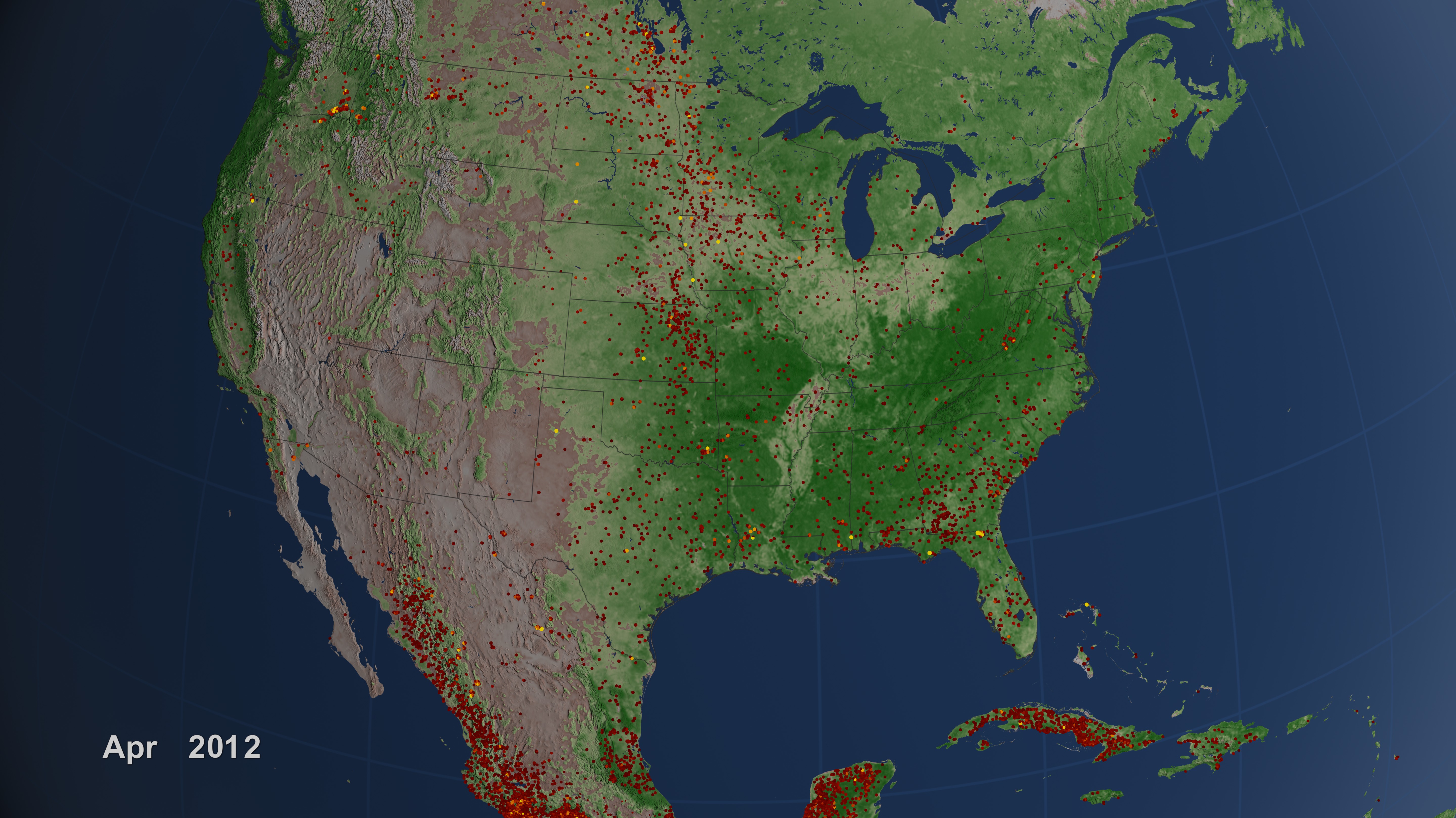
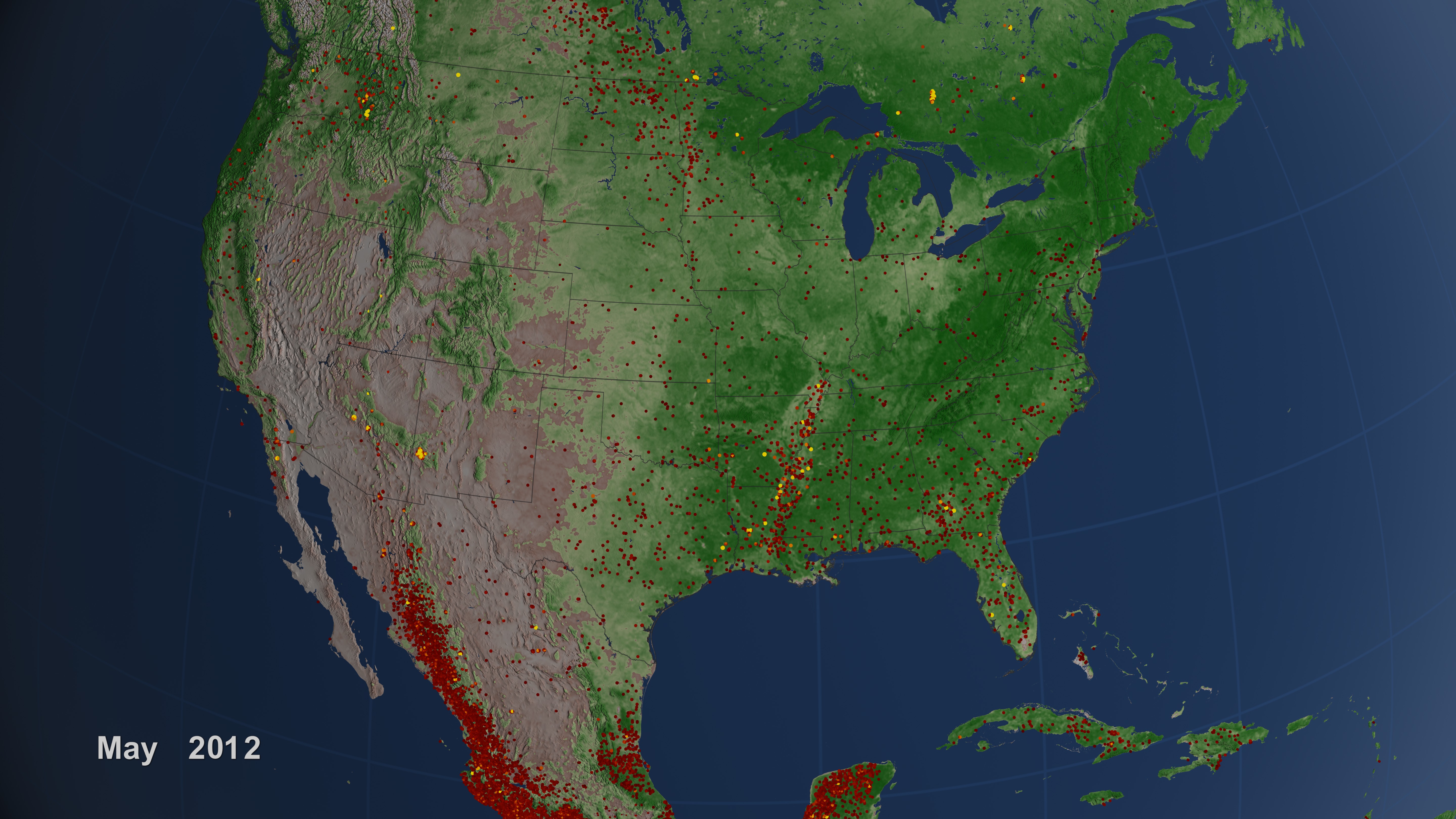
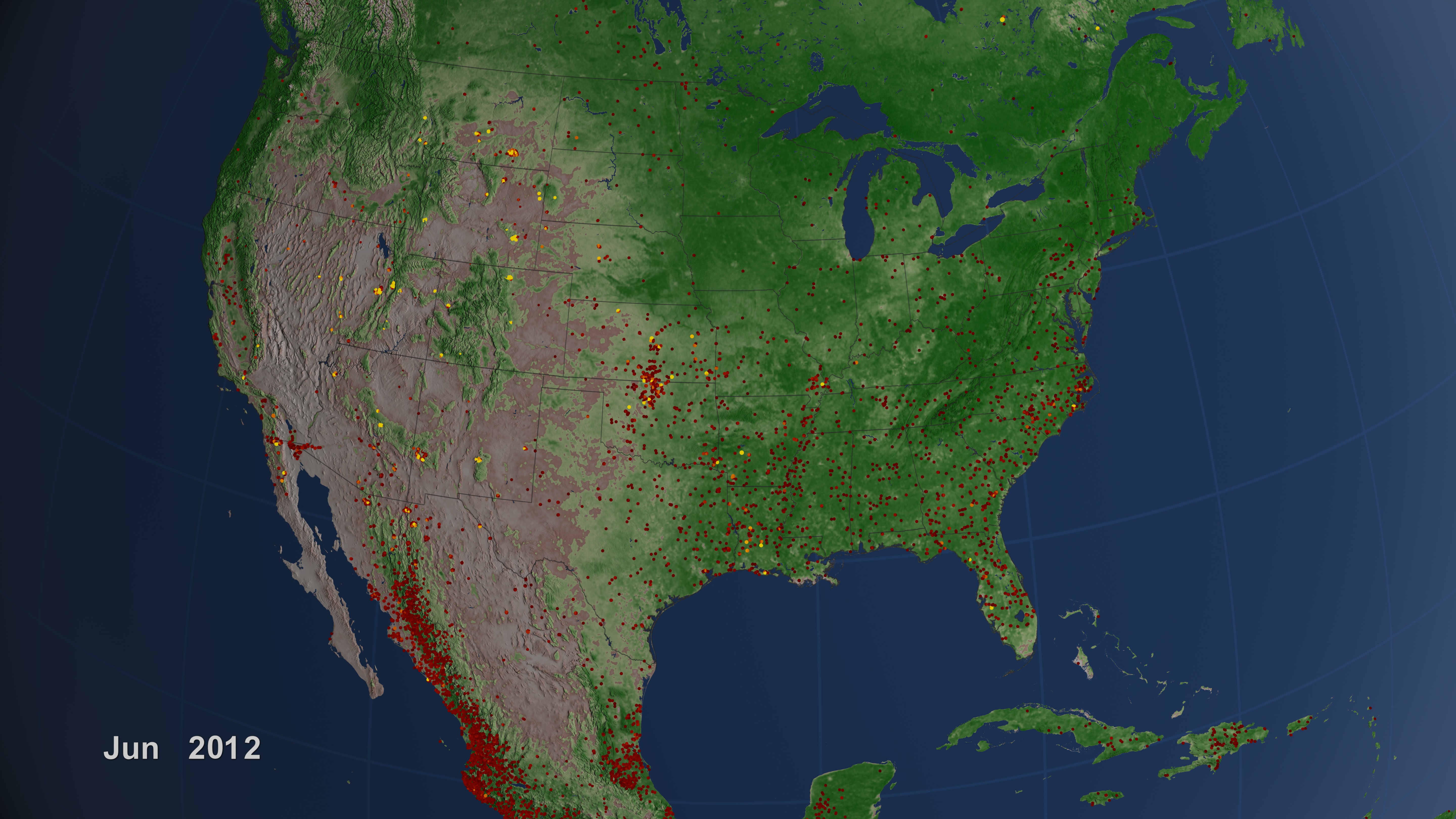
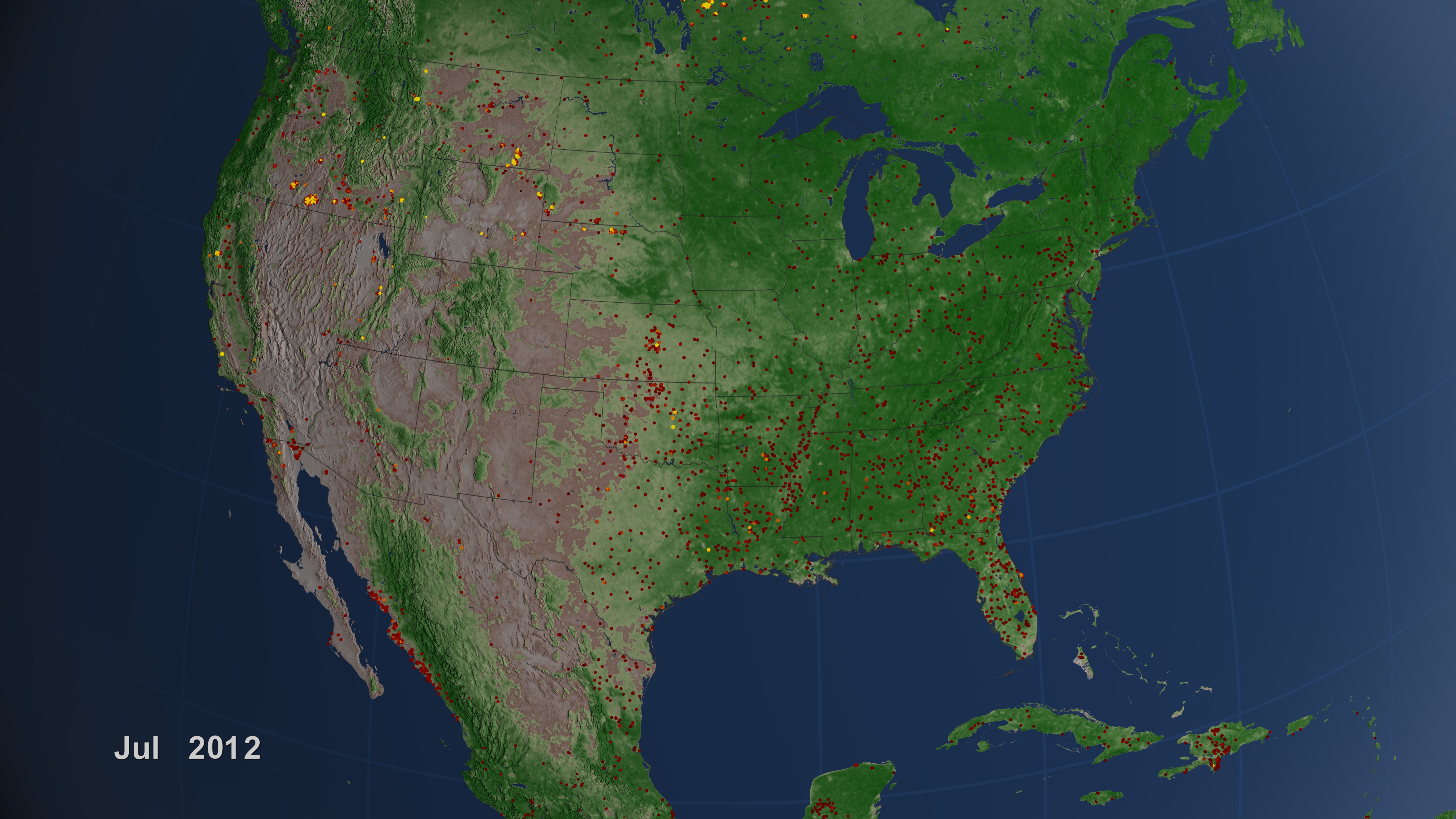
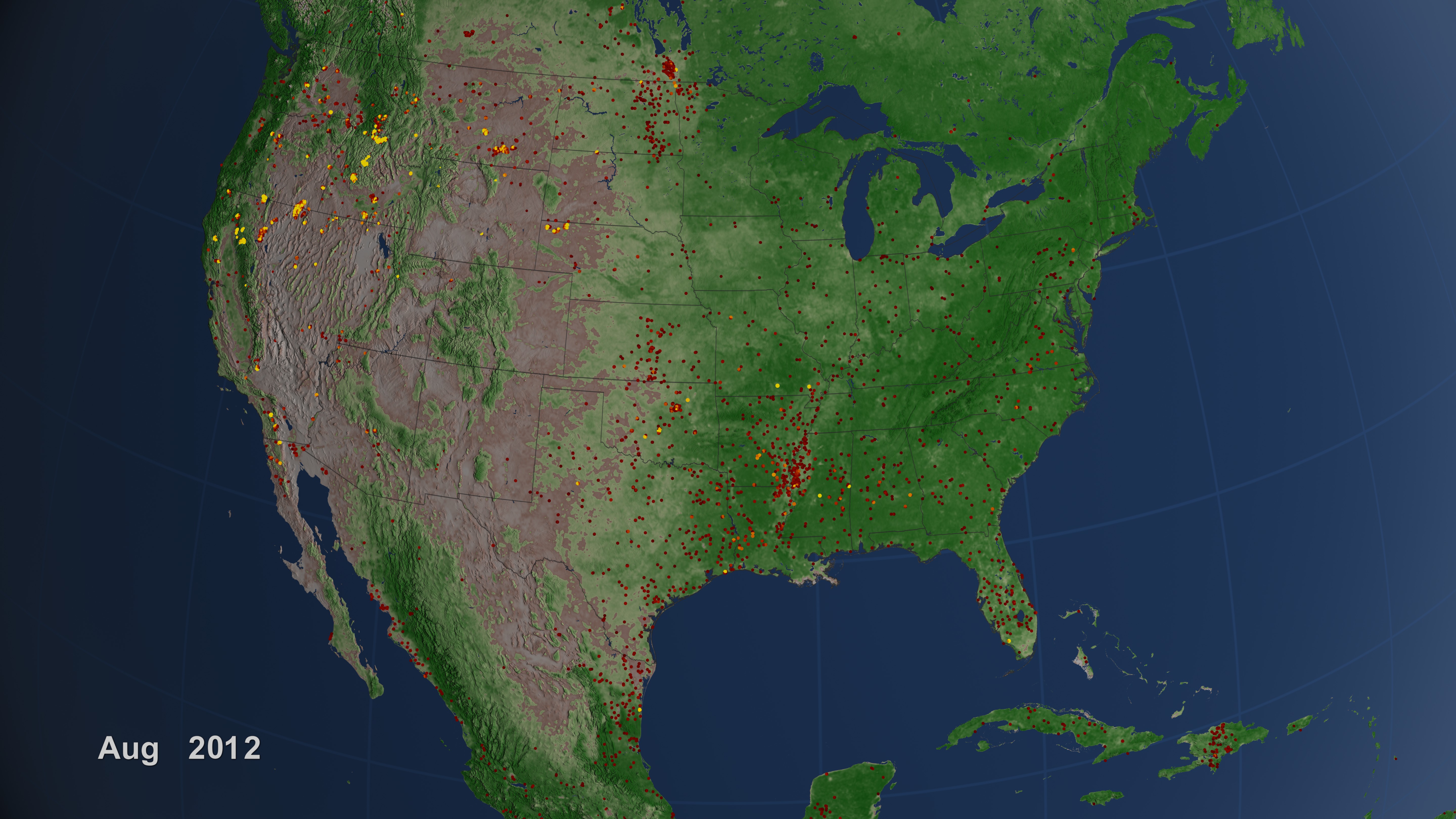
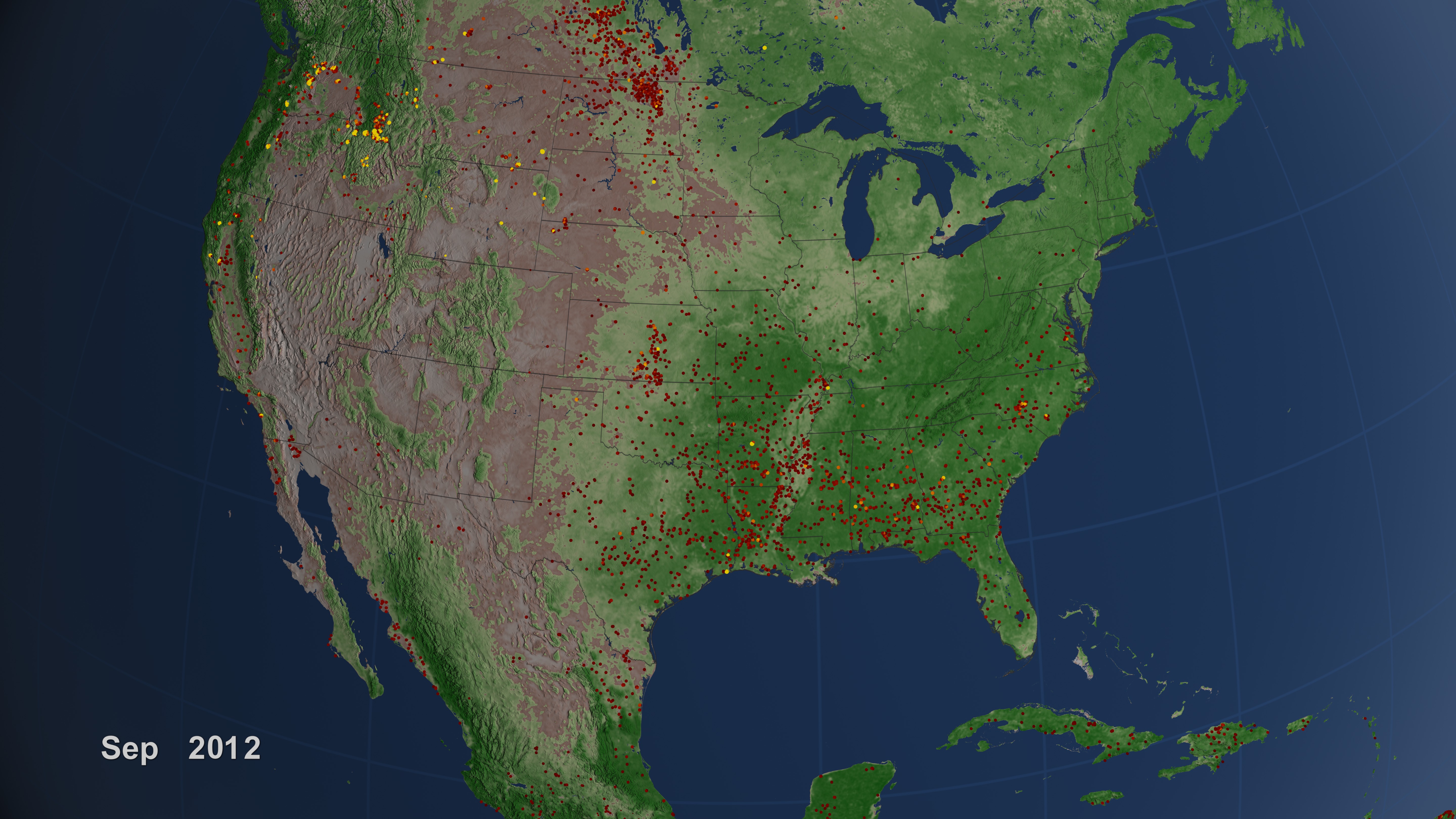
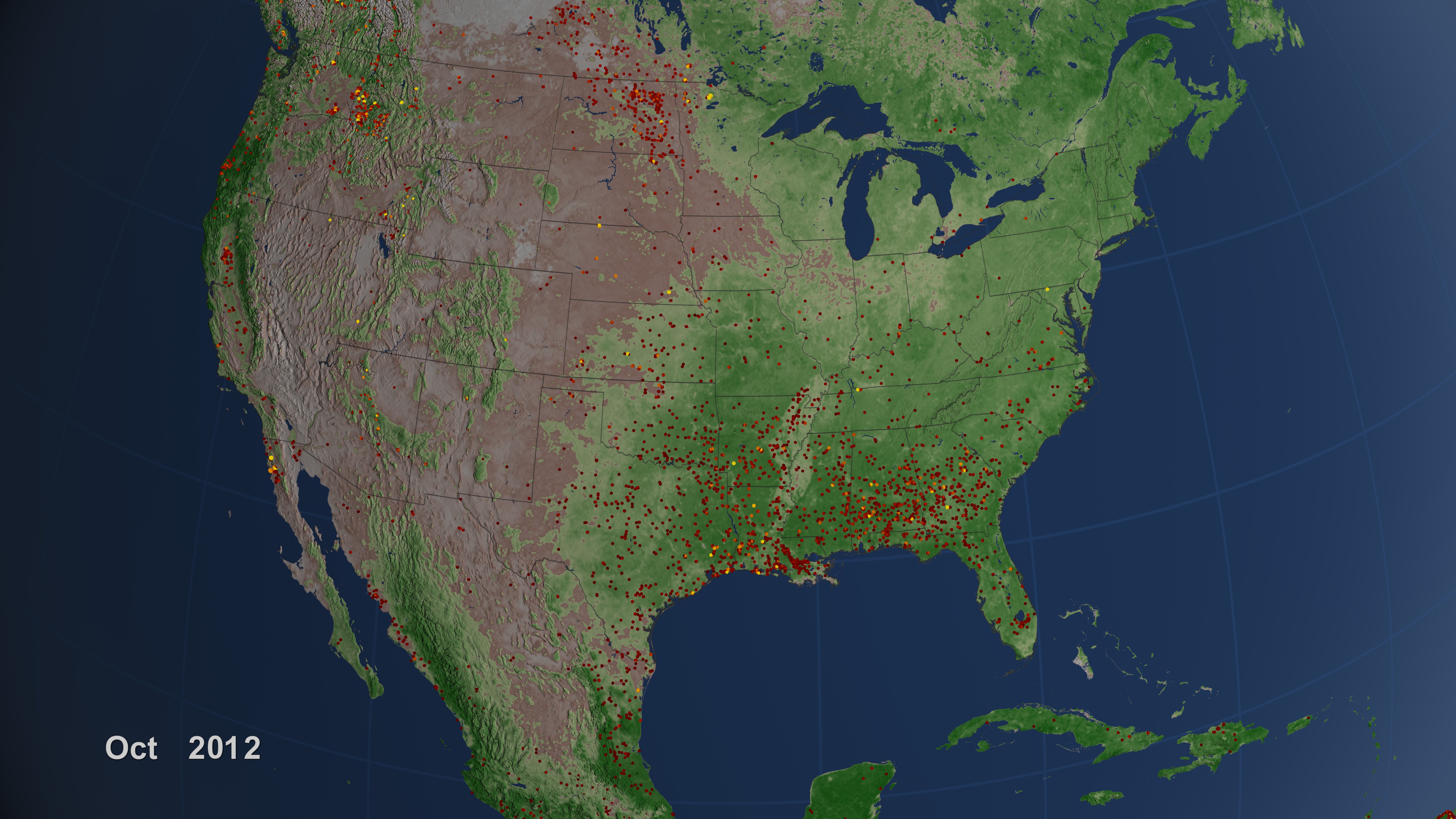
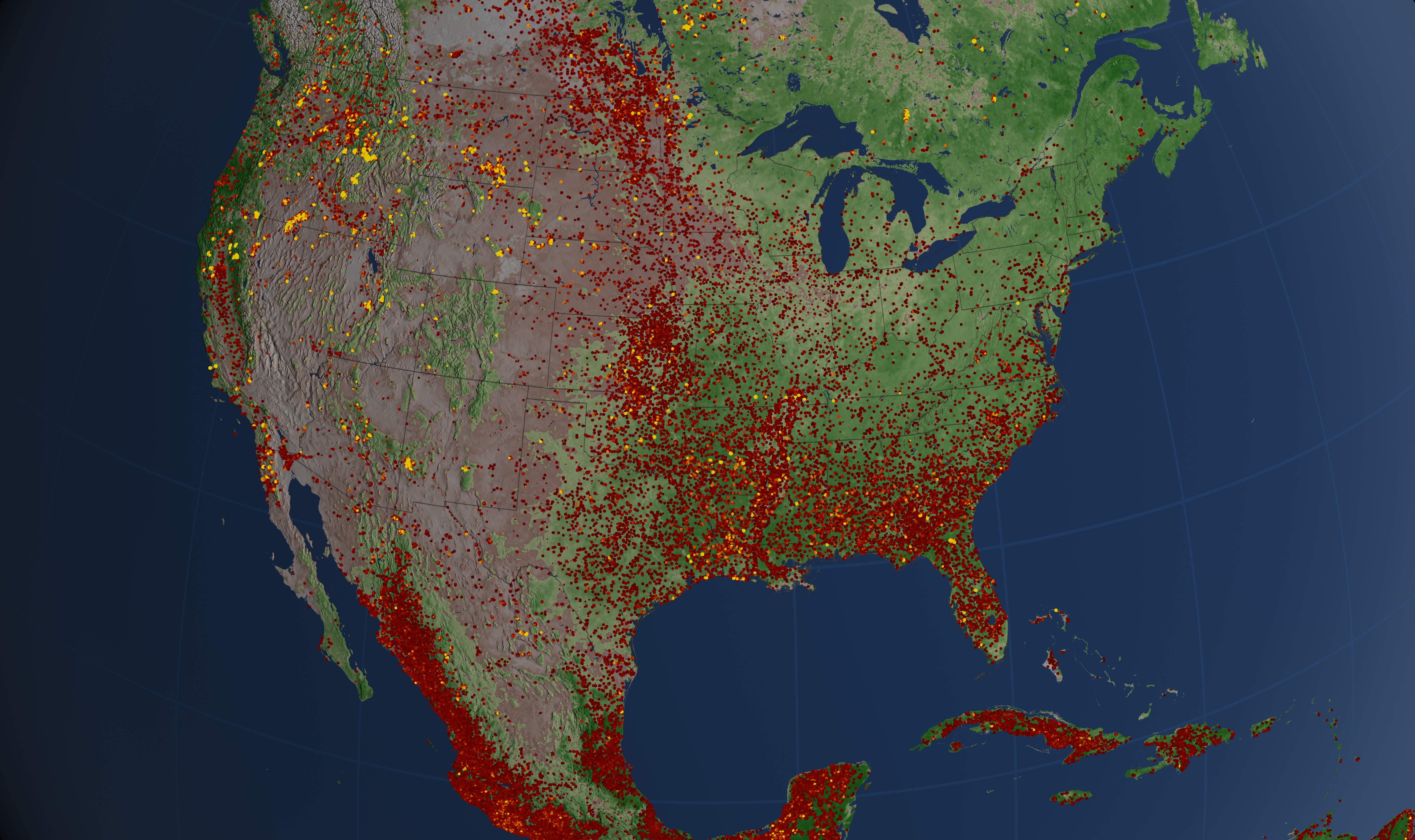
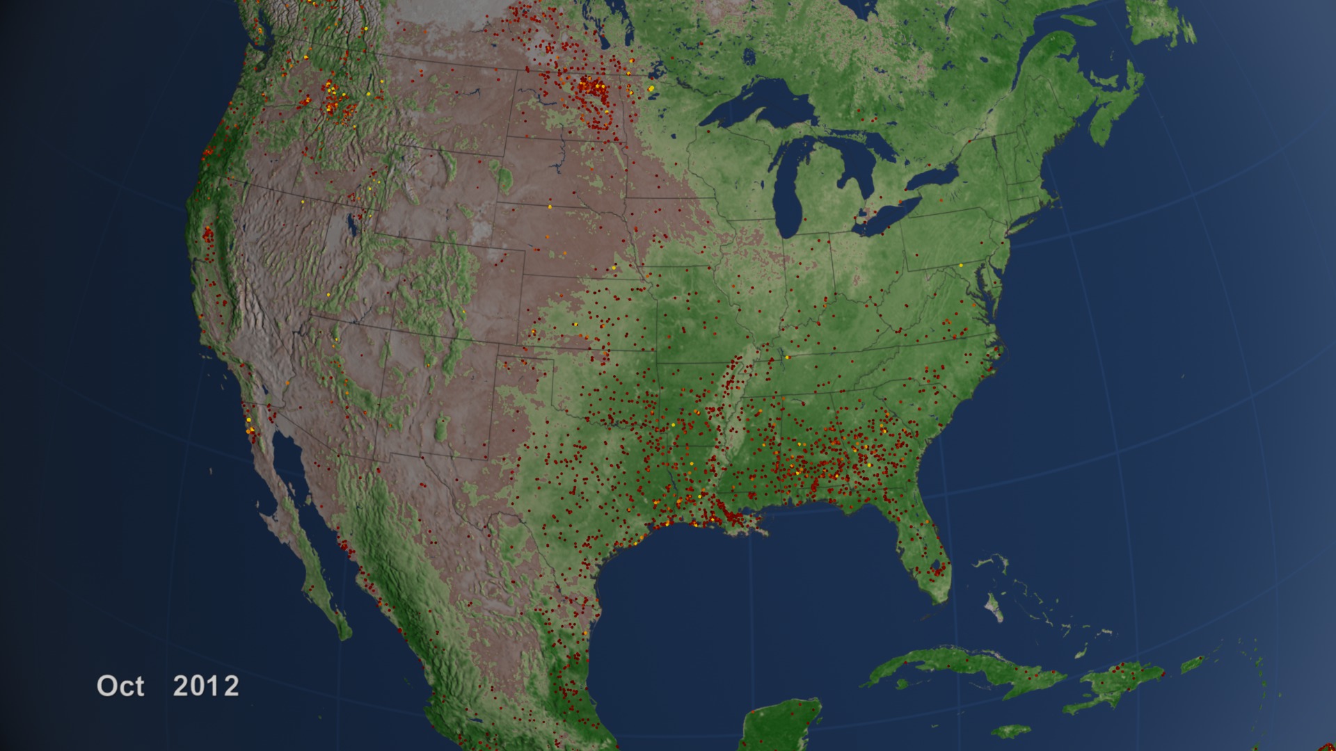
United States Active Fires 2012
NIFC statistics show that more than 9.1 million acres had burned as of November 30, 2012—the third highest total in a record that dates back to 1960. Also notable: despite the high number of acres burned in 2012, the total number of fires—55,505—was low, the least on the NIFC record. Average fire size in 2012 was the highest on the record.
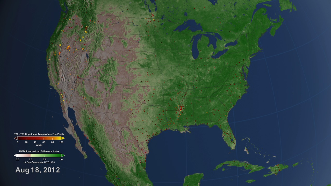
The visualizations depict fires that burned between January 1 and October 31, 2012, as detected by the MODIS instruments. The fires are displayed over MODIS' vegetation and snow cover data. Yellow and orange indicates fires that were more intense and had a larger area of active burning. Most of these intense fires occurred in the western United States, where lightning and human activity often sparks blazes that firefighters cannot contain. Many of the lower intensity fires shown in red were prescribed fires, lit for either agricultural or ecosystem management purposes.
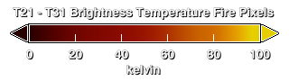
The Terra and Aqua Moderate Resolution Imaging Spectrometer (MODIS) can routinely detect both flaming and smoldering fires that are aproximately 1000 square meters in size. Under pristine and extremely rare observing conditions even smaller flaming fires that are aproximately 50 square meters can be detected. Each active fire location represents the center of a 1 km pixel that is flagged by the algorithm as containing a fire within the pixel. For more information on the fire data, see the MODIS Collection 5 Active Fire Product User's Guide. For more information on the algorithm, see Giglio, L., J. Descloitres, C. O. Justice, and Y. J. Kaufman. 2003. An enhanced contextual fire detection algorithm for MODIS. Remote Sensing of Environment, 87:273-282
Visualization Credits
Jefferson Beck (USRA): Producer
Louis Giglio (SSAI): Scientist
Chris Justice (University of Maryland): Scientist
Doug C. Morton (NASA/GSFC): Scientist
Adam P. Voiland (Sigma Space Corporation): Project Support
Patrick Lynch (Wyle Information Systems): Writer
NASA's Goddard Space Flight Center Scientific Visualization Studio
American GeoPhysical Union (2012, December 5). Press Conference: Fire in a Changing Climate and What We Can Do About It.
American Geophysical Union (2012, December 5) Press Conference Slides: Fire in a Changing Climate and What We Can Do About It (PDF).
Giglio, L., J. Descloitres, C.O. Justice, and Y. J. Kaufman. 2003. An Enhanced contectual fire detection algorithm for MODIS. Remote Sensing of Environemt, 87:273-282.
Short URL to share this page:
https://svs.gsfc.nasa.gov/4011
Mission:
Terra
Data Used:
Terra and Aqua/MODIS/Fire Location
Fire location data courtesy of MODIS Rapid Response Project (NASA/GSFC and University of Maryland - http://rapidfire.sci.gsfc.nasa.gov)
Terra and Aqua/MODIS/Pixel Reliability (value=2) also referred to as: Ice and Snow
AnalysisThis item is part of these series:
Fires
Multisensor Fire Observations
MODIS Daily Snow
Keywords:
DLESE >> Biology
DLESE >> Ecology
SVS >> Fire Management
GCMD >> Earth Science >> Climate Indicators
GCMD >> Earth Science >> Biosphere >> Ecological Dynamics >> Fire Characteristics
GCMD >> Earth Science >> Biosphere >> Ecological Dynamics >> Fire Occurrence
NASA Science >> Earth
SVS >> 2013 Fires
GCMD keywords can be found on the Internet with the following citation: Olsen, L.M., G. Major, K. Shein, J. Scialdone, S. Ritz, T. Stevens, M. Morahan, A. Aleman, R. Vogel, S. Leicester, H. Weir, M. Meaux, S. Grebas, C.Solomon, M. Holland, T. Northcutt, R. A. Restrepo, R. Bilodeau, 2013. NASA/Global Change Master Directory (GCMD) Earth Science Keywords. Version 8.0.0.0.0


