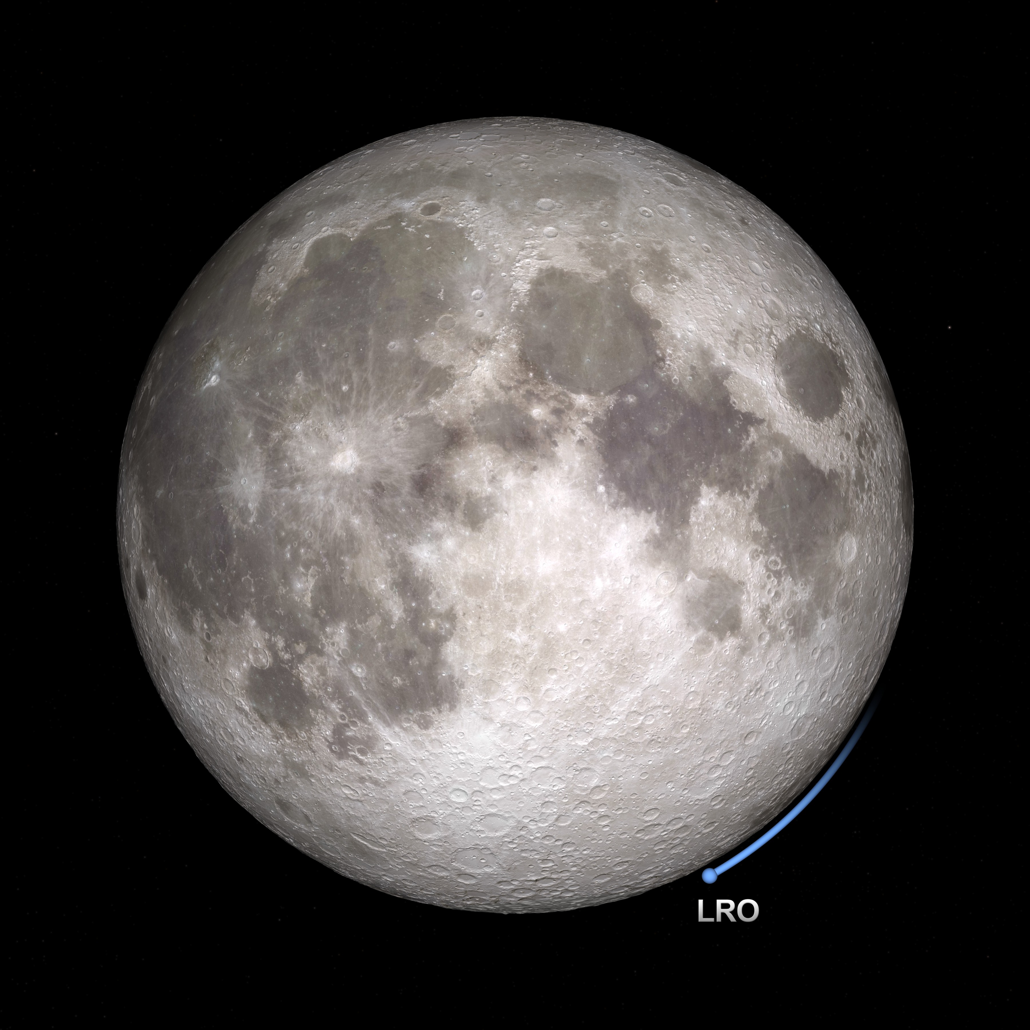
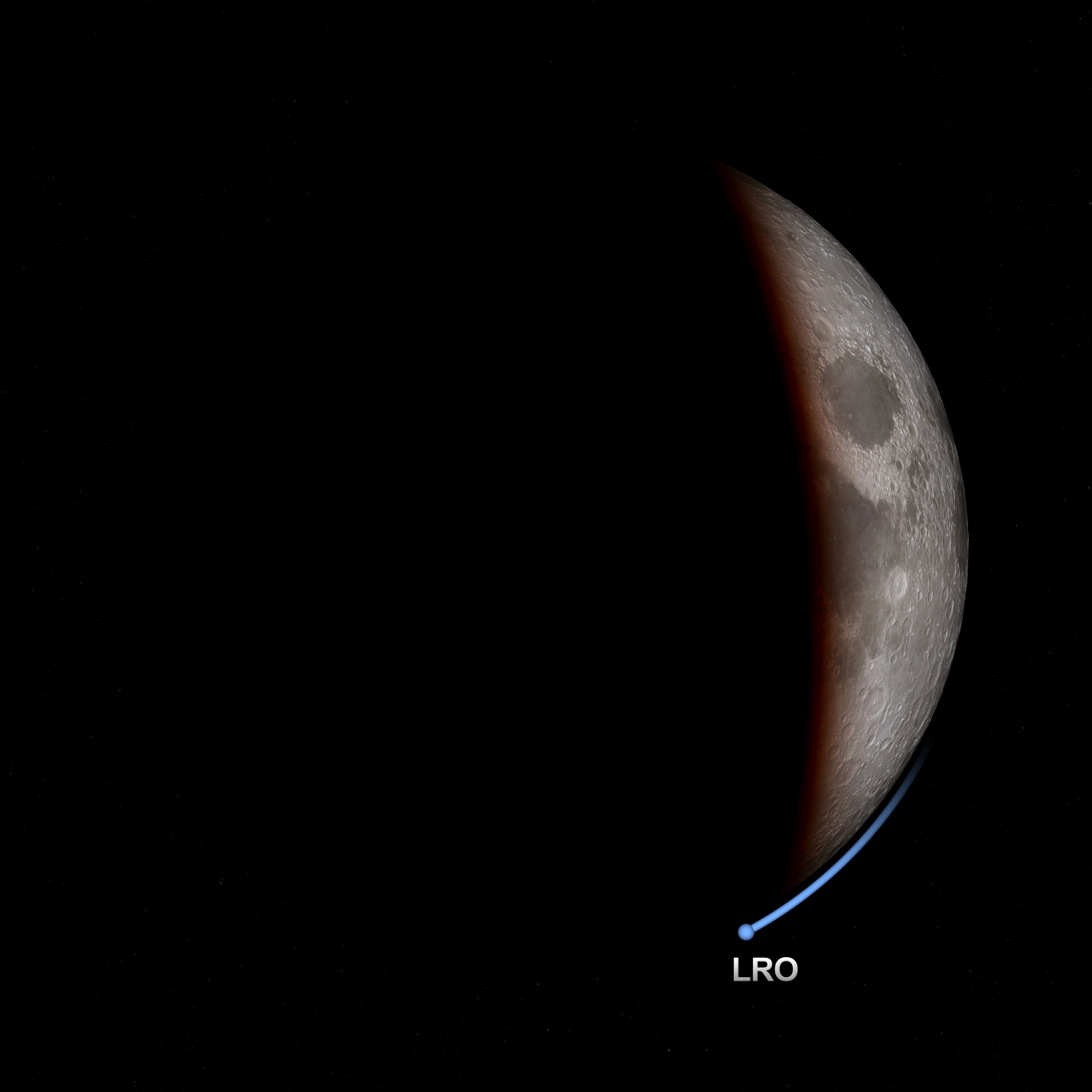
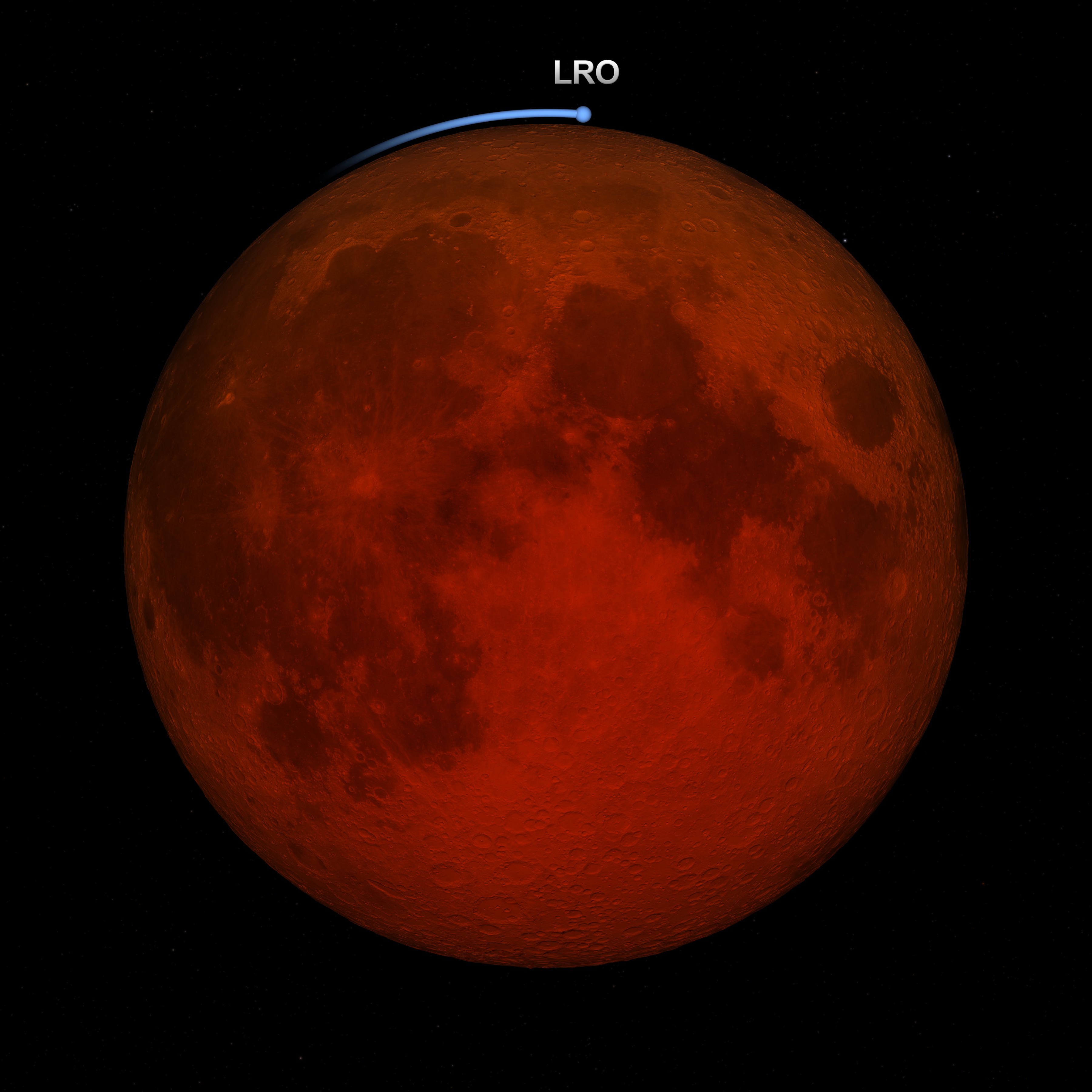
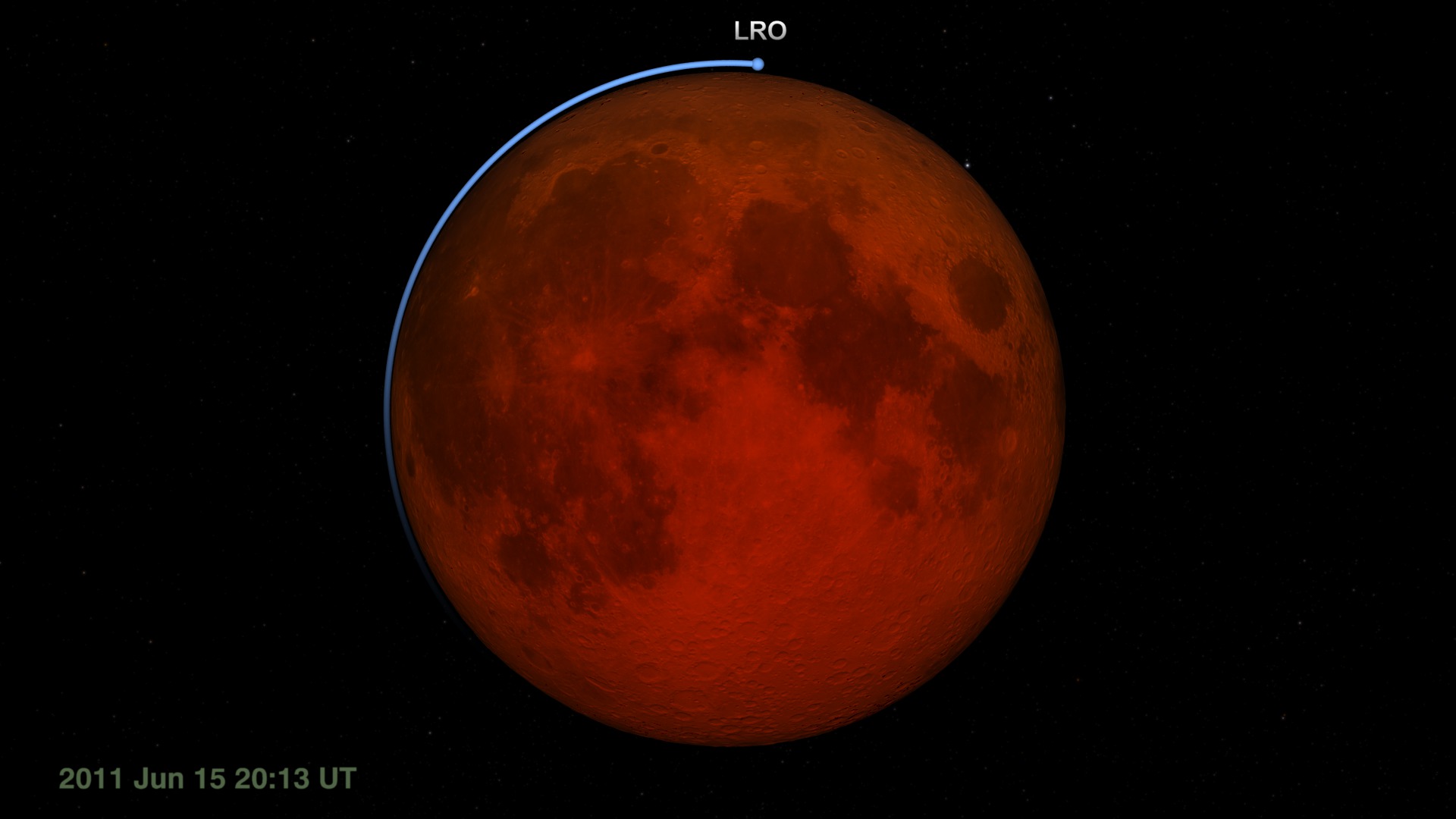
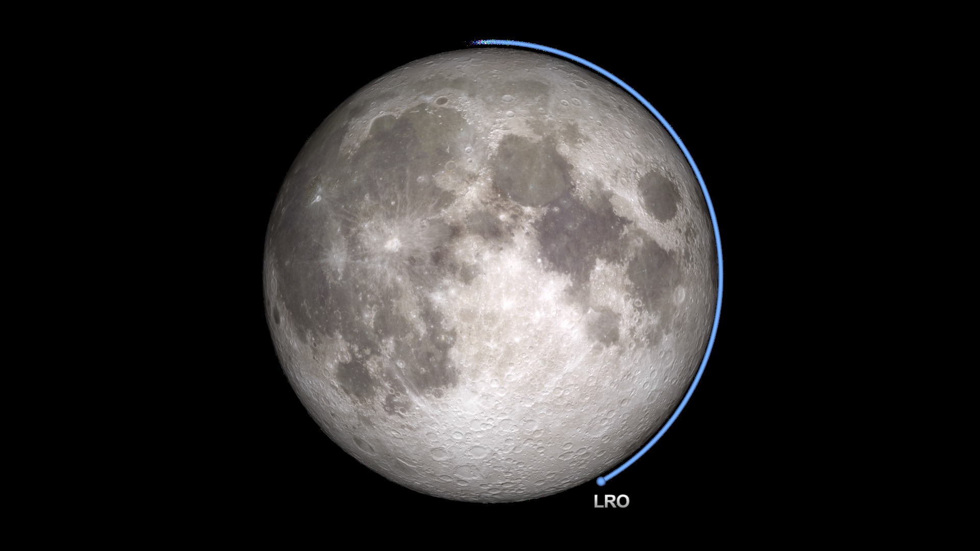
LRO at the June 15, 2011 Lunar Eclipse: Earth View
For Lunar Reconnaissance Orbiter (LRO), the lunar eclipse on June 15, 2011 is likely to be the longest and darkest of its life. This matters because LRO relies on sunlight to power its systems and instruments. Although it spends half of every orbit on the night side of the Moon, each night side pass lasts only an hour. For the June 15 eclipse, LRO will be in the dark for more than twice as long.
During a previous total eclipse, LRO hibernated, turning off all of its instruments to conserve its battery power until the Moon emerged from the Earth's shadow. For the June 15 event, LRO will leave on the Diviner Lunar Radiometry Experiment. Diviner will measure the cooling of the Moon's surface during the eclipse. This unique temperature record is expected to reveal information about the roughness and composition of the swath of lunar surface visible to Diviner's sensors during the eclipse.
The visualization archived on this page shows the eclipse as it might appear through a telescope on Earth (except that you can't see LRO in such a telescope). Celestial north is up. As the Moon enters the umbra (the part of the shadow in which the Sun is completely blocked by the Earth), the shadowed side of the Moon appears black while the sunlit side remains bright. Only when the Moon is almost completely within the umbra is it possible to see the faint red glow of the shadowed side, some 10,000 times fainter than the sunlit Moon. The redness is sunlight filtered and refracted by Earth's atmosphere. The same effect reddens sunrises and sunsets on Earth.
Other visualizations in this series depict the view of the eclipse
- from the Moon, where the event is a solar eclipse
- along the shadow line, with the figures of the umbra, penumbra, and lunar and solar paths
- flying above LRO as Diviner takes temperature measurements
A narrated piece that uses these visualizations is available in entry #10794. For an explanation of lunar eclipses, visit entry #10787.

Visualization Credits
Genna Duberstein (USRA): Producer
Chris Smith (HTSI): Producer
Richard Vondrak (NASA/GSFC): Scientist
NASA/Goddard Space Flight Center Scientific Visualization Studio
https://svs.gsfc.nasa.gov/3834
Missions:
Clementine
LRO (Lunar Reconnaissance Orbiter)
Data Used:
LRO/LOLA/Digital Elevation Map also referred to as: DEM
August 2009 - December 2010Clementine/UVVIS Camera/750-nm Basemap
Mosaic - January - June 1994This item is part of these series:
The Moon
LRO - Animations
Keywords:
SVS >> HDTV
SVS >> Lunar
SVS >> Moon
SVS >> LRO
SVS >> Lunar Reconnaissance Orbiter
SVS >> Eclipse
SVS >> LOLA
SVS >> Lunar Eclipse
SVS >> Lunar Surface
SVS >> Lunar Topography
SVS >> Lunar Elevation Map
SVS >> Satellites >> Lunar
SVS >> Solar System >> Moon >> Lunar Surface
NASA Science >> Planets and Moons


