Earth
ID: 3824
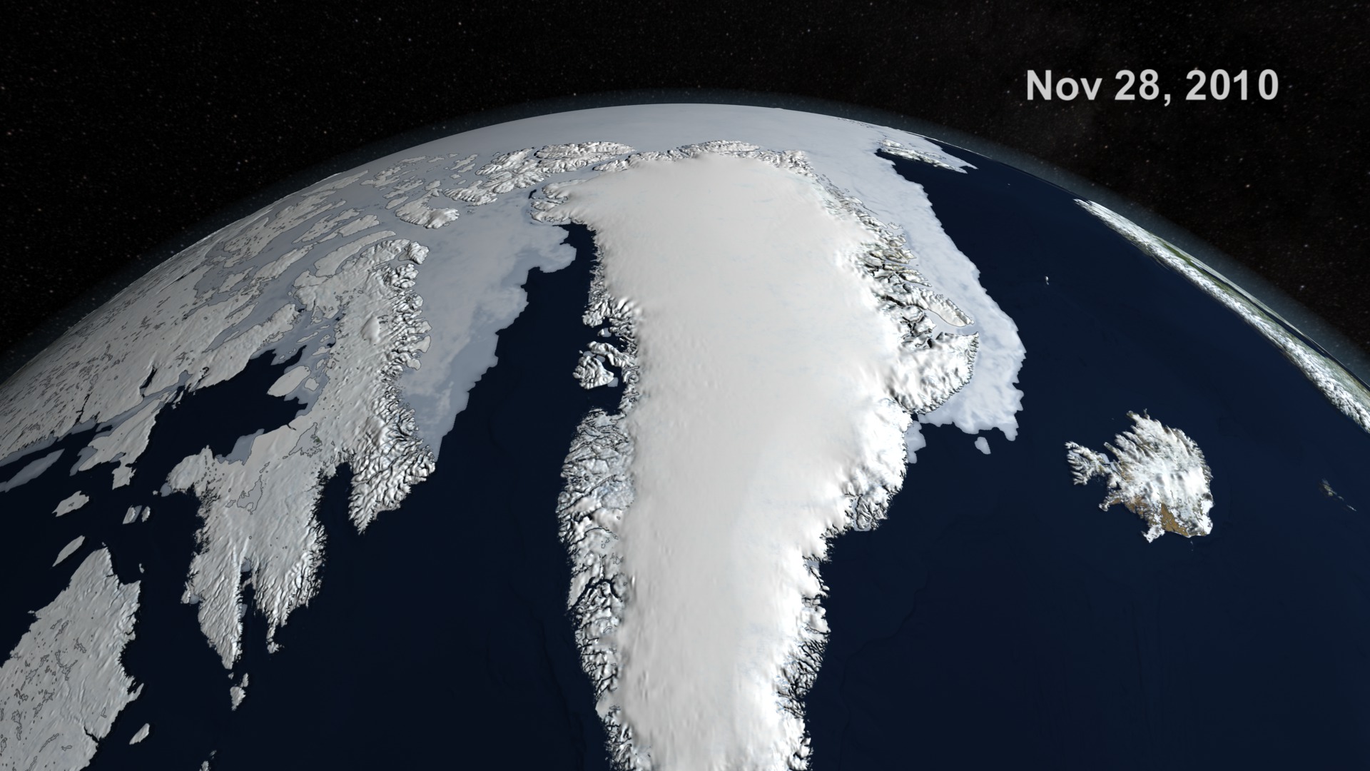
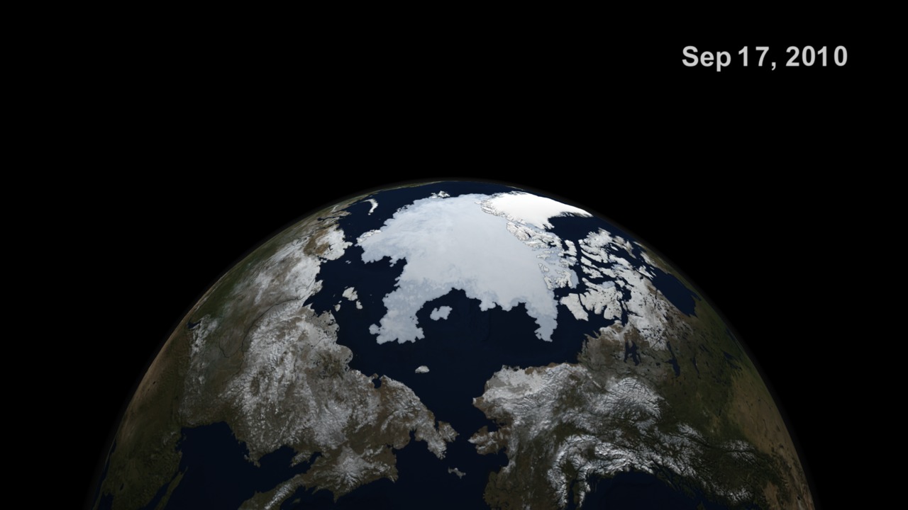
Sea ice is frozen seawater floating on the surface of the ocean. Some sea ice is semi-permanent, persisting from year to year, and some is seasonal, melting and refreezing from season to season. The sea ice cover reaches its minimum extent at the end of each summer and the remaining ice is called the perennial ice cover.
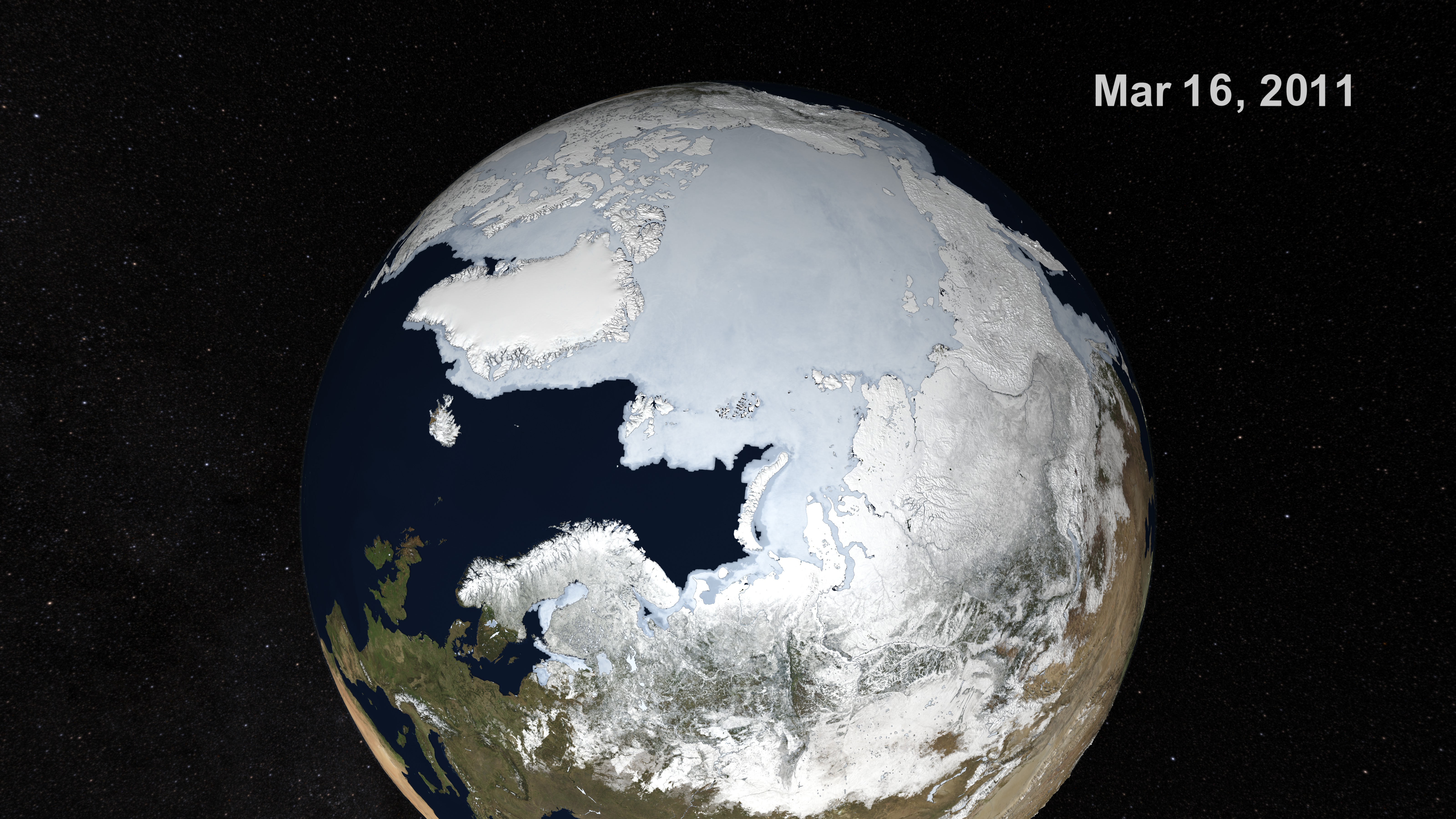
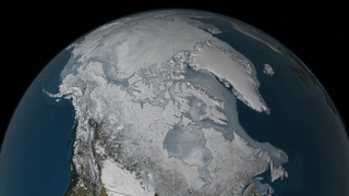
AMSR-E Arctic Sea Ice: September 2010 to March 2011
There is a newer version of this story located here: https://svs.gsfc.nasa.gov/4440
In this animation, the Arctic sea ice and seasonal land cover change progress through time, from the 2010 minimum which occurred on September 17 through March 16, 2011. Over the water, Arctic sea ice changes from day to day showing a running 3-day maximum sea ice concentration in the region where the concentration is greater than 15%. The blueish white color of the sea ice is derived from a 3-day running maximum of the AMSR-E 89 GHz brightness temperature. Over the terrain, monthly data from the seasonal Blue Marble Next Generation fades slowly from month to month.
Newer Version
Visualization Credits
Cindy Starr (Global Science and Technology, Inc.): Lead Visualizer
Trent L. Schindler (UMBC): Animator
Jefferson Beck (UMBC): Producer
Josefino Comiso (NASA/GSFC): Scientist
James W. Williams (GST): Project Support
Shiloh Heurich (GST): Project Support
Trent L. Schindler (UMBC): Animator
Jefferson Beck (UMBC): Producer
Josefino Comiso (NASA/GSFC): Scientist
James W. Williams (GST): Project Support
Shiloh Heurich (GST): Project Support
Please give credit for this item to:
NASA/Goddard Space Flight Center Scientific Visualization Studio.
The Blue Marble data is courtesy of Reto Stockli (NASA/GSFC).
Short URL to share this page:
https://svs.gsfc.nasa.gov/3824
Mission:
Terra
Data Used:
Note: While we identify the data sets used in these visualizations, we do not store any further details nor the data sets themselves on our site.
Keywords:
DLESE >> Cryology
SVS >> HDTV
DLESE >> Physical oceanography
GCMD >> Earth Science >> Cryosphere
GCMD >> Earth Science >> Cryosphere >> Sea Ice
GCMD >> Earth Science >> Cryosphere >> Snow/Ice
GCMD >> Earth Science >> Hydrosphere >> Snow/Ice
GCMD >> Earth Science >> Oceans >> Sea Ice
GCMD >> Earth Science >> Cryosphere >> Sea Ice >> Ice Extent
GCMD >> Earth Science >> Cryosphere >> Sea Ice >> Ice Floes
GCMD >> Earth Science >> Cryosphere >> Sea Ice >> Ice Growth/Melt
GCMD >> Earth Science >> Cryosphere >> Sea Ice >> Ice Types
GCMD >> Earth Science >> Cryosphere >> Sea Ice >> Pack Ice
GCMD >> Earth Science >> Cryosphere >> Sea Ice >> Sea Ice Concentration
GCMD >> Earth Science >> Cryosphere >> Sea Ice >> Sea Ice Motion
GCMD >> Earth Science >> Cryosphere >> Snow/Ice >> Freeze/Thaw
GCMD >> Earth Science >> Cryosphere >> Snow/Ice >> Ice Extent
GCMD >> Earth Science >> Cryosphere >> Snow/Ice >> Ice Growth/Melt
GCMD >> Earth Science >> Cryosphere >> Snow/Ice >> Ice Motion
GCMD >> Earth Science >> Cryosphere >> Snow/Ice >> Lake Ice
GCMD >> Earth Science >> Hydrosphere >> Snow/Ice >> Ice Extent
GCMD >> Earth Science >> Hydrosphere >> Snow/Ice >> Ice Motion
GCMD >> Earth Science >> Hydrosphere >> Snow/Ice >> Lake Ice
GCMD >> Earth Science >> Oceans >> Sea Ice >> Ice Extent
GCMD >> Earth Science >> Oceans >> Sea Ice >> Ice Growth/Melt
GCMD >> Earth Science >> Oceans >> Sea Ice >> Pack Ice
NASA Science >> Earth
GCMD keywords can be found on the Internet with the following citation: Olsen, L.M., G. Major, K. Shein, J. Scialdone, S. Ritz, T. Stevens, M. Morahan, A. Aleman, R. Vogel, S. Leicester, H. Weir, M. Meaux, S. Grebas, C.Solomon, M. Holland, T. Northcutt, R. A. Restrepo, R. Bilodeau, 2013. NASA/Global Change Master Directory (GCMD) Earth Science Keywords. Version 8.0.0.0.0
https://svs.gsfc.nasa.gov/3824
Mission:
Terra
Data Used:
Terra and Aqua/MODIS/Blue Marble Land Cover
Credit:
The Blue Marble data is courtesy of Reto Stockli (NASA/GSFC).
The Blue Marble data is courtesy of Reto Stockli (NASA/GSFC).
Aqua/AMSR-E/Daily L3 12.5km Tb, Sea Ice Concentration, and Snow Depth also referred to as: Sea Ice Concentration
Aqua/AMSR-E/Daily L3 6.25 km 89 GHz Brightness Temperature (Tb)
Keywords:
DLESE >> Cryology
SVS >> HDTV
DLESE >> Physical oceanography
GCMD >> Earth Science >> Cryosphere
GCMD >> Earth Science >> Cryosphere >> Sea Ice
GCMD >> Earth Science >> Cryosphere >> Snow/Ice
GCMD >> Earth Science >> Hydrosphere >> Snow/Ice
GCMD >> Earth Science >> Oceans >> Sea Ice
GCMD >> Earth Science >> Cryosphere >> Sea Ice >> Ice Extent
GCMD >> Earth Science >> Cryosphere >> Sea Ice >> Ice Floes
GCMD >> Earth Science >> Cryosphere >> Sea Ice >> Ice Growth/Melt
GCMD >> Earth Science >> Cryosphere >> Sea Ice >> Ice Types
GCMD >> Earth Science >> Cryosphere >> Sea Ice >> Pack Ice
GCMD >> Earth Science >> Cryosphere >> Sea Ice >> Sea Ice Concentration
GCMD >> Earth Science >> Cryosphere >> Sea Ice >> Sea Ice Motion
GCMD >> Earth Science >> Cryosphere >> Snow/Ice >> Freeze/Thaw
GCMD >> Earth Science >> Cryosphere >> Snow/Ice >> Ice Extent
GCMD >> Earth Science >> Cryosphere >> Snow/Ice >> Ice Growth/Melt
GCMD >> Earth Science >> Cryosphere >> Snow/Ice >> Ice Motion
GCMD >> Earth Science >> Cryosphere >> Snow/Ice >> Lake Ice
GCMD >> Earth Science >> Hydrosphere >> Snow/Ice >> Ice Extent
GCMD >> Earth Science >> Hydrosphere >> Snow/Ice >> Ice Motion
GCMD >> Earth Science >> Hydrosphere >> Snow/Ice >> Lake Ice
GCMD >> Earth Science >> Oceans >> Sea Ice >> Ice Extent
GCMD >> Earth Science >> Oceans >> Sea Ice >> Ice Growth/Melt
GCMD >> Earth Science >> Oceans >> Sea Ice >> Pack Ice
NASA Science >> Earth
GCMD keywords can be found on the Internet with the following citation: Olsen, L.M., G. Major, K. Shein, J. Scialdone, S. Ritz, T. Stevens, M. Morahan, A. Aleman, R. Vogel, S. Leicester, H. Weir, M. Meaux, S. Grebas, C.Solomon, M. Holland, T. Northcutt, R. A. Restrepo, R. Bilodeau, 2013. NASA/Global Change Master Directory (GCMD) Earth Science Keywords. Version 8.0.0.0.0


