Earth
ID: 3745
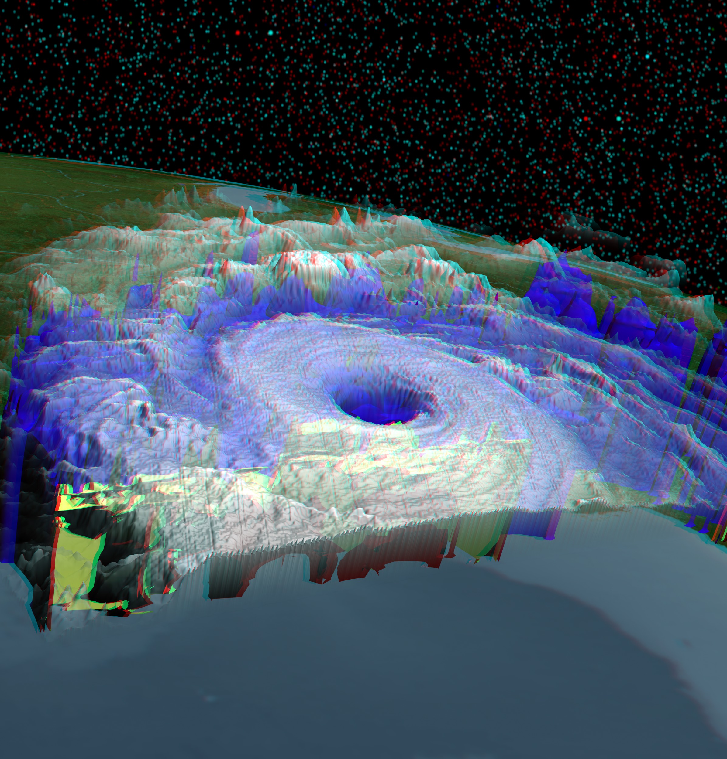
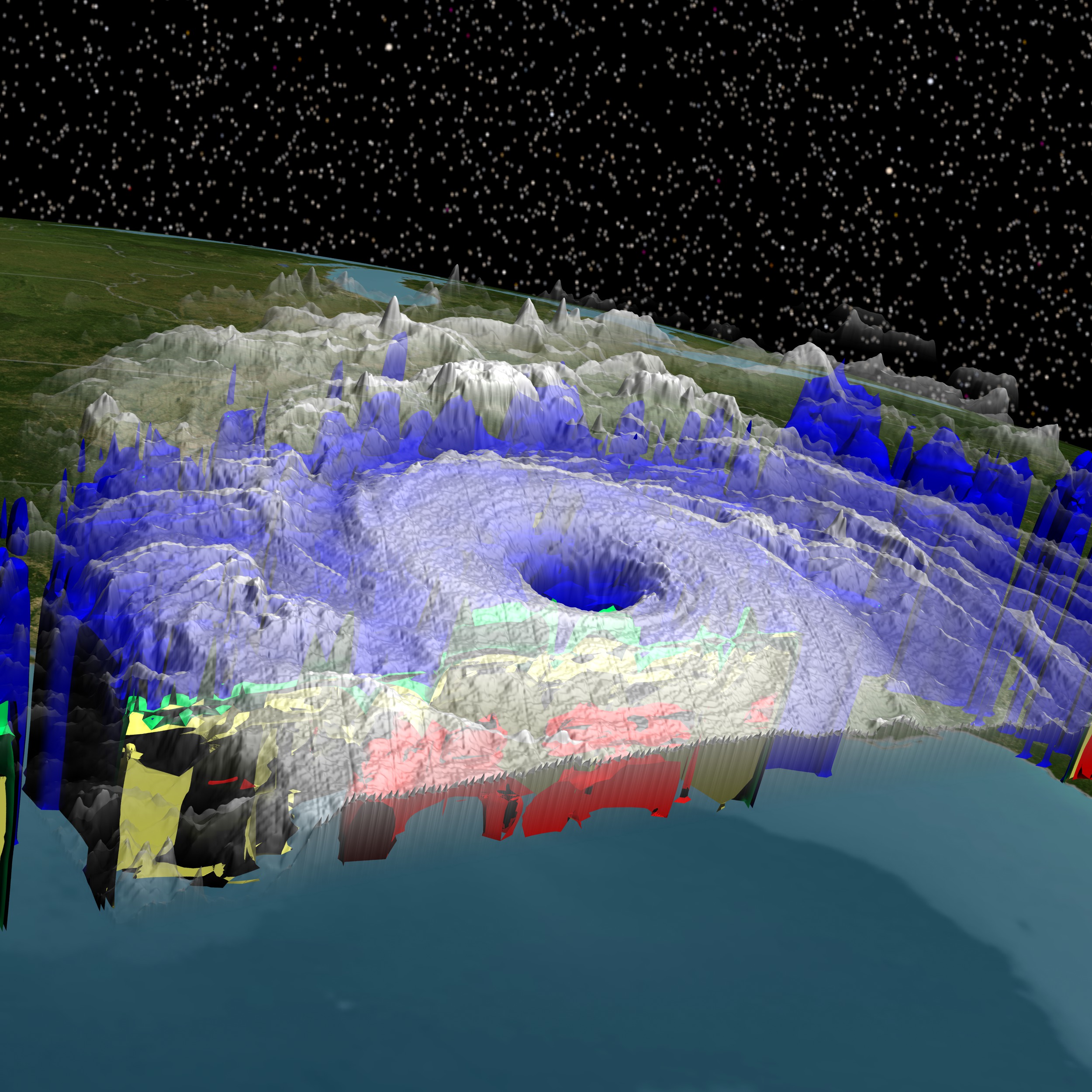
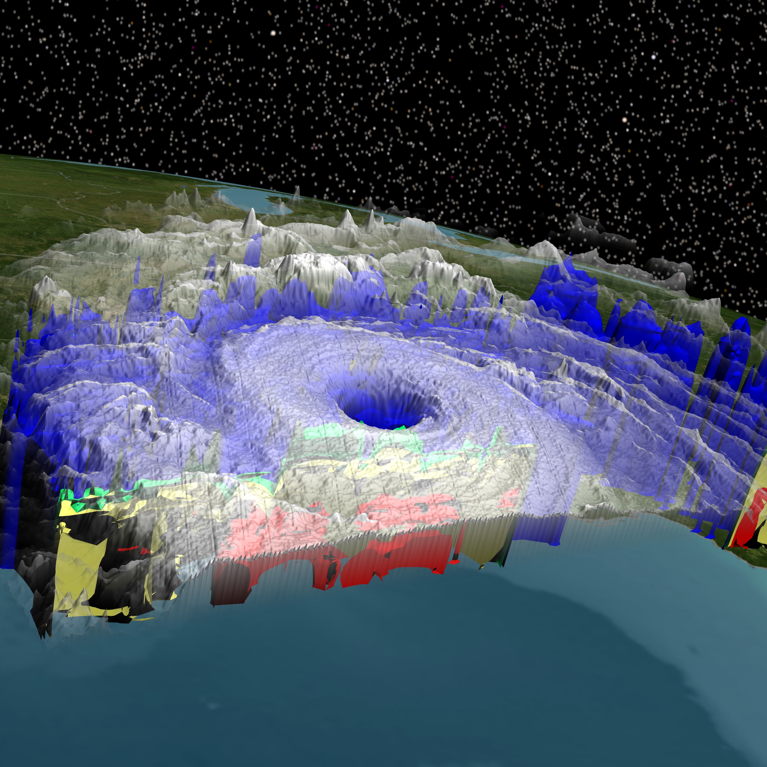
NASA's TRMM spacecraft observed this view of Hurricane Katrina on August 28, 2005. At the time the data was collected, Katrina was a Category 5 hurricane, the most destructive and deadly. The cloud cover data was taken by TRMM's Visible and Infrared Scanner (VIRS), with additional data from the GOES spacecraft. The rain structure data was taken by TRMM's Tropical Microwave Imager (TMI). This view looks underneath the storm's clouds to reveal the underlying rain structure. This stereoscopic still image was created from a previous visualization and is intended for viewing through a special NASA Earth Science Viewfinder available through NASA Headquarters. Below, we include an anaglyph version, a printable viewfinder version, and the individual left eye and right eye views.
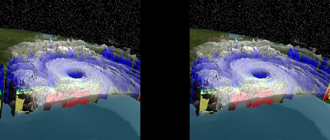
Hurricane Katrina 3D Stereoscopic Viewfinder Image
3D stereographic anaglyph of Hurricane Katrina using TRMM and GOES data. (Red/Cyan glasses are required to view this image properly.) 
Visualization Credits
Alex Kekesi (Global Science and Technology, Inc.): Lead Animator
Lori Perkins (NASA/GSFC): Lead Animator
Jeff Halverson (JCET UMBC): Scientist
James W. Williams (GST): Project Support
Shiloh Heurich (GST): Project Support
Trent L. Schindler (UMBC): Project Support
Lori Perkins (NASA/GSFC): Lead Animator
Jeff Halverson (JCET UMBC): Scientist
James W. Williams (GST): Project Support
Shiloh Heurich (GST): Project Support
Trent L. Schindler (UMBC): Project Support
Please give credit for this item to:
NASA/Goddard Space Flight Center Scientific Visualization Studio
NASA/Goddard Space Flight Center Scientific Visualization Studio
Short URL to share this page:
https://svs.gsfc.nasa.gov/3745
Mission:
Tropical Rainfall Measuring Mission - TRMM
Data Used:
Note: While we identify the data sets used in these visualizations, we do not store any further details nor the data sets themselves on our site.
This item is part of these series:
TRMM 3D Hurricanes
Hurricane Katrina
3D Viewfinder
Keywords:
DLESE >> Natural hazards
GCMD >> Earth Science >> Atmosphere >> Atmospheric Phenomena >> Hurricanes
GCMD >> Earth Science >> Human Dimensions >> Natural Hazards >> Fires
SVS >> Stereo Display
SVS >> Hurricane Katrina
SVS >> GOES
SVS >> For Educators
SVS >> Water Cycle >> Condensation
SVS >> Hurricanes >> Jeanne
NASA Science >> Earth
GCMD keywords can be found on the Internet with the following citation: Olsen, L.M., G. Major, K. Shein, J. Scialdone, S. Ritz, T. Stevens, M. Morahan, A. Aleman, R. Vogel, S. Leicester, H. Weir, M. Meaux, S. Grebas, C.Solomon, M. Holland, T. Northcutt, R. A. Restrepo, R. Bilodeau, 2013. NASA/Global Change Master Directory (GCMD) Earth Science Keywords. Version 8.0.0.0.0
https://svs.gsfc.nasa.gov/3745
Mission:
Tropical Rainfall Measuring Mission - TRMM
Data Used:
TRMM/PR
2005/08/28TRMM/TMI
2005/08/28TRMM/VIRS
2005/08/28GOES
2005/08/28This item is part of these series:
TRMM 3D Hurricanes
Hurricane Katrina
3D Viewfinder
Keywords:
DLESE >> Natural hazards
GCMD >> Earth Science >> Atmosphere >> Atmospheric Phenomena >> Hurricanes
GCMD >> Earth Science >> Human Dimensions >> Natural Hazards >> Fires
SVS >> Stereo Display
SVS >> Hurricane Katrina
SVS >> GOES
SVS >> For Educators
SVS >> Water Cycle >> Condensation
SVS >> Hurricanes >> Jeanne
NASA Science >> Earth
GCMD keywords can be found on the Internet with the following citation: Olsen, L.M., G. Major, K. Shein, J. Scialdone, S. Ritz, T. Stevens, M. Morahan, A. Aleman, R. Vogel, S. Leicester, H. Weir, M. Meaux, S. Grebas, C.Solomon, M. Holland, T. Northcutt, R. A. Restrepo, R. Bilodeau, 2013. NASA/Global Change Master Directory (GCMD) Earth Science Keywords. Version 8.0.0.0.0


