Planets and Moons
ID: 3727
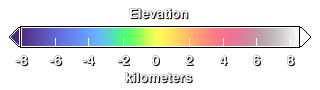
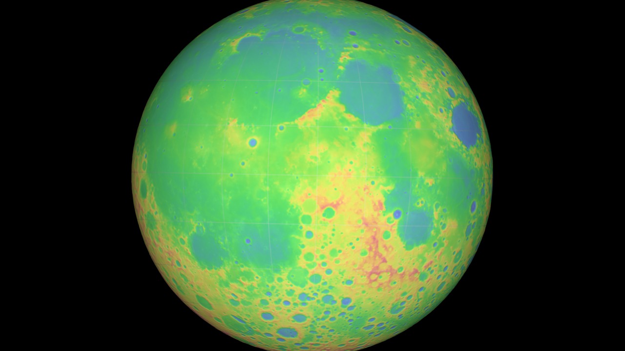
This animation is a brief tour of several prominent features of the Moon's terrain: Tycho crater, the south pole, and the South Pole-Aitken basin. The height of the terrain is color-coded, with blues and greens representing low altitudes and reds representing high altitudes. The view is match-moved to a companion piece showing the Moon in natural colors.
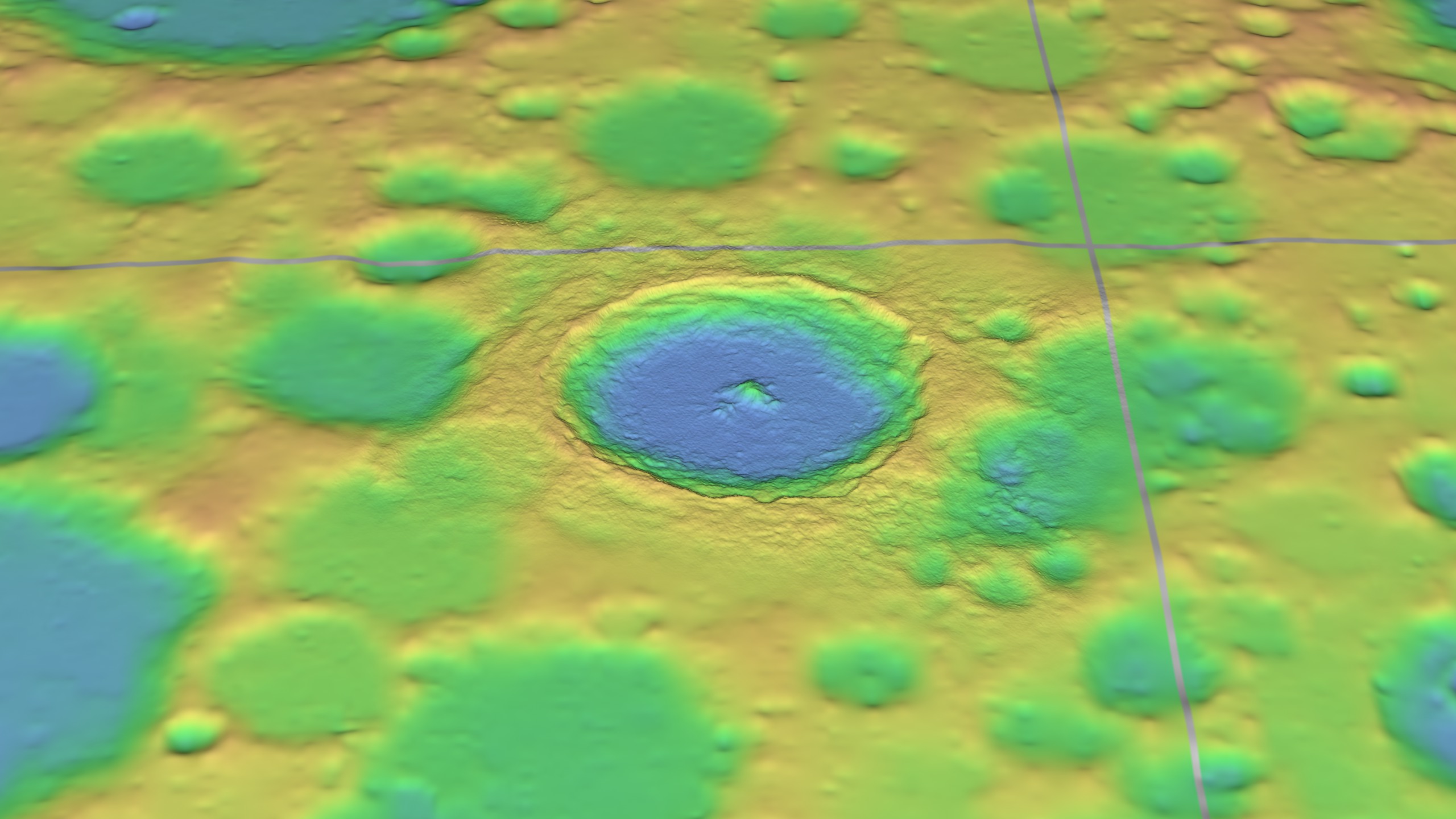
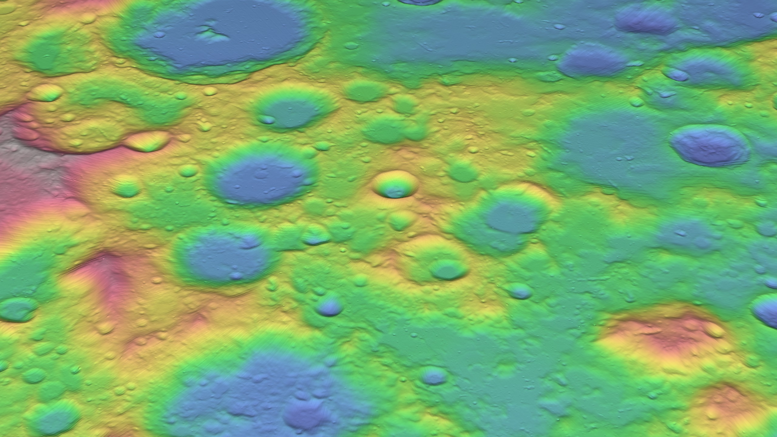

LOLA Lunar Topography in False Color
This is an update of animation 3582, which was produced before the launch of Lunar Reconnaissance Orbiter. Except for the Tycho crater inset, the elevation map in this updated version is based entirely on early results of the Lunar Orbiter Laser Altimeter onboard LRO. These results already represent a substantial improvement in our knowledge of the Moon's topography.
For More Information
Visualization Credits
Ernie Wright (UMBC): Lead Animator
Marte Newcombe (GST): Animator
Andrew Freeberg (NASA/GSFC): Producer
James Garvin (NASA/GSFC): Scientist
Marte Newcombe (GST): Animator
Andrew Freeberg (NASA/GSFC): Producer
James Garvin (NASA/GSFC): Scientist
Please give credit for this item to:
NASA/Goddard Space Flight Center Scientific Visualization Studio
NASA/Goddard Space Flight Center Scientific Visualization Studio
Short URL to share this page:
https://svs.gsfc.nasa.gov/3727
Missions:
Clementine
LRO (Lunar Reconnaissance Orbiter)
Data Used:
Note: While we identify the data sets used in these visualizations, we do not store any further details nor the data sets themselves on our site.
This item is part of these series:
The Moon
LRO - Animations
Keywords:
SVS >> Elevation data
SVS >> False Color
SVS >> HDTV
SVS >> Moon
SVS >> South Pole
SVS >> LRO
SVS >> Lunar Reconnaissance Orbiter
SVS >> LOLA
SVS >> For Educators
SVS >> Lunar Surface
SVS >> Craters
SVS >> Elevation Map
SVS >> Tycho Crater
SVS >> Topographical Map
NASA Science >> Planets and Moons
https://svs.gsfc.nasa.gov/3727
Missions:
Clementine
LRO (Lunar Reconnaissance Orbiter)
Data Used:
Tycho DEM
1998LRO/LOLA/Digital Elevation Map also referred to as: DEM
2009-07-13 to 2009-12-17Clementine/UVVIS Camera/750-nm Basemap
Mosaic - 1994-02-26 to 1994-04-21This item is part of these series:
The Moon
LRO - Animations
Keywords:
SVS >> Elevation data
SVS >> False Color
SVS >> HDTV
SVS >> Moon
SVS >> South Pole
SVS >> LRO
SVS >> Lunar Reconnaissance Orbiter
SVS >> LOLA
SVS >> For Educators
SVS >> Lunar Surface
SVS >> Craters
SVS >> Elevation Map
SVS >> Tycho Crater
SVS >> Topographical Map
NASA Science >> Planets and Moons


