Earth
ID: 3639
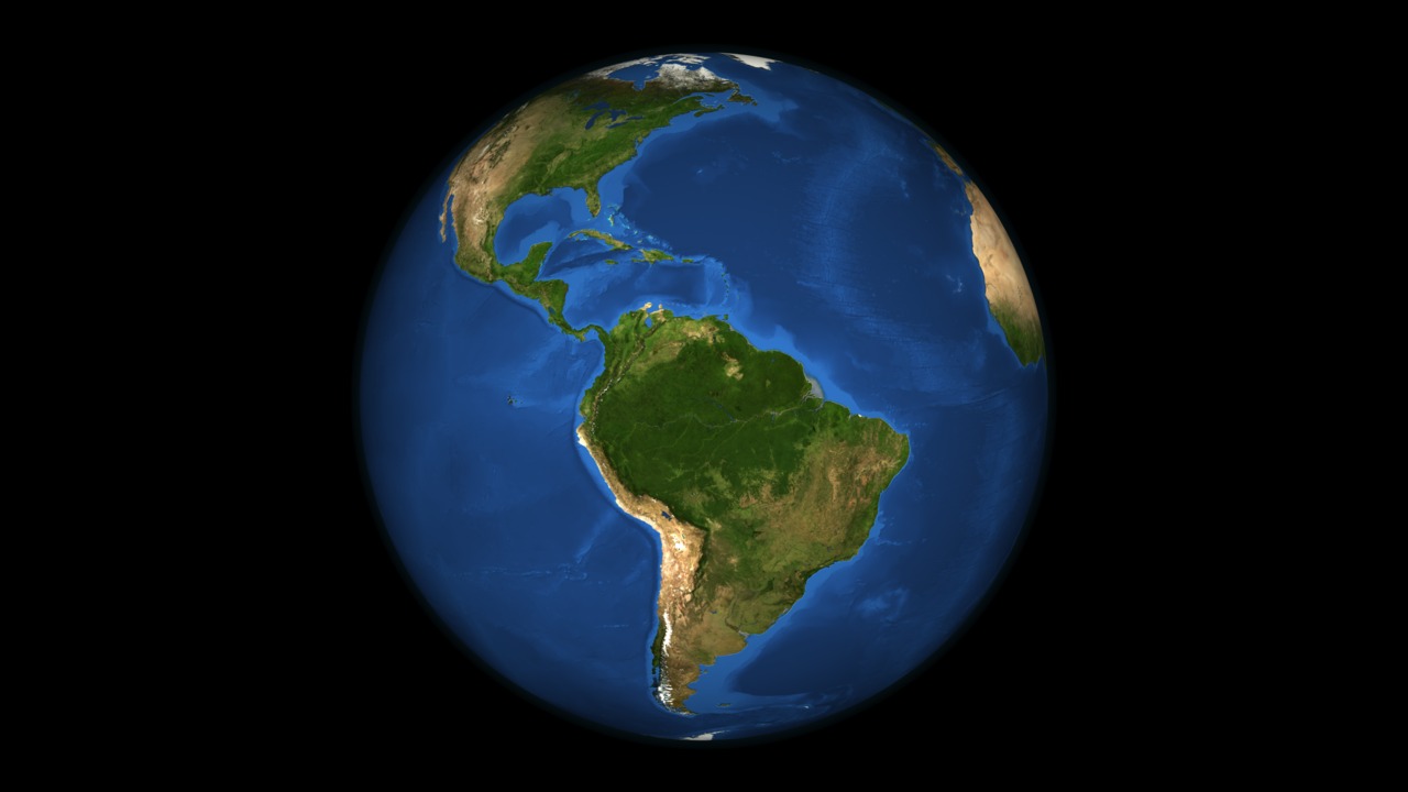
The Blue Marble Next Generation (BMNG) data set provides a monthly global cloud-free true-color picture of the Earth's landcover at a 500-meter spatial resolution. This data set, shown on a globe, is derived from monthly data collected in 2004. The ocean color is derived from applying a depth shading to the bathymetry data. The Antarctica coverage shown is the Landsat Image Mosaic of Antarctica.
Rotating Blue Marble
Visualization Credits
Adam Martin (UMBC): Lead Animator
Horace Mitchell (NASA/GSFC): Animator
Troy Cline (Raytheon/GSFC): Narrator
Maria Frostic (UMBC): Producer
Gene Feldman (NASA/GSFC): Scientist
Michael Behrenfeld (Oregon State University): Scientist
Maria Frostic (UMBC): Writer
Horace Mitchell (NASA/GSFC): Animator
Troy Cline (Raytheon/GSFC): Narrator
Maria Frostic (UMBC): Producer
Gene Feldman (NASA/GSFC): Scientist
Michael Behrenfeld (Oregon State University): Scientist
Maria Frostic (UMBC): Writer
Please give credit for this item to:
NASA/Goddard Space Flight Center Scientific Visualization Studio
NASA/Goddard Space Flight Center Scientific Visualization Studio
Short URL to share this page:
https://svs.gsfc.nasa.gov/3639
Mission:
Terra
Data Used:
Note: While we identify the data sets used in these visualizations, we do not store any further details nor the data sets themselves on our site.
This item is part of these series:
Earth Science Week Phytoplankton
Earth Science Week
Keywords:
SVS >> Globe
SVS >> HDTV
SVS >> Phytoplankton Blooms
GCMD >> Earth Science >> Land Surface >> Topography
GCMD >> Earth Science >> Biosphere >> Microbiota Taxonomy >> Phytoplankton
GCMD >> Earth Science >> Biosphere >> Plant Taxonomy >> Phytoplankton
SVS >> Planets
DLESE >> Narrated
SVS >> Voice Over Talent
SVS >> For Educators
SVS >> Earth >> Texas >> Houston
SVS >> Continents
SVS >> Oceans >> Plant Life
NASA Science >> Earth
GCMD keywords can be found on the Internet with the following citation: Olsen, L.M., G. Major, K. Shein, J. Scialdone, S. Ritz, T. Stevens, M. Morahan, A. Aleman, R. Vogel, S. Leicester, H. Weir, M. Meaux, S. Grebas, C.Solomon, M. Holland, T. Northcutt, R. A. Restrepo, R. Bilodeau, 2013. NASA/Global Change Master Directory (GCMD) Earth Science Keywords. Version 8.0.0.0.0
https://svs.gsfc.nasa.gov/3639
Mission:
Terra
Data Used:
Aqua/MODIS/Blue Marble
Credit:
The Blue Marble data is courtesy of Reto Stockli (NASA/GSFC).
The Blue Marble data is courtesy of Reto Stockli (NASA/GSFC).
Terra and Aqua/MODIS/Blue Marble Cloud Cover
Credit:
The Blue Marble data is courtesy of Reto Stockli (NASA/GSFC).
The Blue Marble data is courtesy of Reto Stockli (NASA/GSFC).
Terra and Aqua/MODIS/Band Combination 1, 4, 3 also referred to as: True Color
NASA - 3/2/2009Sea Surface Temperature-Net Primary Productivity Correlation
1999-2004
Behrenfeld at. al., Nature 444, 752-755 (7 December 2006)
This item is part of these series:
Earth Science Week Phytoplankton
Earth Science Week
Keywords:
SVS >> Globe
SVS >> HDTV
SVS >> Phytoplankton Blooms
GCMD >> Earth Science >> Land Surface >> Topography
GCMD >> Earth Science >> Biosphere >> Microbiota Taxonomy >> Phytoplankton
GCMD >> Earth Science >> Biosphere >> Plant Taxonomy >> Phytoplankton
SVS >> Planets
DLESE >> Narrated
SVS >> Voice Over Talent
SVS >> For Educators
SVS >> Earth >> Texas >> Houston
SVS >> Continents
SVS >> Oceans >> Plant Life
NASA Science >> Earth
GCMD keywords can be found on the Internet with the following citation: Olsen, L.M., G. Major, K. Shein, J. Scialdone, S. Ritz, T. Stevens, M. Morahan, A. Aleman, R. Vogel, S. Leicester, H. Weir, M. Meaux, S. Grebas, C.Solomon, M. Holland, T. Northcutt, R. A. Restrepo, R. Bilodeau, 2013. NASA/Global Change Master Directory (GCMD) Earth Science Keywords. Version 8.0.0.0.0


