Earth
ID: 3559
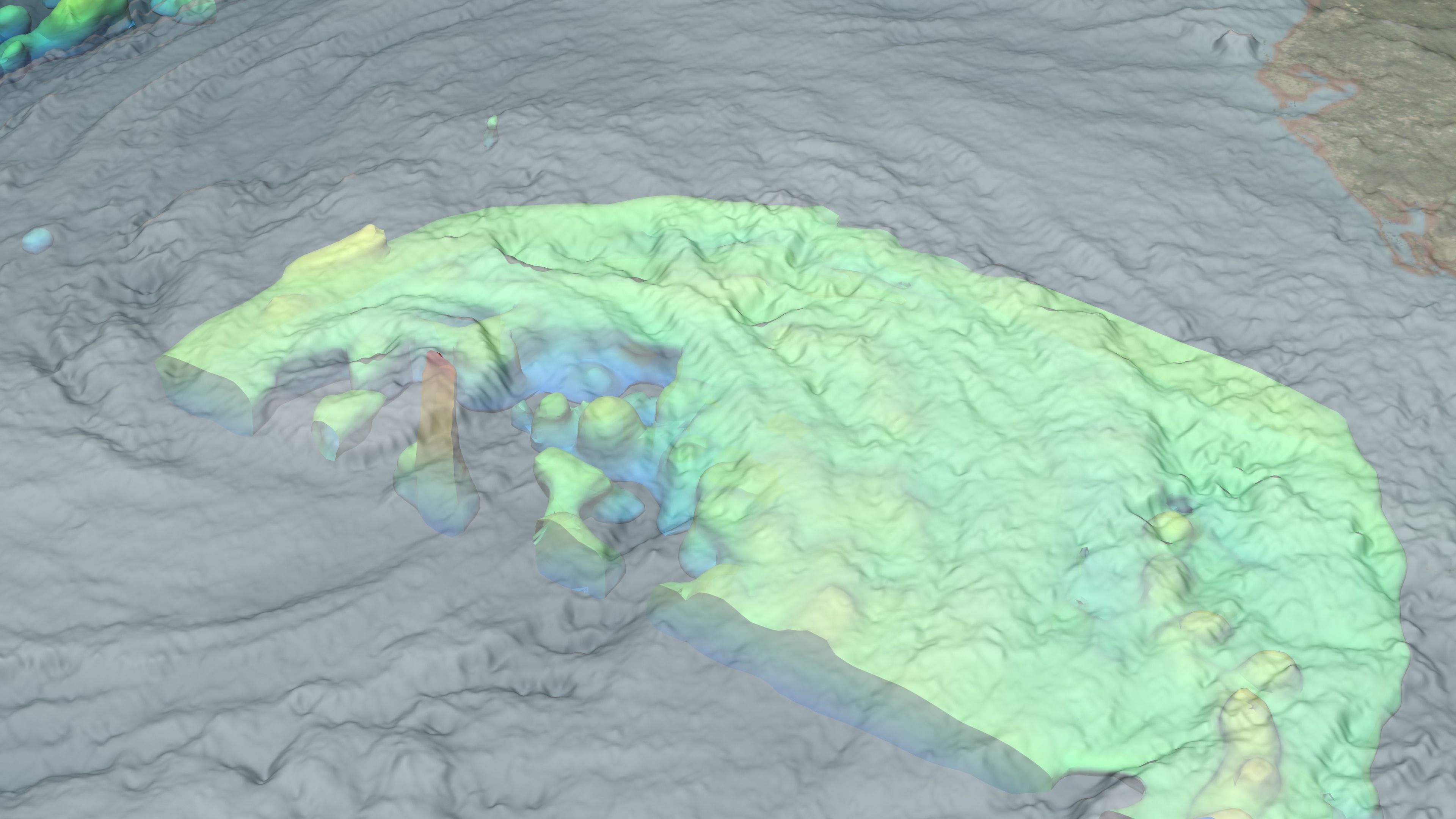
NASA's TRMM spacecraft observed this view of Hurricane Ike on September 10, 2008 at 1745 UTC or 1:45PM EST. At this time the storm was a category 2 hurricane with sustained winds of 85 knots (97.75 mph), a pressure reading of 958 millibars, and a diameter of 100 miles. The cloud cover in this animation is taken by TRMM's Visible and Infrared Scanner(VIRS) and the GOES spacecraft. The rain structure is taken by TRMM's Tropical Microwave Imager (TMI) and TRMM's Precitation Radar(PR) instruments. TRMM looks underneath of the storm's clouds to reveal the underlying rain structure. The colored isosurface uner the clouds show the rain seen by the PR instrument. This surface is colored according to cloud height where yellow represents 10 km thunderclouds and red represents 15 km or more intense thunderclouds. Ike is expected to generate a 10 to 15 foot storm surge along a 100 mile stretch of the Texas Coast from the eye landfall location.
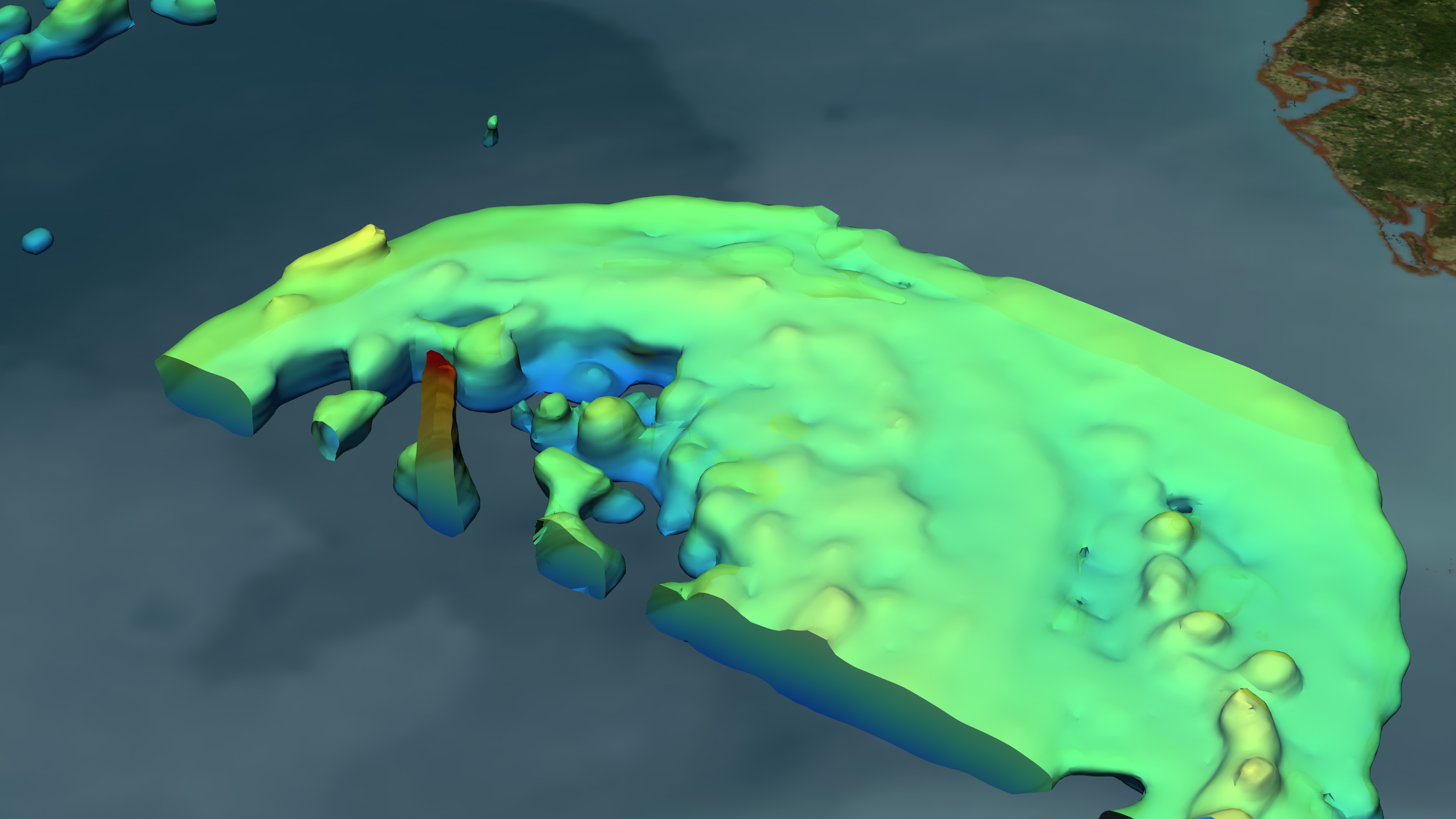
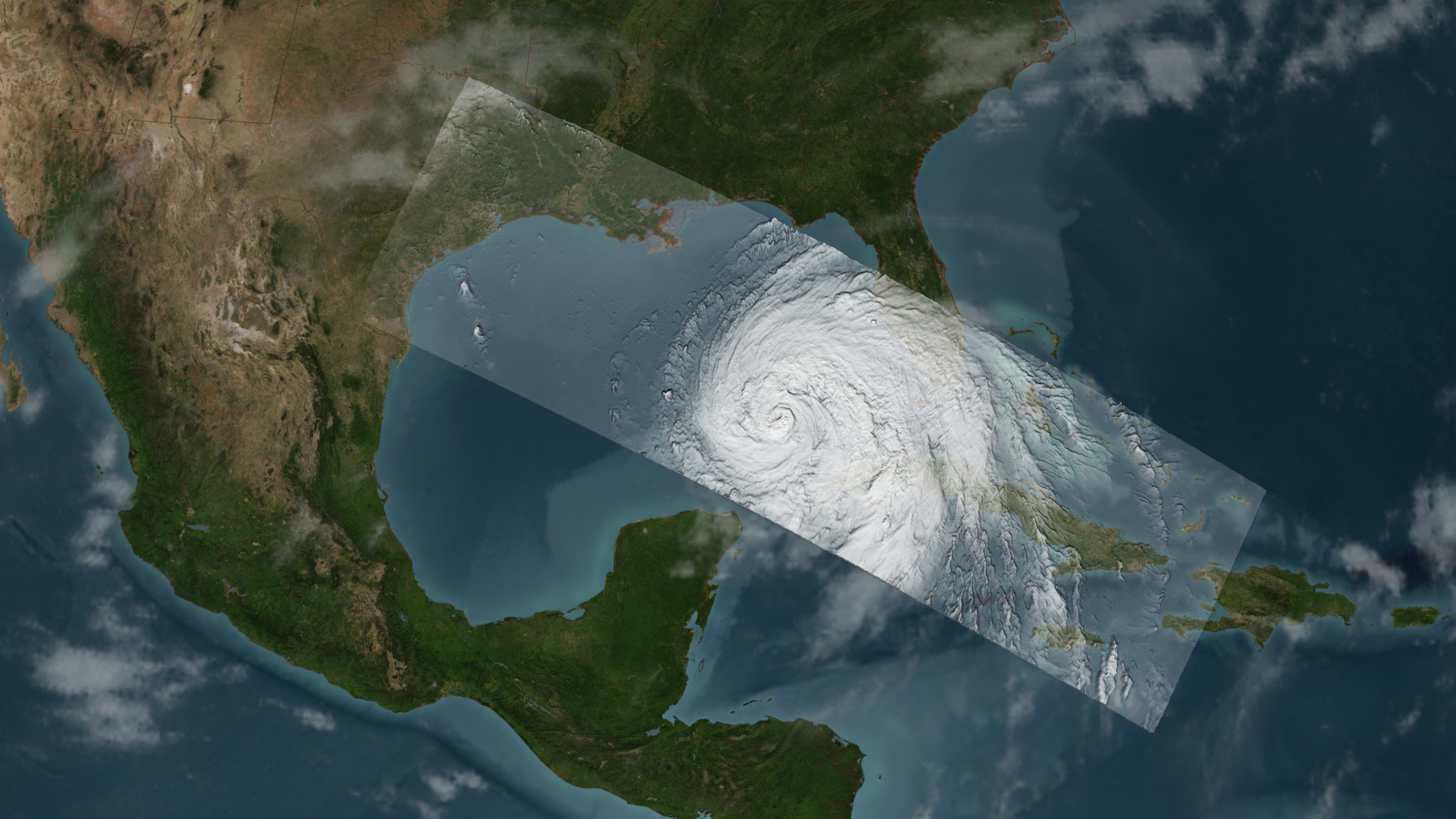
Hurricane Ike on September 10, 2008 at 1745 UTC
Visualization Credits
Please give credit for this item to:
NASA/Goddard Space Flight Center Scientific Visualization Studio
NASA/Goddard Space Flight Center Scientific Visualization Studio
Short URL to share this page:
https://svs.gsfc.nasa.gov/3559
Mission:
Tropical Rainfall Measuring Mission - TRMM
Data Used:
Note: While we identify the data sets used in these visualizations, we do not store any further details nor the data sets themselves on our site.
This item is part of these series:
Hurricanes
TRMM 3D Hurricanes
Keywords:
SVS >> HDTV
DLESE >> Natural hazards
GCMD >> Earth Science >> Atmosphere >> Atmospheric Phenomena >> Hurricanes
SVS >> GOES
NASA Science >> Earth
GCMD keywords can be found on the Internet with the following citation: Olsen, L.M., G. Major, K. Shein, J. Scialdone, S. Ritz, T. Stevens, M. Morahan, A. Aleman, R. Vogel, S. Leicester, H. Weir, M. Meaux, S. Grebas, C.Solomon, M. Holland, T. Northcutt, R. A. Restrepo, R. Bilodeau, 2013. NASA/Global Change Master Directory (GCMD) Earth Science Keywords. Version 8.0.0.0.0
https://svs.gsfc.nasa.gov/3559
Mission:
Tropical Rainfall Measuring Mission - TRMM
Data Used:
TRMM/VIRS
2008/09/11TRMM/TMI
2008/09/11TRMM/PR
2008/09/11GOES
2008/09/11This item is part of these series:
Hurricanes
TRMM 3D Hurricanes
Keywords:
SVS >> HDTV
DLESE >> Natural hazards
GCMD >> Earth Science >> Atmosphere >> Atmospheric Phenomena >> Hurricanes
SVS >> GOES
NASA Science >> Earth
GCMD keywords can be found on the Internet with the following citation: Olsen, L.M., G. Major, K. Shein, J. Scialdone, S. Ritz, T. Stevens, M. Morahan, A. Aleman, R. Vogel, S. Leicester, H. Weir, M. Meaux, S. Grebas, C.Solomon, M. Holland, T. Northcutt, R. A. Restrepo, R. Bilodeau, 2013. NASA/Global Change Master Directory (GCMD) Earth Science Keywords. Version 8.0.0.0.0


