Earth
ID: 3272
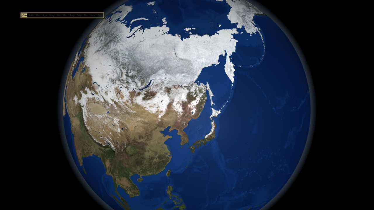
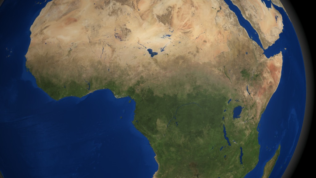
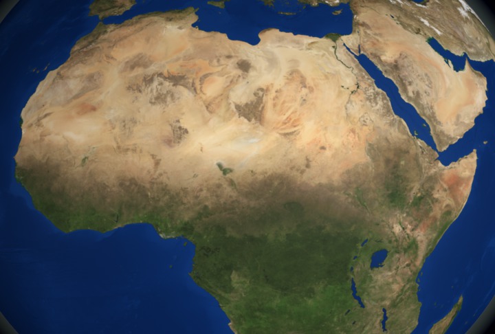
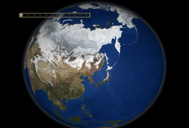
The Blue Marble Next Generation data set provides a monthly global cloud-free true-color picture of the Earth's land cover at a 500-meter spatial resolution. This visualization of the data set shows seasonal variations such as snowfall, spring greening and droughts in a seamless fashion, thereby heightening awareness of changes in the Earth's climate. Here we tour the globe, viewing seasonal land cover over many continents. This data set is derived from imagery taken in 2004 by the MODIS instrument on the Terra satellite.

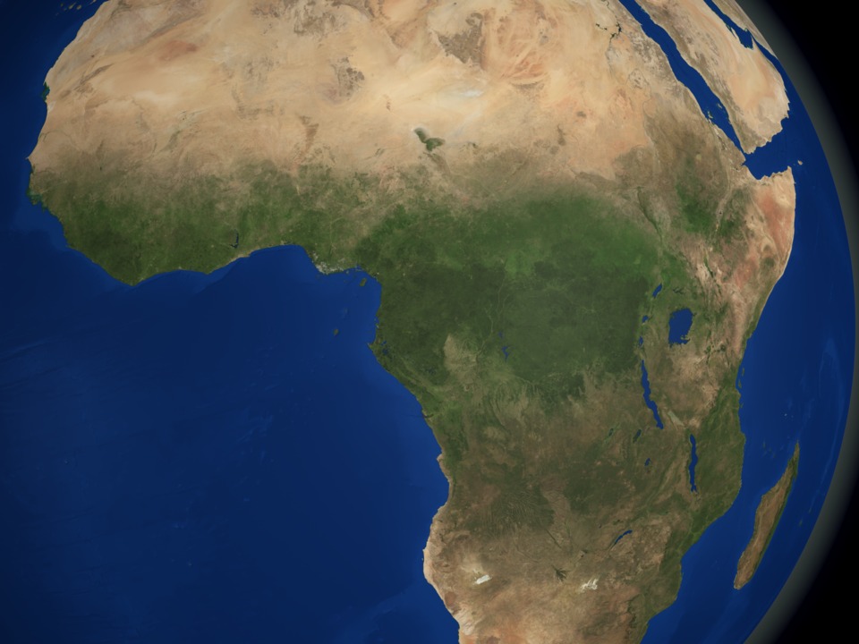
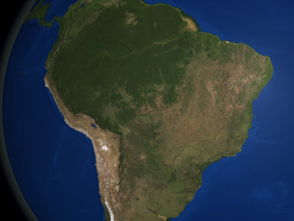
Global Seasonal Landcover in 2004
Visualization Credits
Cindy Starr (Global Science and Technology, Inc.): Lead Visualizer
Reto Stockli (NASA/GSFC): Scientist
David Herring (NASA/GSFC): Scientist
Reto Stockli (NASA/GSFC): Scientist
David Herring (NASA/GSFC): Scientist
Please give credit for this item to:
NASA/Goddard Space Flight Center Scientific Visualization Studio The Blue Marble Next Generation data is courtesy of Reto Stockli (NASA/GSFC) and NASA's Earth Observatory.
NASA/Goddard Space Flight Center Scientific Visualization Studio The Blue Marble Next Generation data is courtesy of Reto Stockli (NASA/GSFC) and NASA's Earth Observatory.
Short URL to share this page:
https://svs.gsfc.nasa.gov/3272
Mission:
Terra
Data Used:
Note: While we identify the data sets used in these visualizations, we do not store any further details nor the data sets themselves on our site.
This item is part of this series:
Blue Marble Next Generation
Goddard TV Tape:
G2007-002HD -- NASA's HD Blue Marble Resource Tape
Keywords:
SVS >> HDTV
GCMD >> Earth Science >> Land Surface >> Land Use/Land Cover >> Land Cover
NASA Science >> Earth
GCMD keywords can be found on the Internet with the following citation: Olsen, L.M., G. Major, K. Shein, J. Scialdone, S. Ritz, T. Stevens, M. Morahan, A. Aleman, R. Vogel, S. Leicester, H. Weir, M. Meaux, S. Grebas, C.Solomon, M. Holland, T. Northcutt, R. A. Restrepo, R. Bilodeau, 2013. NASA/Global Change Master Directory (GCMD) Earth Science Keywords. Version 8.0.0.0.0
https://svs.gsfc.nasa.gov/3272
Mission:
Terra
Data Used:
Terra and Aqua/MODIS/Blue Marble: Next Generation also referred to as: BMNG
1/1/2004 - 12/31/2004
Credit:
The Blue Marble data is courtesy of Reto Stockli (NASA/GSFC).
The Blue Marble data is courtesy of Reto Stockli (NASA/GSFC).
This item is part of this series:
Blue Marble Next Generation
Goddard TV Tape:
G2007-002HD -- NASA's HD Blue Marble Resource Tape
Keywords:
SVS >> HDTV
GCMD >> Earth Science >> Land Surface >> Land Use/Land Cover >> Land Cover
NASA Science >> Earth
GCMD keywords can be found on the Internet with the following citation: Olsen, L.M., G. Major, K. Shein, J. Scialdone, S. Ritz, T. Stevens, M. Morahan, A. Aleman, R. Vogel, S. Leicester, H. Weir, M. Meaux, S. Grebas, C.Solomon, M. Holland, T. Northcutt, R. A. Restrepo, R. Bilodeau, 2013. NASA/Global Change Master Directory (GCMD) Earth Science Keywords. Version 8.0.0.0.0


