Earth
ID: 3219
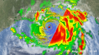
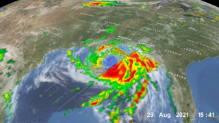
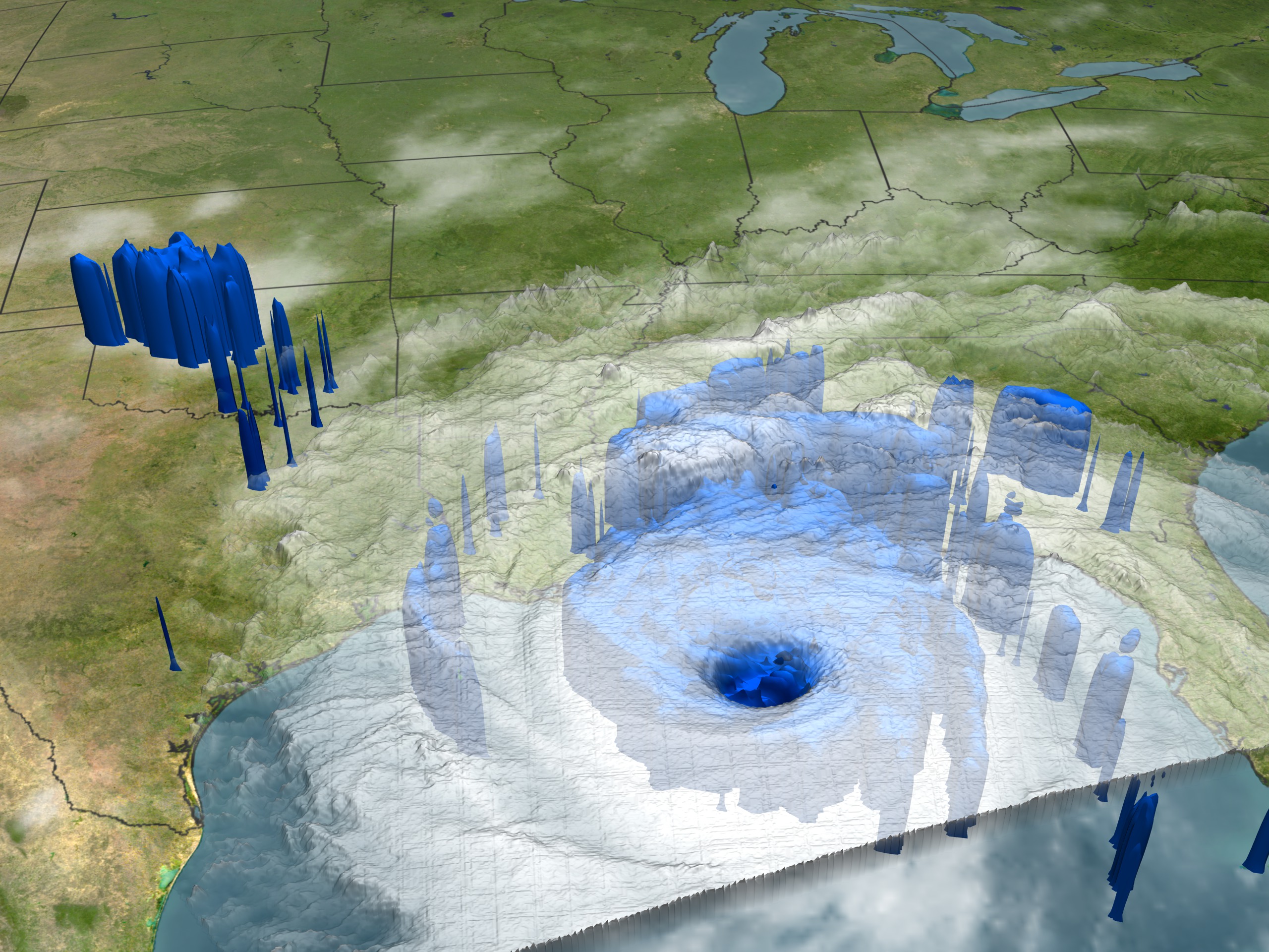
NASA's TRMM spacecraft is used to understand Hurricane Katrina. TRMM observed this view of Hurricane Katrina just before the storm made landfall on August 29, 2005. Katrina remains an extremely large and dangerous hurricane. Hurricane force winds extend outward up to 105 miles from the storm's center. Coastal storm surge flooding of 18 to 22 feet above normal tide levels are expected. The cloud cover is taken by TRMM's Visible and Infrared Scanner(VIRS) and the GOES spacecraft. The rain structure is taken by TRMM's Tropical Microwave Imager (TMI). It looks underneath of the storm's clouds to reveal the underlying rain structure. Blue represents areas with at least 0.25 inches of rain per hour. Green shows at least 0.5 inches of rain per hour. Yellow is at least 1.0 inches of rain and red is at least 2.0 inches of rain per hour.
Hurricane Katrina from TRMM: August 29, 2005
Related
Visualization Credits
Please give credit for this item to:
NASA/Goddard Space Flight Center Scientific Visualization Studio
NASA/Goddard Space Flight Center Scientific Visualization Studio
Short URL to share this page:
https://svs.gsfc.nasa.gov/3219
Mission:
Tropical Rainfall Measuring Mission - TRMM
Data Used:
Note: While we identify the data sets used in these visualizations, we do not store any further details nor the data sets themselves on our site.
This item is part of these series:
TRMM 3D Hurricanes
Hurricane Katrina
Keywords:
DLESE >> Atmospheric science
DLESE >> Natural hazards
SVS >> Tropical Storm Cindy
SVS >> Tropical Storm Emily
SVS >> GOES
NASA Science >> Earth
https://svs.gsfc.nasa.gov/3219
Mission:
Tropical Rainfall Measuring Mission - TRMM
Data Used:
GOES
2005/08/29TRMM/PR
2005/08/29TRMM/TMI
2005/08/29TRMM/VIRS
2005/08/29This item is part of these series:
TRMM 3D Hurricanes
Hurricane Katrina
Keywords:
DLESE >> Atmospheric science
DLESE >> Natural hazards
SVS >> Tropical Storm Cindy
SVS >> Tropical Storm Emily
SVS >> GOES
NASA Science >> Earth


