Earth
ID: 3195
Slightly northeast of Phoenix, AZ, a massive wildfire was started by lightening on June 22, 2005. The fire started as two separate fires that later joined into one large event. The Cave Creek Complex Fire eventually burned over 41,000 acres of land. From these satellite images, one can see the fire's proximity to the city of Phoenix, Arizona, and it's relative size. Areas in yellow and orange are places of active fire detection for a given day, while slightly darker gray/black areas left behind mark the scorched land consumed by the flames.
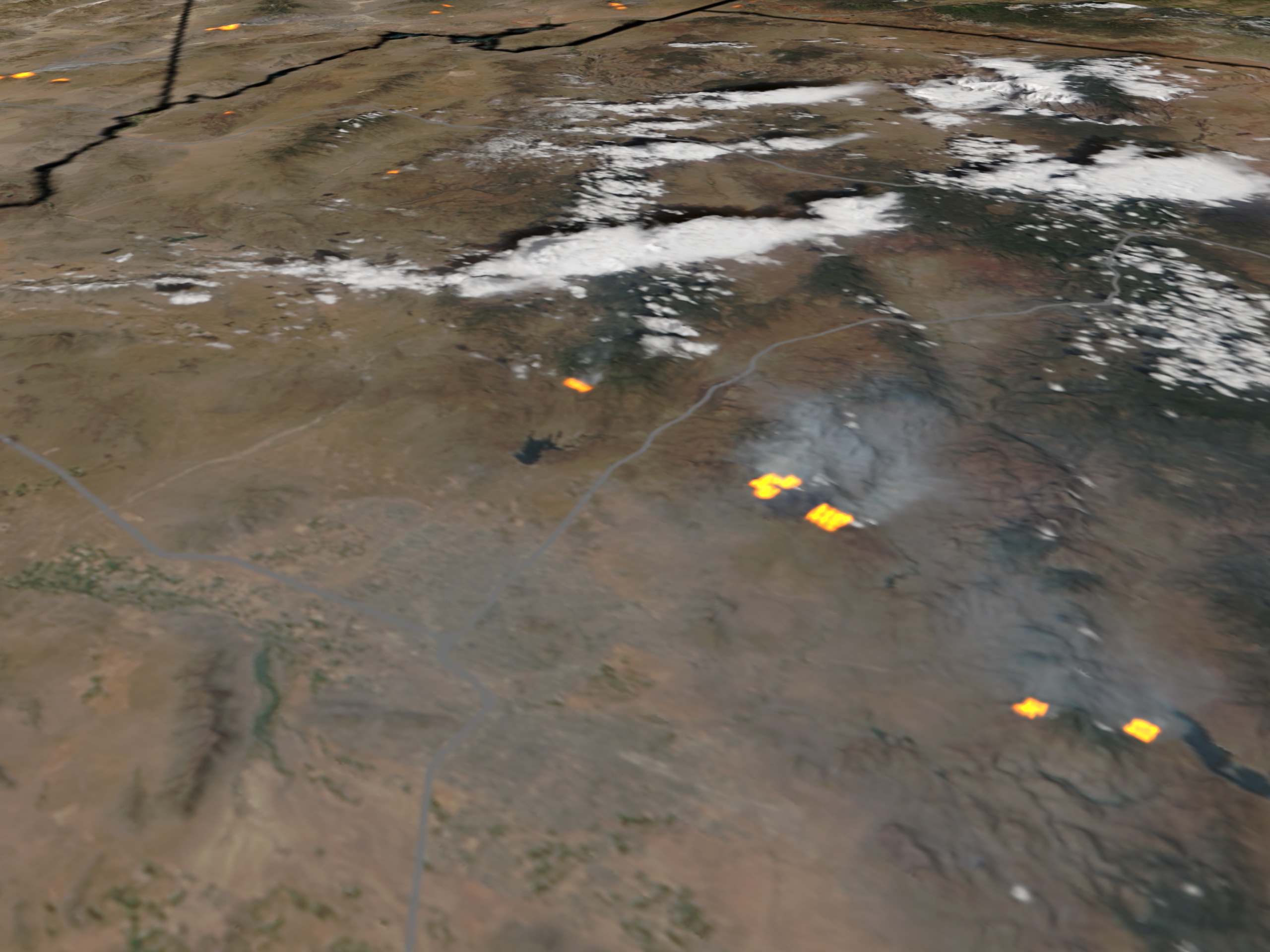
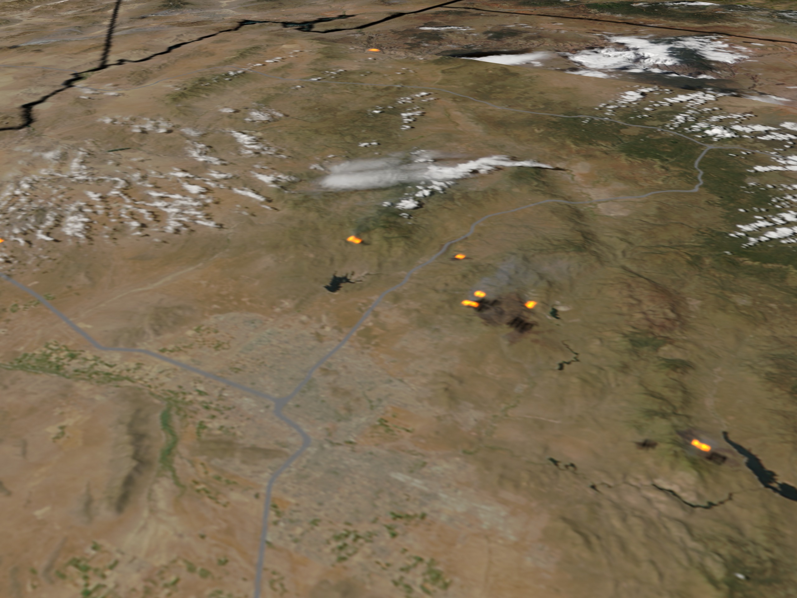
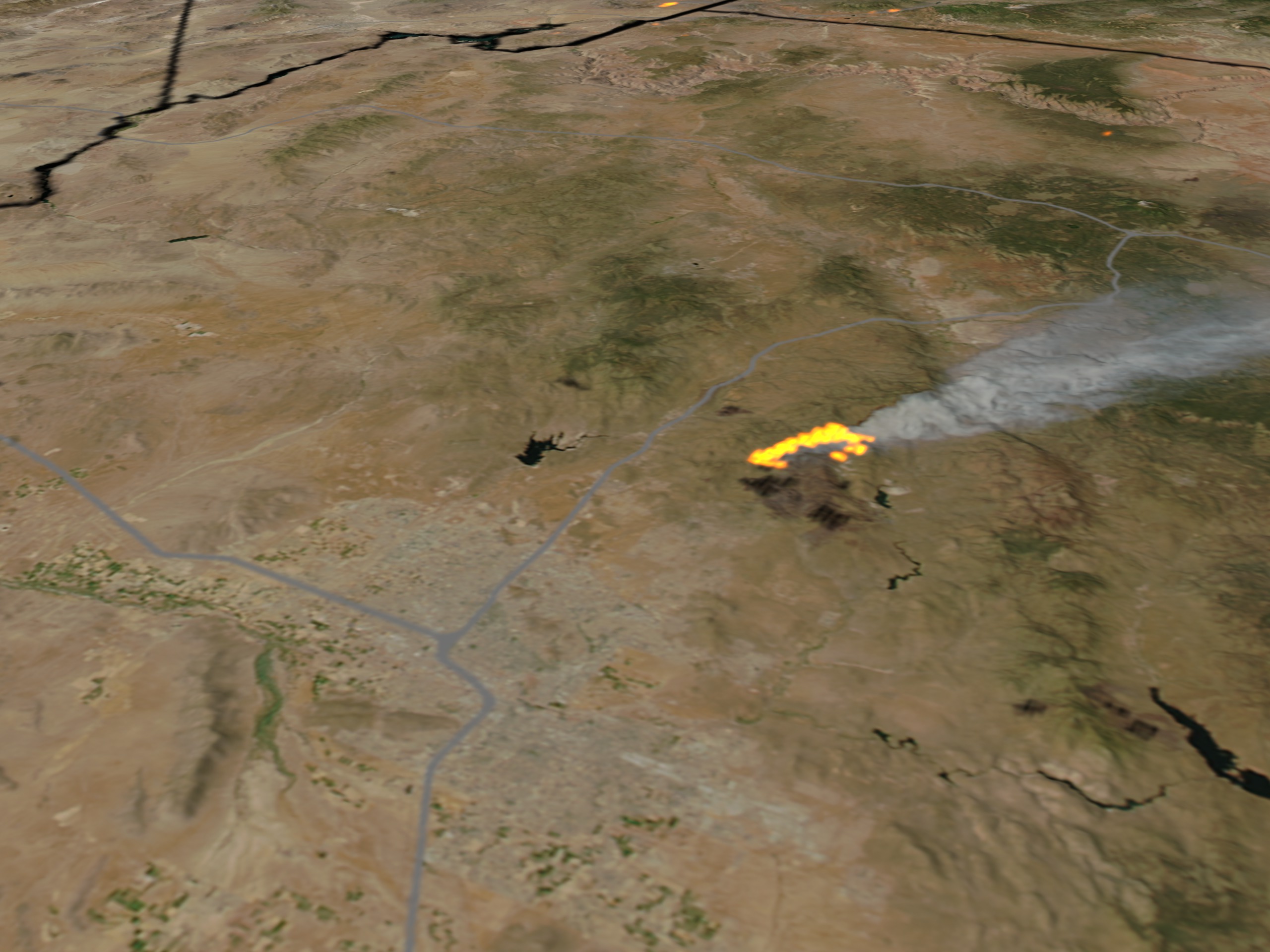


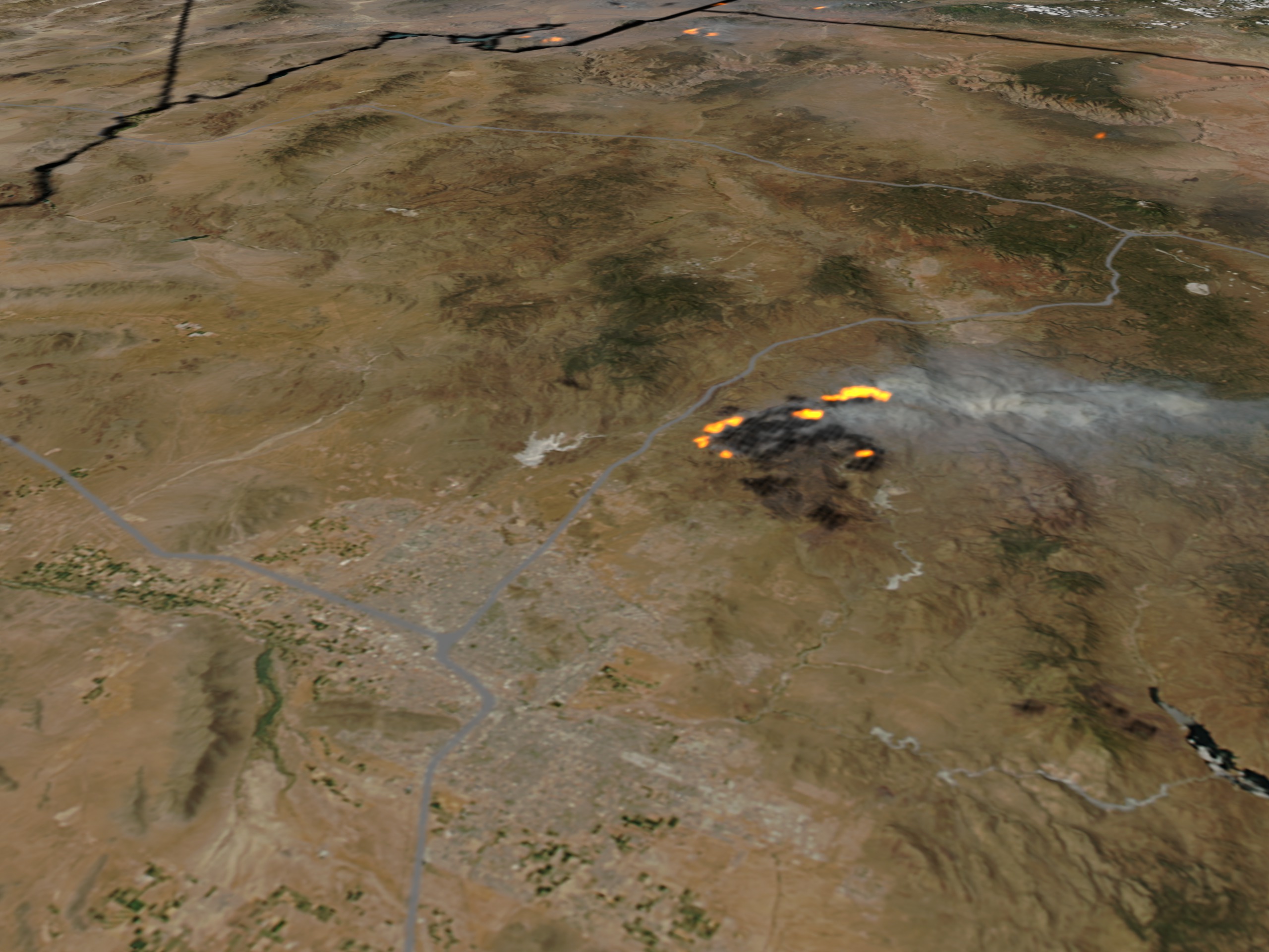
The Cave Creek Complex Fire near Phoenix, Arizona
For More Information
Visualization Credits
Alex Kekesi (Global Science and Technology, Inc.): Lead Animator
Vincent Salomonson (NASA/GSFC): Scientist
Vincent Salomonson (NASA/GSFC): Scientist
Please give credit for this item to:
NASA/Goddard Space Flight Center Scientific Visualization Studio. Data provided by Jeff Schmaltz (SSAI, NASA/GSFC - Code 614.5)
NASA/Goddard Space Flight Center Scientific Visualization Studio. Data provided by Jeff Schmaltz (SSAI, NASA/GSFC - Code 614.5)
Short URL to share this page:
https://svs.gsfc.nasa.gov/3195
Mission:
Terra
Data Used:
Note: While we identify the data sets used in these visualizations, we do not store any further details nor the data sets themselves on our site.
This item is part of this series:
Arizona Fires
Keywords:
GCMD >> Earth Science >> Human Dimensions >> Natural Hazards >> Fires
NASA Science >> Earth
GCMD keywords can be found on the Internet with the following citation: Olsen, L.M., G. Major, K. Shein, J. Scialdone, S. Ritz, T. Stevens, M. Morahan, A. Aleman, R. Vogel, S. Leicester, H. Weir, M. Meaux, S. Grebas, C.Solomon, M. Holland, T. Northcutt, R. A. Restrepo, R. Bilodeau, 2013. NASA/Global Change Master Directory (GCMD) Earth Science Keywords. Version 8.0.0.0.0
https://svs.gsfc.nasa.gov/3195
Mission:
Terra
Data Used:
Aqua/MODIS/Fire Location
2005-06-26, 2005-06-28
Credit:
Fire location data courtesy of MODIS Rapid Response Project (NASA/GSFC and University of Maryland - http://rapidfire.sci.gsfc.nasa.gov)
Fire location data courtesy of MODIS Rapid Response Project (NASA/GSFC and University of Maryland - http://rapidfire.sci.gsfc.nasa.gov)
Terra and Aqua/MODIS/Fire Location
6/23/05, 6/24/05, 6/26/05, 6/28/05, 6/29/05, 6/30/05
Credit:
Fire location data courtesy of MODIS Rapid Response Project (NASA/GSFC and University of Maryland - http://rapidfire.sci.gsfc.nasa.gov)
Fire location data courtesy of MODIS Rapid Response Project (NASA/GSFC and University of Maryland - http://rapidfire.sci.gsfc.nasa.gov)
This item is part of this series:
Arizona Fires
Keywords:
GCMD >> Earth Science >> Human Dimensions >> Natural Hazards >> Fires
NASA Science >> Earth
GCMD keywords can be found on the Internet with the following citation: Olsen, L.M., G. Major, K. Shein, J. Scialdone, S. Ritz, T. Stevens, M. Morahan, A. Aleman, R. Vogel, S. Leicester, H. Weir, M. Meaux, S. Grebas, C.Solomon, M. Holland, T. Northcutt, R. A. Restrepo, R. Bilodeau, 2013. NASA/Global Change Master Directory (GCMD) Earth Science Keywords. Version 8.0.0.0.0


