Earth
ID: 3116
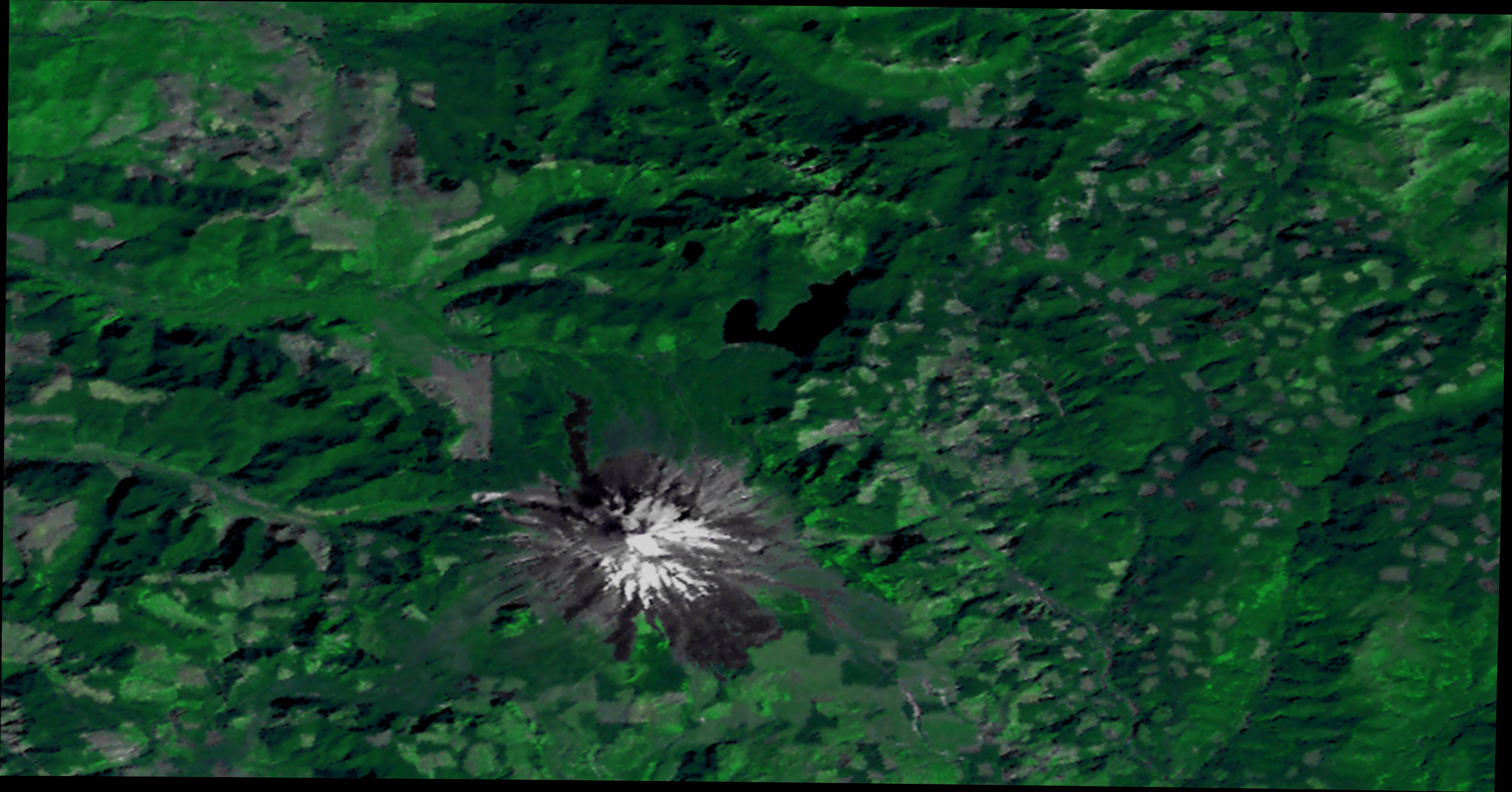
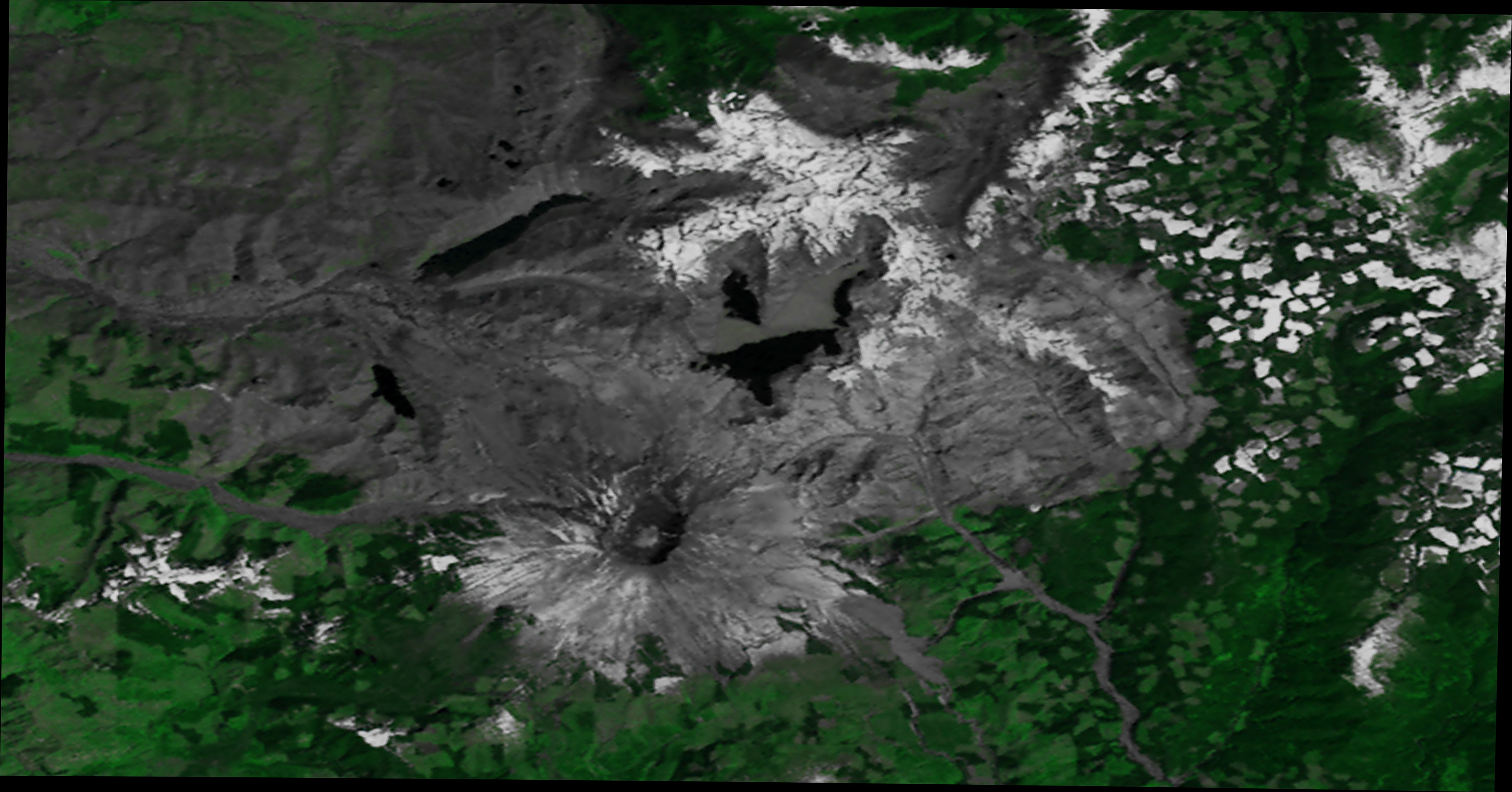
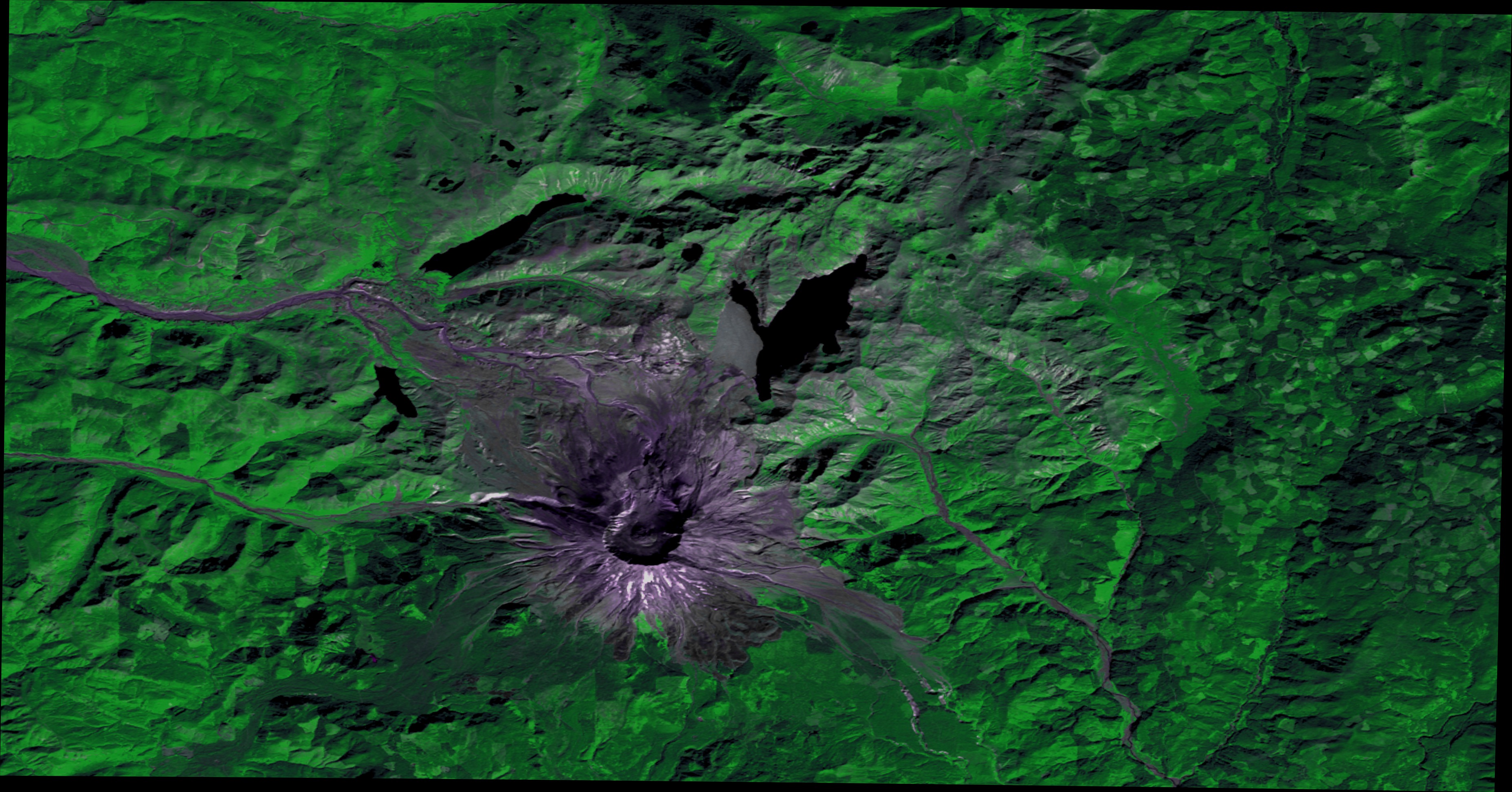
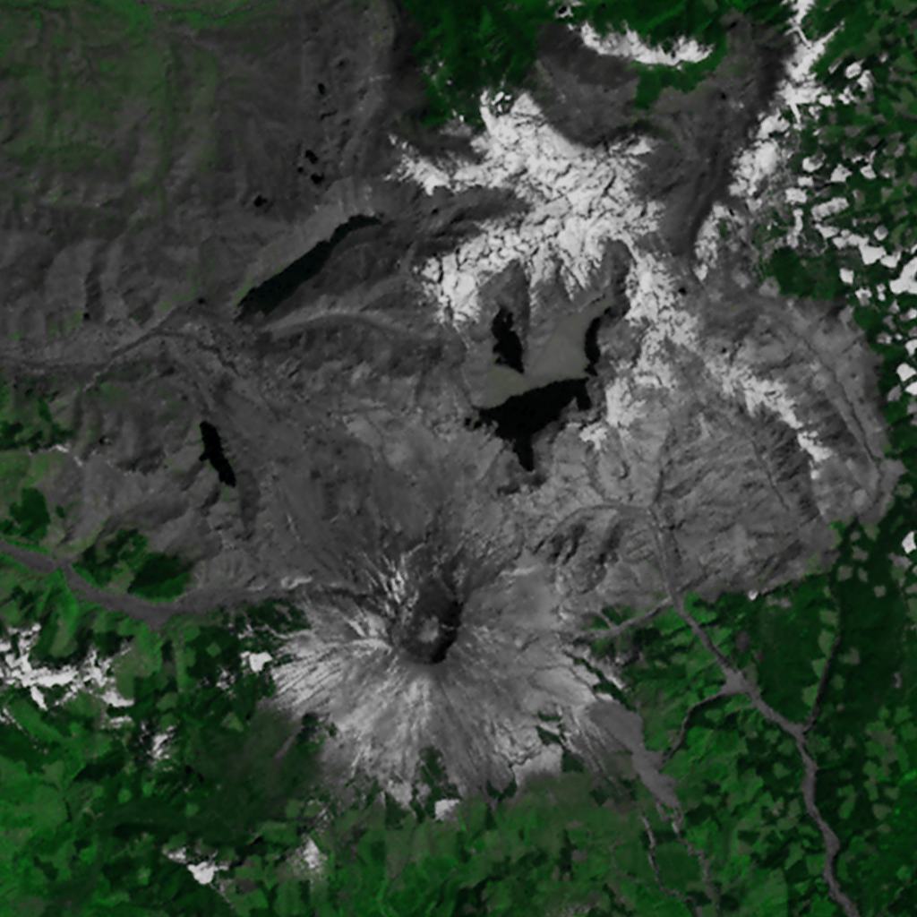
Mount St. Helens erupted on May 18, 1980, devastating more than 150 square miles of forest in southwestern Washington state. This animation shows Landsat images of the Mount St. Helens area in 1973, 1983, and 2000, illustrating the destruction and regrowth of the forest. The 1983 image clearly shows the new crater on the northern slope where the eruption occurred, the rivers and lakes covered with ash, and the regions of deforestation. The 2000 image, taken twenty years after the eruption, still shows the changed crater, but much of the devastated area is covered by new vegetation growth.
Mount St. Helens Before, During, and After (WMS)
For More Information
Visualization Credits
Stuart A. Snodgrass (GST): Lead Animator
Horace Mitchell (NASA/GSFC): Animator
Marte Newcombe (GST): Animator
Darrel Williams (NASA/GSFC): Scientist
Horace Mitchell (NASA/GSFC): Animator
Marte Newcombe (GST): Animator
Darrel Williams (NASA/GSFC): Scientist
Please give credit for this item to:
NASA/Goddard Space Flight Center Scientific Visualization Studio
NASA/Goddard Space Flight Center Scientific Visualization Studio
Short URL to share this page:
https://svs.gsfc.nasa.gov/3116
Mission:
Landsat
Data Used:
Note: While we identify the data sets used in these visualizations, we do not store any further details nor the data sets themselves on our site.
This item is part of this series:
WMS
Keywords:
DLESE >> Forestry
DLESE >> Geology
SVS >> HDTV
DLESE >> Natural hazards
GCMD >> Earth Science >> Biosphere >> Terrestrial Ecosystems >> Forests
GCMD >> Earth Science >> Human Dimensions >> Habitat Conversion/Fragmentation >> Deforestation
GCMD >> Earth Science >> Solid Earth >> Volcanoes >> Volcanic Ash/Dust
SVS >> Hyperwall
NASA Science >> Earth
GCMD keywords can be found on the Internet with the following citation: Olsen, L.M., G. Major, K. Shein, J. Scialdone, S. Ritz, T. Stevens, M. Morahan, A. Aleman, R. Vogel, S. Leicester, H. Weir, M. Meaux, S. Grebas, C.Solomon, M. Holland, T. Northcutt, R. A. Restrepo, R. Bilodeau, 2013. NASA/Global Change Master Directory (GCMD) Earth Science Keywords. Version 8.0.0.0.0
https://svs.gsfc.nasa.gov/3116
Mission:
Landsat
Data Used:
Landsat-1/MSS
1973/09/15Landsat-4/MSS
1983/05/22Landsat-7/ETM+
2000/09/25This item is part of this series:
WMS
Keywords:
DLESE >> Forestry
DLESE >> Geology
SVS >> HDTV
DLESE >> Natural hazards
GCMD >> Earth Science >> Biosphere >> Terrestrial Ecosystems >> Forests
GCMD >> Earth Science >> Human Dimensions >> Habitat Conversion/Fragmentation >> Deforestation
GCMD >> Earth Science >> Solid Earth >> Volcanoes >> Volcanic Ash/Dust
SVS >> Hyperwall
NASA Science >> Earth
GCMD keywords can be found on the Internet with the following citation: Olsen, L.M., G. Major, K. Shein, J. Scialdone, S. Ritz, T. Stevens, M. Morahan, A. Aleman, R. Vogel, S. Leicester, H. Weir, M. Meaux, S. Grebas, C.Solomon, M. Holland, T. Northcutt, R. A. Restrepo, R. Bilodeau, 2013. NASA/Global Change Master Directory (GCMD) Earth Science Keywords. Version 8.0.0.0.0


