Earth
ID: 3029
The WMS Global Mosaic data set was developed at NASA's Jet Propulsion Laboratory (JPL). This global mosaic was produced from visual and near infrared bands taken by the Landsat-7 satellite. Using the panchromatic band to sharpen the final image, a final resolution of 0.5 arc seconds (about 15 meters) can be achieved. This mosaic is available through the Web Mapping Services (WMS) protocol at JPL. This series of images was obtained using a software program called the Digital Earth PC which can use the WMS protocol to obtain images covering an arbitrary region of the earth. These images can be arranged in such a way with the Digital Earth PC software that a nearly continuous zoom effect can be achieved.
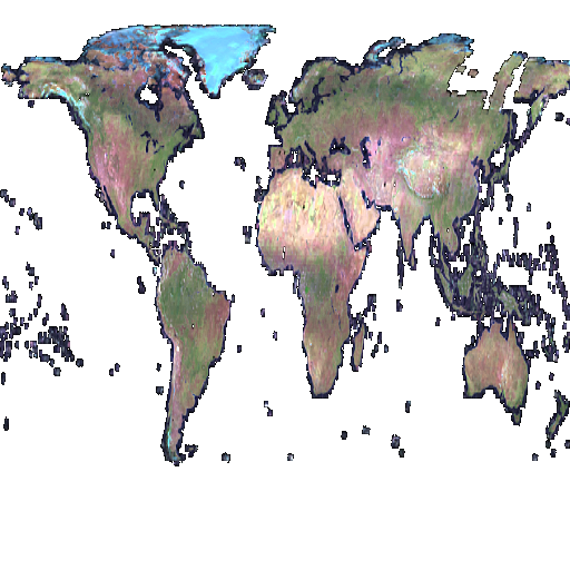
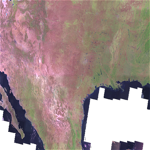
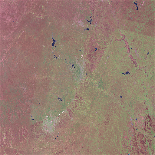
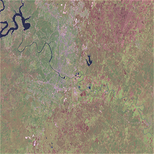
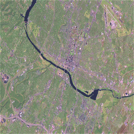
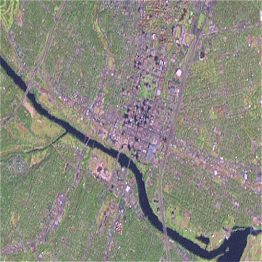
Zoom into Austin, Texas, using Landsat Imagery (WMS)
Visualization Credits
Please give credit for this item to:
NASA/Goddard Space Flight Center Scientific Visualization Studio
NASA/Goddard Space Flight Center Scientific Visualization Studio
Short URL to share this page:
https://svs.gsfc.nasa.gov/3029
Mission:
Landsat
Data Used:
Note: While we identify the data sets used in these visualizations, we do not store any further details nor the data sets themselves on our site.
This item is part of this series:
WMS
Keywords:
SVS >> Landsat
DLESE >> Physical geography
SVS >> Zoom
GCMD >> Earth Science >> Spectral/Engineering >> Visible Wavelengths >> Visible Imagery
SVS >> For Educators
SVS >> Location >> Texas >> Austin
NASA Science >> Earth
GCMD keywords can be found on the Internet with the following citation: Olsen, L.M., G. Major, K. Shein, J. Scialdone, S. Ritz, T. Stevens, M. Morahan, A. Aleman, R. Vogel, S. Leicester, H. Weir, M. Meaux, S. Grebas, C.Solomon, M. Holland, T. Northcutt, R. A. Restrepo, R. Bilodeau, 2013. NASA/Global Change Master Directory (GCMD) Earth Science Keywords. Version 8.0.0.0.0
https://svs.gsfc.nasa.gov/3029
Mission:
Landsat
Data Used:
Landsat-7/ETM+/WMS Global Mosaic, Release 2
Release 2 of the WMS Global Mosaic, a seamless mosaic of Landsat-7 scenes.
This item is part of this series:
WMS
Keywords:
SVS >> Landsat
DLESE >> Physical geography
SVS >> Zoom
GCMD >> Earth Science >> Spectral/Engineering >> Visible Wavelengths >> Visible Imagery
SVS >> For Educators
SVS >> Location >> Texas >> Austin
NASA Science >> Earth
GCMD keywords can be found on the Internet with the following citation: Olsen, L.M., G. Major, K. Shein, J. Scialdone, S. Ritz, T. Stevens, M. Morahan, A. Aleman, R. Vogel, S. Leicester, H. Weir, M. Meaux, S. Grebas, C.Solomon, M. Holland, T. Northcutt, R. A. Restrepo, R. Bilodeau, 2013. NASA/Global Change Master Directory (GCMD) Earth Science Keywords. Version 8.0.0.0.0


