Earth
ID: 2951
The MODIS instrument onboard NASA's Aqua and Terra satellites captured this sequence of true-color images of Super Typhoon Nida churning through the Philippine Islands. Packing winds up tof 100 mph and gusts of 122 mph, and caused floods and landslides. Nida has been responsible for at least six deaths in the Philippines and has displaced thousands as it skirted the eastern part of the country before moving towards southern Japan.
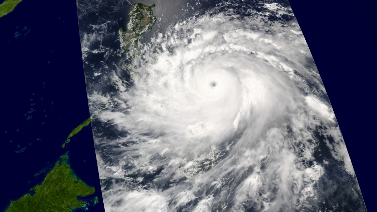
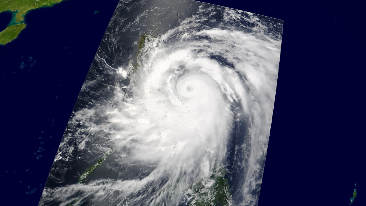
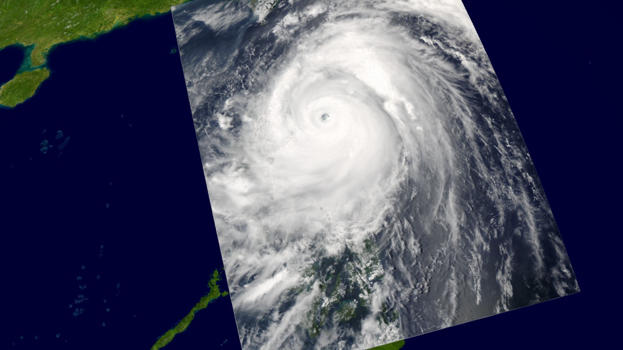
Super Typhoon Nida
Visualization Credits
Please give credit for this item to:
NASA/Goddard Space Flight Center Scientific Visualization Studio
NASA/Goddard Space Flight Center Scientific Visualization Studio
Short URL to share this page:
https://svs.gsfc.nasa.gov/2951
Mission:
Terra
Data Used:
Note: While we identify the data sets used in these visualizations, we do not store any further details nor the data sets themselves on our site.
Keywords:
DLESE >> Atmospheric science
SVS >> HDTV
DLESE >> Natural hazards
GCMD >> Earth Science >> Atmosphere >> Atmospheric Phenomena >> Typhoons
GCMD >> Location >> Philippines
SVS >> Typhoon Nida
NASA Science >> Earth
GCMD keywords can be found on the Internet with the following citation: Olsen, L.M., G. Major, K. Shein, J. Scialdone, S. Ritz, T. Stevens, M. Morahan, A. Aleman, R. Vogel, S. Leicester, H. Weir, M. Meaux, S. Grebas, C.Solomon, M. Holland, T. Northcutt, R. A. Restrepo, R. Bilodeau, 2013. NASA/Global Change Master Directory (GCMD) Earth Science Keywords. Version 8.0.0.0.0
https://svs.gsfc.nasa.gov/2951
Mission:
Terra
Data Used:
Aqua/MODIS
2004/05/16 - 2004/05/18Terra/MODIS
2004/05/16 - 2004/05/18Keywords:
DLESE >> Atmospheric science
SVS >> HDTV
DLESE >> Natural hazards
GCMD >> Earth Science >> Atmosphere >> Atmospheric Phenomena >> Typhoons
GCMD >> Location >> Philippines
SVS >> Typhoon Nida
NASA Science >> Earth
GCMD keywords can be found on the Internet with the following citation: Olsen, L.M., G. Major, K. Shein, J. Scialdone, S. Ritz, T. Stevens, M. Morahan, A. Aleman, R. Vogel, S. Leicester, H. Weir, M. Meaux, S. Grebas, C.Solomon, M. Holland, T. Northcutt, R. A. Restrepo, R. Bilodeau, 2013. NASA/Global Change Master Directory (GCMD) Earth Science Keywords. Version 8.0.0.0.0


