Earth
ID: 2800
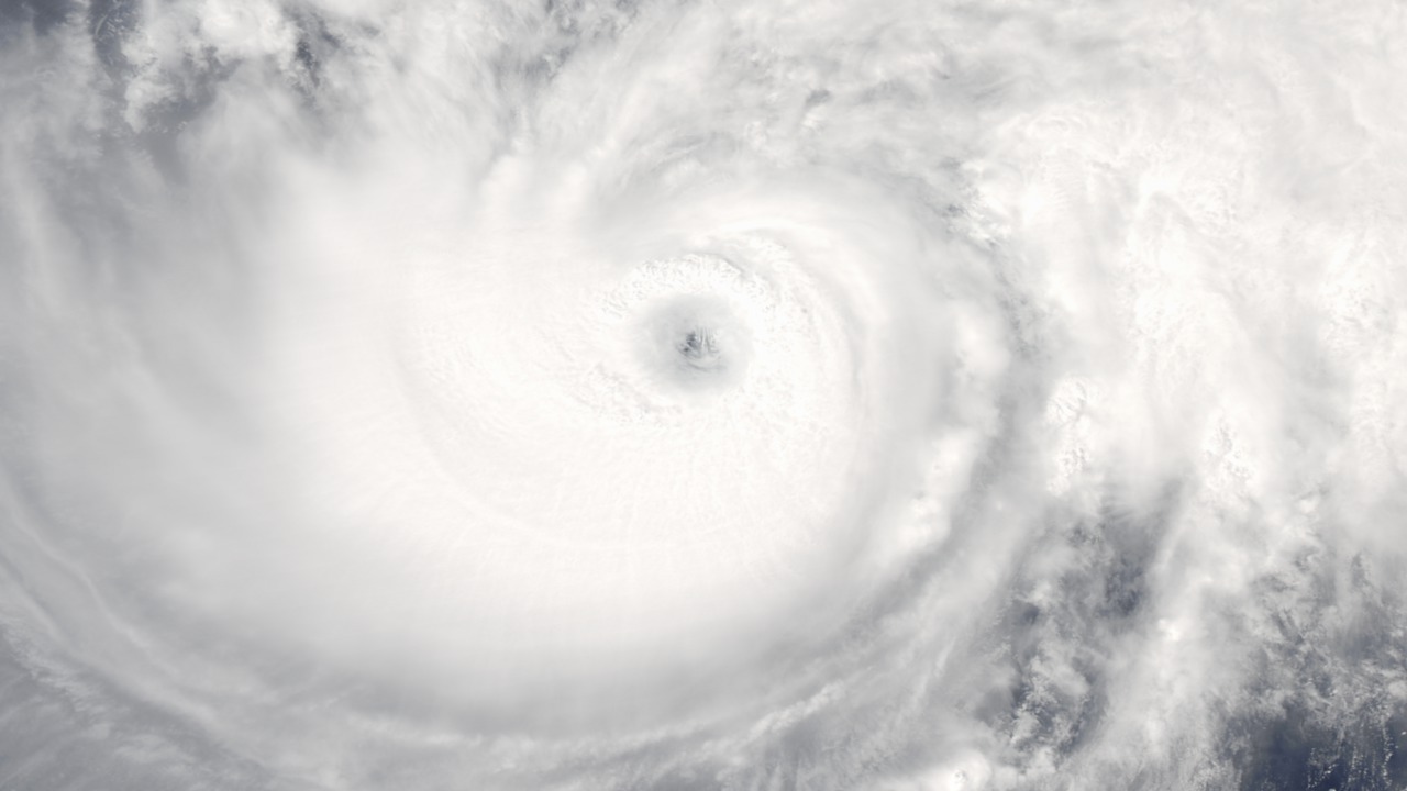
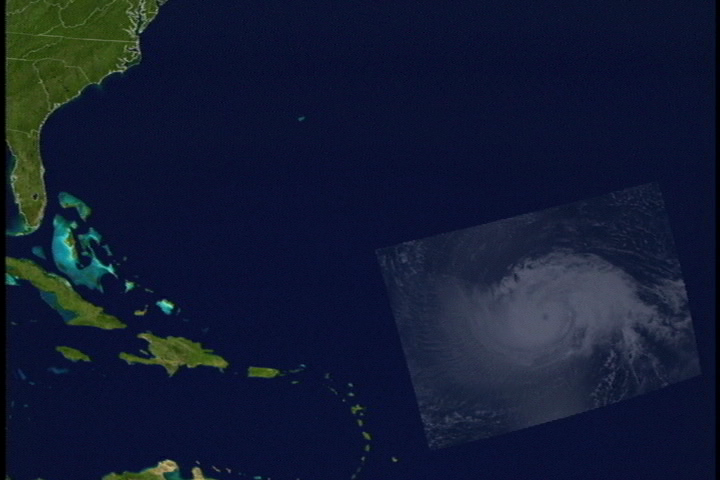
Captured by Aqua's MODIS instrument on September 10, 2003, the (category 4) hurricane heads west towards the U.S. Isabel's maximum wind cuts are at least 135 mph. The thin cirrus clouds indicate that outflow is on the western side and expanding to the West.
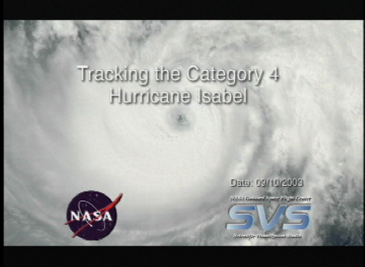
Tracking the Category 4 Hurricane Isabel, September 10, 2003
Visualization Credits
Please give credit for this item to:
NASA/Goddard Space Flight Center Scientific Visualization Studio, MODIS Rapid Response Team, NASA Goddard Space Flight Center (http://rapidfire.sci.gsfc.nasa.gov)
NASA/Goddard Space Flight Center Scientific Visualization Studio, MODIS Rapid Response Team, NASA Goddard Space Flight Center (http://rapidfire.sci.gsfc.nasa.gov)
Short URL to share this page:
https://svs.gsfc.nasa.gov/2800
Data Used:
Note: While we identify the data sets used in these visualizations, we do not store any further details nor the data sets themselves on our site.
This item is part of this series:
Hurricanes
Keywords:
DLESE >> Atmospheric science
SVS >> Isabel
DLESE >> Natural hazards
GCMD >> Earth Science >> Atmosphere >> Atmospheric Phenomena >> Hurricanes
NASA Science >> Earth
GCMD keywords can be found on the Internet with the following citation: Olsen, L.M., G. Major, K. Shein, J. Scialdone, S. Ritz, T. Stevens, M. Morahan, A. Aleman, R. Vogel, S. Leicester, H. Weir, M. Meaux, S. Grebas, C.Solomon, M. Holland, T. Northcutt, R. A. Restrepo, R. Bilodeau, 2013. NASA/Global Change Master Directory (GCMD) Earth Science Keywords. Version 8.0.0.0.0
https://svs.gsfc.nasa.gov/2800
Data Used:
Aqua/MODIS
2003/09/10This item is part of this series:
Hurricanes
Keywords:
DLESE >> Atmospheric science
SVS >> Isabel
DLESE >> Natural hazards
GCMD >> Earth Science >> Atmosphere >> Atmospheric Phenomena >> Hurricanes
NASA Science >> Earth
GCMD keywords can be found on the Internet with the following citation: Olsen, L.M., G. Major, K. Shein, J. Scialdone, S. Ritz, T. Stevens, M. Morahan, A. Aleman, R. Vogel, S. Leicester, H. Weir, M. Meaux, S. Grebas, C.Solomon, M. Holland, T. Northcutt, R. A. Restrepo, R. Bilodeau, 2013. NASA/Global Change Master Directory (GCMD) Earth Science Keywords. Version 8.0.0.0.0


