Earth
ID: 2792
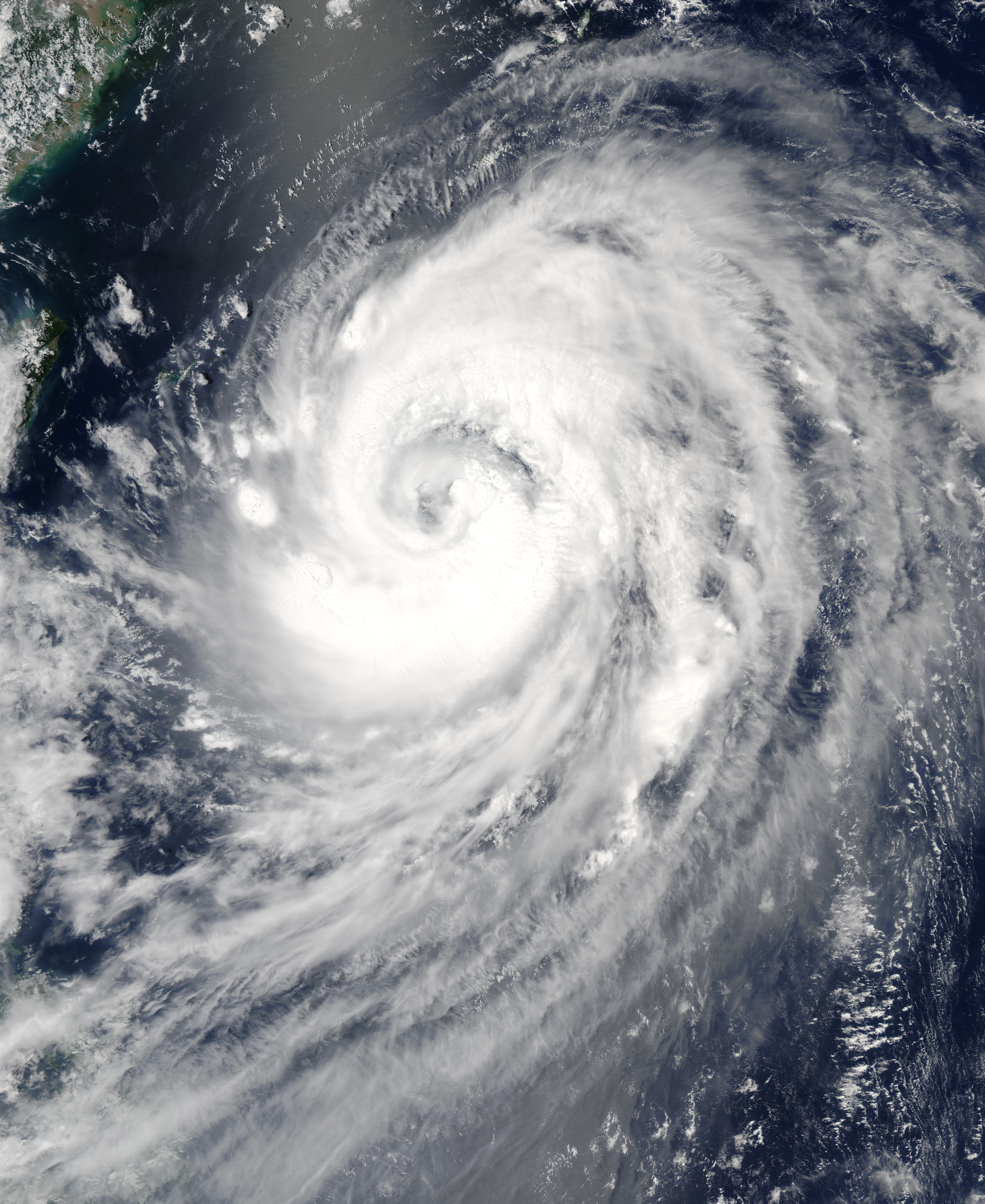
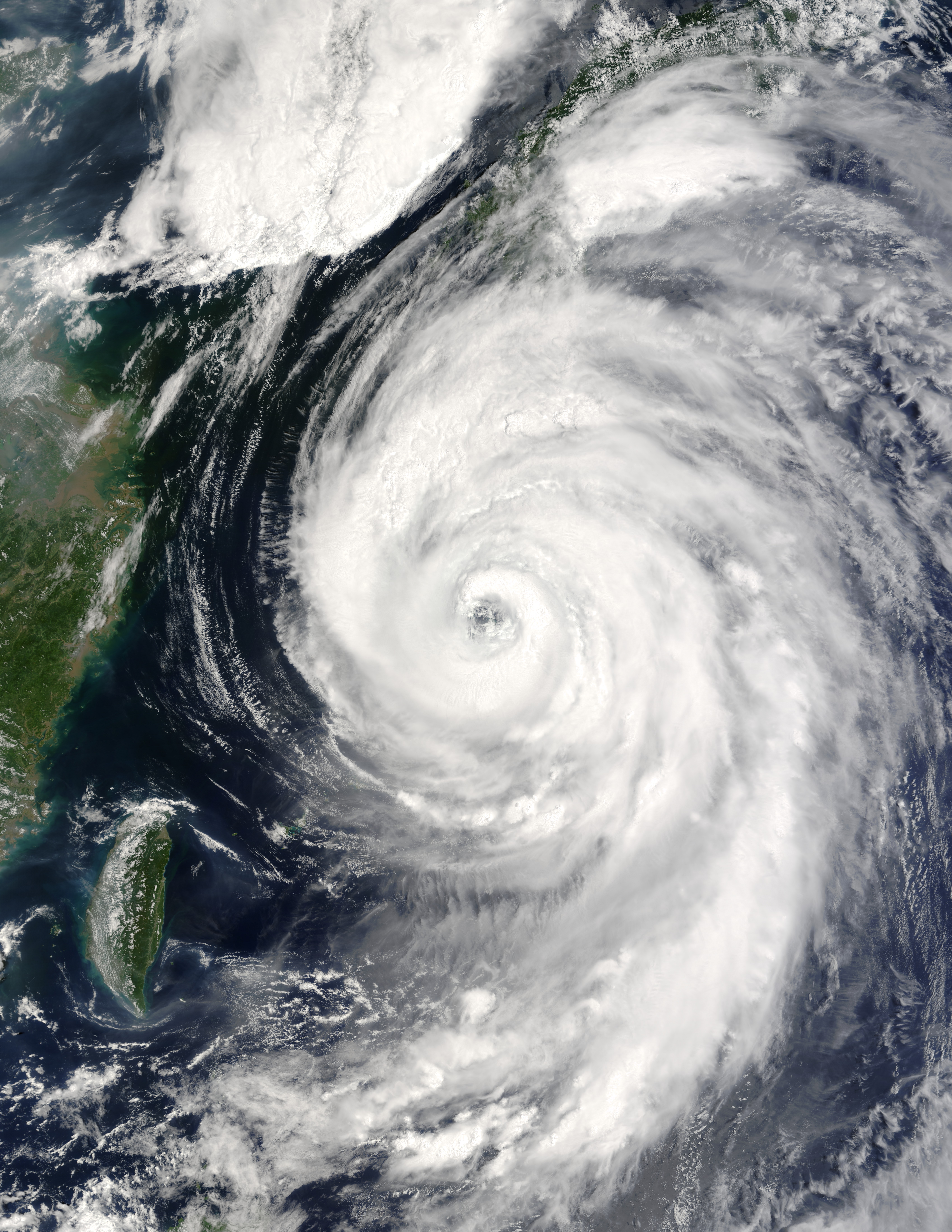
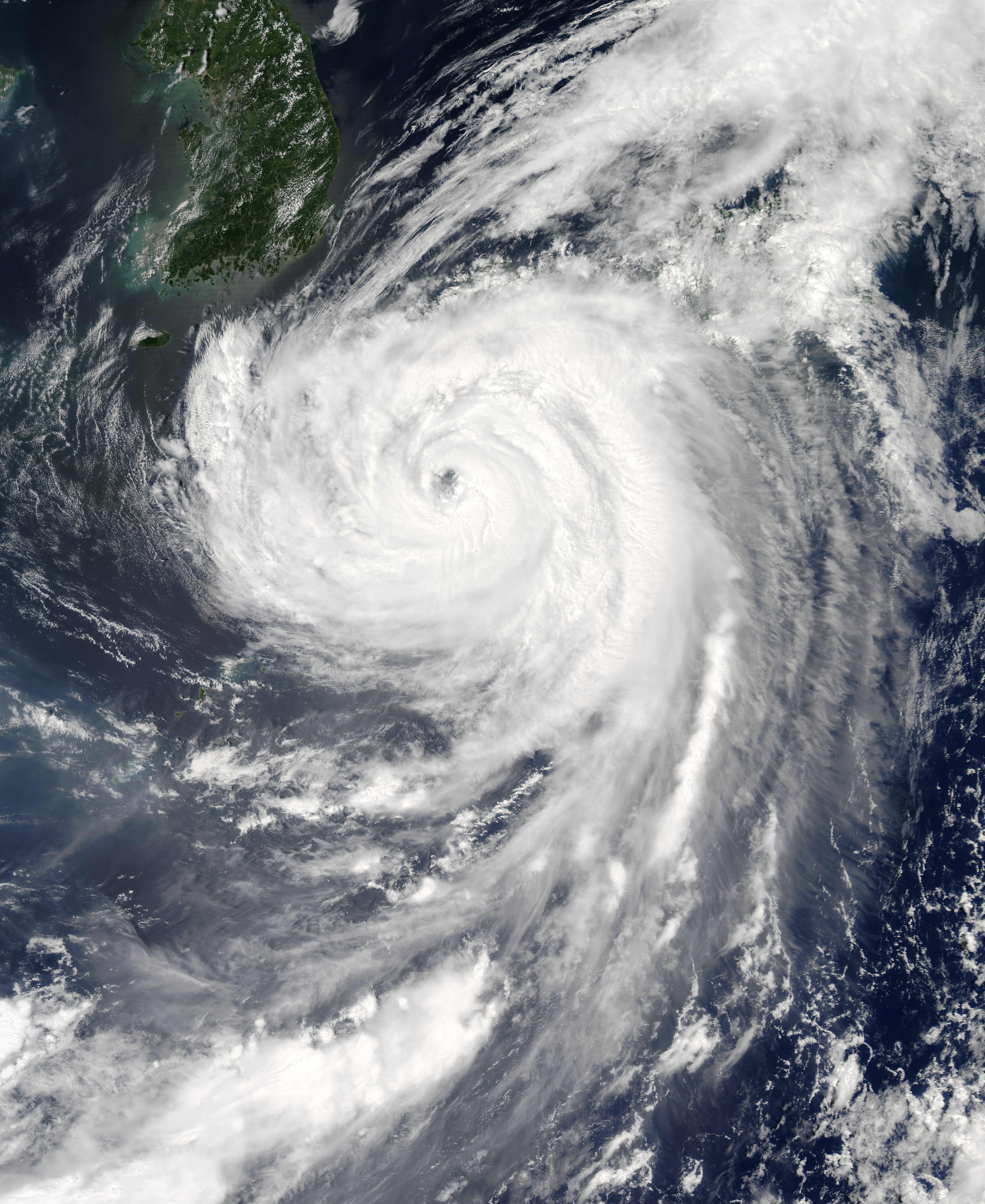
The MODIS instrument onboard NASA's Terra spacecraft captured this birds-eye view of Typhoon Etau as it was buffeting the southern island chain of Okinawa, affecting airlines, a refinery and other industries.


Typhoon Etau


Visualization Credits
Please give credit for this item to:
NASA/Goddard Space Flight Center Scientific Visualization Studio,MODIS Rapid Response Team, NASA Goddard Space Flight Center ((http://rapidfire.sci.gsfc.nasa.gov))
NASA/Goddard Space Flight Center Scientific Visualization Studio,MODIS Rapid Response Team, NASA Goddard Space Flight Center ((http://rapidfire.sci.gsfc.nasa.gov))
Short URL to share this page:
https://svs.gsfc.nasa.gov/2792
Mission:
Terra
Data Used:
Note: While we identify the data sets used in these visualizations, we do not store any further details nor the data sets themselves on our site.
This item is part of this series:
Hurricanes
Keywords:
DLESE >> Natural hazards
GCMD >> Earth Science >> Atmosphere >> Atmospheric Phenomena >> Typhoons
GCMD >> Location >> Japan
NASA Science >> Earth
GCMD keywords can be found on the Internet with the following citation: Olsen, L.M., G. Major, K. Shein, J. Scialdone, S. Ritz, T. Stevens, M. Morahan, A. Aleman, R. Vogel, S. Leicester, H. Weir, M. Meaux, S. Grebas, C.Solomon, M. Holland, T. Northcutt, R. A. Restrepo, R. Bilodeau, 2013. NASA/Global Change Master Directory (GCMD) Earth Science Keywords. Version 8.0.0.0.0
https://svs.gsfc.nasa.gov/2792
Mission:
Terra
Data Used:
Aqua/MODIS
2003/08/06, 2003/08/07, 2003/08/08Terra/MODIS
2003/08/06, 2003/08/07, 2003/08/08This item is part of this series:
Hurricanes
Keywords:
DLESE >> Natural hazards
GCMD >> Earth Science >> Atmosphere >> Atmospheric Phenomena >> Typhoons
GCMD >> Location >> Japan
NASA Science >> Earth
GCMD keywords can be found on the Internet with the following citation: Olsen, L.M., G. Major, K. Shein, J. Scialdone, S. Ritz, T. Stevens, M. Morahan, A. Aleman, R. Vogel, S. Leicester, H. Weir, M. Meaux, S. Grebas, C.Solomon, M. Holland, T. Northcutt, R. A. Restrepo, R. Bilodeau, 2013. NASA/Global Change Master Directory (GCMD) Earth Science Keywords. Version 8.0.0.0.0


