Earth
ID: 2791
This animation contains a time series of print resolution still images showing the progression of the Biscuit fire with smoke plumes in Oregon during 2002. Fire locations are represented as particles that change color as the fire ages. The Biscuit fire burned 500,000 acres of forest in Oregon and Northern California during the summer and fall of 2002.
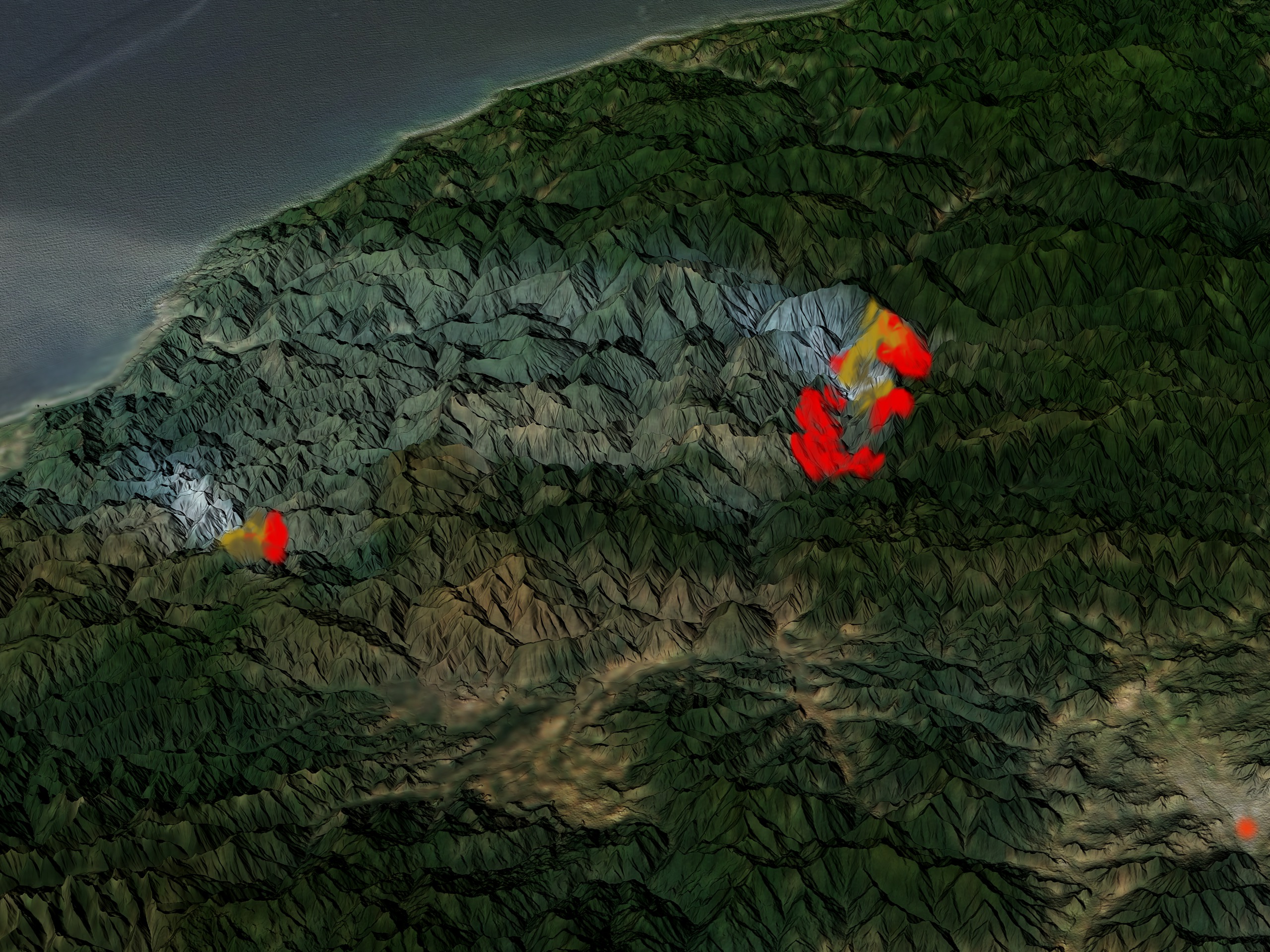
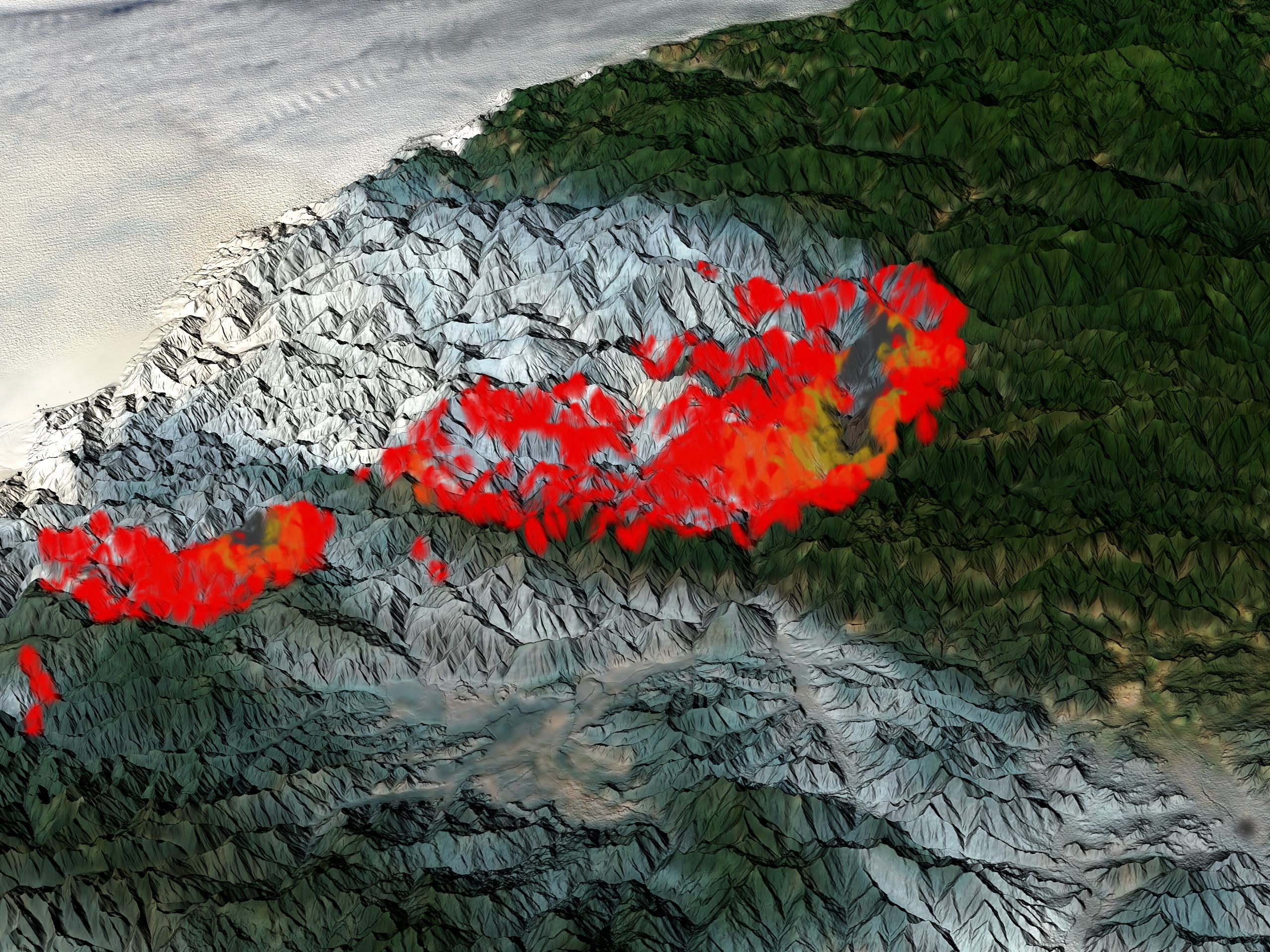
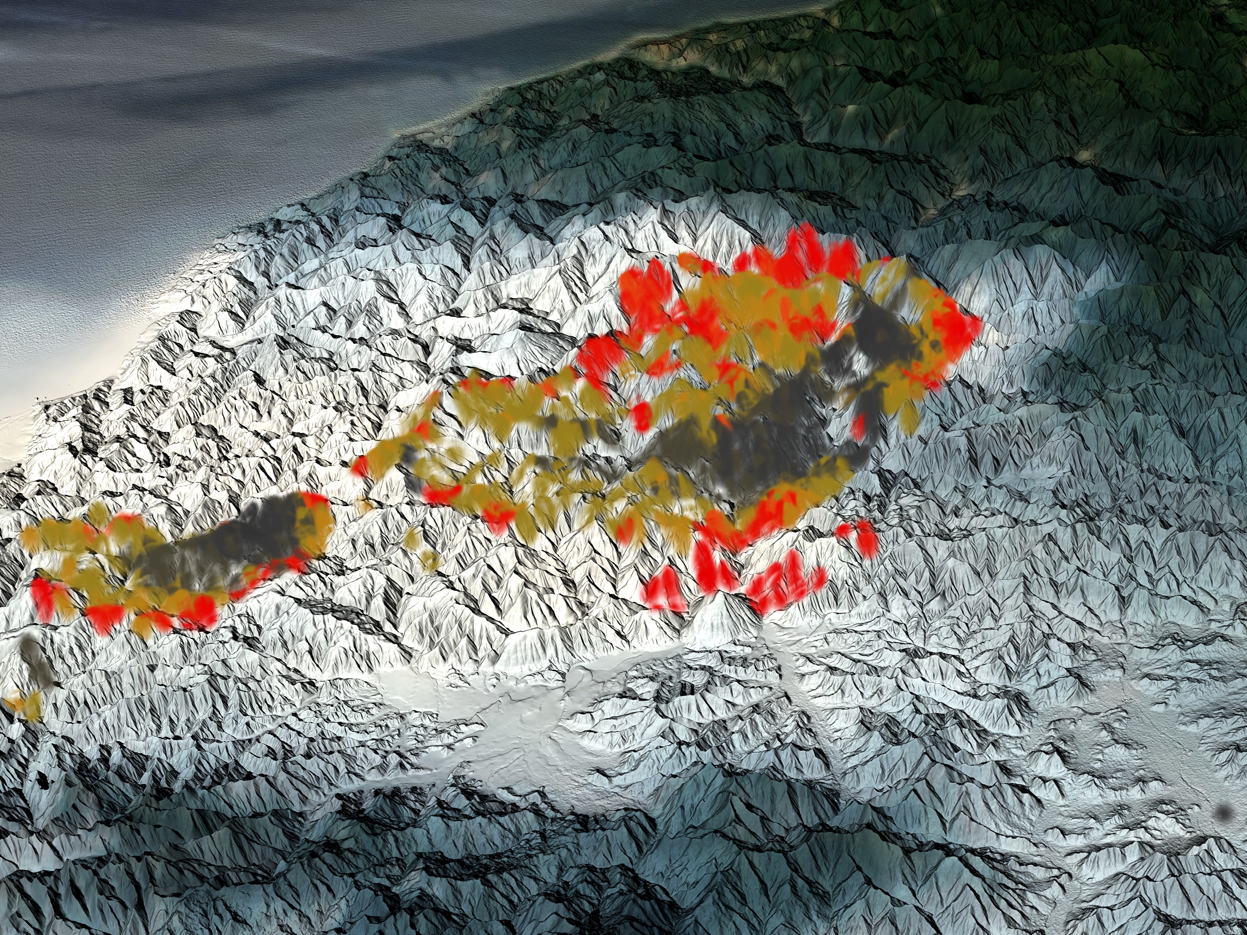
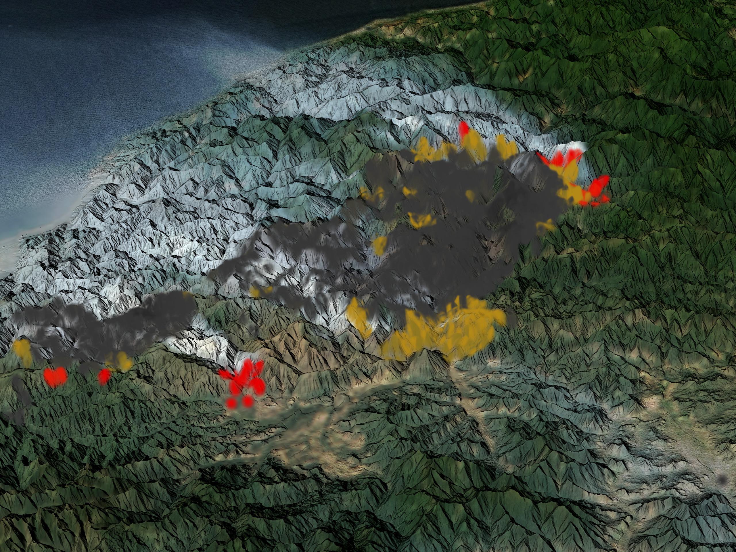

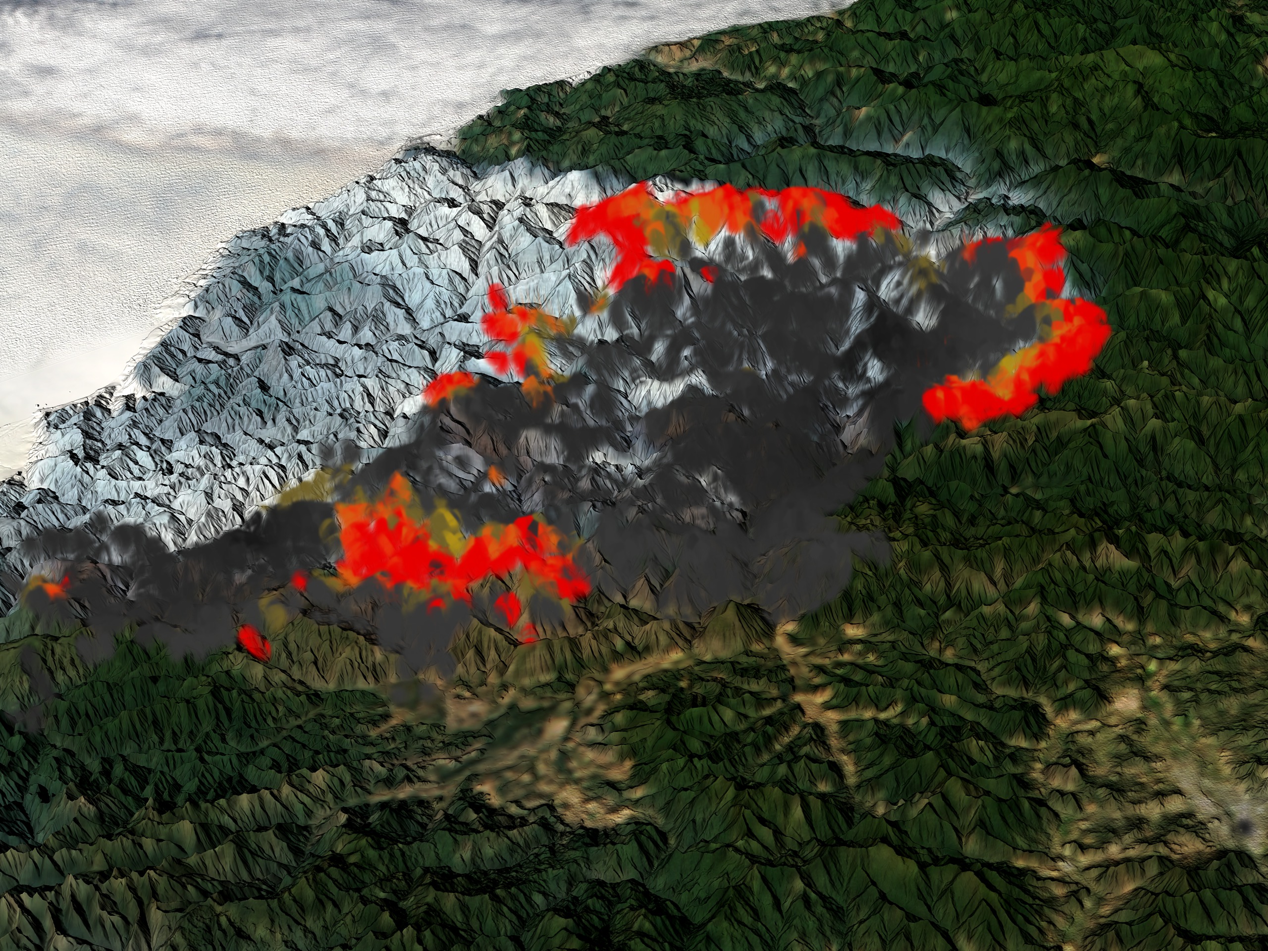
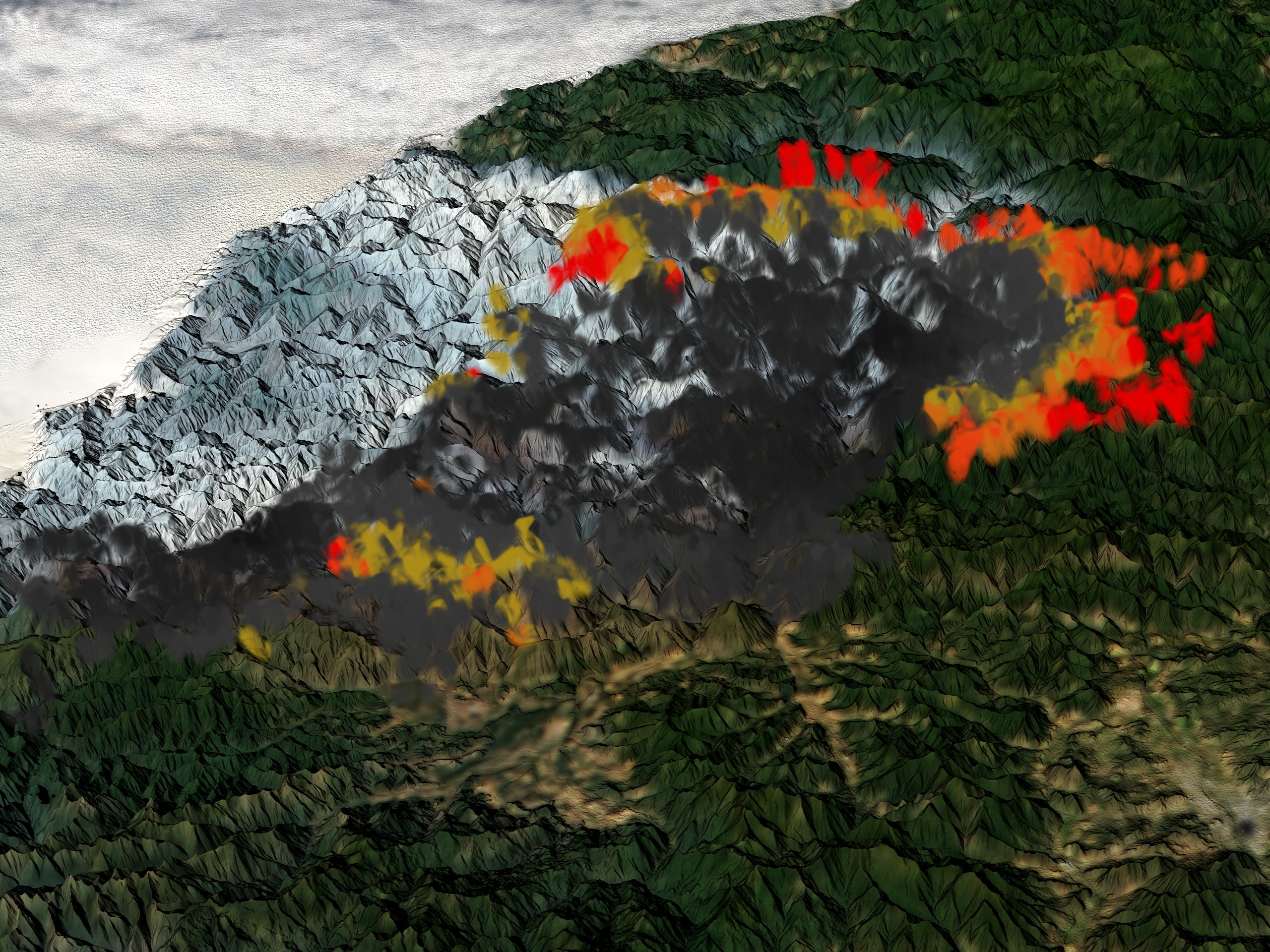
Time Series of the Biscuit Fire with Smoke
Visualization Credits
Cindy Starr (Global Science and Technology, Inc.): Lead Visualizer
Robert Sohlberg (University of Maryland): Scientist
Chris Justice (University of Maryland): Scientist
William C. North (NASA/GSFC): Scientist
Fred J. Gunther (CSC): Scientist
Robert Sohlberg (University of Maryland): Scientist
Chris Justice (University of Maryland): Scientist
William C. North (NASA/GSFC): Scientist
Fred J. Gunther (CSC): Scientist
Please give credit for this item to:
NASA/Goddard Space Flight Center Scientific Visualization Studio,MODIS Rapid Response Team, NASA Goddard Space Flight Center (http://rapidfire.sci.gsfc.nasa.gov)
NASA/Goddard Space Flight Center Scientific Visualization Studio,MODIS Rapid Response Team, NASA Goddard Space Flight Center (http://rapidfire.sci.gsfc.nasa.gov)
Short URL to share this page:
https://svs.gsfc.nasa.gov/2791
Mission:
Terra
Data Used:
Note: While we identify the data sets used in these visualizations, we do not store any further details nor the data sets themselves on our site.
Keywords:
DLESE >> Atmospheric science
SVS >> Biscuit
DLESE >> Forestry
DLESE >> Natural hazards
GCMD >> Earth Science >> Biosphere >> Ecological Dynamics >> Fire Occurrence
NASA Science >> Earth
GCMD keywords can be found on the Internet with the following citation: Olsen, L.M., G. Major, K. Shein, J. Scialdone, S. Ritz, T. Stevens, M. Morahan, A. Aleman, R. Vogel, S. Leicester, H. Weir, M. Meaux, S. Grebas, C.Solomon, M. Holland, T. Northcutt, R. A. Restrepo, R. Bilodeau, 2013. NASA/Global Change Master Directory (GCMD) Earth Science Keywords. Version 8.0.0.0.0
https://svs.gsfc.nasa.gov/2791
Mission:
Terra
Data Used:
Terra and Aqua/MODIS/Fire Location
Credit:
Fire location data courtesy of MODIS Rapid Response Project (NASA/GSFC and University of Maryland - http://rapidfire.sci.gsfc.nasa.gov)
Fire location data courtesy of MODIS Rapid Response Project (NASA/GSFC and University of Maryland - http://rapidfire.sci.gsfc.nasa.gov)
Keywords:
DLESE >> Atmospheric science
SVS >> Biscuit
DLESE >> Forestry
DLESE >> Natural hazards
GCMD >> Earth Science >> Biosphere >> Ecological Dynamics >> Fire Occurrence
NASA Science >> Earth
GCMD keywords can be found on the Internet with the following citation: Olsen, L.M., G. Major, K. Shein, J. Scialdone, S. Ritz, T. Stevens, M. Morahan, A. Aleman, R. Vogel, S. Leicester, H. Weir, M. Meaux, S. Grebas, C.Solomon, M. Holland, T. Northcutt, R. A. Restrepo, R. Bilodeau, 2013. NASA/Global Change Master Directory (GCMD) Earth Science Keywords. Version 8.0.0.0.0


